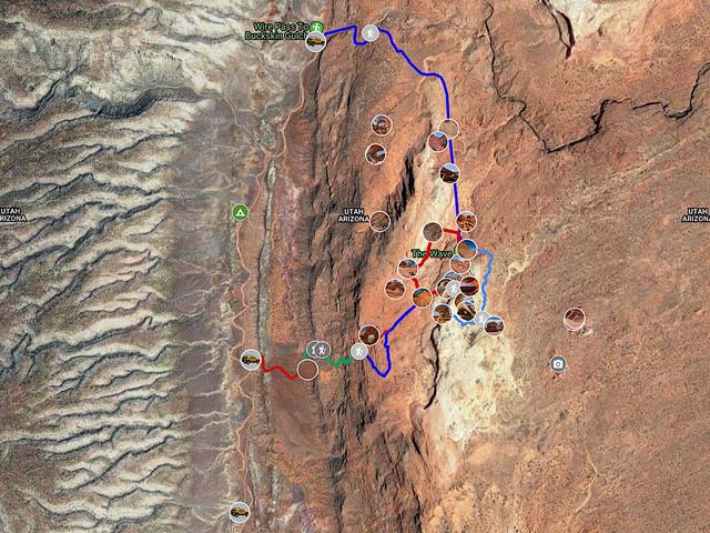
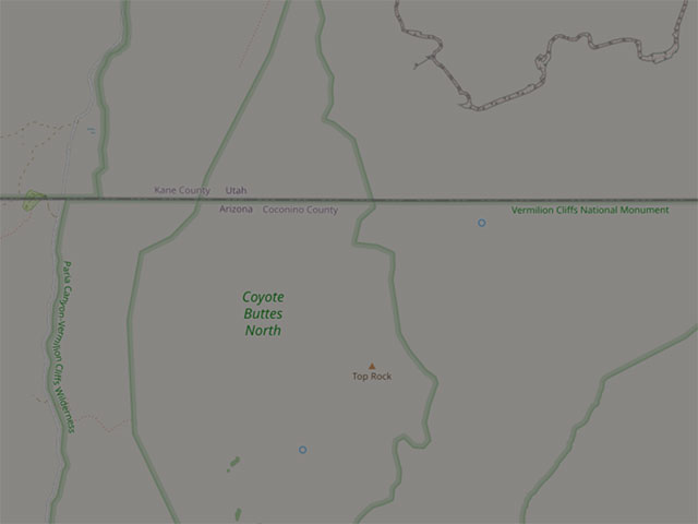
Coyote Buttes North Maps and Directions
Directions to the Wave
There are two entry points to Coyote Buttes North, Wirepass Trailhead (WP) and The Notch. The Notch is no longer publicized by the BLM. The trail from the Notch is poorly defined. I strongly recommend access from the Wirepass parking lot. To get to the Wirepass trailhead, take Highway 89 to House Rock Road. The House Rock Road turnoff is between mileposts 25 and 26 on Highway 89 in Utah. House Rock Road is normally passable by passenger cars. Do not take this road if it is wet. It is clay-based and impassable even to 4WD vehicles when wet. When the road is muddy, it is like driving on ice, and there are drop-offs. When dry, take House Rock Road 8.4 miles to the WP parking area on the right. You can dry camp at the Wirepass trailhead, and a toilet is present. Better camping with fire pits, tables, and pit toilets is available at the Stateline Campground, one mile south, just off House Rock Road.
Begin your hike to the Wave by placing half of your permit on your car's dashboard, signing the trailhead register, and crossing House Rock Road.Follow the well-defined trail east for fifty yards until you enter the wash. Wirepass wash feeds into Buckskin Gulch, the longest slot canyon in North America. Continue walking down the wash. About .55 miles from the trailhead, you will see a sign marked Coyote Buttes on the right. Turn right and follow the good trail up the hill and across the sage field. At the end of the field, you will cross a wash. This wash also flows into the Wirepass slot canyon one-half mile downstream. The total distance across the sage field to the wash is about .65 miles. The Permit area begins just after the wash. After crossing the wash, hike up the slickrock to a saddle. If you have a GPS, mark this location. From here, there may or may not be cairns, which may or may not be accurate. There are a small number of BLM signposts in the area at critical locations; one can be seen about 50 yards east of the saddle. Note its location; on your return, this marker will tell you where to turn to the west. Proceed south from the saddle. After .35 miles, you will see a twin butte with a barbed wire fence and a gate on its left (east) side. Either go through the gate (the route is easy but slightly exposed) or walk around the buttes via their west side. Continue heading almost due south, aiming for the crack in the cliffs to the south. After another .8 miles, you will cross another small wash, continue heading towards the crack in the Wall, and go up the sand dune. Unless it was windy overnight, there should be a clear trail up the dune. You will shortly arrive at The Wave. It is about 2.8 miles in total from the WP trailhead to The Wave.
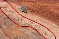
An aerial view of the hike
I created the above video Google Earth Pro. It shows an aerial view of the hike to The Wave. The view is from 100 meters above ground level at a 45-degree angle. The blue line in the video is the actual route I took on a recent visit to The Wave. You can view the video full screen by clicking the [] icon in the lower right. A high-resolution 1080p video of the hike is available; click here and choose Save Link As or Save Target As. The download is quite large and may take some time to complete.
A guide on how to create a video from a GPS track using Google Earth Pro is available on this site by clicking here.
Returning to the trailhead
It is fairly easy to get back to your car, even at dusk. The small signposts installed by the BLM will glow in the dark if a flashlight shines on them. When you return, make sure you avoid crossing the ridge too early after heading north. Look for the signpost referenced above; it will tell you when to turn to cross the ridge. It should be easy to cross over the small ridge. If it is not, you have turned west too early. Conversely, if you go too far north, you will end up in or overlooking Wirepass Slot Canyon. If so, turn around and try again. For an interesting story of someone who got lost on the return, see Trouble in Coyote Buttes. If you get lost or injured and need help, look for a "Coyote Buttes Safety Patrol" member or try to gain elevation. You may be able to get a cell signal to call 911. I have gotten service via Verizon and Tmobile, and a friend via AT&T.
Access via The Notch
The trail via The Notch starts at The Maze Petroglyph parking area on House Rock Road. The Maze parking area is 10.9 miles south of the intersection of Highway 89 and House Rock Valley Road. Follow the good Maze trail to the petroglyphs and photograph them either on the way into the permit area or on the way out. After shooting the petroglyphs, backtrack 100 yards and leave the trail going north. Shortly afterward, you should be able to find the old Notch Trail. This trail has not been maintained for a long time and is hard to follow. Make sure to find the trail before turning east to ascend the cliffs. The trail bypasses a pour-off just to its north and then follows a wash to its end. At the end of the wash, scramble up the chute to the washes south and make your way up to The Notch. From the Notch, the easiest way down is to follow the trail to the southeast before turning north.
The hike via The Notch is longer, less scenic, and much more difficult than the hike from Wirepass. Only experienced off-trail hikers should attempt it.
Drones
Drones are prohibited in designated wilderness areas and U.S. National Parks. Drones cannot be flown at The Wave, Coyote Buttes North, or Coyote Buttes South. These areas are in the Paria Canyon-Vermilion Cliffs Wilderness Area. My map of Coyote Buttes North shows the boundaries of this wilderness area. When viewing the map, ensure the last layer "CBN Permit Area, Paria Wilderness") is visible; the map default is to hide it. Surprisingly, the wilderness area includes the land between House Rock Valley Road and the CBN permit area. As a result, drones cannot fly near the Maze Petroglyph, High Heel Arch, and Dick's Arch. The North and South Teepees are also within the wilderness boundary.
Other Locations
Click on any image for a larger version.
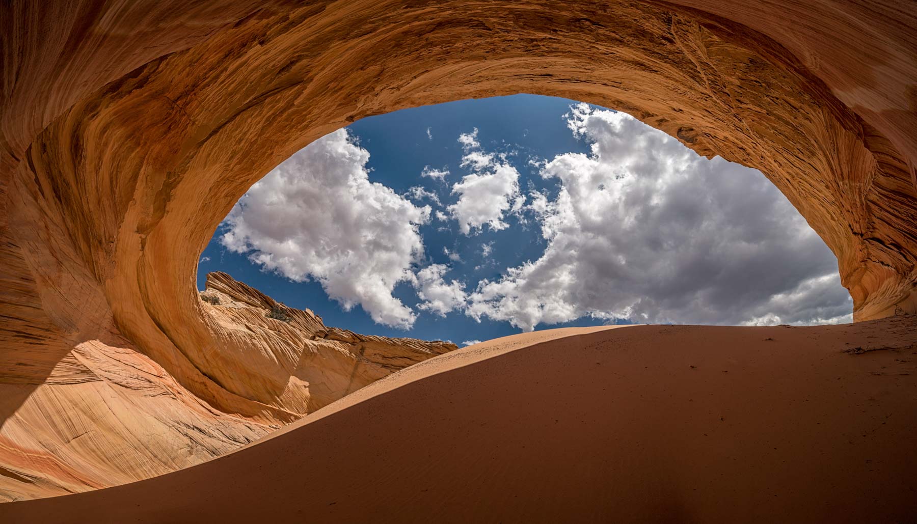
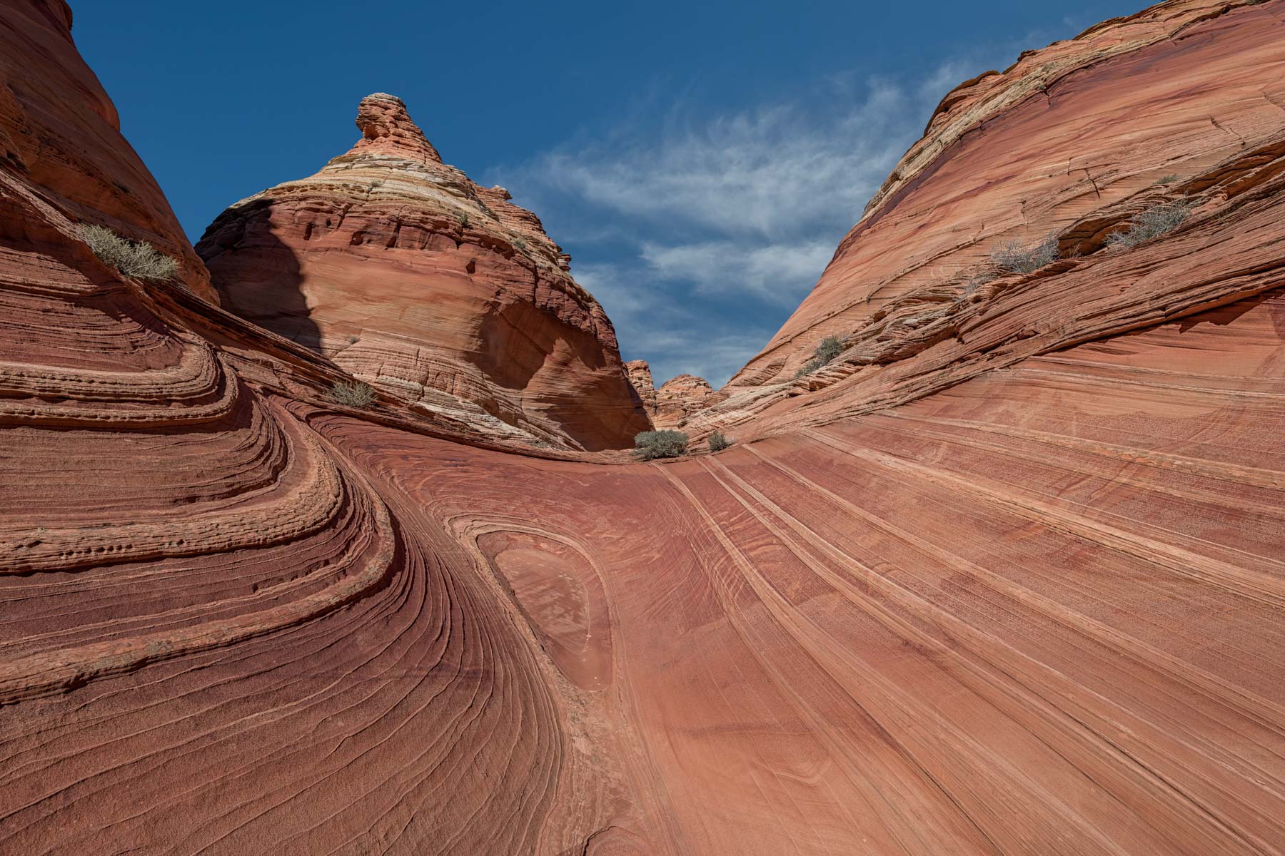
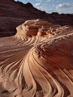
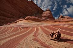
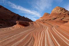
The Second Wave
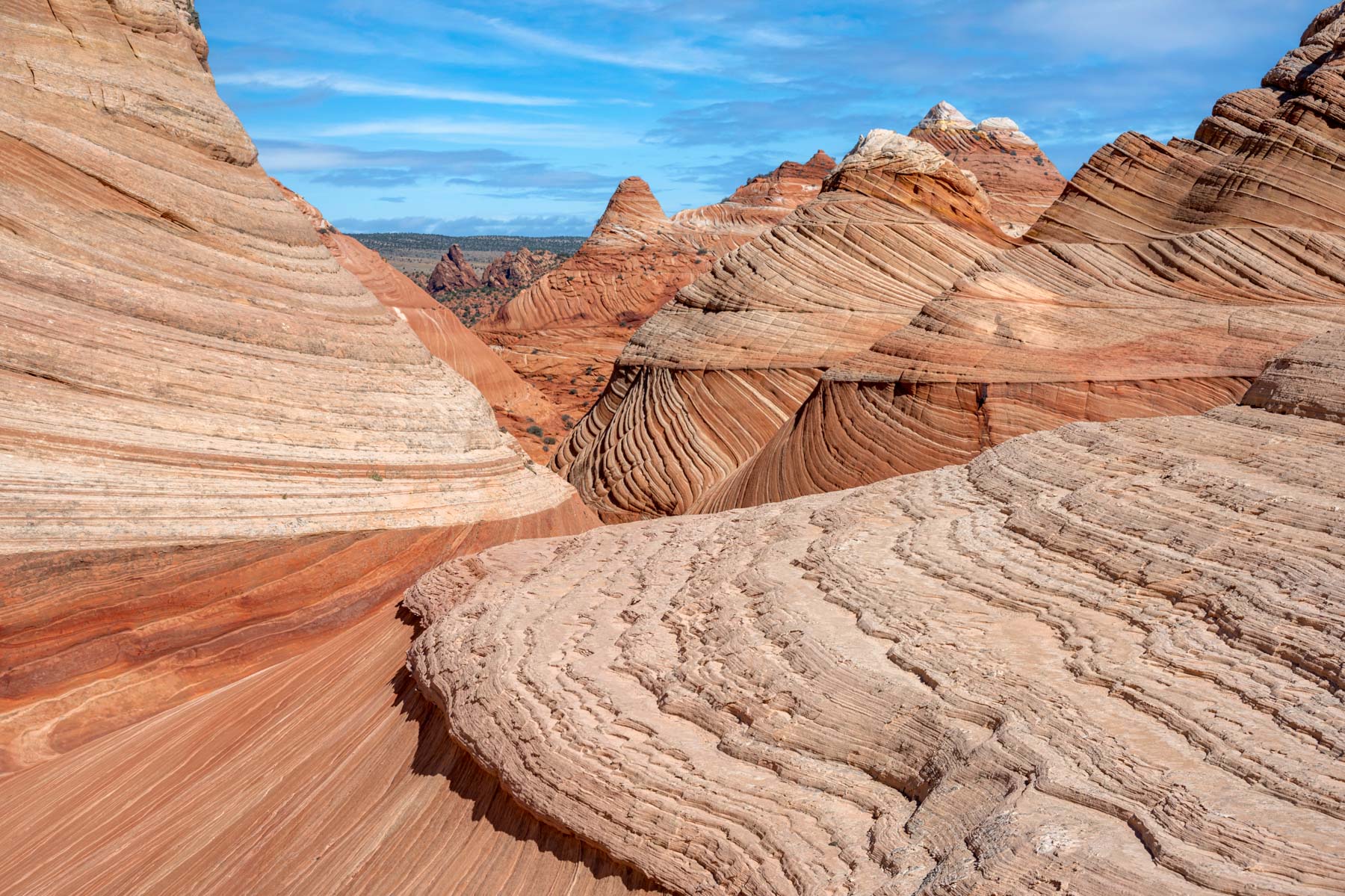
About 0.3 miles south of the Wave. It is best late afternoon; you should wait until the cliffs to the west are in shadow before shooting. I usually shoot until the Sun disappears behind the western cliffs and then hurry back to the car. Most compositions are vertical. Shoot from the small sand dune a few feet south or from the rocks just above it to the southeast. The Second Wave is a poor subject when snow is present.
GPS Coordinates: 36.99344, -112.00812
Rating: *****
24K Topo Map: Coyote Buttes
The Second Wave
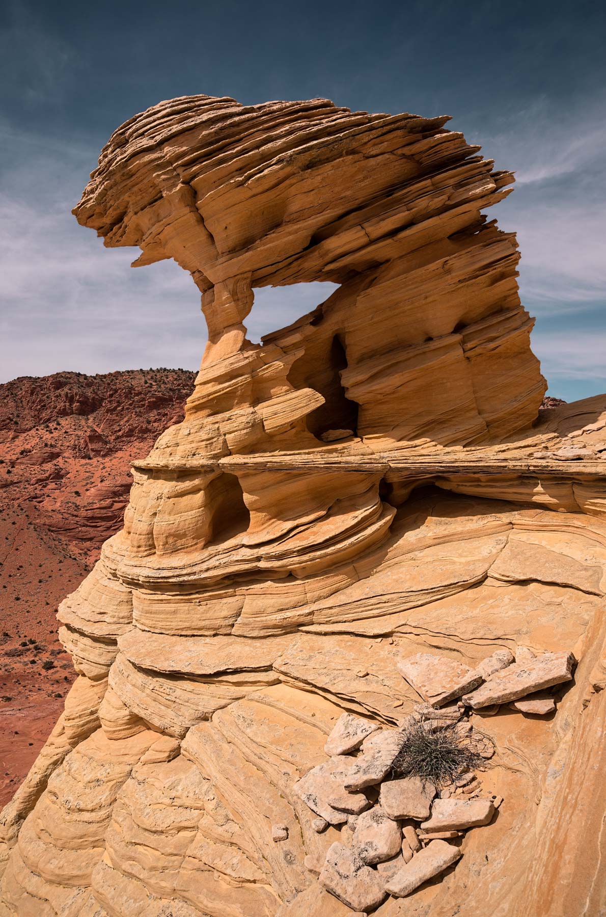
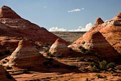
Top Rock and The Alcove
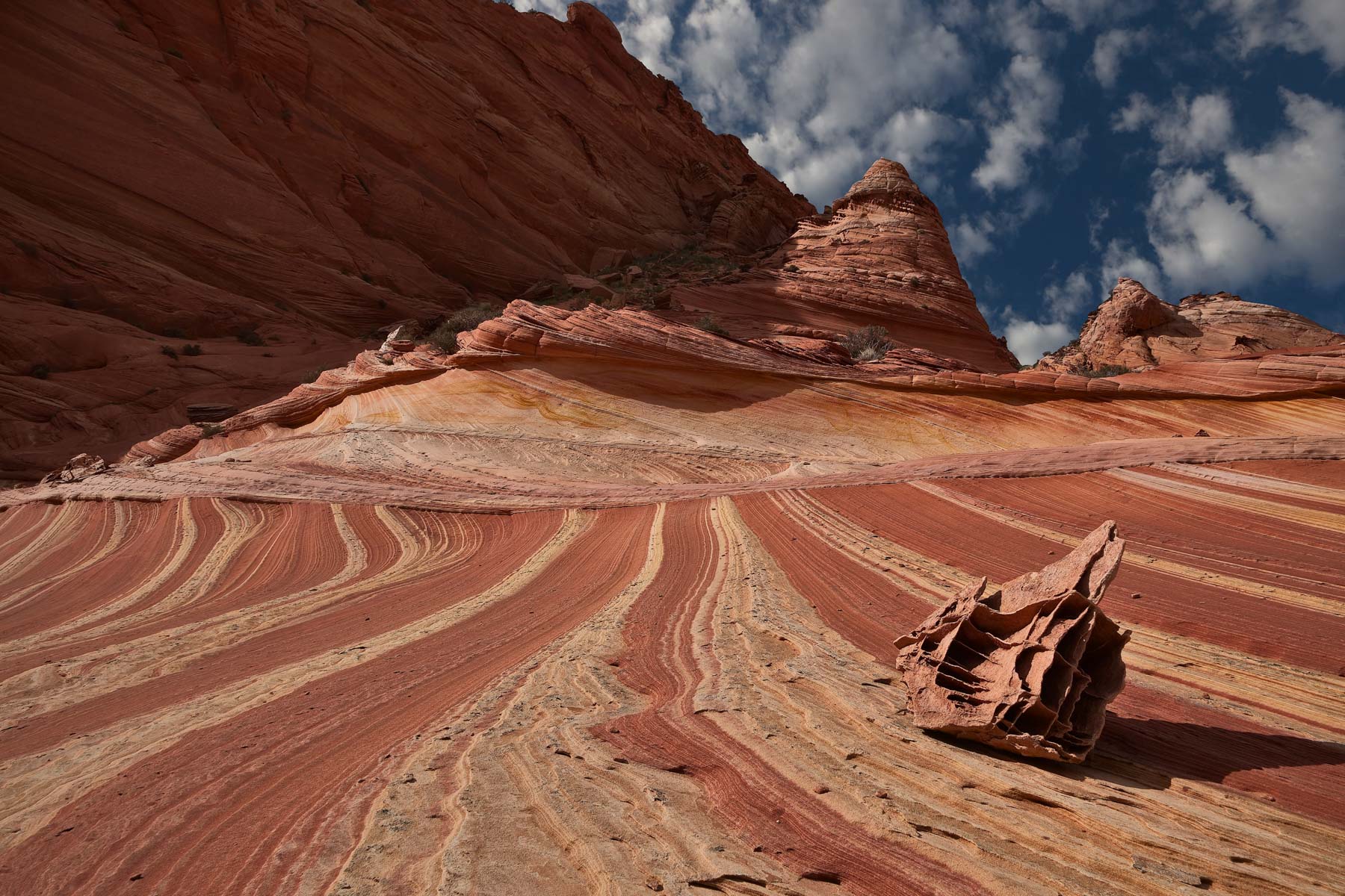
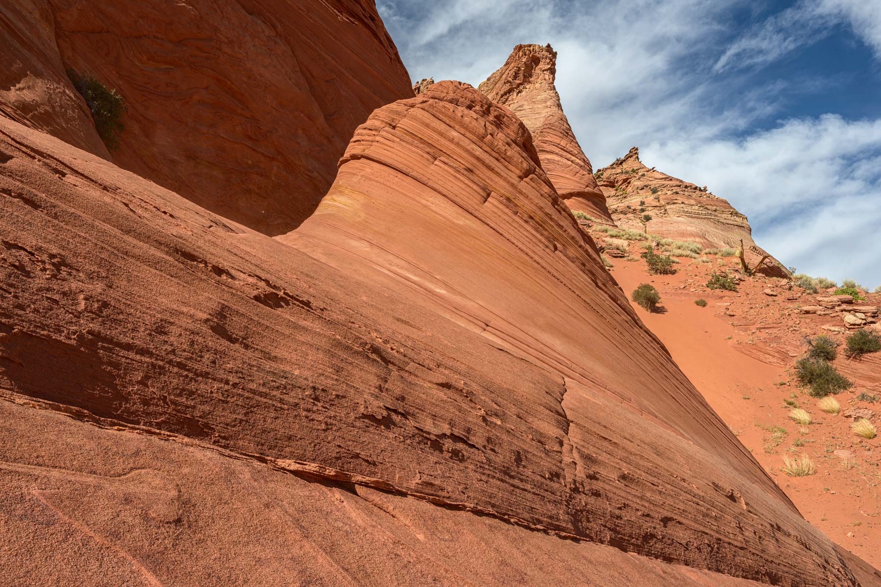
Top Rock is the area a few hundred feet above the Wave. Top Rock is largely Navajo sandstone and presents many good photo opportunities. It is best shot from mid-day on. The least risky way to climb Top Rock is from its back (east) side. From The Wave, head north and then east till you get behind Top Rock. Hike south about .5 miles, and you will see a fairly easy way to ascend to the top. When you get to the top, you will be in an area known as Pine Canyon. Pine Canyon is home to the "Dinosaur Dance Floor (DDF)" with its many small potholes. The DDF received national publicity in October of 2008, see this NBC Science article. Unfortunately, it is now believed that the potholes are just that - dinosaurs did not form them.
Top Rock can also be climbed from the front (west) side. Start just north of the Second Wave and make your way up wherever possible. There is one short, steep, and exposed section. Some people can scramble or even run right up this section. If you can't, there is a crack to the right. The crack offers good handholds and is an easy scramble when not covered in wet sand. When you hike up Top Rock from the front, note the way down. The front route up Top Rock involves 400 feet of elevation gain and is only about .3 miles long. The back route from The Wave to the top is over a mile long. If you fear heights, take the longer route around the back.
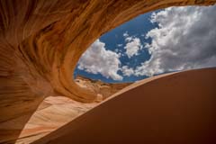
The Alcove - A beautiful alcove with a tiny, colorful area reminiscent of Antelope Canyon. The Alcove is difficult to photograph in its entirety, but a good image can be had around noon in the summer when its walls are in shadow. Sunrise and sunset are also good times to shoot. Try shooting the inside of The Alcove from the northwest side of the sand dune in its interior. The Alcove is easy to find if you climb Top Rock from the front side; when you get to the top, The Alcove will be just a few hundred feet south and slightly east.
GPS Coordinates: 36.99201, -112.00577
Rating: *****
24K Topo Map: Coyote Buttes

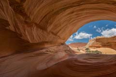
Melody Arch and the Grotto
Two arches within a grotto. The inner arch is called Melody Arch after photographer Melody Thomas, who popularized it. A postcard of hers is available at the Paria Ranger Station. The outside arch/window I call Wall Arch; it frames the North Teepees and Navajo Mountain. Wall Arch can be seen from below if you ascend Top Rock from the back; it is high on the cliff right of Pine Canyon. Melody Arch is one hundred feet southeast and 20 feet above the Alcove. It is not visible from below. To get to Melody Arch:- Go 100 feet south of The Alcove to an area that looks like the beginning of another alcove.
- Climb up the right side to ascend to the top.
- Walk east until you will see two arches in a grotto. You can drop down into the grotto from the north side.
GPS Coordinates: 36.99103, -112.00555
Rating: ****
24K Topo Map:Coyote Buttes
Melody Arch
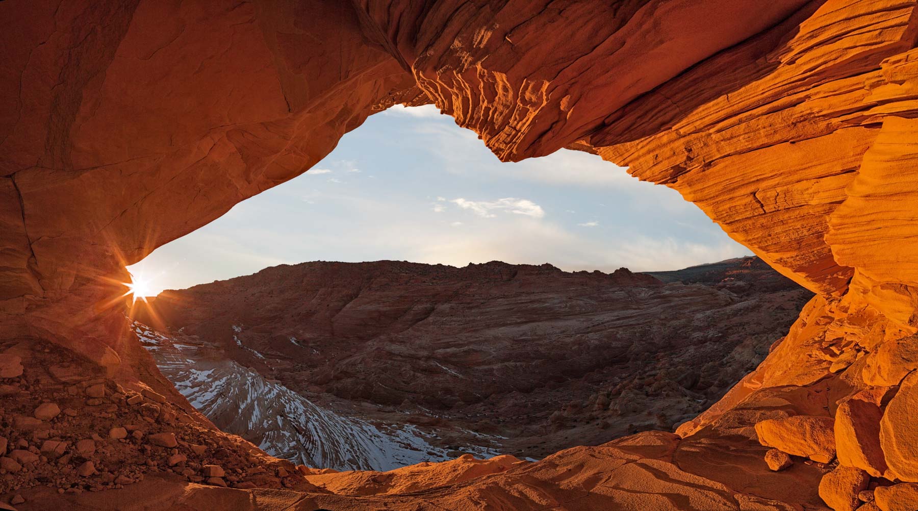
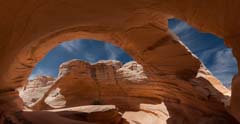
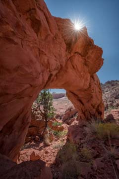
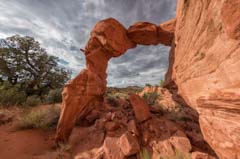
Top Rock Arch
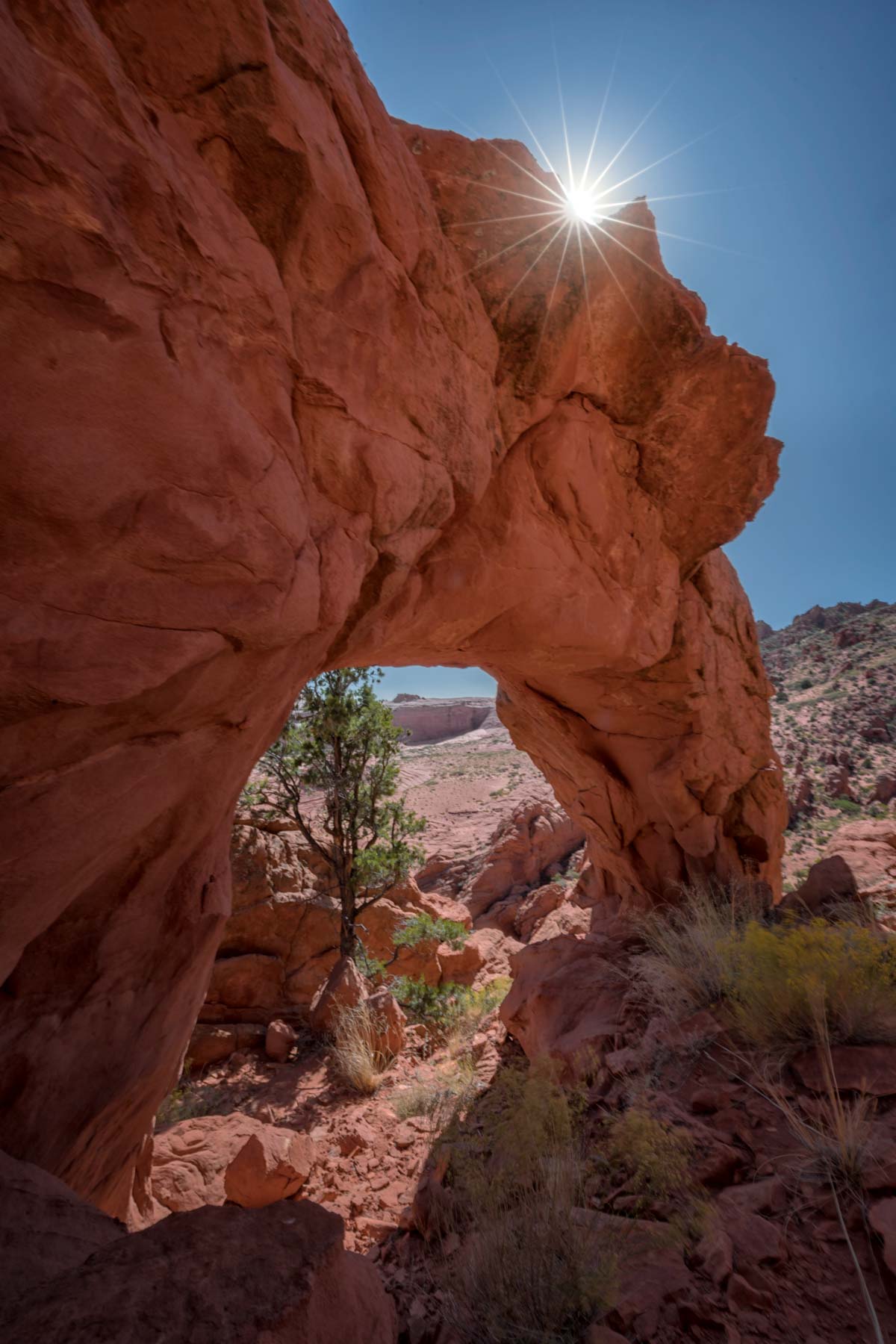
This is the arch you can see above you from The Wave. It is also visible from Hamburger Rock. Top Rock Arch is good early in the day and gets a nice glow late afternoon. It is a few hundred feet north of the Alcove on Top Rock. Top Rock Arch (NABSQNO 12S-410195-4094000) is misplaced in the Natural Arch and Bridge Society map.
GPS Coordinates: 36.99366, -112.0051
Rating: ***
24K Topo Map: Coyote Buttes
Top Rock Arch at Sunset
The Hooters
These are three photogenic teepees. You'll pass by them on the way to The Wave. They are not easy to photograph as they blend into the background.
GPS Coordinates: 37.00528, -112.00765
Rating: **
24K Topo Map: Pine Hollow Canyon
The Hooters
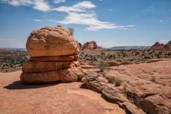
Ginger Rock
This is the brightly colored rock you see to the left after climbing the sand dune. It is about 150 yards north of the entrance to The Wave. It has a nice vortex that gets good light mid-day.
GPS Coordinates: 36.99745, -112.00548
Rating: ***
24K Topo Map: Coyote Buttes

Ginger Rock
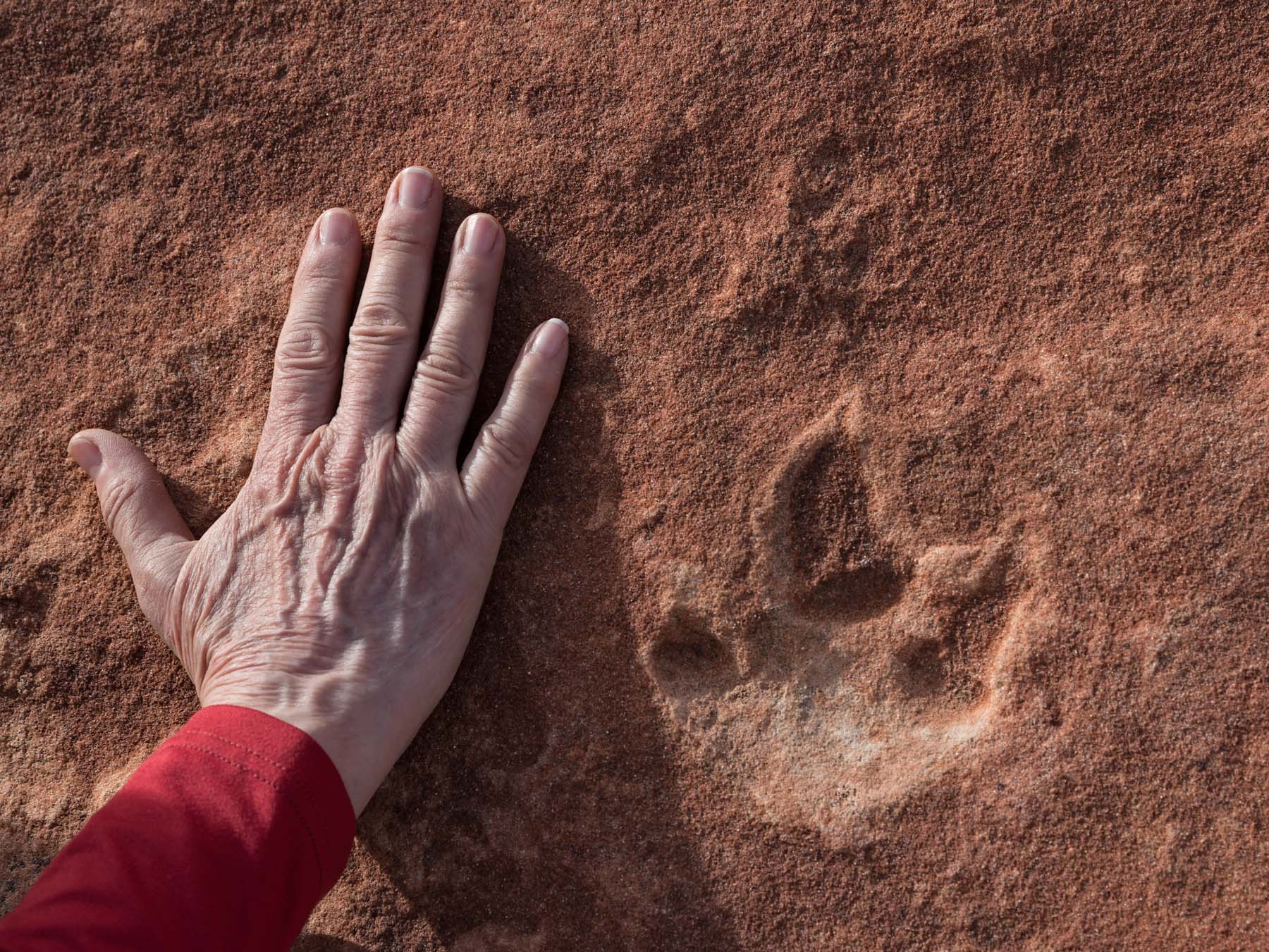
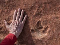
Dinosaur Tracks
While the "Dinosaur Dance Floor" was not walked on by dinosaurs, there are true dinosaur tracks in the area. Many (hundreds?) are on the west side of the cove opposite The Wave. GPS coordinates for a pair of footprints can be found below. The GPS coordinates are believed to be accurate to within ten feet. The tracks can be hard to find unless you know exactly what you are looking for. I have placed a circle of rocks around two to make them easier to find.
Note - Do not try to touch, brush out sand, or remove debris from any tracks you find; this can damage the track. It is okay to add water to tracks to improve contrast; after all, the tracks are exposed to rain occasionally.
GPS Coordinates: 36.99925, -112.00988
Rating: ***
24K Topo Map: Coyote Buttes
Dinosaur Tracks
Another Dinosaur Trackway and Teepee Terrace
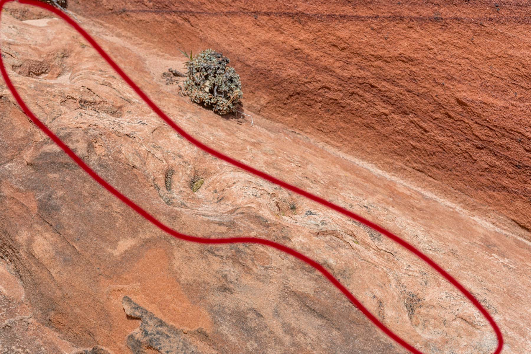
100 meters south of the Hooters is a well-defined trackway made by Sauropodomorths in the early Jurassic period (175M to 200M years ago). The tracks are very close to the trail to The Wave. Most guided tours stop at them since the tracks are easy to find and only a slight detour from the trail. Guides from three different guiding companies have told me Giant (Ground) sloths created the tracks. This is not the case. Ground sloths only migrated to North America about 8 million years ago. The other tracks in the Coyote Buttes Area were made about 190 million years ago. The paper by Jesper Milan in Acta Palaeontologica Polonica June 2008 states that a Sauropodomorph made the tracks in the early Jurrasic. The paper discusses how the trackway was created and is interesting reading. Here's a condensed description of the trackway from the paper "Trackway of sauropodomorph dinosaur walking up the lee slope of a dune. Note the elongated traces from the claws being dragged through the sediment. The present-day slope is approximately 25° due to the compaction of the sediments. The original slope angle was around 32° which is the residual angle of slope of dry sand after shearing (Allen 1984)."
Additionally, another track lies on the flat ground about 30 feet east of the trackway. It can be hard to find even with GPS coordinates.
Teepee Terrace is about 400 feet west of the trackway and offers great views of the many petrified sand dunes in the area. The image to the right was shot mid-morning. The area has two water pools, but I have yet to see water in the more westerly one, even after heavy rain.
GPS Coordinates: 37.004553, -112.007718
Rating: ***
24K Topo Map: Pine Hollow Canyon
Dinosaur Trackway

Teepee Terrace
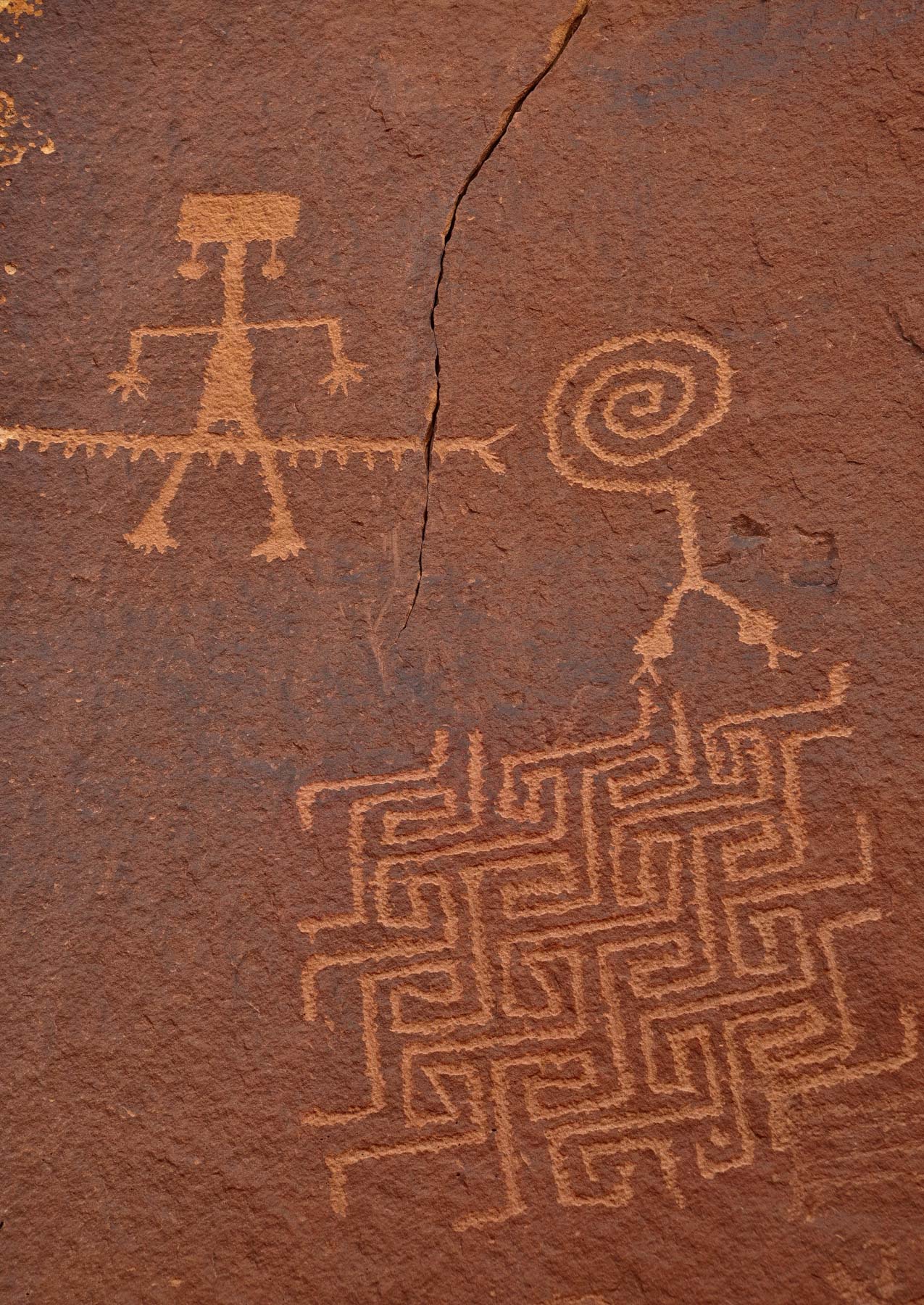
The Maze Petroglyph
Please do not touch the petroglyph. The petroglyph is on the red wall to the right of the Access Canyon, used to hike to the Wave from the Notch trailhead. The panel is easily seen even from a distance. It is on a west-facing wall, so it is the best shot in the afternoon. A parking area and a good trail to the petroglyphs starts on House Rock Road at 36.986, -112.0335. Use a polarizer to reduce any glare on the rock. A real or digital red-enhancing filter also improves the image. The image to the right is a closeup. Shoot the petroglyphs in their setting also to add context. The Maze Petroglyph is outside the Coyote Buttes North permit area and can be visited anytime.
GPS Coordinates: 36.98501, -112.02615
Rating: ***
24K Topo Map: Coyote Buttes

The Maze Petroglyph
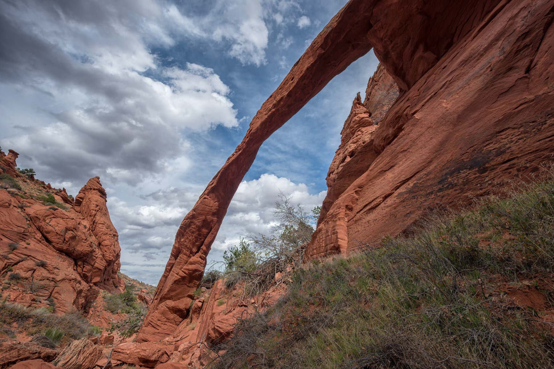
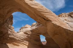
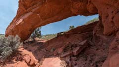
The Notch Arch
A small arch with a ten-foot span. It is easily seen from The Notch; look to the NNE. The arch was first reported to me by Anthony Marko. He sent me a good image which inspired me to see it. The easiest way to access the arch is via the Notch trail. From the trail's summit, traverse NNE .15 miles to the arch. Be careful on the traverse; there is no trail, and the terrain is loose and somewhat exposed. Alternatively, Notch Arch can be accessed from below; an untested route is shown on the map. Notch Arch is probably best shot close to sunrise when its underside should get some glow.
GPS Coordinates: 36.98891, -112.01818
Rating: ***
24K Topo Map: Coyote Buttes
The Notch Arch
The Boneyard
This area was "discovered" by photographer Michael Fatali who has a magnificent image of it. The Boneyard is on the west side of the cove, 0.5 miles south of the dinosaur tracks. It is best photographed either shortly after dawn or about two hours before sunset. Shooting at dawn requires hiking in before sunrise. About fifty yards above The Boneyard is an area of lace rock. Most of the lace rock is on an east-facing slope and is best in the early morning.
GPS Coordinates: 36.99552, -112.01308
Rating: ****
24K Topo Map: Coyote Buttes
The Boneyard
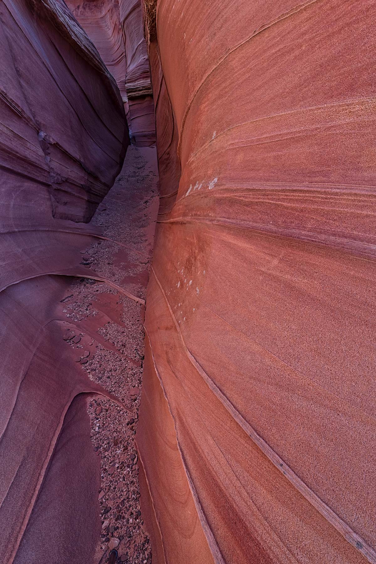
Sand Cove
Sand Cove lies about halfway between the Boneyard and The Second Wave. It is in the middle of the wash running down the center of the cove. It is a very good late-afternoon shot. A wide or ultra-wide lens is needed to emphasize the fine detail in the leading lines of sandstone
GPS Coordinates: 36.99249, -112.0113
Rating: ****
24K Topo Map: Coyote Buttes
Sand Cove
West Side Buttes
These small buttes lie about .25 miles northwest of Sand Cove and are south of The Boneyard. They are worth visiting should you be in the area of either. The buttes are best at sunrise.
GPS Coordinates: 36.99381, 112.01481
Rating: ***
24K Topo Map: Coyote Buttes

West Side Buttes
High Heel Arch
This is the arch marked on the 24K topo map near 5238. It is outside the permit area. I've also seen it called "Flame Arch." It is a beautiful arch and is good late in the day. Part of the arch recently collapsed, making it more beautiful than before. To get to the arch, turn south when you are about halfway across the sage field at the beginning of your hike to The Wave. The arch is about 0.5 miles from where you turn off the trail.
GPS Coordinates: 37.01036, -112.01648
Rating: ****
24K Topo Map: Pine Hollow Canyon
High Heel Arch
Moby Dick Arch
More likely a natural bridge since a wash runs through it. With an estimated thirty-foot span, it is surprising it is not better known. Victor Cooper of the Rocking V in Kanab first told me about it. The arch is not particularly photogenic, except perhaps to capture a sunburst at sunrise in spring and summer. A panorama head is needed to capture the full span effectively from close-up, even 14mm wasn't enough for me. The arch is .25 miles south of High Heel Arch and can be visited on the same trip. The arch is outside the permit area.
GPS Coordinates: 37.00736, -112.01728
Rating: **
24K Topo Map: Pine Hollow Canyon
Moby Dick Arch
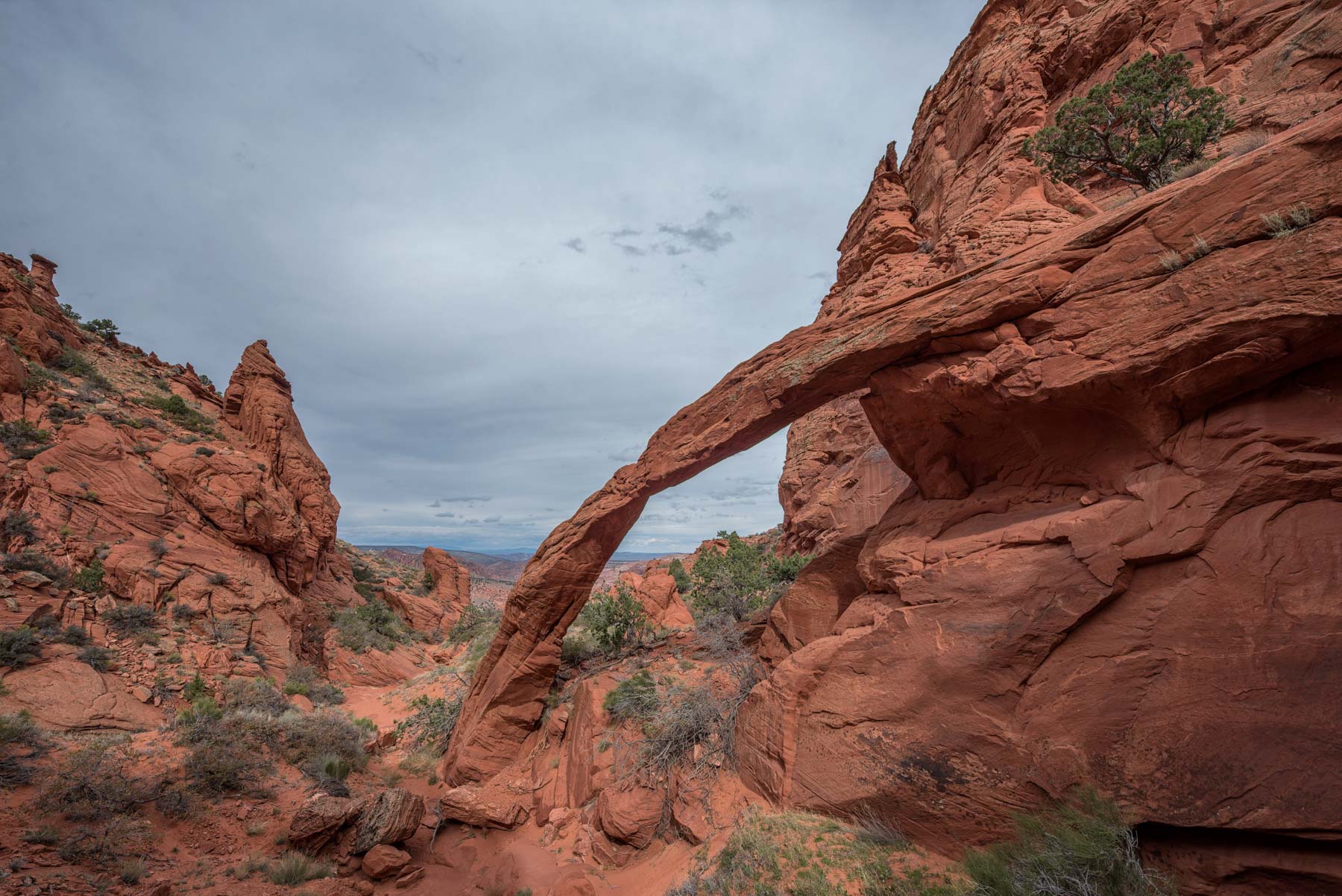
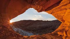
Dick's Arch
A newly reported spectacular arch only 2/3 of a mile from The Wave! It was first reported in 2016 by Dick Kent of Centennial, Colorado. Dick first saw the arch in 1996, before the days of GPS, so the exact latitude and longitude were unknown. In late October 2016, I went looking for the arch based on the trip log from Dick's 1996 hike. I found it by pretty much following his directions. Here is a paraphrased version of Dick's discovery: "Leave Wire Pass TH camp at 6:43a. Pedometer 0. Altitude 4880'. Leave Wire Pass drainage and ascend the sand hill on the 4WD track (now trail) at 6:55a. Descend the sandhill and turn right at the wash that is now the North Coyote Buttes permit boundary. I walked up the wash about a mile until further passage was blocked by rock. I had an exhausting climb up the dune to the right of the rock until it finally leveled somewhat. I had given up finding anything when I took a final look, and there was an arch! I reached the arch at 8:09. 2.6 miles from Wire Pass. Altitude 5400'. No doubt additional mileage and time because of the difficult dune ascent".
Tom Van Bebber, David Kennedy, and David Alexander of the Natural Arch and Bridge Society recently visited Dick's Arch and measured the span to be 54 feet, with a height of 18.2 feet. For comparison, Cobra Arch, which has a somewhat similar shape, spans 35 feet. Tom Van Bebber maintains the World Arch Database, a subscription-based catalog of natural arches throughout the world. If you are interested in arches, you should subscribe. Highly recommended. Tom also indicated they found two other new arches in the area. One of the arches is called Fox Arch since a fox was seen when it was "discovered." I do not have details on the other arch.
It is amazing Dick's Arch was only recently reported, being so close to The Wave. Based on its UTM coordinates, I assigned the arch an identification number (NABSQNO) of 12S-409531-4095398. You can see the top of the arch on Google Earth. Despite being less than a mile from The Wave, I believe the arch was unknown because access requires hiking up the uninteresting wash you cross on the way to The Wave and gaining 600 feet of elevation, all off-trail and mostly in sand. You won't see the arch until you have hiked to within 200 feet of it. I saw several other small unknown arches in the area. The area around the arch is quite photogenic and contains a great deal of "lace" rock. Unfortunately Dicks Arch only gets good light mid-day. I am unsure if the arch is in the Coyote Buttes North Permit area. It seems to be right on its boundary. You can hike to the arch from the "Sage field" you cross on the way to the Wave. At the highest point of the sage field, proceed south for about 1.5 miles to the arch at 37.00038, -112.01676. A kml file can be downloaded here and a GPX file here. The hike to Dicks Arch is about 2.5 miles one way and is largely off-trail over rough terrain. Elevation gain is 700 feet from the WP trailhead. The hike is significantly more difficult than the hike to The Wave and should only be undertaken by experienced off-trail hikers. Strong hikers may wish to explore the area around the arch more thoroughly and may be able to gain the ridge that overlooks The Wave from the west. The view to the east from this ridge should be spectacular. Because the area is so remote, there is a good chance you will see wildlife. I briefly saw a herd of mule deer near the arch. I had never seen deer near The Wave before.
You can visit all three arches in the sage hill area in good light on a single day. Visit Moby Dick at sunrise and then proceed to Dick's Arch. Probably the easiest way to do this is to head down the gully that runs under Moby Dick for .1 miles and then turn south and follow the red line on the map below. This route is not the most direct, and you'll have to regain some elevation, but it is very straightforward, and you won't be traversing a sand-covered slope. Shoot Dicks Arch until it loses light, and then head back to Moby Dick and shoot till mid-afternoon or so. Finally, head to High Heel for sunset.
GPS Coordinates: 37.00038, -112.01676
Rating: ****
24K Topo Map: Pine Hollow Canyon


Dicks Arch
Hour Glass Arch
A small but beautiful arch. It lies on the west side of Top Rock and is on a cliff. It is difficult to find, and it's hard to get a good composition once found. The best way to photograph the arch is to approach it from the northeast. Scramble over the small buttes to the northeast and find a way down to the arch. There's a rough track shown in the Google map below. The arch is at its best mid to late afternoon. The arch is also visible from below using binoculars or a long lens. From the Boneyard, look towards the cliffs above the north edge of the butte in the middle of Sand Cove to see the arch.
GPS Coordinates: 36.99074, -112.00864
Rating: ****
24K Topo Map: Coyote Buttes

Hour Glass Arch
Hamburger Rock
Also known as The Big Mac. Best at dawn. The north side of the rock is its most photogenic. It is an easy detour if you are climbing Top Rock from its back (east) side.
GPS Coordinates: 36.98954, -112.00195
Rating: ***
24K Topo Map: Coyote Buttes
Hamburger Rock
The North Teepees
These lie outside the permit area .6 miles east of Top Rock. You can access the interior of this rock formation via the "Secret Passage," a narrow slot on the south side, or via the east side. The Secret Passage and the vortex just above it are quite photogenic. If you have a Wave permit, the best way to see them is to hike around Top Rock and head east. Follow up the North Teepees with a stop at Hamburger Rock and the rest of Top Rock. If you do not have a permit, you can access the North Teepees from the Cottonwood trailhead of Coyote Buttes South. Follow the old road until it turns west, then leave it and head north to the Coyote Buttes Teepees. The hike is about seven miles round trip over sand, which makes it feel much longer.
GPS Coordinates: 36.99036, -111.99147
Rating: ****
24K Topo Map: Poverty Flat
The North Teepees
Wirepass Parking Area and Trailhead
Pit toilets are available. For your safety, leave your permit visible on the windshield and sign the trailhead register. Sign out when you return to the trailhead.
GPS Coordinates: 37.01901, -112.0251
Rating: NA
24K Topo Map: Pine Hollow Canyon
Google Map and Directions
The map below shows The Wave and the locations of all the landmarks above. The maps also show routes and actual tracks in the area.
Google Maps have two sections. The left side of the map typically shows a legend. If the legend is hidden, click the "Map Legend" box on the upper left to reveal it. The legend includes a list of folders. To display or hide the contents of a folder, click the check box to its left. Folders contain locations and routes. Click on a place to display more information and possibly a cropped photo. Click on the cropped image to display a higher-resolution uncropped version. The legend's top right shows a magnifying glass icon and three dots (ellipsis). Clicking on the magnifying glass creates a search box to find a particular location or route. The ellipsis gives you several options. You can collapse the legend so you can see more of the map, print the map, download a KML file for use with a GPS, or view the map in an online version of Google Earth.
The online version of Google Earth helps measure distances, displays GPS coordinates and elevations, and displays additional photos of the area. To measure distances, click the ruler icon at the bottom left. GPS coordinates and elevations at the cursor are displayed on the bottom right. Click the menu icon (three bars) on the upper right and drag the Photos slider to the right to reveal additional images.
The right side shows the map. To drag the map, hold the left mouse button down. To zoom in or out, use the mouse wheel or the +- box on the lower left. Clicking on a route or location brings up its details.
- Click to download a KMZ file (Note - in IE Right Click and choose Save Target as)
- Click to download a KML file (Note - KML files do not include custom icons)
- Click to download a GPX file (Note - in IE Right Click and choose Save Target as)
Dark Sky Map of Coyote Buttes North
The following map from darksitefinder.com gives a rough idea of how dark the skies are in the Coyote Buttes North area. Click on the map below to zoom in or out or change the base layer:
The map contains 15 colors. The Milky Way is invisible in the white, light gray, and red areas, visible but washed out in the yellow and orange areas, shows the Milky Way's structure in the green and blue areas, and in the black area, light from the Milky Way center casts shadows. Here's more information about how to interpret the colors on the map. This information comes from handprint.com:

Actual GPS Tracks
To the right are some tracks I took on visits to The Wave. I simplified the tracks to remove meanders and errors. The tracks were compressed using GPS Prune. They are also subject to normal GPS inaccuracies. Errors in these tracks could be substantial; you should not follow the tracks mindlessly. Caution -If the track leads you to terrain that is difficult to climb or to a steep drop-off, do not follow the track. When in doubt, use your judgment as to the best route; do not follow the track.
To download a file below, either click on the file or right-click and choose Save Link As or Save Target As:
| Track | KML File | GPX File | Description |
| To The Wave | To The Wave | To The Wave | The hike from Wirepass trailhead to The Wave. Differs slightly from that recommended by the BLM in that it goes to the left of a butte about 1.5 miles into the hike. |
| A Day at The Wave | Loop | Loop | A roughly two mile loop around Sand Cove hitting most of the best photographic sites. |
| Top Rock ascent from its west (front) side | Top Rock | Top Rock | Goes from The Second Wave to a point near The Alcove on Top Rock. About .3 miles long. |
| Top Rock ascent from its east {back) side | Top Rock Back Route | Top Rock Back Route | Goes from The Wave to the head of Pine Tree Canyon on Top Rock. About 1.2 miles long. |
| Straight to the Boneyard | The Boneyard | The Boneyard | A direct route from Wirepass trailhead to The Boneyard and Sand Cove. |
| Upper West Side / Lace Rock | Lace Rock | Lace Rock | Takes you high on the west side starting near The Hooters and ending near The Boneyard. This area is rarely visited. |
Photo Map
The following map shows the locations of all geocoded photos in my Coyote Buttes North Gallery. Click on the image to open the map in Google Maps. The map has many images and will take a few seconds to load. Click on any image to display a cropped thumbnail, the GPS coordinates, elevation, and focal length used when shooting the image.
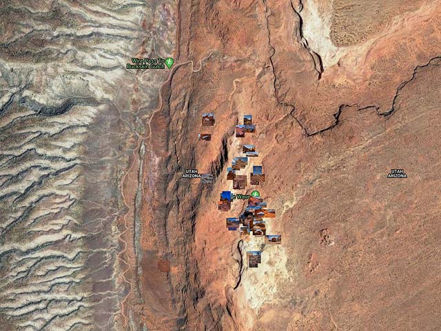
The points of interest on the map can be downloaded as a kmz file by clicking here.
USGS 24K Topo Maps
Four Topo Maps cover the north and south permit areas and The White Pocket. The two topo maps Coyote Buttes and Pine Hollow Canyon contain most of the locations in Coyote Buttes North and the Coyote Buttes South Pawhole trailhead. West Clark Bench and Poverty Flat cover Edmaier's Secret, Coyote Buttes South Cottonwood trailhead, and the White Pocket. The topo maps in the table below are high resolution and can be quite large (typically 5-10 megabytes). The zip files and merged maps are much larger.
Vermilion Cliffs Index Map

| 24K Map (GeoTiff/Avenza) | KMZ | Oruxmaps | KMZ Decollared | Oruxmap Decollared | Avenza Decollared | Locations included |
| Coyote Buttes | KMZ | Oruxmap | KMZ Decollared | Oruxmap Decollared | Avenza Decollared | The Wave, The Second Wave, Sand Cove, Fatali's Boneyard, The Alcove, Melody Arch, The Grotto, Top Rock Arch, Pawhole Trailhead, Dinosaur Tracks |
| Pine Hollow Canyon | KMZ | Oruxmap | KMZ Decollared | Oruxmap Decollared | Avenza Decollared | Wirepass trailhead, The Hooters, 24K Arch |
| West Clark Bench | KMZ | Oruxmap | KMZ Decollared | Oruxmap Decollared | Avenza Decollared | Edmaier's Secret, Cobra Arch |
| Poverty Flat | KMZ | Oruxmap | KMZ Decollared | Oruxmap Decollared | Avenza Decollared | Cottonwood Cove trailhead, the White Pocket, North and South Teepees |
| All 4 Maps (zip file) | KMZ | Oruxmap | KMZ Decollared | Oruxmap Decollared | Avenza Decollared | All |
| All 4 Maps Merged | NA | NA | KMZ Decollared | Oruxmap Decollared | Avenza Decollared | All |
| All of Vermilion Cliffs NM Merged | NA | NA | KMZ Decollared | Oruxmap Decollared | Avenza Decollared | All |