Yellowstone National Park
Official Park Map
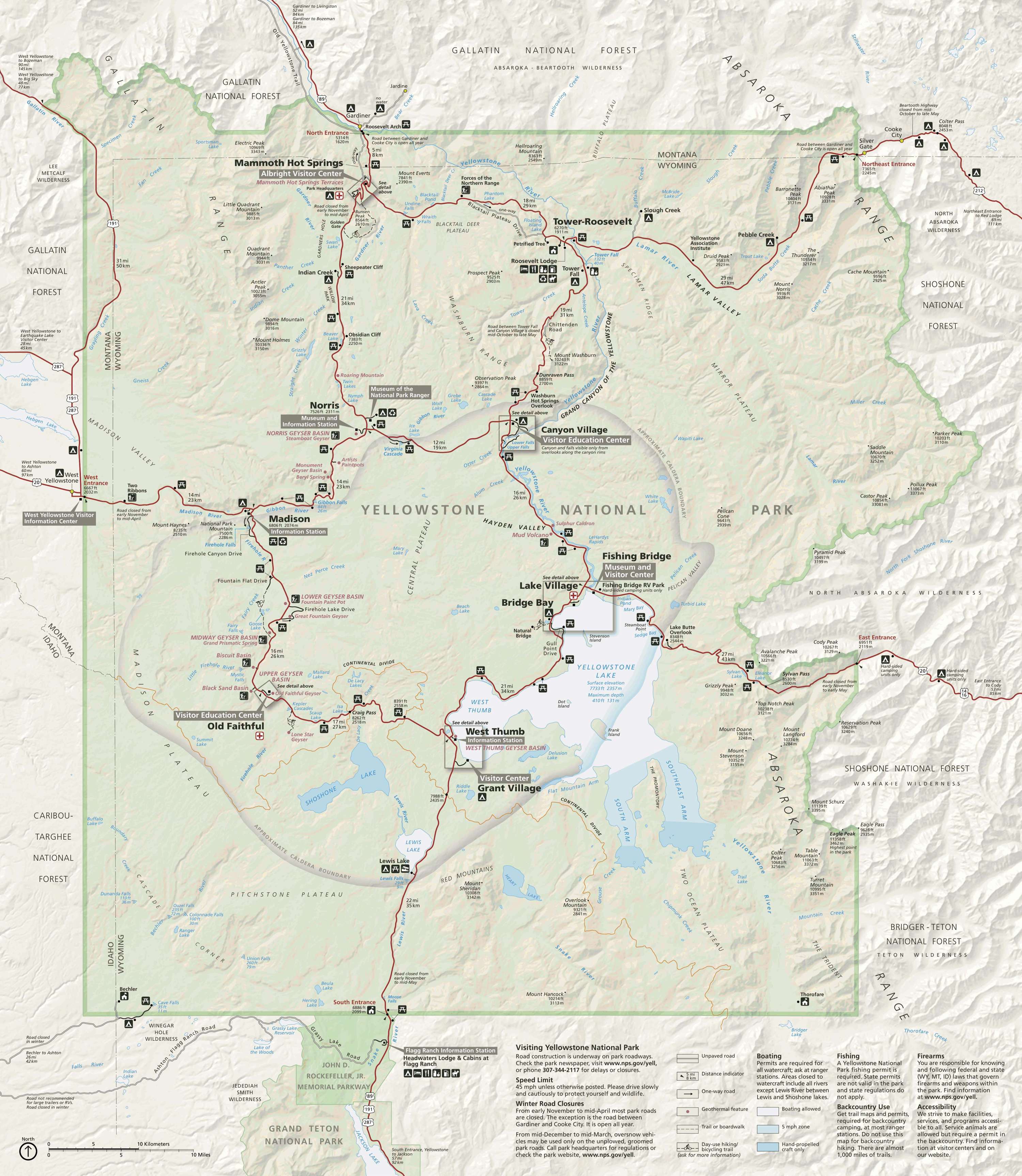
Below is the official Yellowstone National Park map as a jpeg and in three geocoded formats, as a GeoTiff, as a KMZ file, and in Oruxmaps format. The official park map as a Geo PDF can be found here.
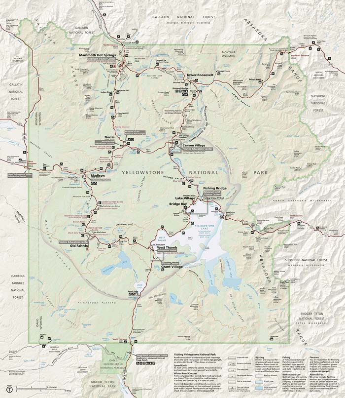
- Click to download a high resolution Jpeg file. File is not geocoded.
- Click to download a GeoTiff file viewable in PDF Maps
- Click to download a KMZ file viewable in Google Earth
- Click to download an Oruxmap file (Note - in IE Right Click and choose Save Target as)
Geyser Predictions
Geyser predictions from the National Park Service are only available for six geysers as of 2019. Geysertimes.org has additional information for many geysers such as time of last eruption, average time between eruptions, ... and is a very useful sourece. If you are planning to shoot geysers you should become familiar with the following sources:
- National Park Service Geyser Predictions
- Geyser Times Predictions
- Geyser Predictions by Phone at 307-344-2751 (option 2)
- Geyser Times Android App
Shooting Locations and Points of Interest
Here is an overview map showing all of Yellowstone National Park and popular places to visit
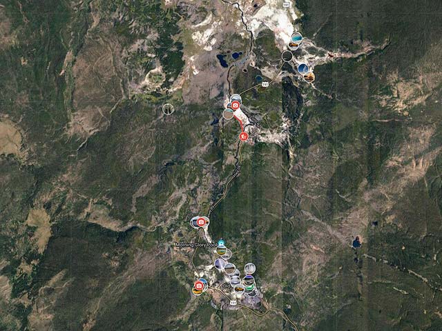
To view the map in Google Maps please click anywhere on the map above.