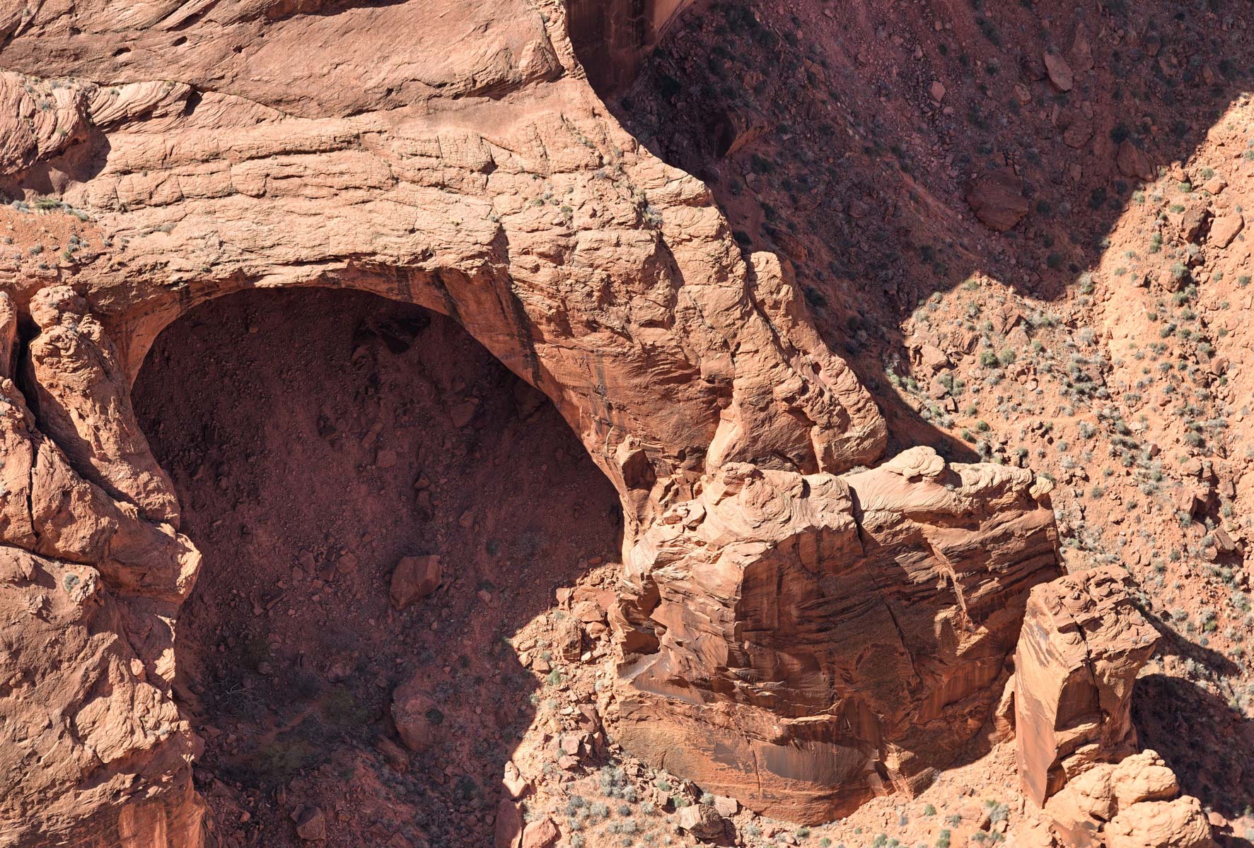
The White Pocket and Vermilion Cliffs National Monument
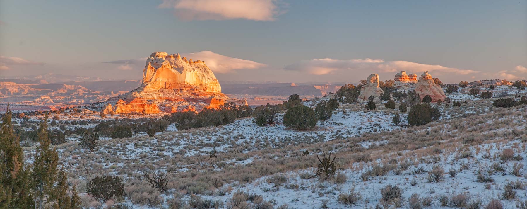
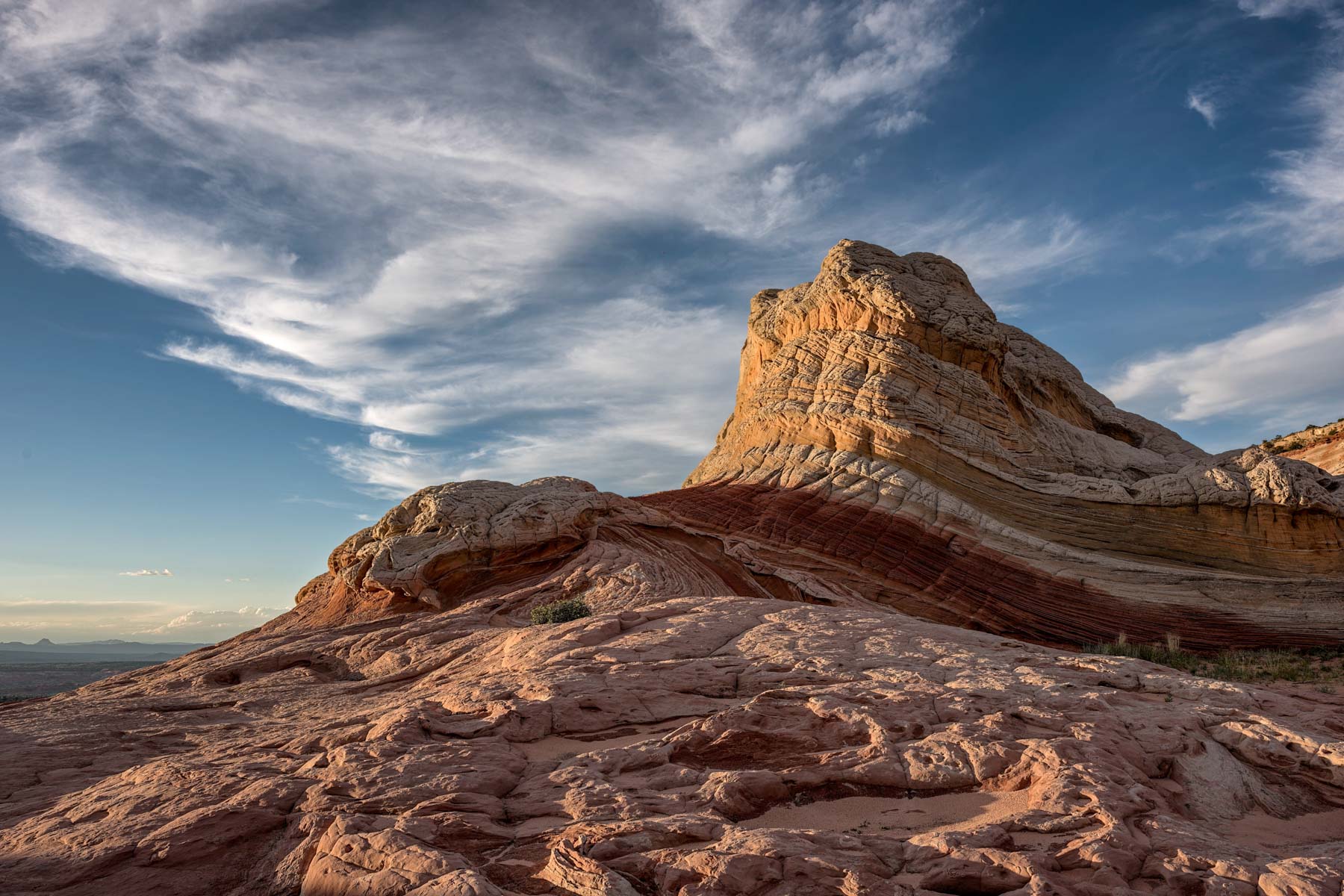
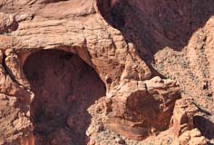
The White Pocket (Arizona) is a superb photographic destination about five miles due east of South Coyote Buttes (Cottonwood Trailhead). The White Pocket is part of Vermilion Cliffs National Monument. It was "discovered" by photographers 20 years ago. The name White Pocket refers to two areas. The topo map shows a tall butte about 500 feet high that can be seen from miles around. I'll refer to this butte as the White Pocket Monolith or the White Pocket Butte. Conversely, photographers use the term White Pocket to refer to the area of white and coral-colored cauliflower (aka brain) rock to the east of the White Pocket Butte. This area has many water pockets, which account for the name, and is the area of photographic interest. The area is small, about one hundred acres. No permit is needed for the White Pocket, and cattle can roam freely as of July 2015, although they are mostly fenced out.
Directions to the White Pocket
It isn't easy to get to the White Pocket. You need a high-clearance four-wheel-drive vehicle due to the deep sand. The White Pocket is often combined with a trip to Coyote Buttes South, so I will also give directions from there. Due to poor road conditions, I recommend camping at the White Pocket trailhead overnight and driving out the next morning.
Best Route
If you are coming from the North, take House Rock Road 20 miles to BLM 1017 (Pine Tree Road), shown in green on the Google map below. After about three miles, bear right and continue on Pine Tree Road (in blue). 6.1 miles from the intersection with House Rock Road, reset your odometer and turn left. The general direction of the road you are traveling on is NNE. Go through the gate and continue for 3.9 miles, then bear left. Continue another 5.4 miles, and you will see the main White Pocket parking area on your left. Alternatively, you can continue straight for another .3 miles down a sandy hill to a second flat rocky area where you can also park. If you are camping, this second area offers more privacy, but the last sandy hill will present problems for some on the return.
From the main parking area, head west on the well-defined trail to the White Pocket.
Notes for your return - 0.5 miles after you leave the White Pocket, bear right, the left fork goes to the Hole in the Rock arch. You will reach an intersection 1.4 miles after you leave the White Pocket; bear left here to retrace your route. If you go right, you will soon hit a steep uphill, which could be troublesome for some cars. As of August 2011, the road was almost impassable in the uphill direction.
Route from Coyote Buttes South
From Pawhole, take the "Shortcut" Road East from Pawhole 2.8 miles to Poverty Flat. The road is shown in red on the map. This road has a steep uphill near Pawhole and is difficult in dry conditions. The road is now marked one-way against you because of the deep sand, but people in good vehicles can drive it uphill. Then follow the directions below for Poverty Flat.
From the Cottonwood Cove trailhead, take the road in blue 2.4 miles south to Poverty Flat.
From Poverty Flat, take the Red Road northeast, then east 4.5 miles, bear left, and continue 1.4 miles to the White Pocket trailhead. This road has a steep downhill about 4 miles from Poverty Flat. The road is much easier to traverse going to the White Pocket than from it.
Photography at The White Pocket
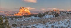
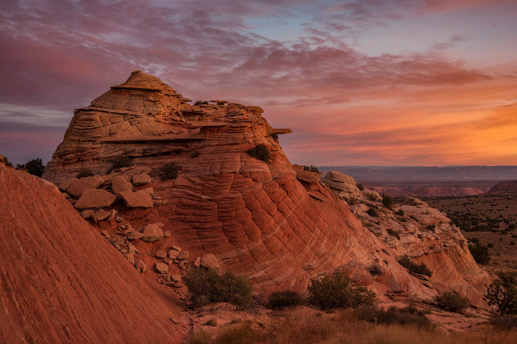
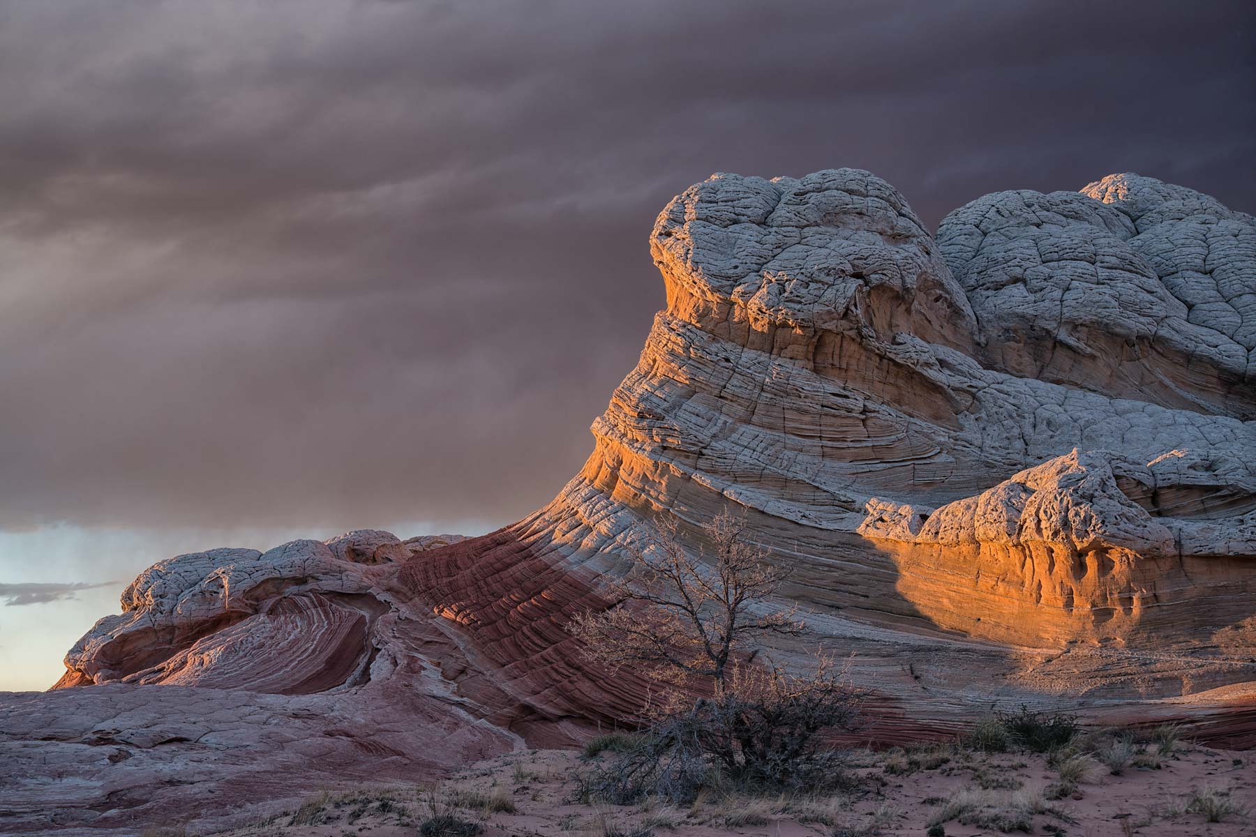
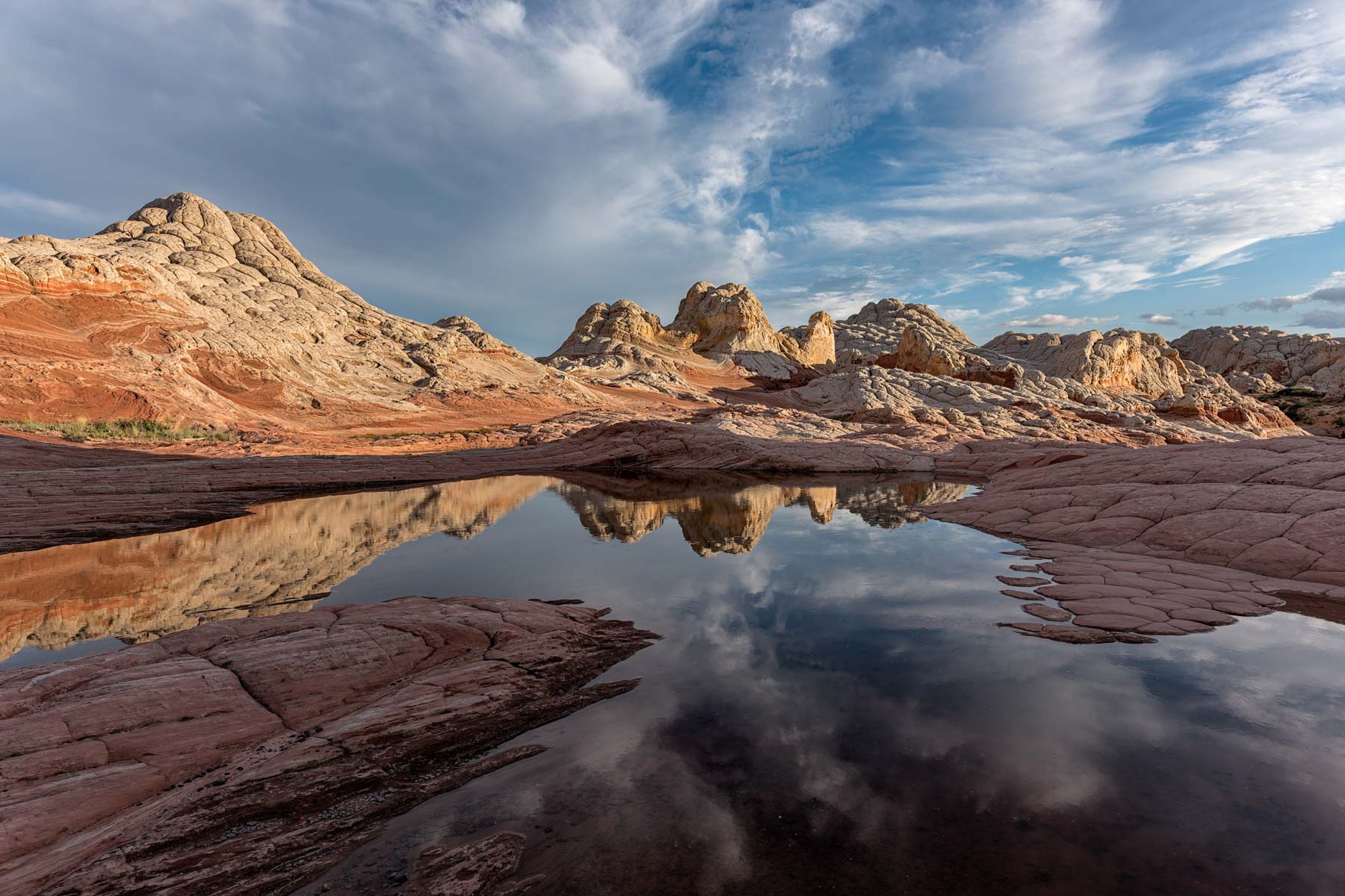
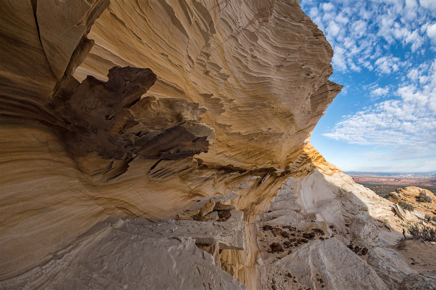
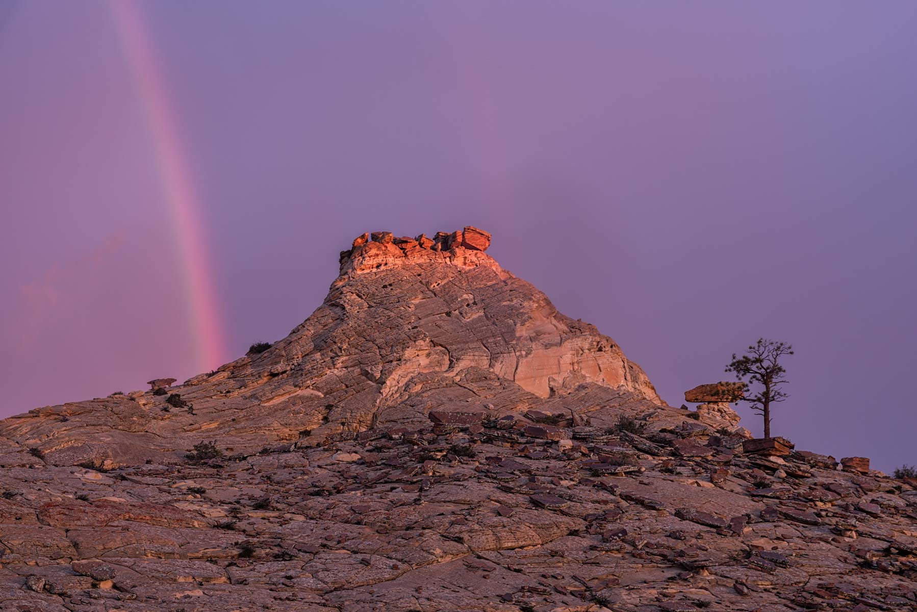
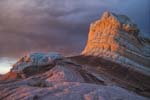
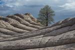
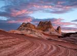
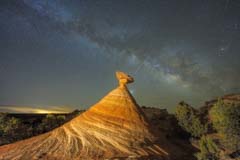
The White Pocket has an upper and lower level. The lower level is to the west, and the upper is to the east. The lower level is best shot mid- to late afternoon and is in shadow at sunrise and for an hour after. The lower level includes the formation I call The Swirl, probably the most popular White Pocket subject. Shoot The Swirl late afternoon. Near the winter solstice, it is nicely lit on both the SE and SW sides; during the rest of the year, only the SW side is lit at sunset.
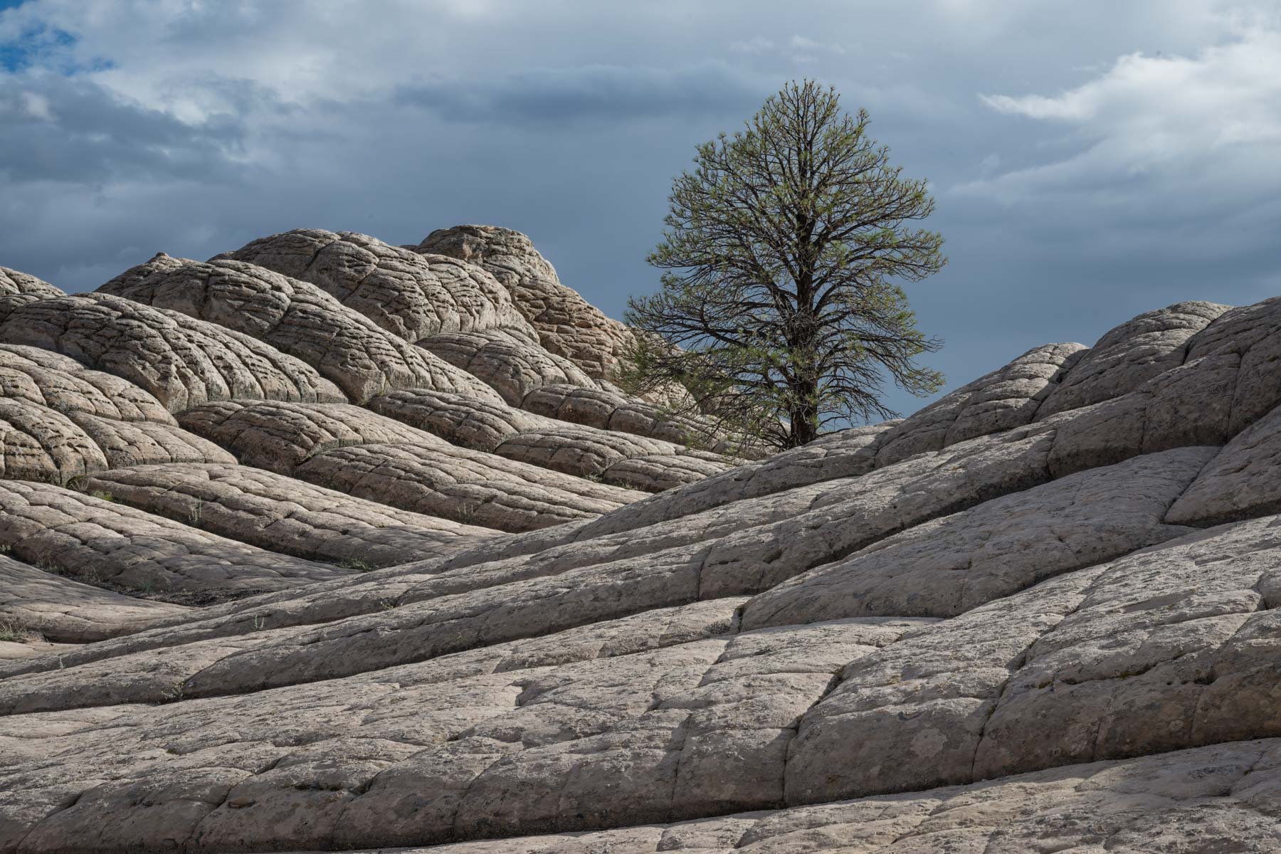
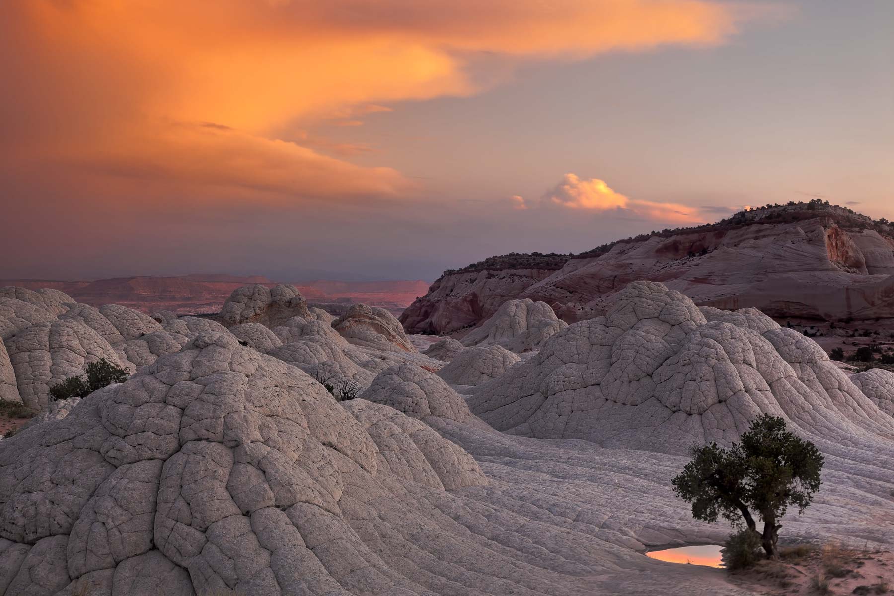
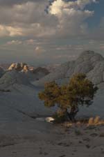
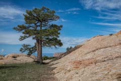
The upper level gets good light a bit after sunrise and at sunset. There are two trees on the upper level; the "First Tree" is visible to the left (south) of the end of the short trail into the White Pocket. The "Second Tree" is a bit southwest of the first and cannot be seen from the trail. This tree is in an open area and gets excellent light at sunrise and sunset in August. In early July, the second tree is in shadow at sunset. At the far north end of the White Pocket is an area with many moqui marbles in a good setting. This area is an excellent late-afternoon location.

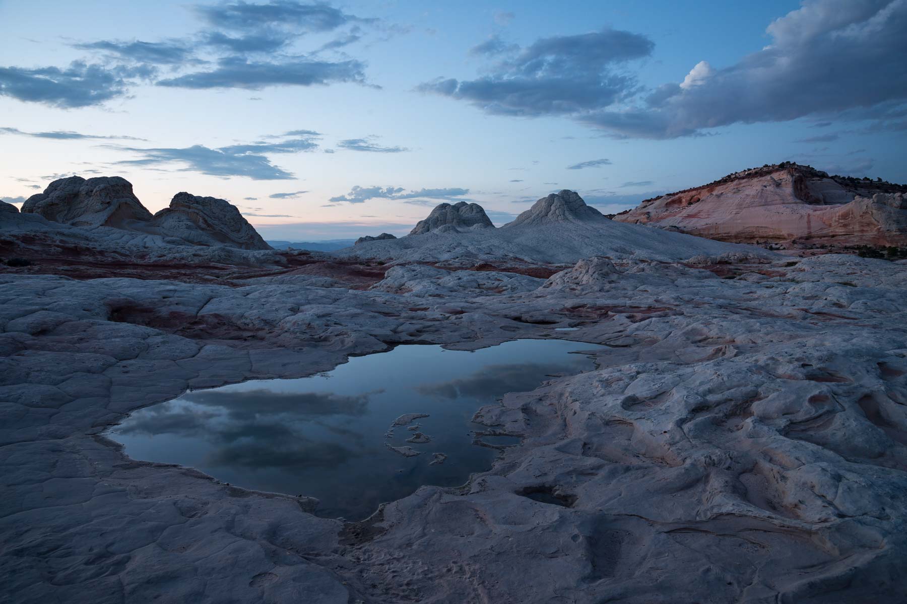
You can shoot at the White Pocket well into the "Blue Hour" since it is only a half mile back to your car from any place in the area. The Blue Hour is four to eight degrees below the horizon, either after the sun sets or before it rises. During the blue hour, the sky turns brilliant blue, and the landscape takes on a blue glow. The glow occurs then because only the blue rays of the solar spectrum are bent by the atmosphere toward the Earth; the warmer tones pass through the atmosphere into space. The best photos of the White Pocket are taken just a few minutes after sunrise or before sunset, in the Blue Hour, or at night. During the blue hour, exposure times can be long, with 5-30 seconds typical when shooting at low ISO. You'll need to use a tripod or increase your ISO. If you go to the White Pocket, you should car camp overnight rather than try to drive in or out in the dark. Going with a guide is a good option; if you do, get a tour of the White Pocket at sunrise or sunset. Some tours include camping. The White Pocket is popular for car camping; expect to see others. There are no toilets or potable water at the White Pocket. If you car camp, you can get a bit more privacy if you avoid the main parking area and proceed to the alternate parking area about .3 miles to the north.
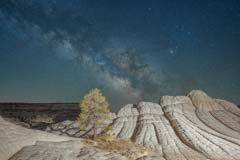
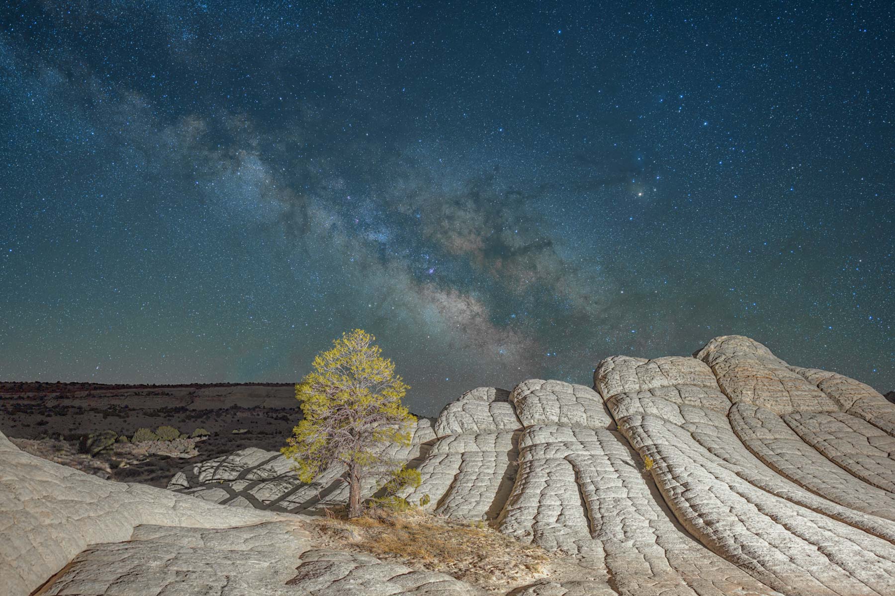
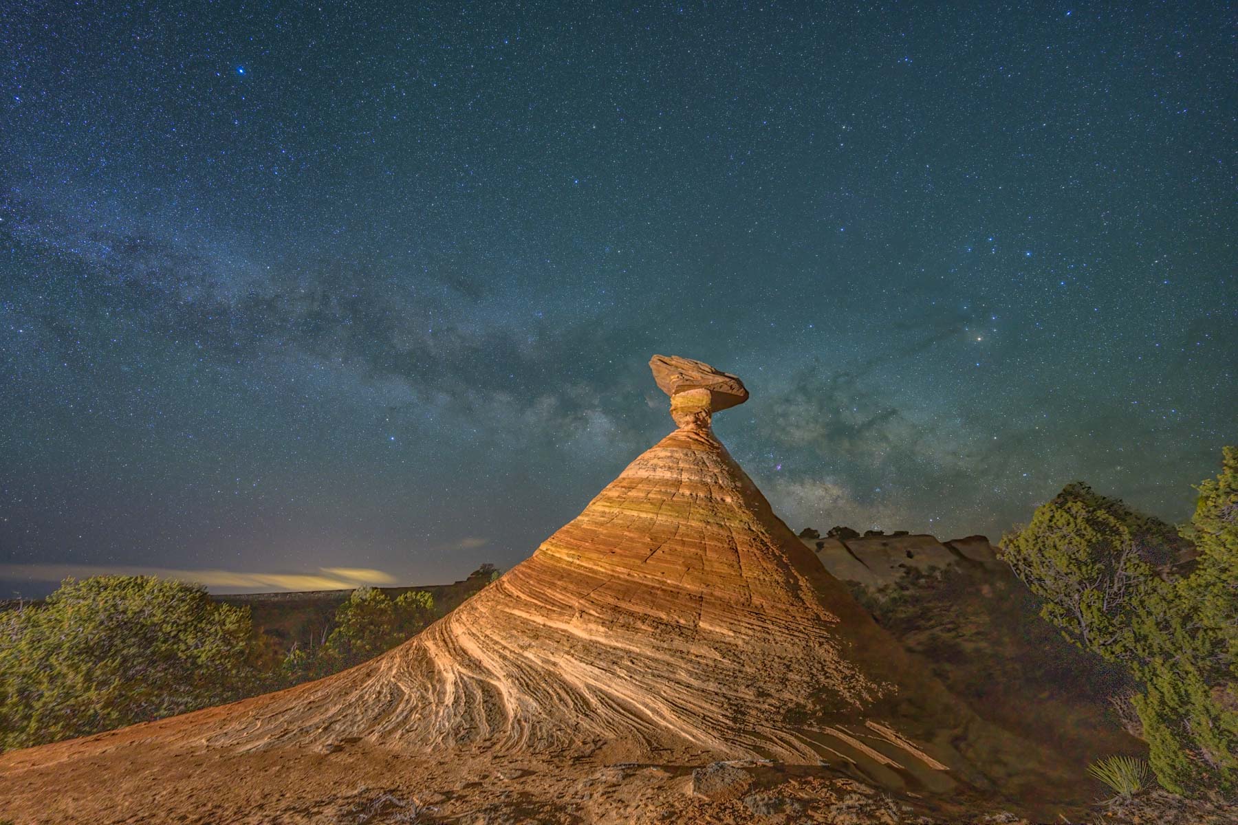
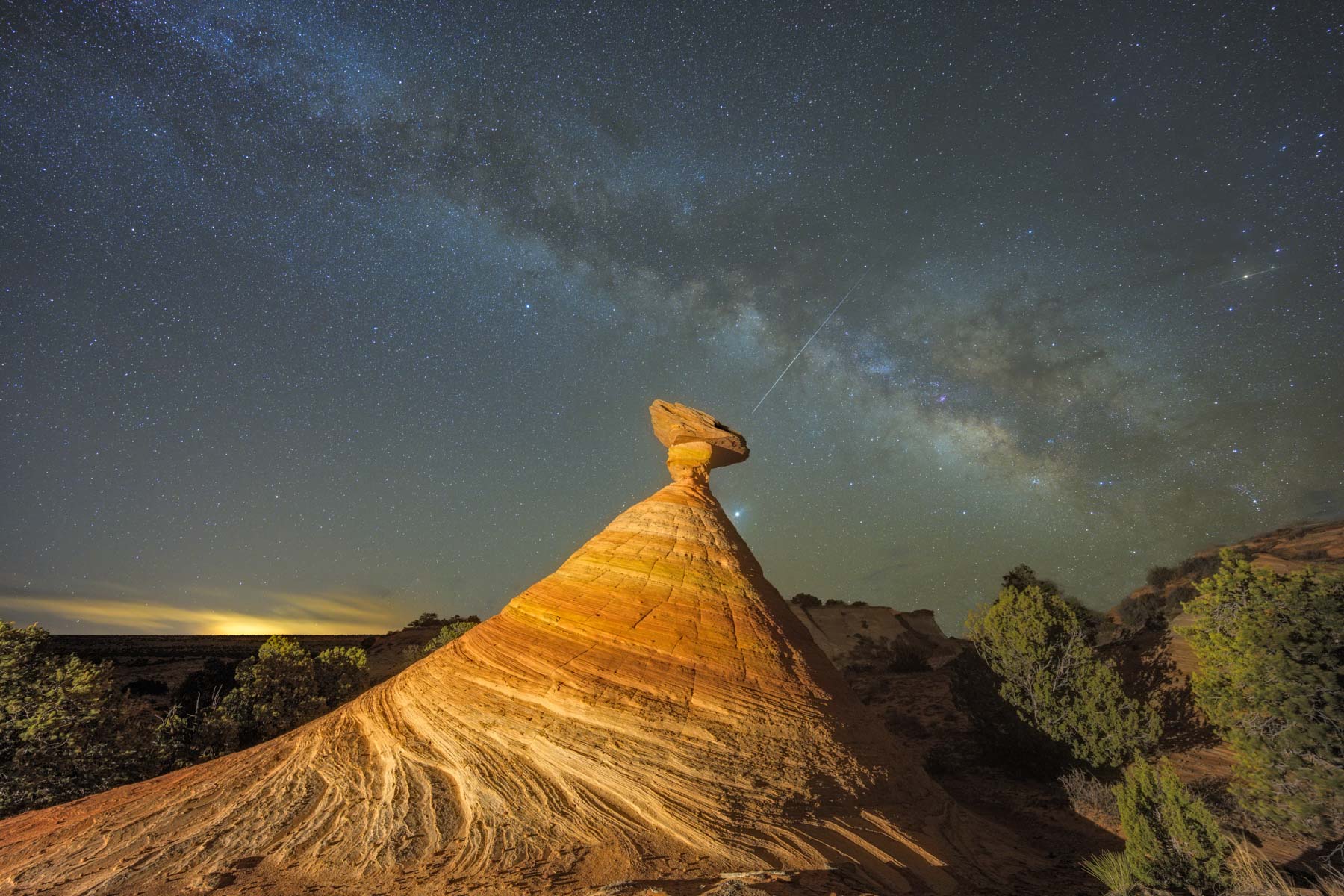
The White Pocket is an excellent location for night photography. There is little ambient light except to the east, where there is some glow from Page. The best view of the first tree is to the south, making the tree a good foreground for the Milky Way. You'll need a night with light winds. From March to May, when the Milky Way is more horizontal, shoot from the west side of the tree. From June to August, try the North Side. The S Curve with The Citadel in the middle ground is also a good foreground for the Milky Way. The Swirl faces south, so star trails work well here. At Moqui City, both star trails and Milky Way shots are possible.
If you shoot at night, make sure you mark the location of your car with a GPS. The White Pocket is trail-less except for the short path going in.
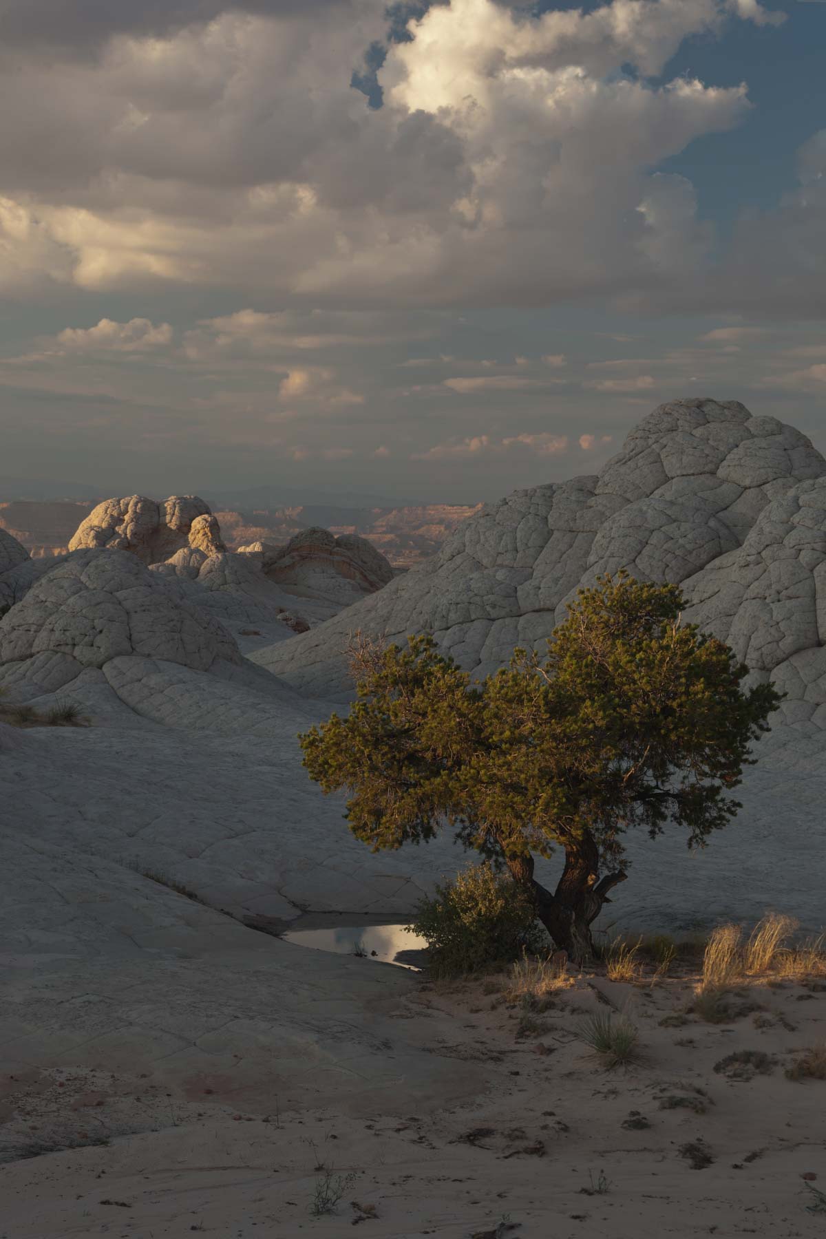
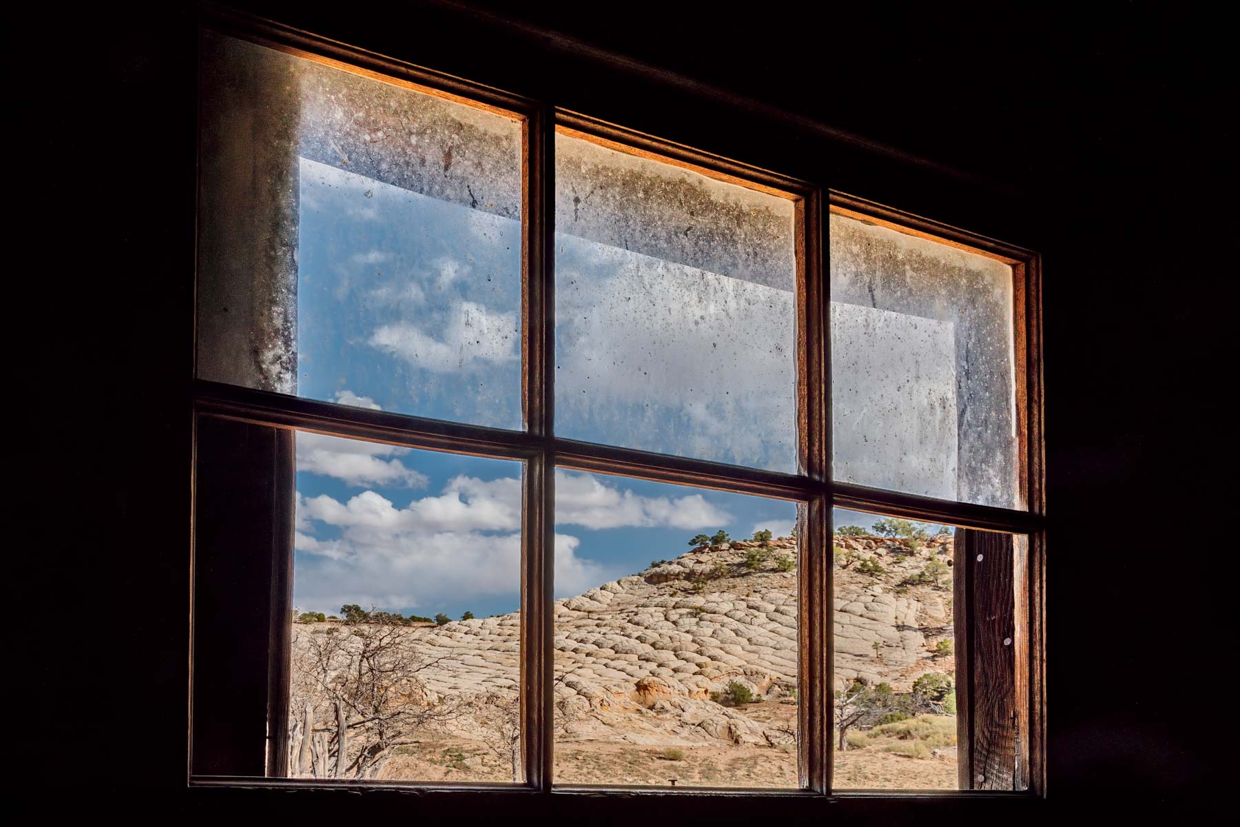
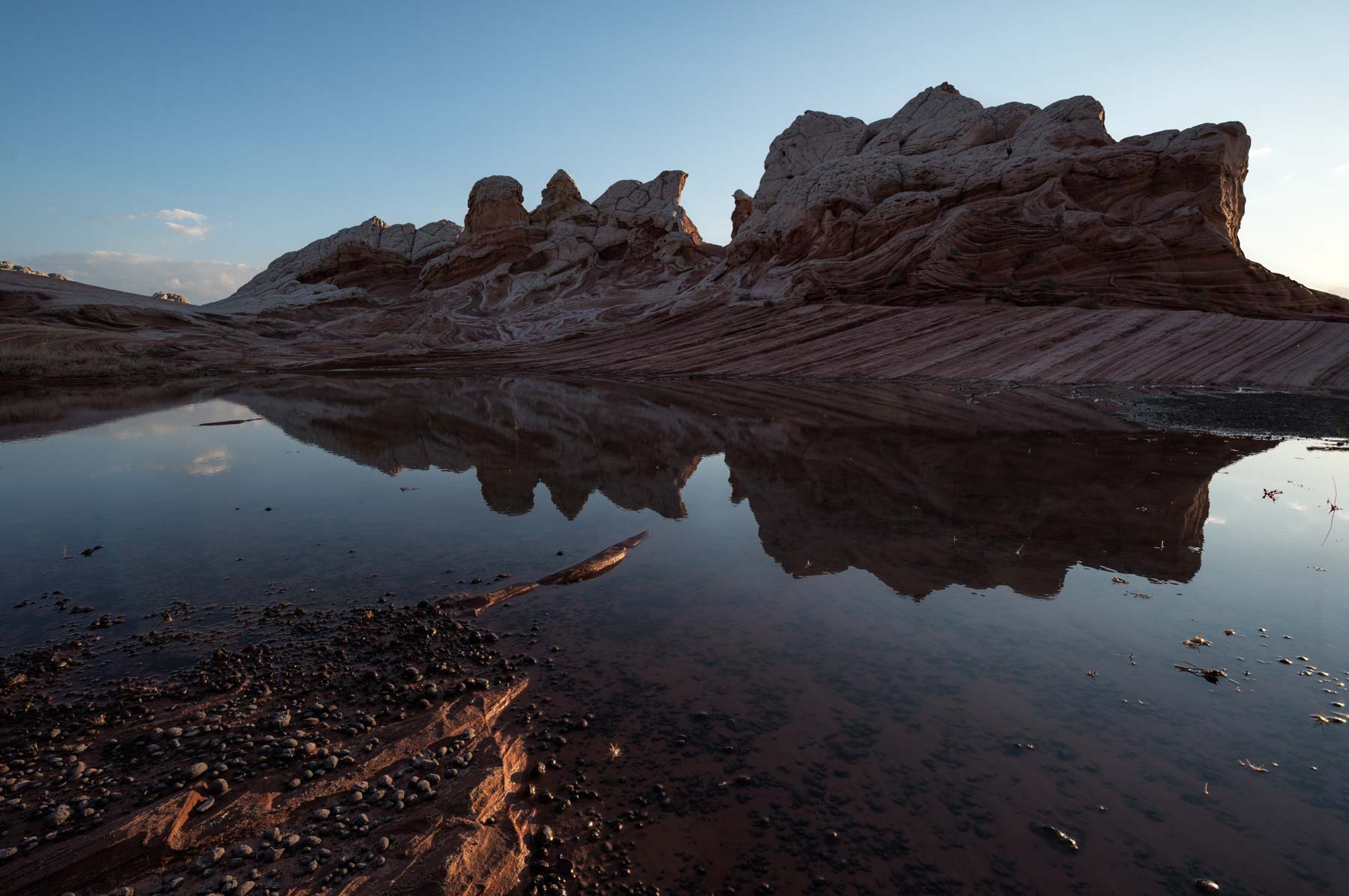
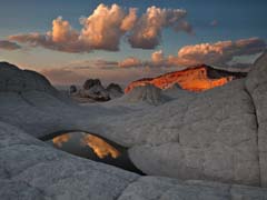
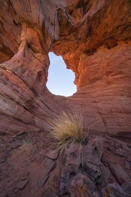
After rainfall, there are many shallow pools in the lower area of The White Pocket. Use them to frame reflections of the White Pocket Monolith or the Swirl. The deeper pockets in the upper area reflect the two trees. After a rainfall, you may not be able to access The White Pocket as House Rock Road may be impassable. After heavy rains, you may even find quicksand on some roads into the White Pocket. Quicksand is rarely more than knee deep, but if you drive into it, you will not be able to get your car out without a winch or tow.
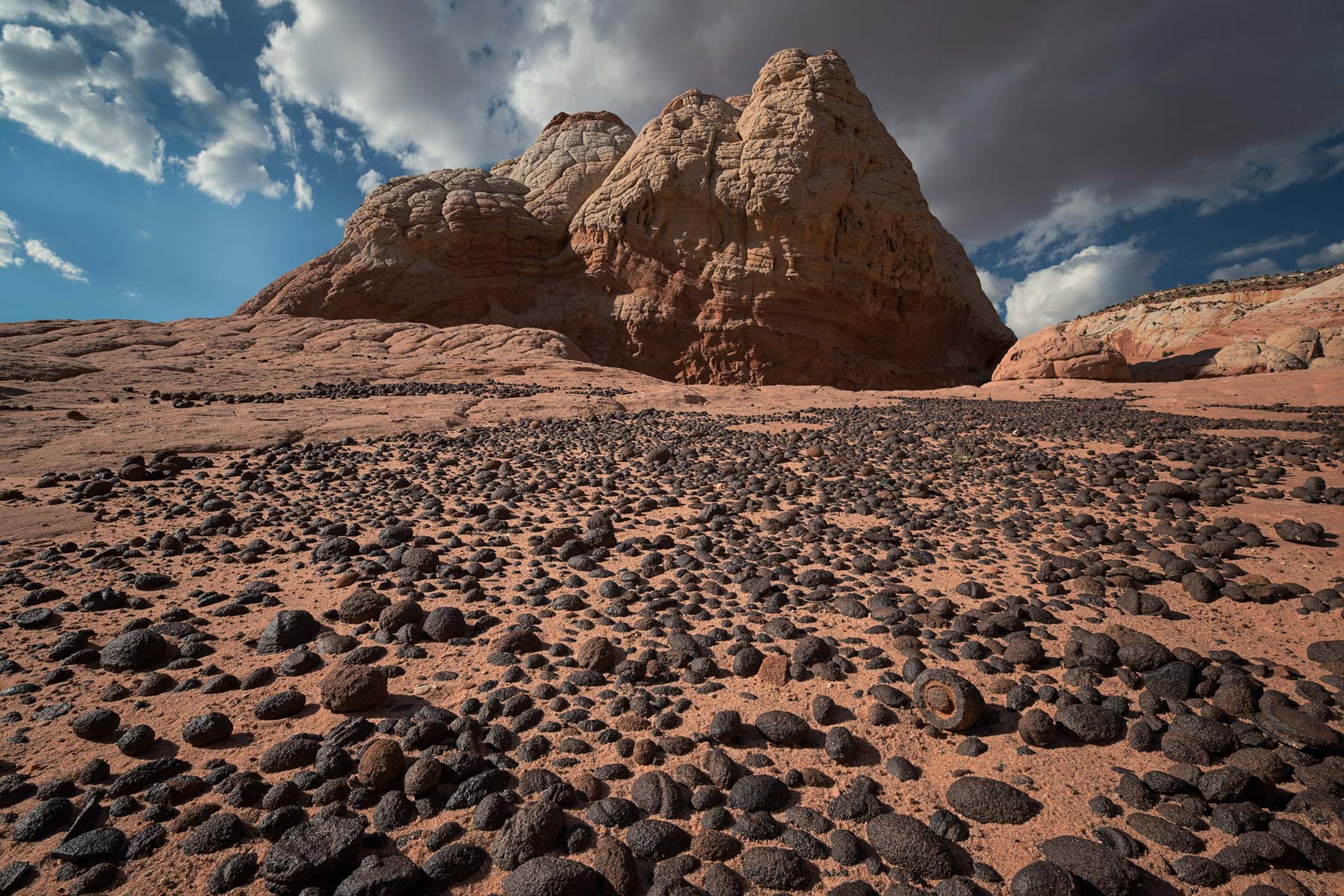
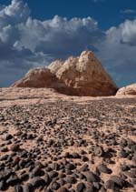
When the potholes are full of water, you may find tadpoles and tadpole shrimp in them. In early August 2011, I found hundreds of tadpoles and tadpole shrimp in the pools at The White Pocket. Desert tadpoles grow into toads, not frogs. While both are amphibians, toads live on land rather than in the water. Toads spend their adult lives finding shelter in vegetation, under rocks, and in abandoned burrows. After a heavy rain, male toads find a water pocket and begin croaking to attract a mate. I have heard toads croaking at The Wave in mid-April after a heavy rain. Toad croaks are very loud, and toads may croak for hours till they mate. After fertilization, eggs take over ten days to hatch into tadpoles. Tadpoles then spend the next 9-12 weeks transforming into toads so they can survive on land. Only a few make it; often, the pool dries up before the tadpole can mature. Desert shrimp have a different life cycle since they survive only in water. After sufficient rain (seen by the shrimp eggs as adequate water pressure), shrimp eggs, which may have been dormant for years, hatch into shrimp. Shrimps have a very short lifespan; they live, reproduce, and die over just a few weeks. Tadpole shrimp and tadpoles are good subjects for video, especially if you have a macro lens with you.
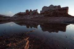
You will usually find water at the White Pocket in July and August. While the smaller pools dry up within a day or two of rain, the larger ones, such as those created by rancher dams, keep their water throughout the period. Look for pools that are evenly lit. If you shoot ground level from the water's edge, the pool will look more like a lake than a pool. The pool in the image to the right was only a few inches deep and six feet wide!
White Pocket Points of Interest
| Latitude | Longitude | Rating | Comments | |
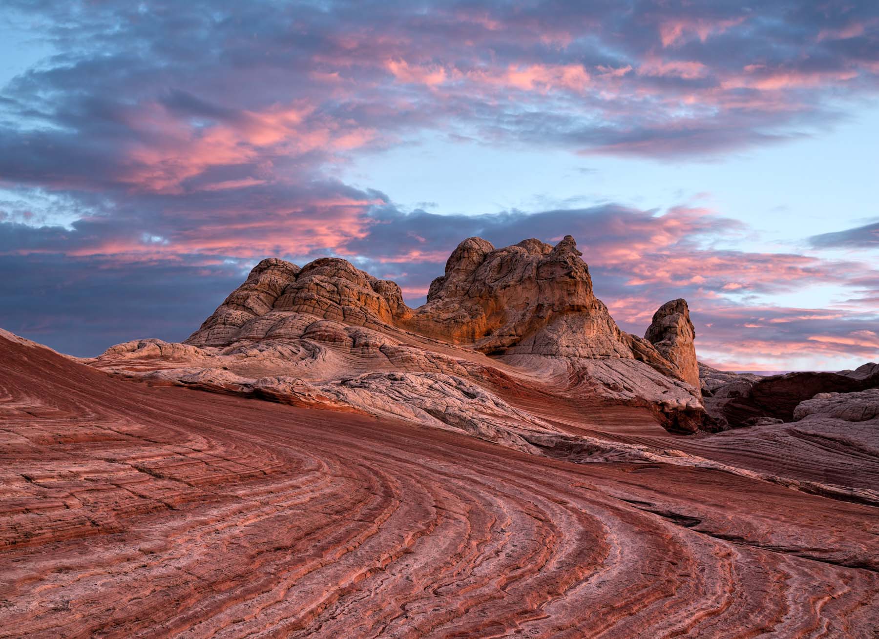
 The Monolith |
36°57'23.9" N | 111°54'26.3" W | **** | Best at sunrise, shoot a reflection from the water pools near the Swirl, or from the south end of the WP. Worth climbing from the north side. West side has some hoodoos. |
 The Swirl |
36°57'34.6" N | 111°53'50.4" W | ***** | Best an hour or two before sunset. Good foreground for star trails. |
 Moqui City |
36°57'43.2" N | 111°53'48.3" W | ***** | Best moqui marble site I know. Shoot using a wide angle from ground level. Best late afternoon in spring/summer or to sunset in Fall/Winter. |
 The Tree |
36°57'18.2" N | 111°53'51.3" W | **** | Ponderosa Pine surrounded by Brain Rock. Good at sunrise and sunset. |
 The Second Tree |
36°57'15.8" N | 111°53'52.2" W | **** | Good at sunrise and sunset most of the year. In May, June not lit at sunset. |
 The S Curve |
36°57'29.5" N | 111°53'49.8" W | *** | The Citadel is the background. Good sunset location especially near the summer solstice. Good foreground for Milky Way shots. |
 Cattle Trail? |
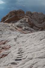
36° 57' 25.3" N | 111° 53' 48.1" W | *** | Hard to believe these indentations were made by cow's repeated passage. Other theories - wild horses, and dinosaurs? |
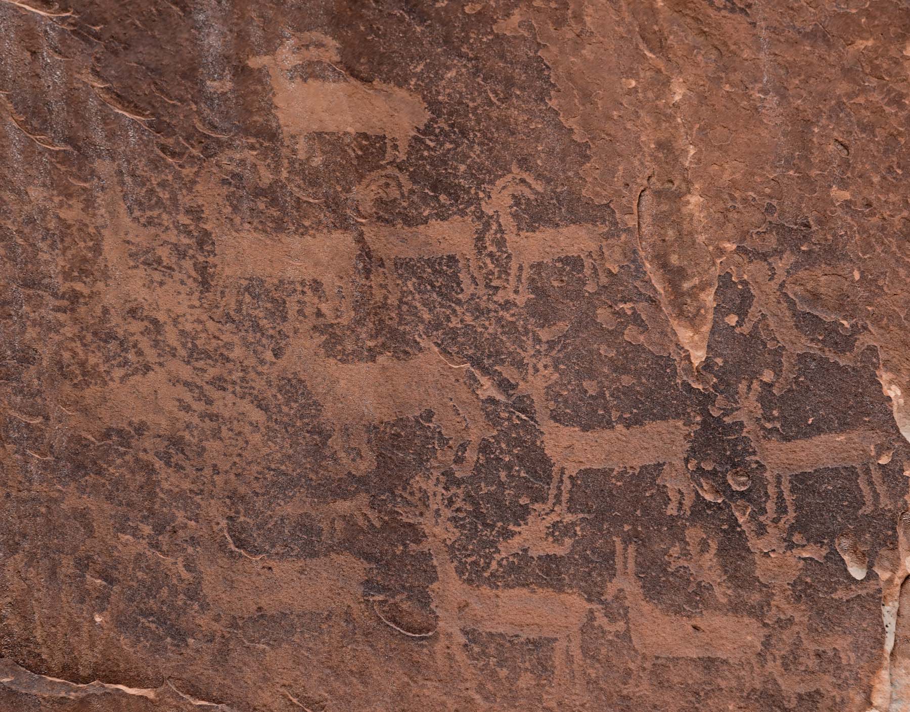
 Petroglyphs |
36°57'43.2" N | 111°53'40.5" W | ** | And a cowboy glyph from 1937. Best in the afternoon. |
Directions to Other Areas in the Sand Hills / Vermilion Cliffs
Caution - The first three areas shown below are very remote and see little visitation. They are much more remote than the White Pocket, which sees visitors almost daily. If your vehicle gets stuck or breaks down, if you injure yourself, or if you get lost, you may die. If you visit these areas, I strongly recommend you go with another vehicle or at least let someone know where you are going. Have a good spare, extra gas and water, and a satellite phone or personal radio beacon (PRB). A GPS will also help keep you on the right road.
Joe's ranch and the Cowboy Hat
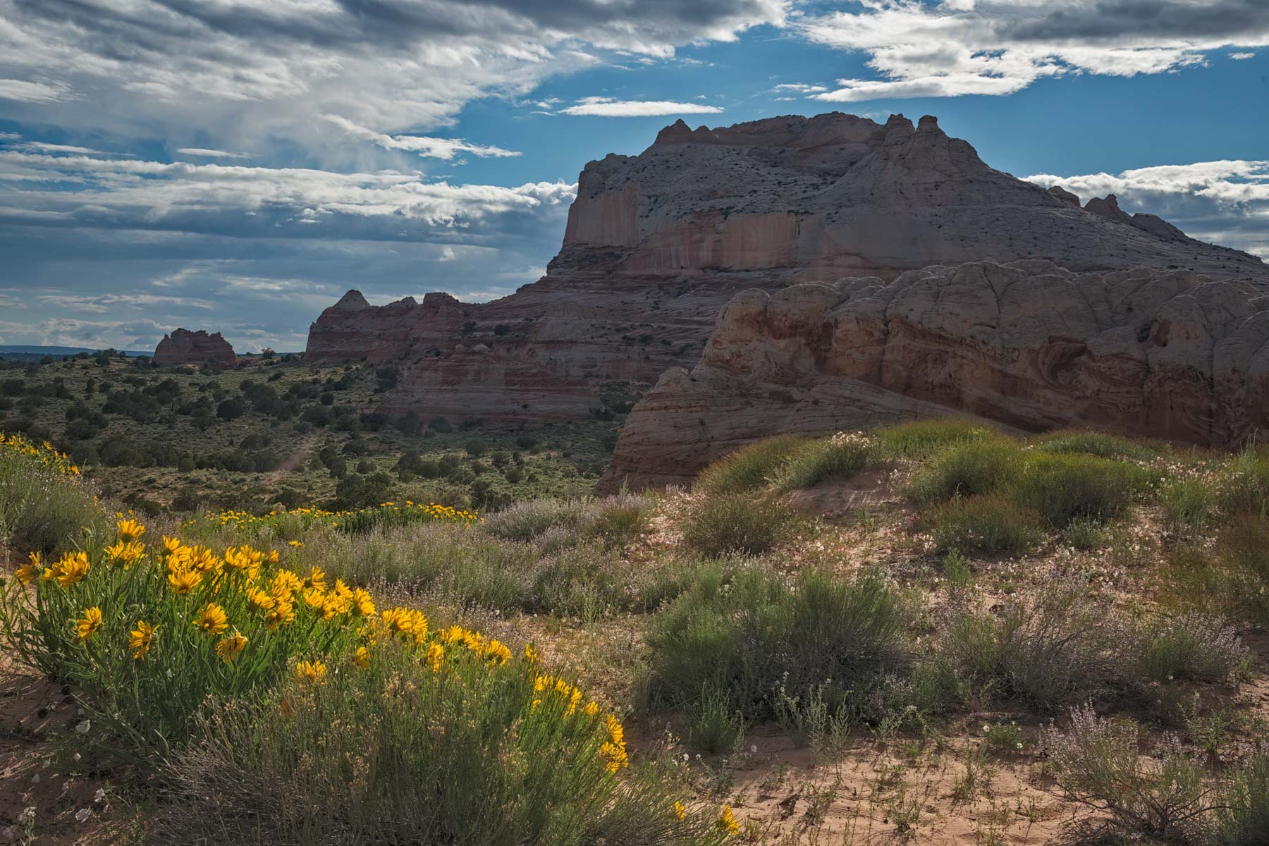
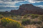
The Joe's Ranch area contains an abandoned ranch and a large water pond marked "Joes Tank" on the USGS 24K "The Big Knoll" Topo Map. "Joe" refers to Joe Hamblin, son of Jacob Hamblin, a famous Mormon explorer. Jacob Lake and Jacob Hamblin Arch in Coyote Gulch were named after Jacob. I visited Joe's Ranch during a dry period, and the pond had plenty of water, so I expect there is usually water present. East of the pond, brain rock is interspersed with small trees. There are many good photo opportunities between the pond, the brain rock, and the ranch. Mid-afternoon to sunset works well here.
The Cowboy Hat is a nice hoodoo with good leading lines to the north. Unfortunately, the Cowboy Hat is in a small depression, so it doesn't get great light at sunset. I suggest shooting it late afternoon while its base is still lit. I have not been there at sunrise or early morning, but I believe the formation probably gets decent side lighting in the summer.
From House Rock Road, take BLM 1017, about six miles, to "Pine Tree Pockets." At Pine Tree Pockets, BLM 1017 continues southeast, becoming the Loop Road, shown in red-orange on the map (with a lavender section at the end to close the loop). The entire loop is over 20 miles in length. The road is very sandy and occasionally difficult to follow. The road near Joe's ranch is particularly sandy. Joe's ranch and the Cowboy Hat can be reached from the loop road via short spur roads, which are in even worse condition. Joe's ranch is right off the spur road. To get to the Cowboy Hat, park where I've indicated on the map and hike east .3 miles. The Cowboy Hat (at the top of the rock formation) is visible from where you park, making it easy to find. The Cowboy Hat is best near sunset or at night as a foreground to the Milky Way. Many moqui marbles are at its base and on the butte to the north, including some of the largest moquis I have seen. Please do not take them.
Soap Creek Tank and the Beehives
Soap Creek Tank is an area of multicolored brain rock high on the Vermilion Cliffs above Cliffdwellers Lodge on Highway 89A. It is a good location for both sunrise and sunset.
From House Rock Road, take BLM 1017 about 6 miles to "Pine Tree Pockets." At Pine Tree Pockets, continue straight on BLM 1017 for 13.6 miles and turn right onto a sandy track. Take the Sandy track 4.1 miles and park just before a short, steep hill. Do not continue up the hill; it is easy to get stuck on it. After parking, explore the areas to the south and east; there are many good photo opportunities here, along with some of the most unusually colored rocks I have seen. Soap Creek Tank itself always has water in it. When full, it drains into the Colorado River via Soap Creek.
You can combine Soap Creek Tank with Joe's Ranch or The Beehives. The Beehives are a small formation with some hillside ruins and pottery fragments. To get to them, proceed on the loop road to the sandy track leading to Soap Creek Tank. After about 2 miles on the sandy track, you will see a road going off to the left with a road closed sign. Park here and continue on foot via the closed road to The Beehives. The hike is about .4 miles one way.
Wrather Arch Overlook
With a span of 180 feet, Wrather Arch is one of the longest arches in the US and is considered the least accessible of the US major arches. It is found in a short tributary of the Paria River. The usual route to the arch requires a four to five-day backpacking trip down the Paria. An overlook of the arch is on the northern rim of Sand Hills. The best way to get to the overlook is to follow the directions to the Cowboy Hat trailhead. Follow them to the intersection of the red and blue lines. Take the blue line from the intersection for 150 feet and bear right onto the yellow line below. Follow the yellow line 6.9 miles to its end at a water tank. After parking, hike off the trail to the east for about 100 yards, then cross the wash wherever you can. After crossing the wash, hike along the rim of the tributary about .6 miles to the overlook. Michael Kelsey's book Hiking the Paria, 5th edition, indicates that it is possible to descend down the cliffs near the overlook to the Paria River/arch. A guide I spoke with said the trail is challenging and should be attempted only if you are a climber.
Pinnacle Valley

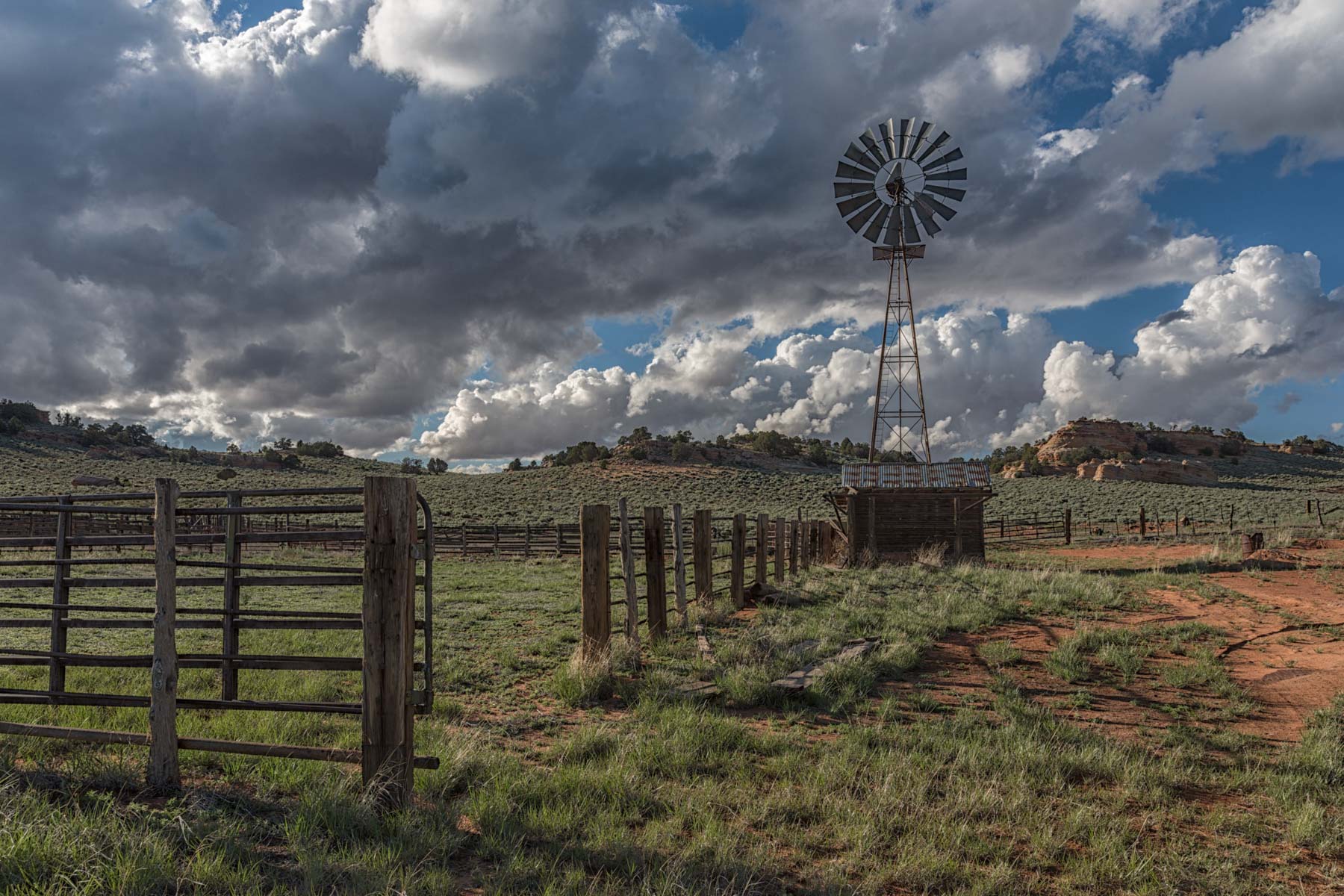
Pinnacle Valley is the largest basin in the Sand Hills. There is an old cabin (line shack), a windmill, several nice hoodoos, and The Pinnacle, a large butte covered with Brain Rock. There are three water pockets on top of The Pinnacle, one of which usually has water. The others contain many pottery fragments. Please leave them alone. To get to Pinnacle Valley from Pine Tree Pockets, bear right at the turnoff to The White Pocket, continue 5.2 miles, and bear left. After an additional 1.4 miles, you will reach the cabin and windmill area. The Pinnacle is a 1/4-mile hike east, and Kelsey says it can be climbed on its northeast side. I could not find a way to climb it.
Pinnacle Valley is good at both sunrise and sunset. The cabin and the windmill provide a good foreground for Milky Way shots at night. The windmill rotates with the wind direction, which can lead to unusual effects over the course of a long exposure.
Double Barrel Arch
This arch is easily seen from House Rock Road just south of BLM 1017. From the north, take Highway 89 to House Rock Valley Road (HRVR) from the north, between mileposts 25 and 26. Proceed south on HRVR 20.5 miles and park on the side of the road. To get there from the south, proceed 9 miles on HRVR and park. You should be able to see the arch off to the east. Hike east through the sage field to the arch. There is no trail. The hike is about .9 miles one-way. About halfway through the hike, there is a lot of clay-based soil, which is difficult to walk on when wet, so I suggest you do this hike only in dry weather. You can easily climb Double Barrel Arch from its south side. The east side of the arch is inaccessible. The arch is best lit at sunset. Sunrise works as well; the underside of the arch gets a nice red glow, and sunbursts are possible. Set the aperture at f/16 or f/22 and exposure bracket to shoot a sunburst. HDR works well to bring out the arch's colors at sunrise. A wide angle is needed to best photograph the arch.
Vermillion Arch
This alcove arch is just below the rim of Vermilion Cliffs. It cannot be seen from House Rock Valley Road or the 4x4 road to One Mile Spring. Vermillion arch has a reported span of 34 feet. The spelling of the arch's name is odd. The arch appears in the World Arch Database as Vermillion Arch (with two l's). Vermilion with one "l" is the preferred spelling on both sides of the Atlantic and is the spelling used in "Vermilion Cliffs National Monument." The images in my album were taken about four hours after sunrise, which seems a good time to shoot them. You could combine a trip to Vermilion Arch with a visit to Double Barrel Arch. Shoot Double Barrel at sunrise and then go on to Vermilion.
The "trailhead" to Vermilion Arch is off the 4x4 road to One Mile Spring. From the south, One Mile Spring Road is 5.5 miles from the intersection of Highway 89A and HRVR; from the north, it is 24 miles from the intersection of Highway 89 and HRVR. Turn east on One Mile Spring Road. You will immediately come to a fork. The road to the left goes to Two Mile Spring and is signed "Administrative Use Only." Go right and proceed 0.6 miles to a small parking area on the road's left (north) side. The road past this spot is narrow and quite rough. Reportedly, petroglyphs and some degraded ruins are near the parking area. I didn't see either, but I wasn't aware of them when I hiked to the arch. The hike to the arch from the parking area is all off-trail and about one mile long. You'll need to ascend two escarpments. The first is best climbed by following the cliff to its left (west) side until you reach a break. For convenience, I have shown my actual route on the map below. During the hike, you'll see the remains of an old water pipe. This pipe was likely used to pump water for cattle to the top of Vermilion Cliffs. The pipeline is probably 70-100 years old. In some places, you'll even see the cairns used to guide the water pipe's installation.
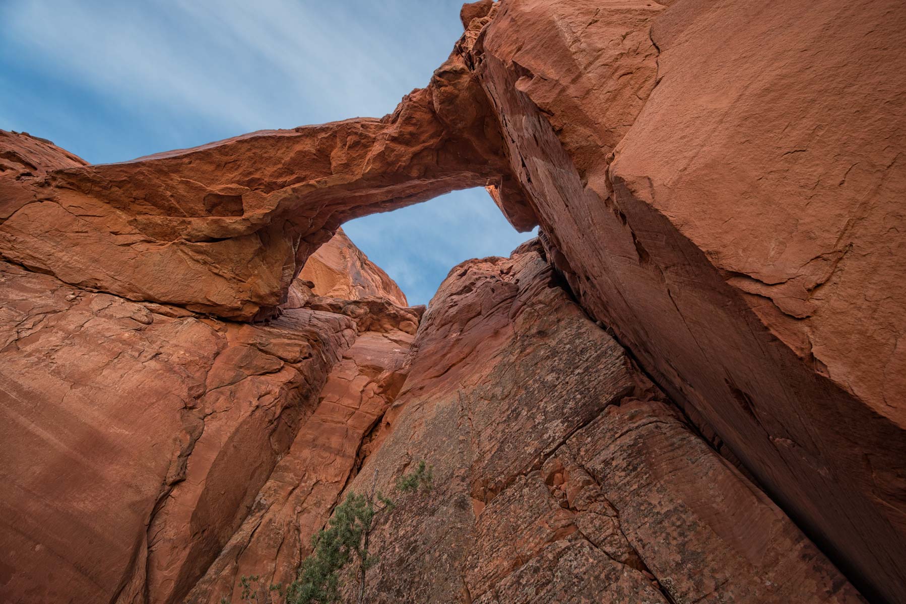
Hole in the Rock Arch
When visiting The White Pocket, you should consider seeing Hole in the Rock arch, which is a short but sandy drive away. Hole in the Rock Arch gets very few visitors, so if you go there, make sure someone knows this. Bring plenty of water, in case your car gets stuck. Bring a shovel, as the roads are very sandy. Loaner shovels are often available at the Paria contact station from March to November. Hole in the Rock Arch is best photographed in the afternoon. You can reach the arch's opening by climbing up the scree on the right side. Be careful; you are a long way from help.
Google Map and Directions
The following map covers an extensive area and is a work in progress. It covers most of the Vermilion Cliffs National Monument. Vermilion Cliffs is on BLM land and is open to the public. There is some state-owned and private land in the area; click here to see the large-scale official BLM map showing ownership and to place the map in context.
Caution - Some of the roads shown have yet to be driven by me and may be closed or impassable. The main routes to Coyote Buttes South and The White Pocket have been verified.
The map below covers The White Pocket, Coyote Buttes South, and the entire Sand Hills area. The map has many layers. You can turn layers on or off to zoom in on areas of particular interest. The map shows the boundaries of the Coyote Buttes South permit area and the Paria Canyon wilderness. You cannot fly a drone in either area. You may want to turn this layer off to improve map visibility. Click on the image below to open Google Maps. Then use the checkboxes on the left to turn on or off specific features of interest.
Note that the new Google Maps engine does not show you the latitude/longitude of waypoints or points of interest, elevation, or the distance between two points on the map. The engine also does not show track or route elevation profiles. If you need these, I suggest downloading the KML or KMZ file for the map and loading it into Google Earth or another mapping tool.
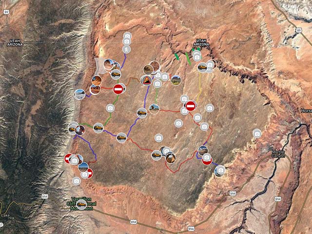
To view the map in Google Maps please click anywhere on the map above.
- Click to download a KMZ file (Note - in IE Right Click and choose Save Target as)
- Click to download a KML file (Note - KML files do not include custom icons)
- Click to download a GPX file (Note - in IE Right Click and choose Save Target as)
Photo Map
The following map shows the locations of all of the geocoded photos in my White Pocket Gallery. After opening Google maps click on any image to display a cropped thumbnail, the GPS coordinates, elevation, and focal length used when shooting the image. Click on the cropped thumbnail in the upper left corner to display a larger uncropped image.
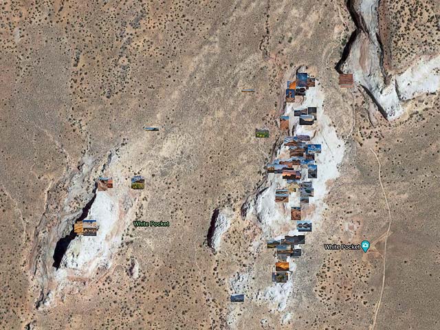
To view the map in Google Maps please click anywhere on the map above. The Google Map contains many photos and will take 10-20 seconds to load.
The map can be downloaded by clicking here.
Dark Sky Map of Vermilion Cliffs
The following map from darksitefinder.com gives a rough idea of how dark the skies are in Vermilion Cliffs National Monument. Click on the map below to zoom in or out or change the base layer:

The map contains 15 colors. The Milky Way is invisible in the white, light gray, and red areas, visible but washed out in the yellow and orange areas, shows the Milky Way's structure in the green and blue areas, and in the black area, light from the Milky Way center casts shadows. Here's more information on interpreting the colors on the map. This information comes from handprint.com:

USGS 24K Topo Maps
Vermilion Cliffs and vicinity is largely covered by 16 USGS 24K topo maps. The White Pocket is covered by the Poverty Flat Map. The roads to it are covered by the Coyote Buttes, House Rock Spring, and One Toe Ridge maps.
The table to the right contains the topographical maps in a variety of formats. KMZ overlay files can be opened with Google Earth, and Oruxmap files can be opened with Oruxmaps, a free mapping app for Android phones and tablets. USGS topo maps have a white border (called the collar) that contains information such as the map name, names of neighboring maps, the date the map was created, latitude and longitude reference lines, etc. While collars are very useful on printed maps, the information on the collar is much less useful for computer use. Maps with the collar removed can also be downloaded in the table below.
For reference, here is an image showing the names of all 16 topo maps and their location. The topo maps can be downloaded below.
Vermilion Cliffs Index Map