Valley of Fire State Park
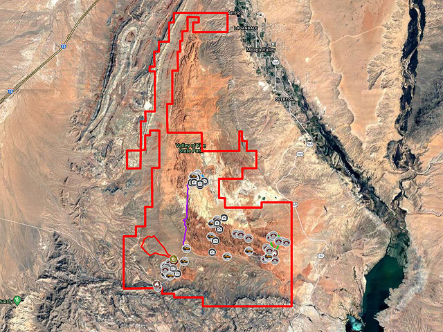
Valley of Fire State Park is a dreamland of red Aztec sandstone arches nestled amongst its 40,000 acres. Valley of Fire is only an hour from Las Vegas and is an excellent destination on the way to the National Parks of Utah or on its own. The cost to enter the park is $10 per vehicle per day, and camping is available for $20 per night. Campsites with hookups are an additional $10. There are many free campsites available just outside the park as shown on the Google map below.
Valley of Fire would be much more popular with photographers if it weren't for some restrictions. The park is only open from sunrise to sunset. If you are camping inside the park you are restricted to your campground after sunset. The rule appears to be loosely enforced. You can shoot until sunset but after the sun sets you should immediately return to your car. It may be possible to stay after sunset by purchasing a commercial photography permit.
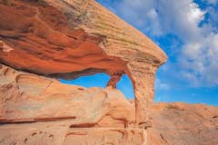
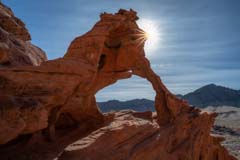
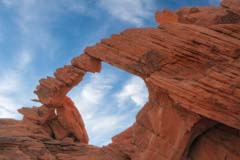
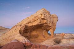
The other restriction limits access to Arch Rock and Elephant Rock, the two most photogenic arches in the park. Both are signed "Keep Off". The signs seem to be routinely ignored but you might be warned or ticketed if you disregard them.
Locations

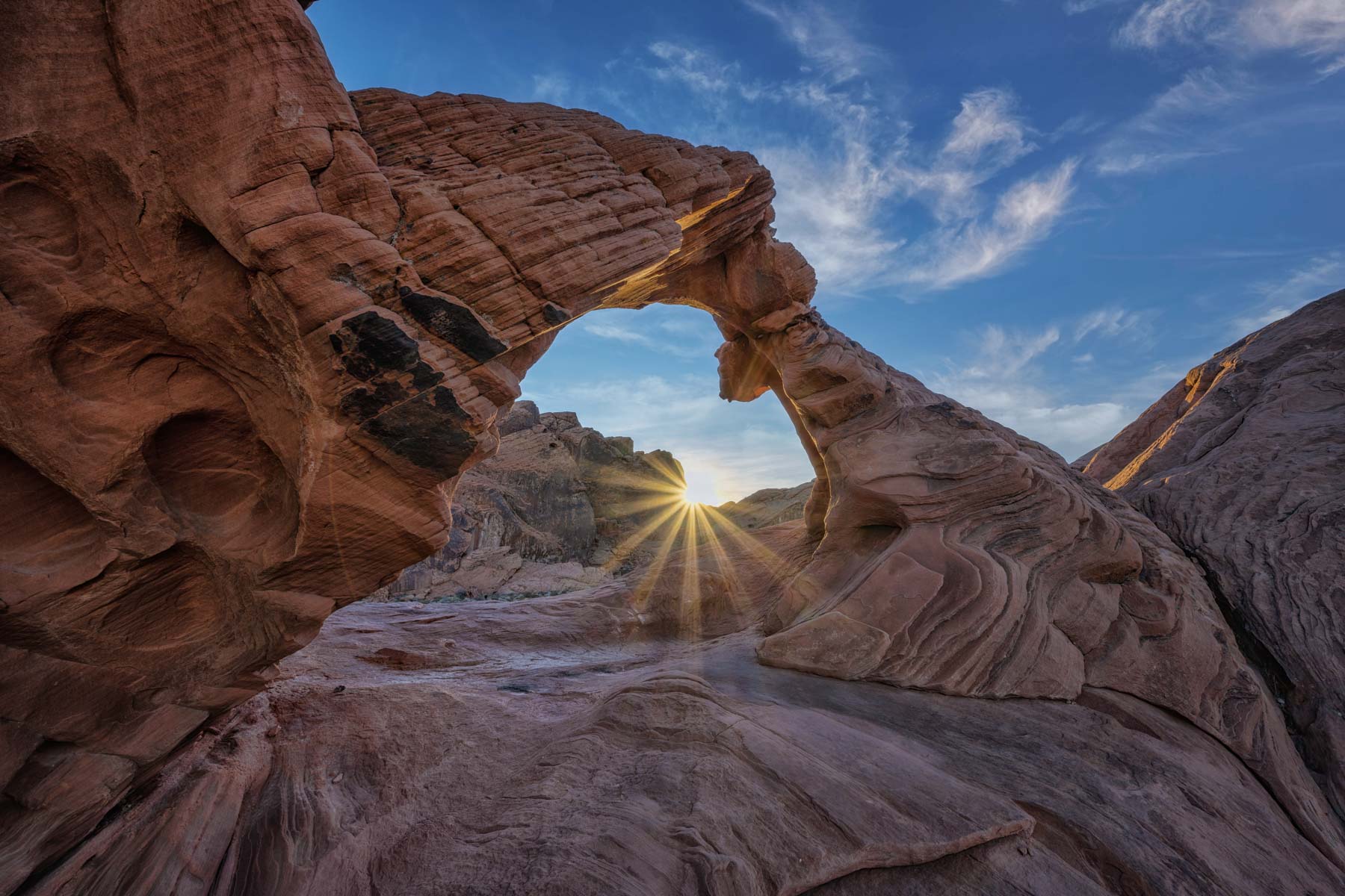
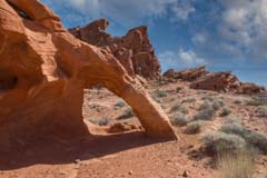
At 36.42177, -114.55451. Best at sunrise, but sunset works also. It could be crowded at sunset, and if you climb up to the arch you will attract others. There are multiple signs saying "Keep Off". Don't blame me if ticketed. The easiest access is from the northwest corner. Be careful on the slick rock. You can also get good images without climbing up to the arch.
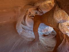
At 36.4125, -114.554. Park at 36.412, -114.5543 and hike north. Windstone is a small arch in the campground area. Windstone is best early to mid-morning when it is in shadow. Don't get there too late as I did! Consider shooting it shortly after shooting either Piano Rock or Arch Rock. Google maps refers to Windstone as Fire Cave. A 14mm lens works well.
At 36.41927, -114.55944. Piano Rock is front lit in the morning, but good images are possible towards sunset as well.
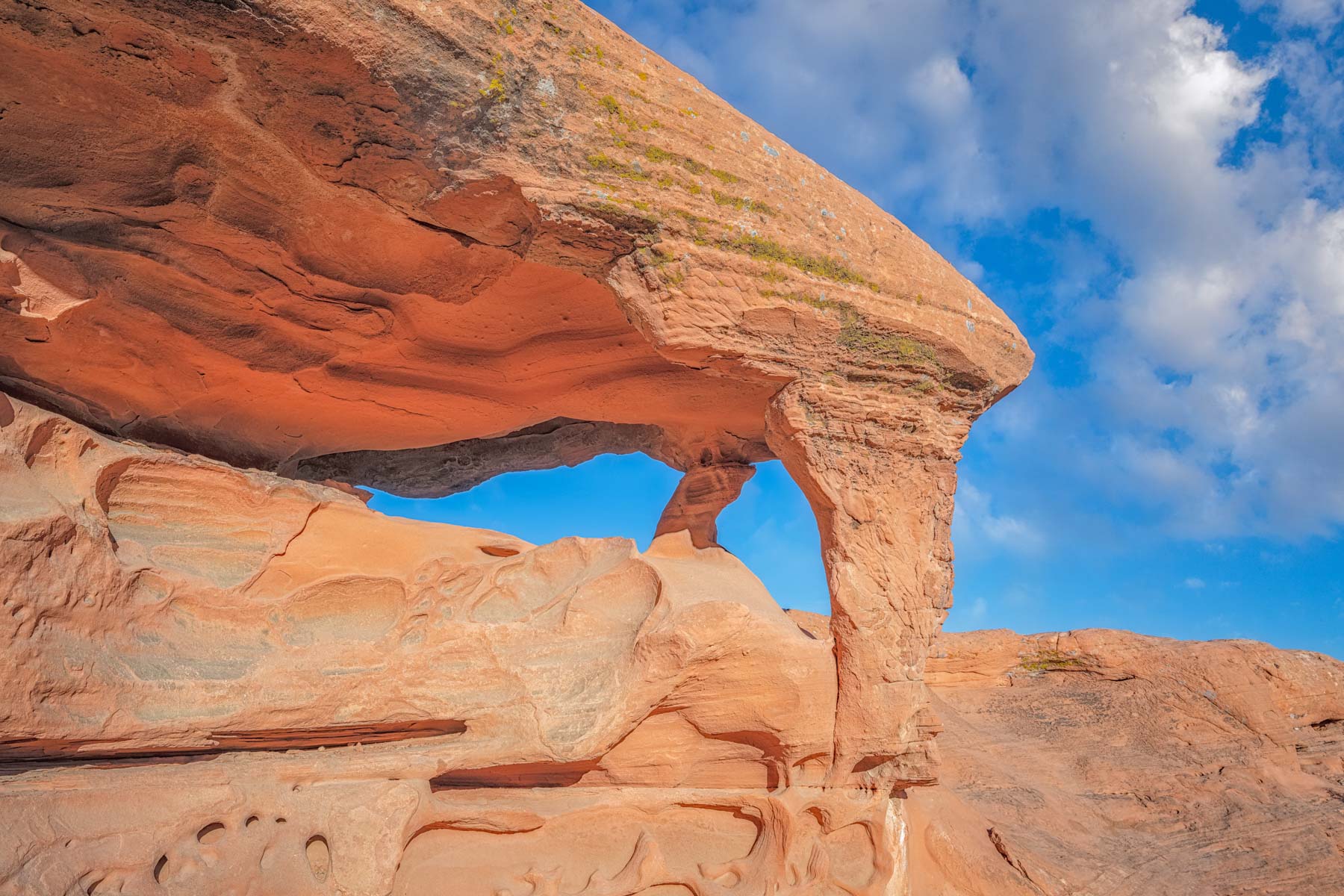
At 36.41428, -114.55667. We parked at a small pullout on Campground Road at 36.41313, -114.55879. The trail-less hike to the arch is only 0.3 miles long one way but finding Pagoda and a good way to access it is a little challenging. I've included our route on the Google map below should you have difficulties. The arch is in shade in the morning, but by mid-day the light is good.
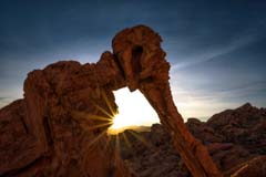
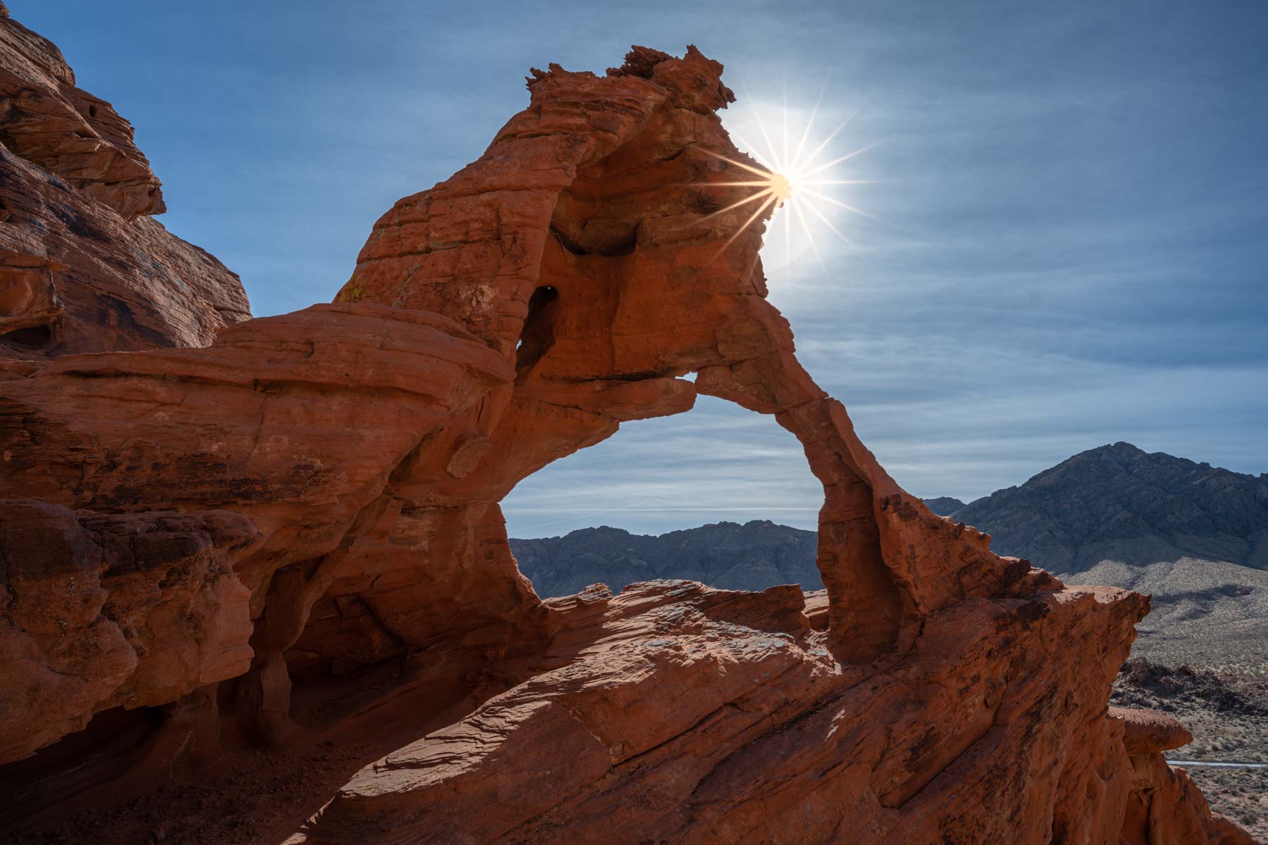
At 36.42828, -114.46026. The trailhead is at the parking lot just after the east entrance to the park. From the parking lot walk 200 meters along Elephant Rock Trail paralleling Valley of Fire Highway. You will come to a sign that says "Elephant Rock" and "Please Keep Off". In my trips to this area I have always seen people at the arch; so much for signs. In any event, tread lightly and do not touch the arch. At the sign, turn right and make your way up to the arch. Elephant Rock trail does not go to the arch! The arch is best photographed at sunrise or in the afternoon. A 24mm lens will capture the arch adequately. There are many other arches in the area worth shooting. These include Turret Arch aka El Portal Arch, the misspelled Preying Mantis Arch aka At Least Five Hole Arch, Pretzel Arch which nicely frames Lighthouse Arch, Arrowhead Arch, Lean-To Arch, and Falcon Arch aka Little Mosquito Arch. These names come from arch hunter Chris Moore's book on Valley of Fire Arches (Volume Number 6). This out of print book lists 450 arches in the Valley of Fire area with spans of five feet or more. The book was published in 1991. The images in the book are Black and White and are of low quality. This makes it hard to identify some of the arches and to determine which are worth shooting. Chris' book was written before GPS devices were available so some of the coordinates are off by more than 100 meters. Even so Chris' book is the best reference for arches in the area.
The alternative names above come from Isabel Synnatschke's excellent eGUIDE" A CLOSER LOOK AT Valley of Fire". This book is the definitive guide for photographing Valley of Fire and is only €4.95. I highly recommend it.
At 36.4411, -114.4608. From the East Entrance parking area, hike off-trail 0.9 miles north to the arch. You will pass Pretzel Arch on the way. The north side of Tilted Window arch is more photogenic than the south side. I suggest you shoot early in the day during late Spring or early Summer.
At 36.4513, -114.5108. Park at 36.4540, -114.5110 and hike south 0.2 miles to the arch. The arch faces south and is best shot in the late afternoon in the late fall or early winter. Don't get there too late like I did, or you'll miss the best light. The arch is good in the blue hour, but you'll need to quickly hike back to your car to avoid a ticket.

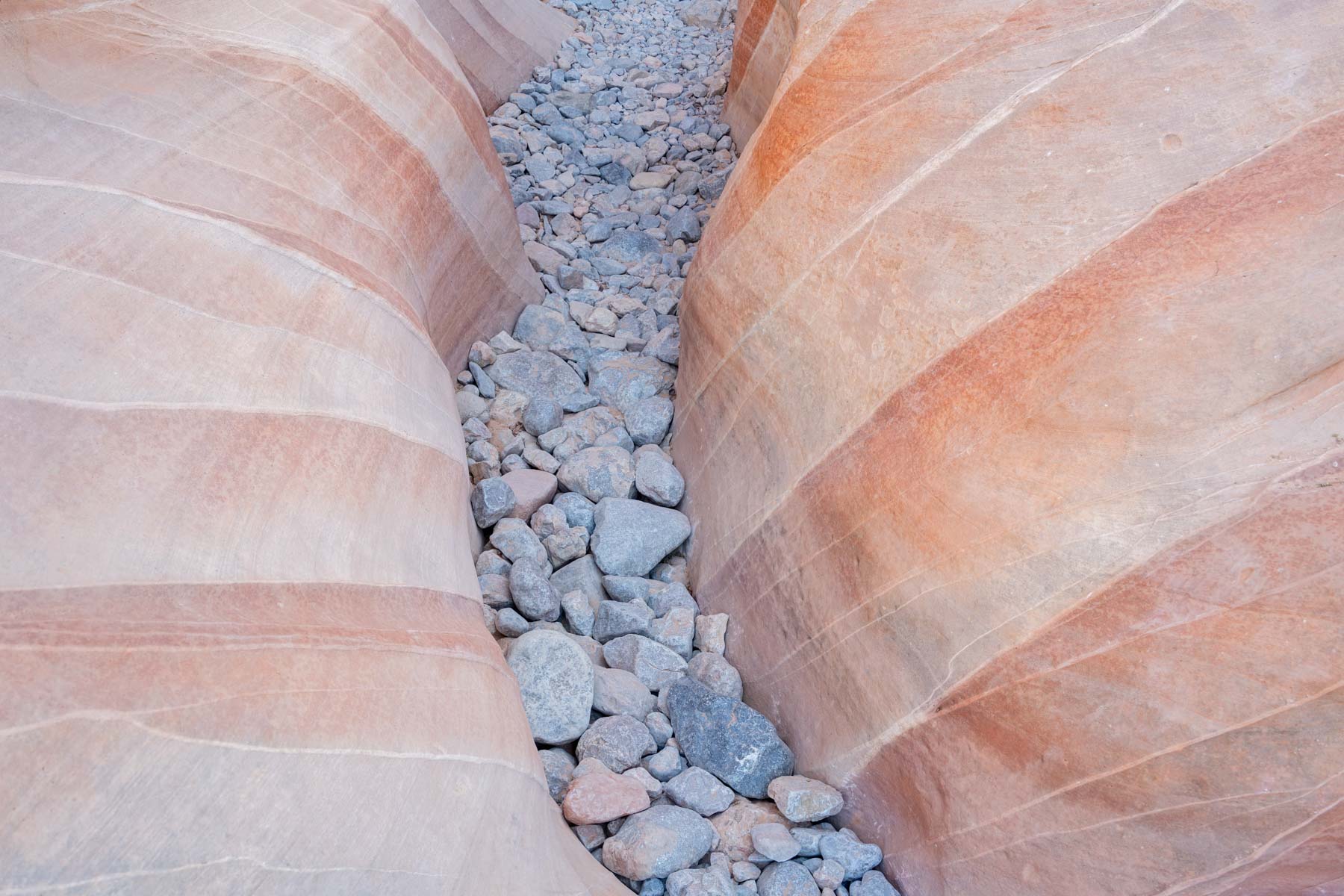
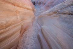
At 36.4815, -114.5344. From the White Domes Parking area, take the one-mile White Domes Trail to the slot. Most people take this loop trail in a clockwise direction starting at the south end of the parking lot. By doing so, you avoid the steep-up hill at the end of your hike. From the parking lot, continue down the steep hill 0.3 miles. Just after the old movie set used in the western "The Professionals" turn right. If you follow the trail to the left instead of the right, you will arrive in Pink Canyon. In about 100 meters, you will come to the narrowest part of the White Domes Slot. The slot's best part is at its western end where the broad pink and white bands are. The stripes are best shot when uniformly lit. The image to the left was shot mid-morning before sunlight hit the stripes. After shooting, continue north to complete the loop or retrace your steps to shoot Pink Canyon or return to your car.
At 36.480408, -114.525560. Pink Canyon is also known as Pastel Canyon or Kaolin Wash. It can be accessed from the Fire Wave Parking area via the Seven Wonders Trail, via the White Domes Trail, or by parking on Mouse's Tank Road where it crosses Kaolin Wash. The last option is preferable, but there is only room for a few cars and is often occupied. Pink Canyon is divided into two pieces by Mouse's Tank Road. Both pieces are worth photographing. Following the canyon west from Mouse's Tank Road brings you to the White Dome Slot, and following it easy brings you to the Fire Wave.
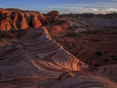
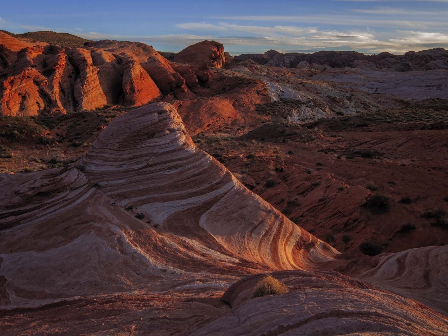
At 36.4827, -114.5224. The Fire Wave is the most popular attraction in Valley of Fire, and there will be many others present at sunset. Normal access is from the Fire Wave Parking lot at 36.4882, -114.5290. On occasion this parking lot will be full, and you will need to wait for a spot, so arrive a bit early. From the parking lot, take the Fire Wave trail 0.6 miles southeast to the Fire Wave. A better way to access the Fire Wave is to start at the pullout where Kaolin Wash crosses Mouse's Tank Road. Follow Pink Canyon to the northeast for 0.3 miles and hike up the hill 0.1 miles to the Fire Wave on the left. This route is both shorter and more scenic than the normal route in that it goes through the best part of Pink Canyon as seen in the image above, and you can also stop at Candy Stripe Arch on the way.
The Fire Wave is in shadow at sunrise. SHoot in the late afternoon or 15-20 minutes after sunset for the best images. If you stay past sunset you will need to hurry back to your car to avoid being ticketed
Google Map of Valley of Fire
The following map shows many of the arches and rock formations in Valley of Fire and the locations of a few of the many campsites along Valley of Fire Road.
To view the map in Google Maps please click anywhere on the map above.
- Click to download a KMZ file (Note - in IE Right Click and choose Save Target as)
- Click to download a KML file (Note - in IE Right Click and choose Save Target as)
- Click to download a GPX file (Note - in IE Right Click and choose Save Target as)
Caltopo Map showing various Points of Interest
In addition to the Google Map of Valley of Fire I have added a Caltopo Map. Caltopo maps show land ownership which is very important if you plan to boondock. You do not want to camp on private land, and US Forest Service, NPS, and BLM camping regulations are often different. Caltopo maps are also preferable for off-trail hiking since they show ten feet elevation contours and terrain slope shading.
USGS 24K Topo Maps
Four USGS maps cover Valley of Fire.
| Geo Tiff/Avenza | KMZ | Oruxmaps | KMZ Decollared | Oruxmap Decollared | Avenza Decollared |
| Overton | KMZ | Oruxmap | KMZ Decollared | Oruxmap Decollared | Avenza Decollared |
| Valley of Fire East | KMZ | Oruxmap | KMZ Decollared | Oruxmap Decollared | Avenza Decollared |
| Valley of Fire West | KMZ | Oruxmap | KMZ Decollared | Oruxmap Decollared | Avenza Decollared |
| Weisner Ridge | KMZ | Oruxmap | KMZ Decollared | Oruxmap Decollared | Avenza Decollared |
| Map of the entire area | NA | NA | KMZ Decollared | Oruxmap Decollared | Avenza Decollared |