The Oregon Coast
The Oregon Coast is a landscape photographer's dreamland of secluded beaches, rocky cliffs, sea stacks, arches, sand dunes, and lighthouses. Wildlife photographers will love the large variety of marine life and birds. Most of Oregon's 363 miles of coastline are within a few miles of Highway 101. All beaches are open to the public up to the vegetation line. However, crossing private property to access beaches is forbidden, and some beaches can only be reached by muddy hikes down steep cliffs.
When to Go
The Oregon Coast is very popular with tourists from June through August as temperatures are mild and the likelihood of rain is low. Daytime highs in Florence are in the mid 60's during these months, and overnight lows are in the low 50's. Only one day in six is cloudy or mostly cloudy in August, and there is only a three percent chance of rain on any given day. Unfortunately, the mild temperatures from June through August also bring fog to the immediate coast. This is not reflected in the statistics which are for towns typically a few miles inland from the coast. Inland from the coast skies can be clear while the coast is in heavy fog. Coastal fog generally occurs at dawn, partially clears by noon, and returns at sunset. Fog can last for several days in a row, but you may get an occasional good day. If you live near the coast summer can be an excellent time to shoot; wait for a day without fog. However, if you need to plan in advance, summer is less than ideal.
Winter brings high waves and wet weather to the Oregon Coast. Seventy percent of days are mostly cloudy or cloudy, and there is a fifty percent chance of rain each day. Winter is generally a poor time to visit the coast, but if you want to photograph or video large waves, it is the best time. Wave heights can easily exceed 100 feet at Shore Acres State Park. The highest wave recorded at Shore Acres was 320 feet high! If you decide to shoot here, be careful; people have died at Shore Acres. Cape Disappointment is another place that does not disappoint when it comes to large waves. Waves are normally their largest one to two hours before high tide. The National Weather Service's Portland officeissues surf forecasts for the northern half of the Oregon Coast. The NWS Medford Office issues forecasts for the southern half. Surfing apps are also a good source of information.
For photography, May and October are considered the best times to shoot the Oregon coast. Clouds and rain are common, but fog is normally not present. If you like to shoot the night sky, October is ideal as the Milky Way appears in the southwest vertically over the Pacific ocean.
There is another important consideration when planning a trip to the coast. Many coastal locations cannot be accessed or are not optimal when tides are high. Inaccessible locations include the wreck of the Peter Iredale, Arch Cape, Blumenthal Falls, the Neskowin Ghost Forest, the interior of the Devil's Punchbowl, and Secret Beach. Low tide reveals more tide pools and associated sea stars and anemones. It would be best to visit tide pools one or two hours before low tide. This timing gives one a few hours to search for marine life before the tide comes in. A good source for information about tidepooling is https://www.beachconnection.net/oregon_coast/72207oregon_coast_tidepools.php
.As far as I know, only Thor's Well and Spouting Horn are best at high tide.
You should review tide tables before planning a trip to the Oregon Coast. The website saltwatertides is a good source of tides. For Android Tides 6.0 by David Easton is an excellent source of worldwide tides and includes both the east and west U.S. coasts, Iceland, and the Falkland Islands.
Selected Locations from north to south
At 46.29889, -124.07795. Okay, its actually in southern Washington, as is Cape Disappointment. North Head Light is a well-maintained scenic lighthouse. Interior tours are available, and it's 69 steps up a spiral staircase to the top of the tower. It is possible to overnight at the Assistant Lighthouse Keeper's or Head Lighthouse Keeper's former homes.

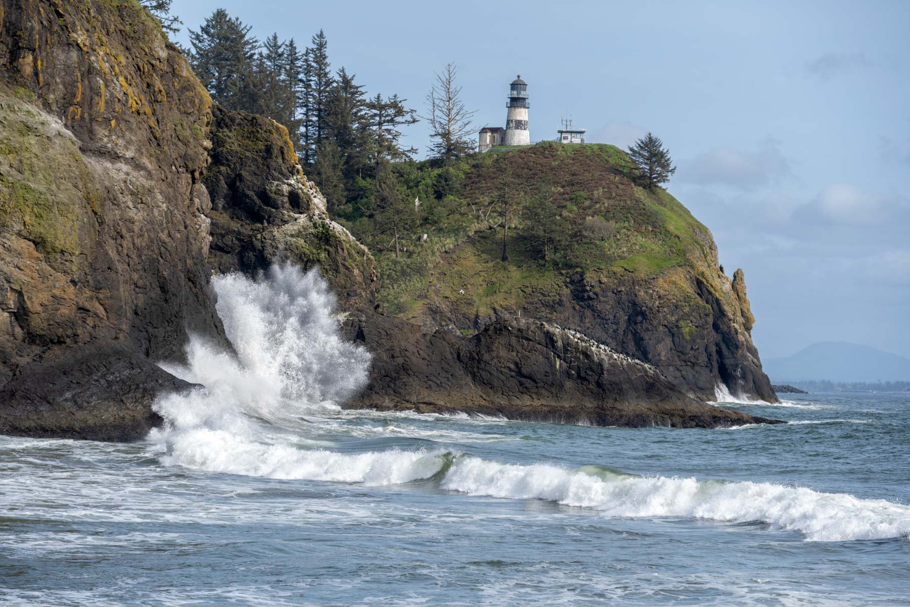
At 46.27584, -124.05224. The lighthouse can be reached by parking at the Lewis and Clark Interpretive Center and hiking 0.6 miles on the Cape Disappointment trail. The lighthouse is difficult to photograph from close up as other structures surround it. The interior of the lighthouse is not open to the public. On the trail to the lighthouse you will pass a view of Deadman's Cove, named after dead sailors who washed up in the cove following shipwrecks. You can shoot the cove from above, but a better shot can be had at sea level. Unfortunately, the trail down to the cove is currently closed.
The view of Cape Disappointment Lighthouse from Waikiki Beach (seen in the image to the left) is excellent, especially in the winter when large waves are present.
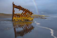
At 46.17836, -123.98111. Excellent shot at sunset. At low tide the wreck is fully on the beach. I prefer it partially in the water, as shown here.
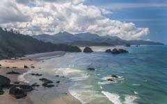
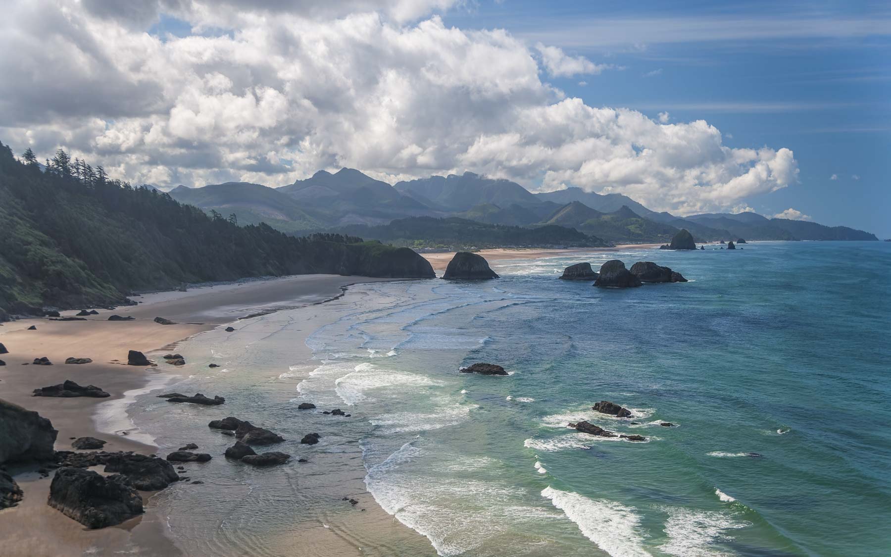
At 45.91844, -123.98019. The view south from Ecola Point is magnificent. Crescent Beach, Cannon Beach, the Bird Rocks, and Haystack Rock are visible in the distance.

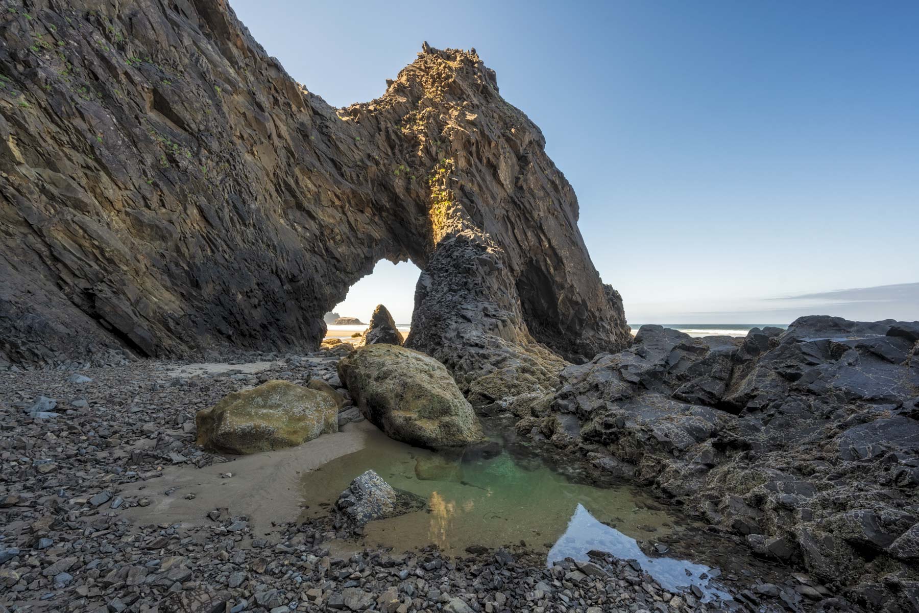
At 45.80257, -123.96845. A pretty arch only accessible at low tide. A two-car pullout on the south side of W Ocean Lane in Arch Cape is the closest parking to the arch. If this is full, you can also get to the arch by parking at Hug Point and walking a sandy two miles down the beach. Locals and renters mostly use Arch Cape Beach. Arch Cape is a good tidepooling location. T
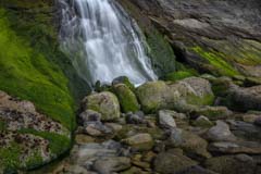
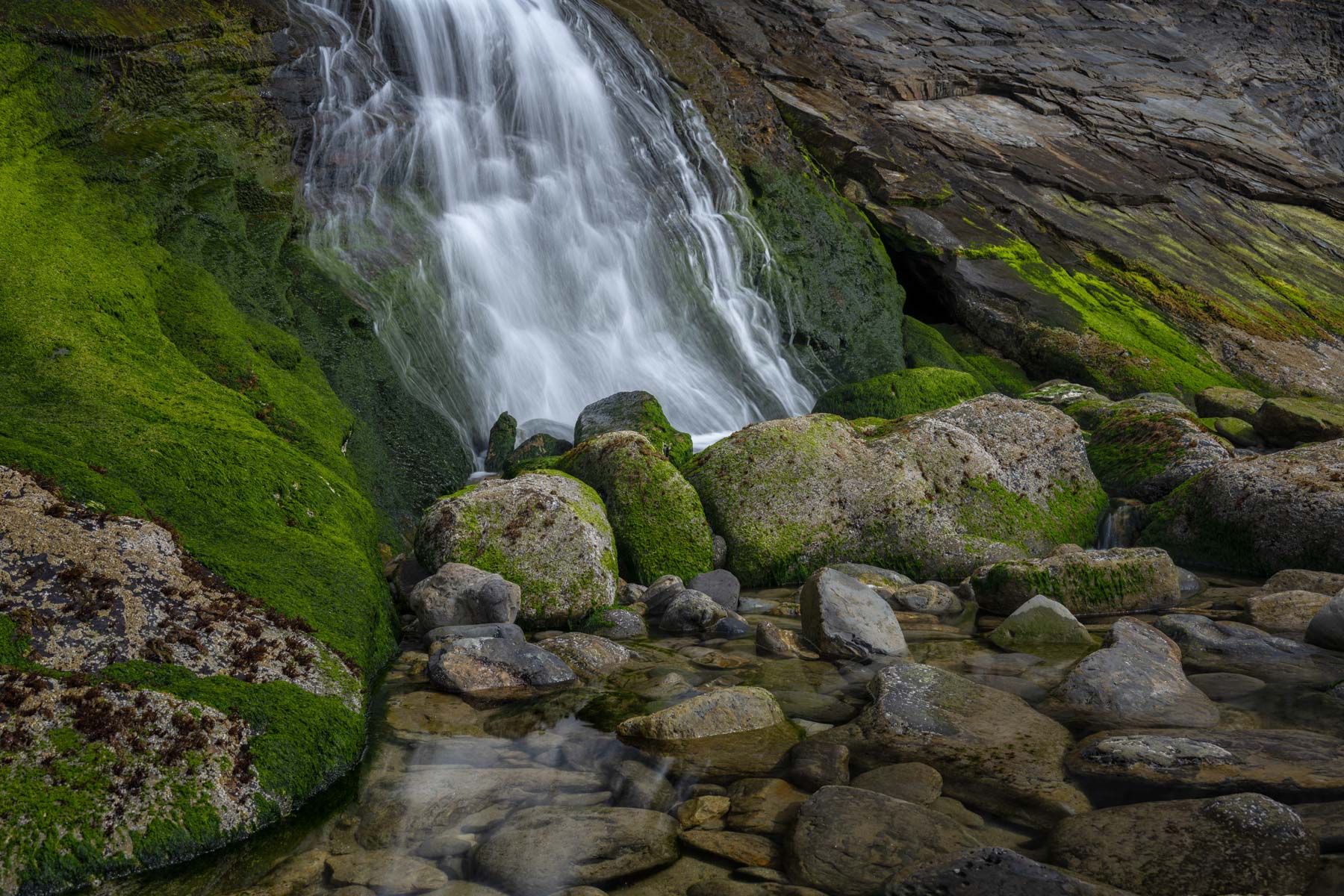
At 45.76406, -123.97199. Blumenthal Falls, formerly known as Smuggler's Cove Falls, is one of the few waterfalls in the northwest that empties right into the ocean, at least when the tide is high. The falls are inaccessible at high tide. The falls may be dry in the summer but are quite impressive the rest of the year. Colorful sandstone surrounds the base of the falls. Tide pools are present at low tide, making this the best time to visit. Smuggler's Cove is well-protected from the wind and is a good surfing location for beginners. More information on tides and surfing conditions at surfline.com.

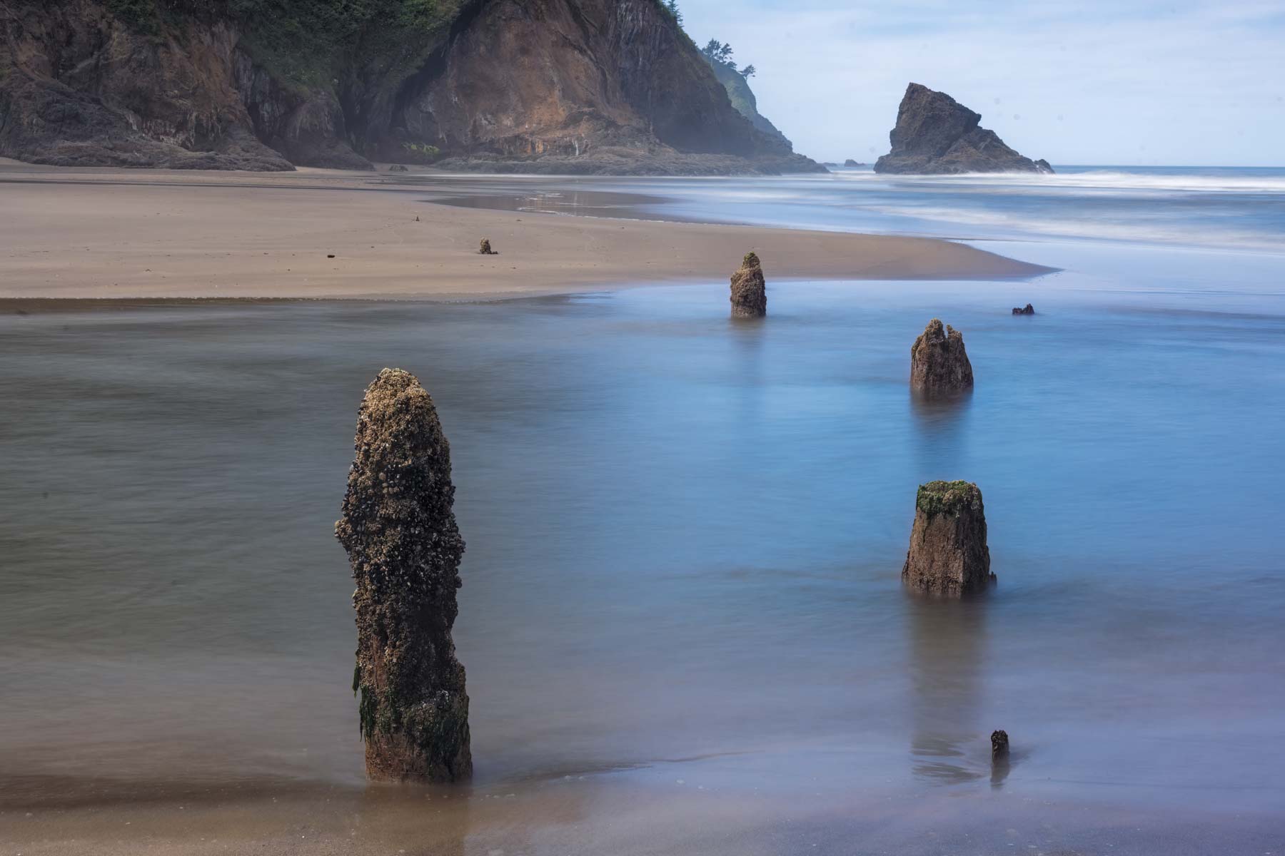
At 45.09557, -123.98869. Neskowin Ghost Forest consists of about one hundred 2000-year-old tree stumps partially submerged in water on Neskowin Beach. The stumps are best shot at low tide. Long exposures produce an ethereal effect and work well. I used an eight-second exposure to create the image at the right. Proposal rock at the north side of the beach provides excellent background. Surfers may be present on the waters off the beach; see surf-reports.com for conditions.
At 44.7471, -124.06519. The Devil's Punchbowl is a large natural bowl on the central Oregon coast. The collapse of the roof of a sea cave formed the bowl. It is very difficult to get a good picture of the collapsed sea cave from above. Shoot from inside the bowl when the tide is low. The Yaquina USCG tide station can be used for tides. I shot the image to the left when the tide level was approximately two feet. Other people will be inside the bowl during high season, making panoramas difficult. To access the interior of Devil's Punchbowl park at the end of 1st Street and walk east to C avenue. Turn left onto C avenue and proceed 650 feet to a good trail headed to Otter Crest Beach. Walk south along the beach to the bowl. Another good source of tide information is surfline.com.
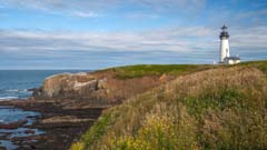
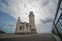
At 44.67676, -124.07954. At 93 feet Yaquina Head Lighthouse is the tallest on the Oregon Coast. The lighthouse is best at sunset, but sunrise and Milky Way photography also work. Shoot from Agate Beach or from Cobble Beach just south of the lighthouse. At low tides, Cobble Beach is a good tidepooling location. The interior of the lighthouse is open. Only the ground floor can be accessed as the tower stairway is being renovated. The lighthouse grounds are closed at night.
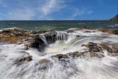
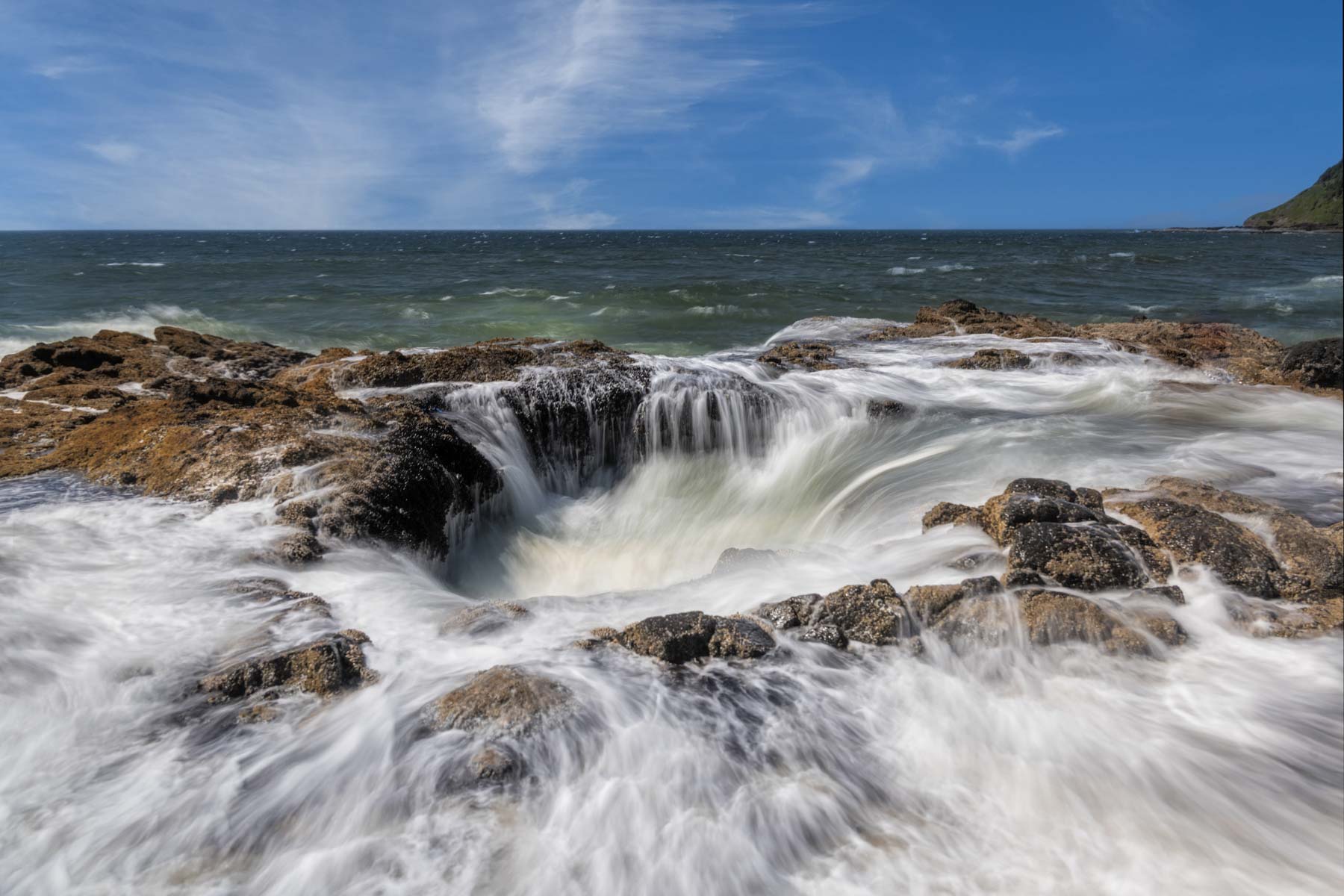
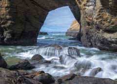
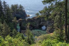
At 44.2784, -124.1135. Thor's Well, also known as the "Drainpipe of the Pacific" is a collapsed sea cave just south of the Cape Perpetua Visitor Center. The well is about twenty feet deep. At high tide, the well fills with water until it erupts and overflows, followed by draining. Thor's well is best shot about an hour before high tide. While no one has ever fallen into the abyss and died exercise extreme care when photographing the well. Thor's well is about .5 miles from the trailhead on US 101. Spouting horn can be seen across the inlet to the south and is also worth shooting.

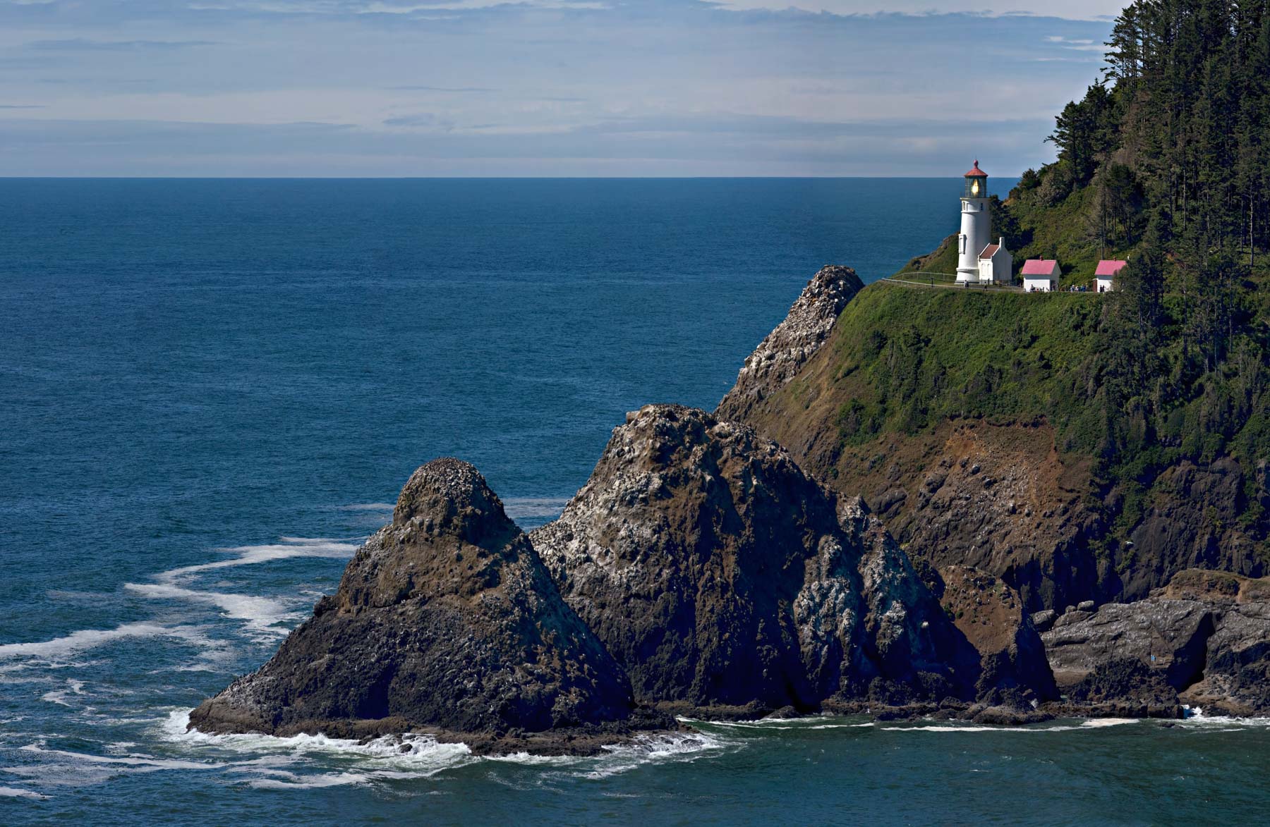
At 44.13742, -124.12814. Heceta Head Lighthouse sits dramatically on top of 150 feet high Heceta Bluff and is perhaps the most photographed lighthouse on the Oregon Coast. The lighthouse grounds are open for day use only though night tours are occasionally available. Call 541-547-3416 for dates of night tours. I have yet to see good images of Heceta Head Light and the Milky Way. Tours of the lighthouse's interior are available from 11 AM to 3 PM in the summer and 11 AM to 2 PM in the winter. Interior tours only include the ground floor; the tower is closed to the public.
Heceta Head Lighthouse is normally photographed at sunset from a vantage point about .5 miles south of the lighthouse on the west side of US101. Time your shot so that the light is on in your image. Another good viewpoint is at the overlook about 75 feet above the lighthouse to its north.
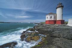
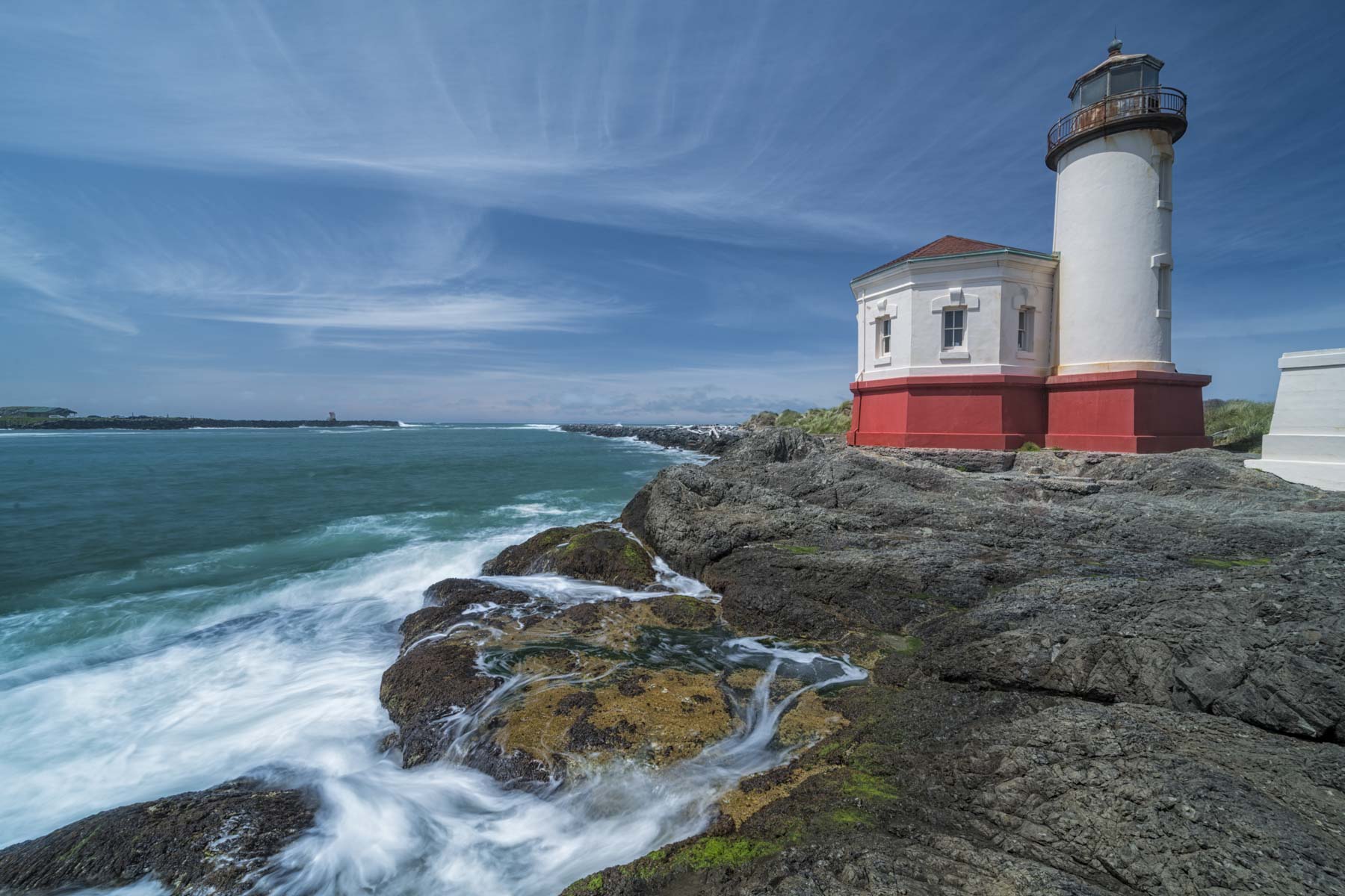
At 43.12389, -124.42425. The Coquille River lighthouse is the most underrated lighthouse on the Oregon Coast. Good images can be had at both sunrise and sunset. Shoot from the grasses to the northwest or from the shore rocks to the south. If you're lucky, you may get a reflection of the lighthouse in a tidepool. Day use only but you can get permission to shoot at night, contact the Bullards Beach Park Office at 541-347-2209 x 221 for information. The lighthouse needs a coat of paint, so you'll need to do some fixup in Photoshop to get a clean image.

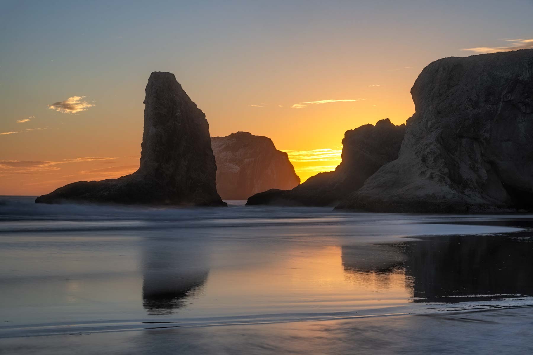
At 44.13742, -124.12814. Bandon Beach is known for its many spectacular sea stacks, stunning sunsets, and creature-filled tide pools. To access the beach, park at Coquille Point or Gravel Point and take the stairway down to the beach. At high tide, it may be impossible to get around these points. The beach is best at sunset but gets light just after sunrise as well. At sunrise, the sea stacks are front lit. Drones are prohibited at Bandon Beach. Bandon Beach is an excellent location for Milky Way photography. You'll need permission to park overnight at the Coquille or Gravel Point lots. Call the Bullard Beach Park Office at 541-347-2209 x 221 for information. Camping or sleeping on the beach at night is prohibited.
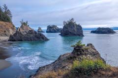
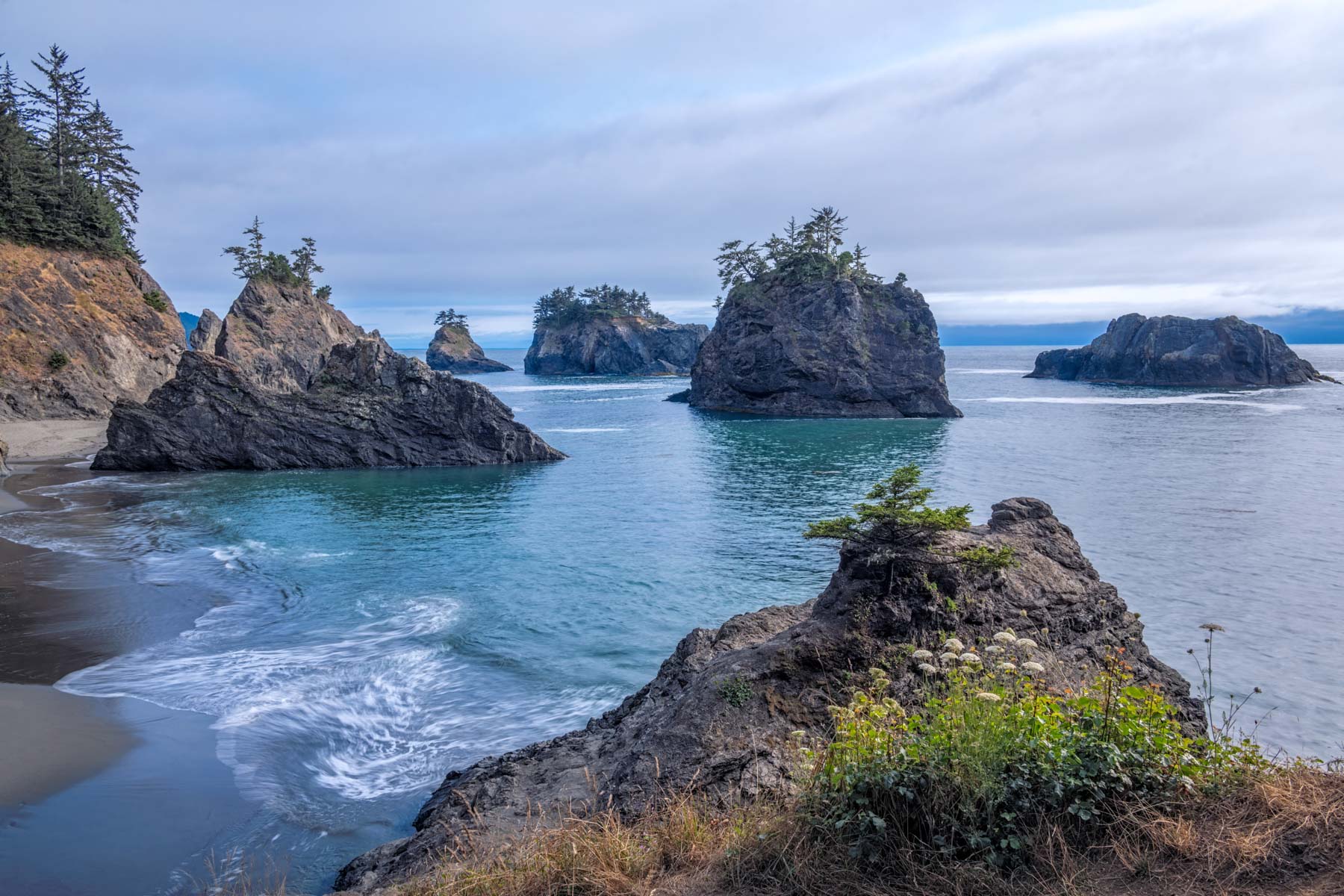
At 42.19497, -124.37188. Secret Beach is no secret and can get crowded. It's best at low tide and sunset. It's also a good Milky Way location in September and October. There are four separate beaches at Secret Beach; the fourth is only accessible at low tide. There's a nice waterfall (Miller Creek) at the first beach. The closest parking to Secret Beach is often full in the afternoon. Alternate parking is available at the Seal Cove pullout 0.4 miles to the south or at the Arch Rock or Spruce Island Viewpoint lots to the north. If you park at one of the alternate lots, take the Oregon Coast trail to the beach.
At 42.1887, -124.36767. A short trail headed south leads you to a good viewpoint of the two arches. A trail going north will take you down to the bridges. There have been two fatalities on this trail in 2021 and 2022. The trail to the arches is muddy, steep, and slippery. This trail is now marked closed. Natural Bridges is a great location for drone photography. It is also good for Milky Way shots.
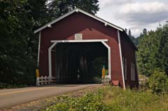
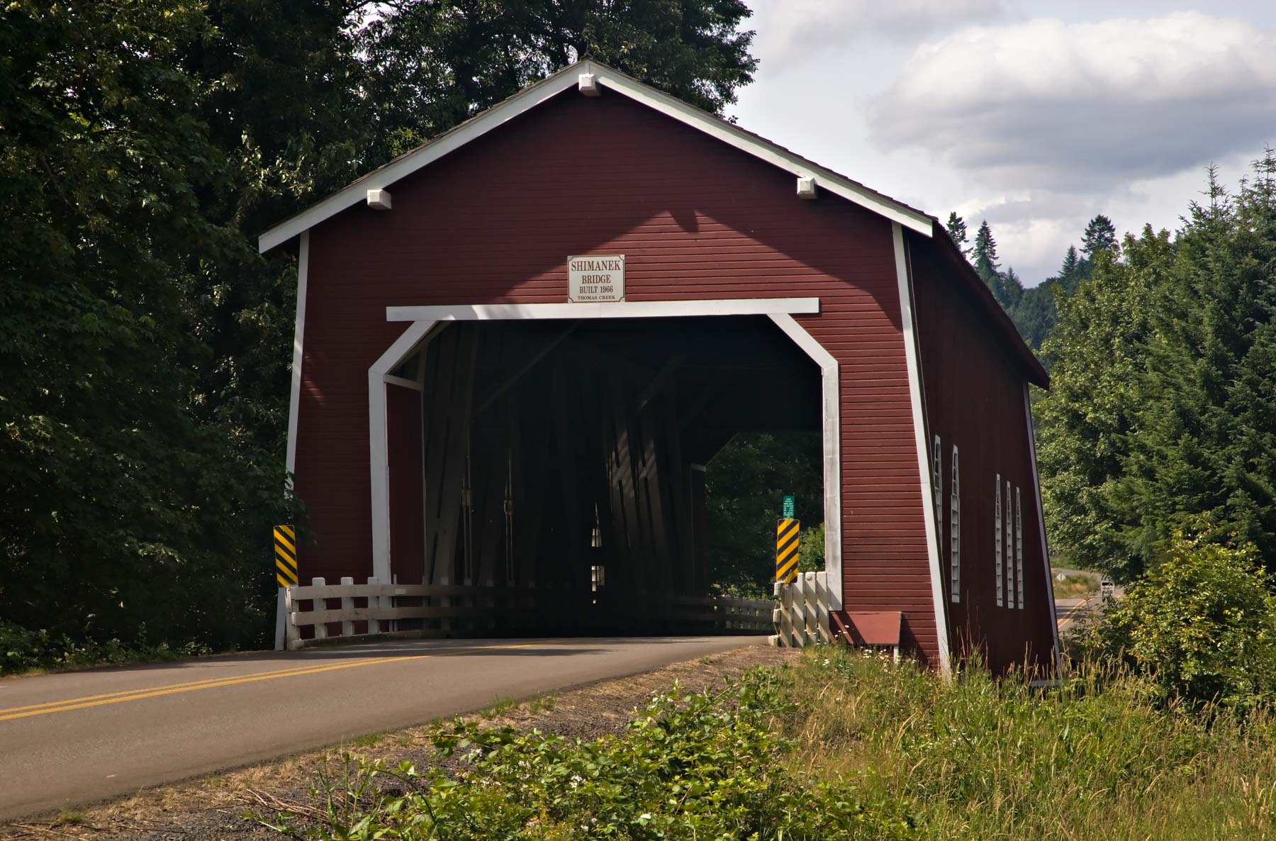
At 44.71593, -122.8044. If you are in the Newport area on fogged-in days, consider heading inland and shooting some of Oregon's famous covered bridges. Ten covered bridges are within 90 minutes of the coast, mostly in the Scio area. In addition to standard compositions from the outside in, consider going inside the covered bridge and shooting outwards. Shooting waterfalls on foggy days is also a good way to spend otherwise idle time on the coast, as is the Newport Aquarium.
Google Map of the Oregon Coast
The following map shows many of the beaches, lighthouses, arches, and coves on the Oregon Coast. It also shows the locations of ten covered bridges and selected waterfalls inland of the coast.
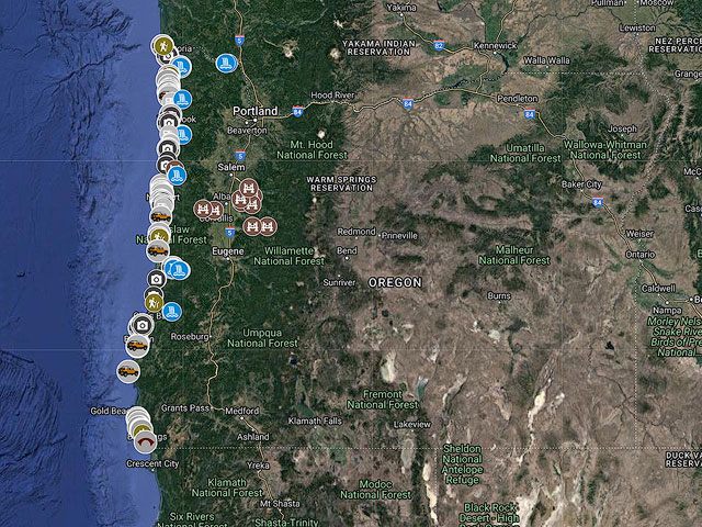
To view the map in Google Maps please click anywhere on the map above.
- Click to download a KMZ file (Note - in IE Right Click and choose Save Target as)
- Click to download a KML file (Note - in IE Right Click and choose Save Target as)
- Click to download a GPX file (Note - in IE Right Click and choose Save Target as)