Edmaier's Secret and the surrounding area
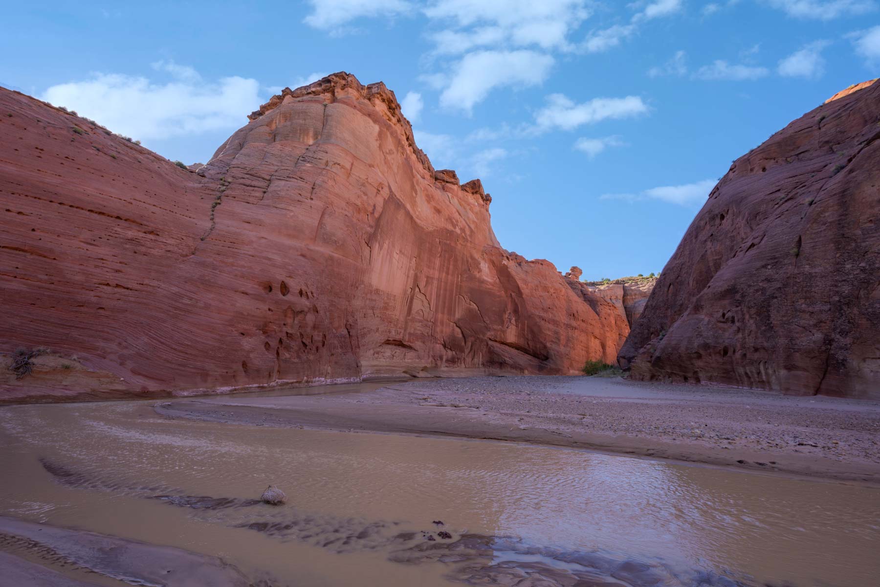
The area between Buckskin Gulch and the Paria River is exceptionally scenic. The landscape abounds with hoodoos, lace rock and fins, sandstone domes, and brain rock. Included in the area are Edmaier's Secret, West Clark Bench, Cobra Arch, the Paria Windows, and The Nautilus which unfortunately collapsed come years ago.
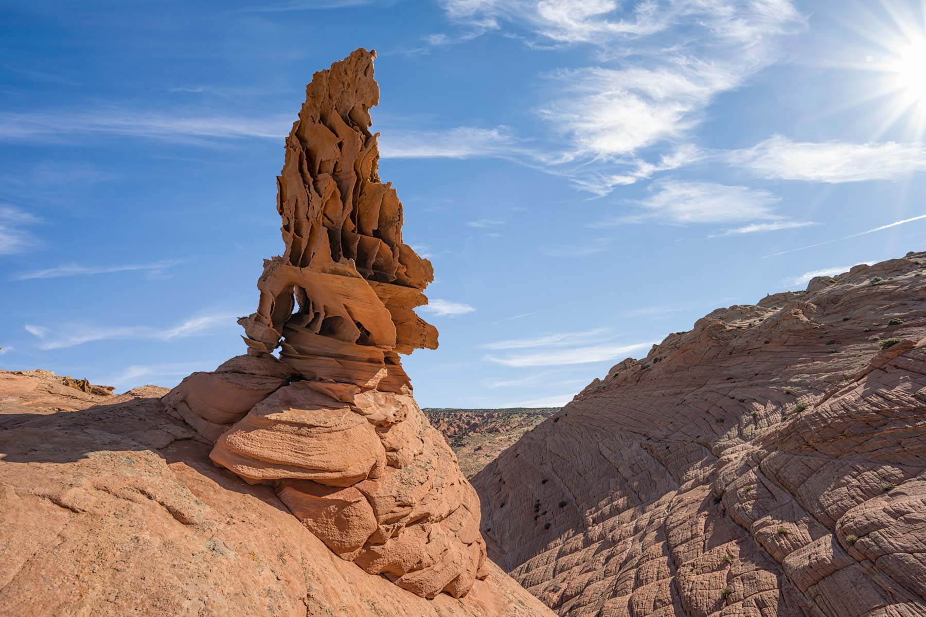
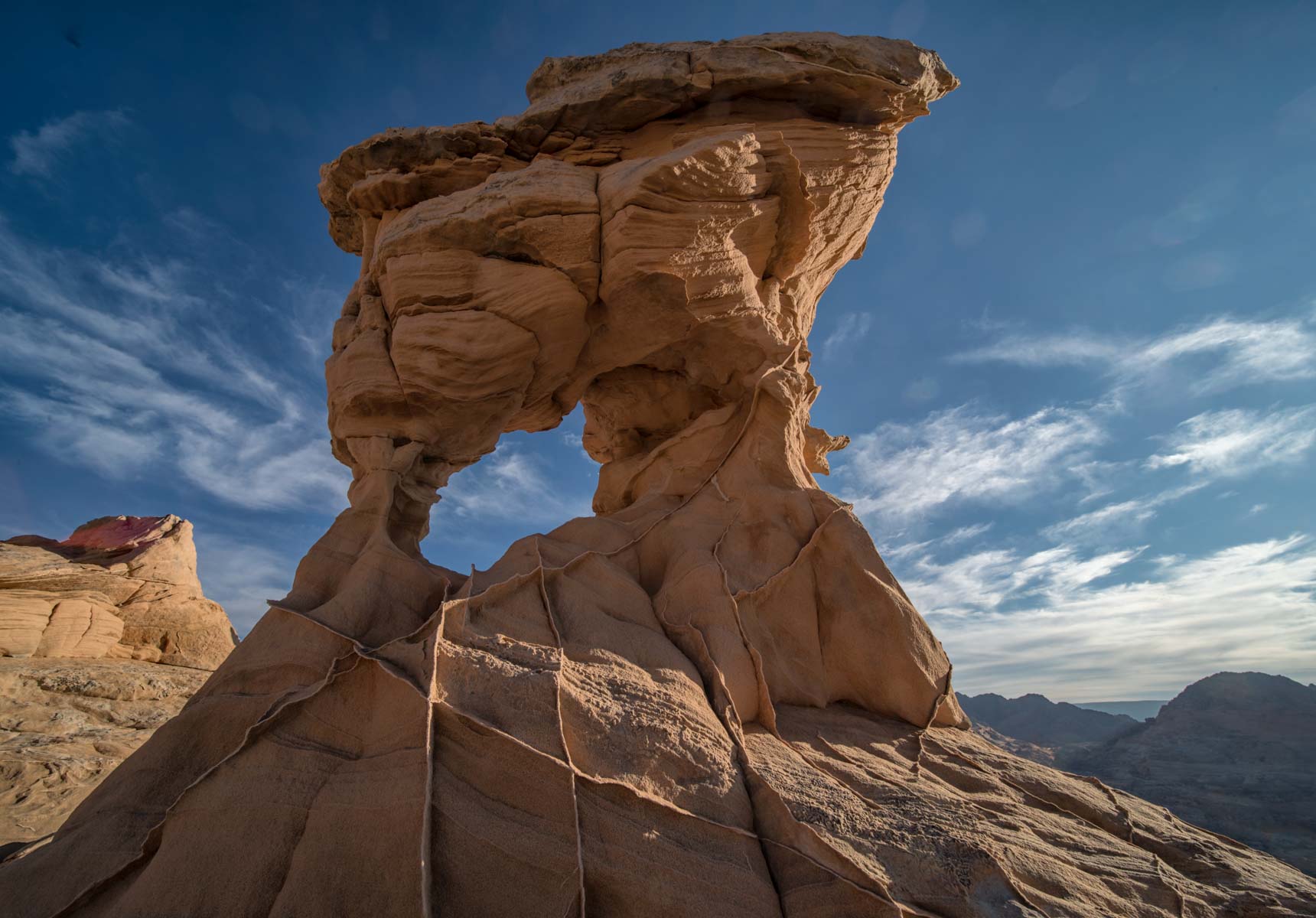
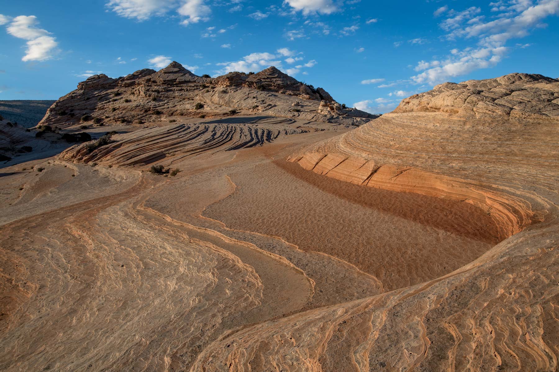
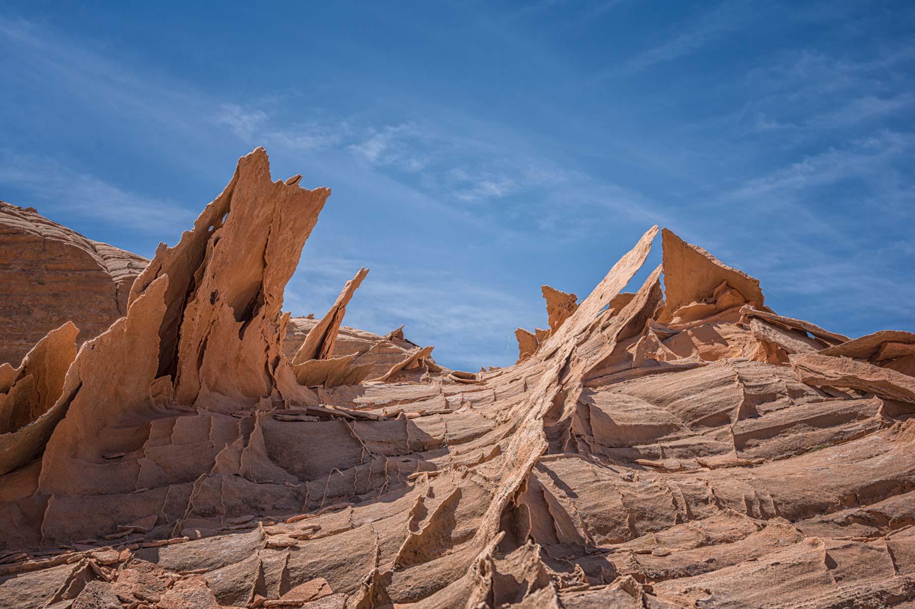
Edmaier's Secret
Edmaier's Secret is an area of lace rock and brain rock east of Buckskin Gulch. There are two routes into Edmaier's Secret. The recommended route is to park at the trailhead to Buckskin Gulch (BG) and hike down downstream for two miles where a wide sandy wash enters from the left and BG turns to the right. Head left (east) up the sandy wash and make your way up to the interesting formations of "Brain Rock". The BG trailhead is 4.2 miles down House Rock Valley Road. You will need to pay $6 (cash or check only) at the BG trailhead for day use as of 2020. There are no day use limitations on the number of people allowed in the gulch. One advantage of this route to Edmaier's Secret is that when it is time to exit getting back to your car is very straightforward. Make your way to BG and turn right for the easy two mile hike back to your car. Buckskin Gulch does not "slot up" during its first two miles so there is little danger from flash flood. You are usually hiking on "user" trails above Buckskin Gulch. The gulch is almost always dry but there are several crossings so if water is running you will get wet. The disadvantage of the Buckskin Gulch route is a largely uninteresting hike and the $6 fee.
The second route which I no longer recommend due to BLM road closures is via Long Valley Road (also called Long Canyon Road). Long Valley Road also goes to Cobra Arch and West Clark Bench. Long Valley Road is the road heading south from Highway 89 at the signed "Paria Outpost" at US 89 Milepost 21.4. Paria Outpost is 0.6 miles West of the Paria Contact Ranger Station, and just west of where the Paria River runs under Highway 89. Long Valley Road is impassable and very dangerous when wet. Take Long Valley Rd 4.5 miles and fork right onto a small sandy jeep trail. This road is a signed BLM "administrative road". It is not legal to drive it, and you may be ticketed if you do so. It is permissible to hike or ride a horse into the area. Mountain bikes are not permitted. The administrative road may not have been maintained recently, and it may not be maintained in the future. Follow this road 0.6 miles to a small water hole, and mark your location on your GPS. Leave the road and hike off-trail .75 miles southwest to the escarpment and make your way down to the brain rocks. You should have and know how to use a GPS if you use the second route. Use it to mark the location where you leave the administrative road, and the point at which you descend the escarpment.
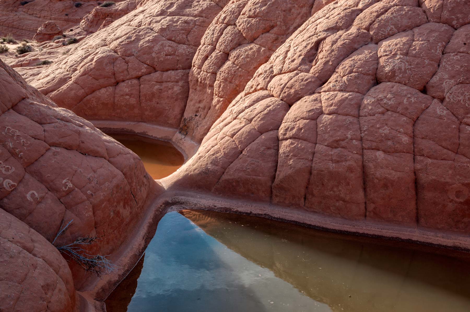
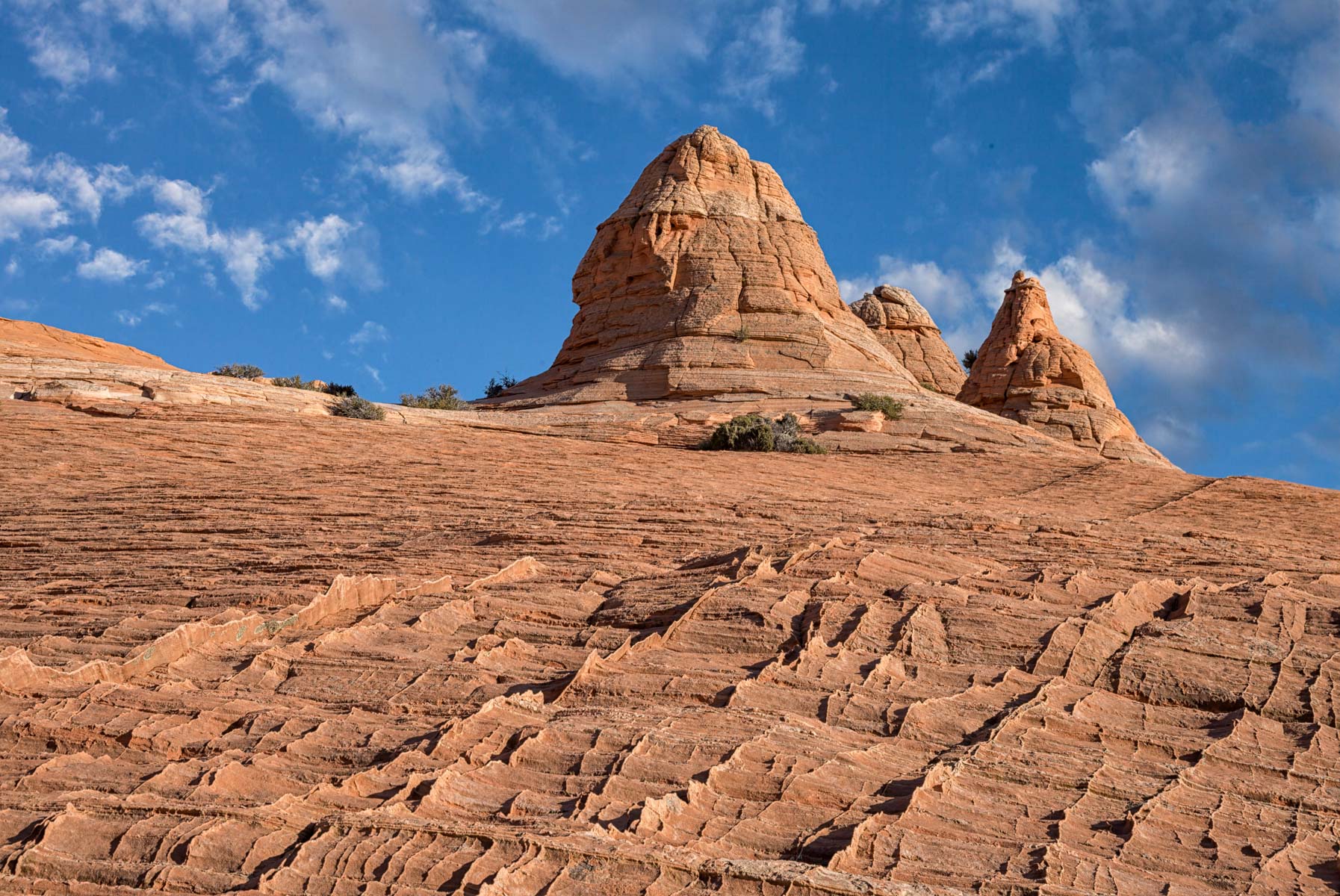
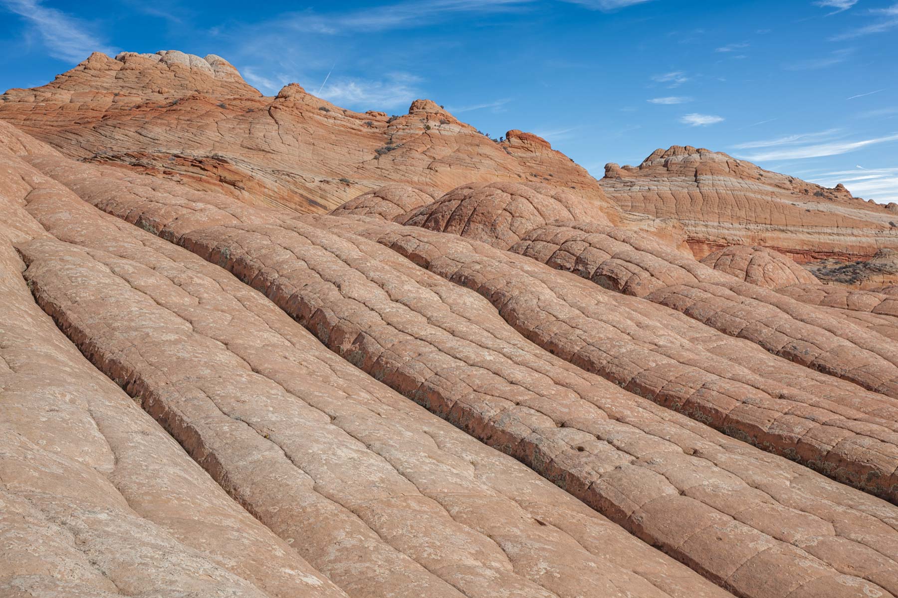
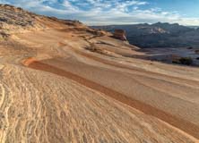
Edmaier's Secret is best photographed late in the day as the sun doesn't hit parts of it until several hours after sunrise. The best parts of Edmaier's Secret are the "Teepee Dome" (aka the "Big Dome") and the areas just to the south and west of it. This area has many "teepees", water pockets, and crossbedded sandstone. Edmaier's Secret, together with the White Pocket, are best following rain as the water pockets will be full. You will need to wait until House Rock Road becomes passable before heading to the trailhead however.
West Clark Bench
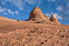
West Clark Bench is the area above the cliffs you see to the east - northeast when hiking to The Wave. Edmaier's Secret lies below the cliffs, as does Buckskin Gulch. West Clark Bench is largely devoid of vegetation and is heavily crossbedded, and like the White Pocket it is full of cauliflower / brain rock and water pockets. It also has a great deal of fin / lace rock and because the area is remote and sees little visitation the fins are well preserved. Like The White Pocket West Clark Bench is best visited when water is present, but it is also good even when dry. The best features are a small but dramatic arch and an S Curve nearby. Both are best photographed at sunset.
West Clark Bench is difficult to get to. The easier but less interesting route is to approach it via Long Valley Road. Long Valley Road begins at milepost 21.4 on US 89. Take Long Valley Road 5.2 miles to the administrative road on the left at 37.05918, -111.95684. This road is closed to the public and you risk getting a ticket if you drive on it. Walk or ride 1.5 miles and bear right. Continue 0.2 miles to the signed wilderness boundary near Rubin Tank. Hike past the wilderness boundary and follow the very rough road 1.25 miles to its end where you can begin your exploration. Note that following this approach costs you about three miles (one way) of hiking on closed sandy boring roads. You may be able to save .5 miles by taking a more direct off trail route from Long Valley Road but you are still in for a long day even before beginning your exploration.
The recommended route is to approach West Clark from Buckskin Gulch via Edmaier's Secret. Park at The Buckskin Gulch trailhead and follow the directions to Edmaier's Secret given above. After visiting the Big Dome continue south about one mile to the ramp at 37.0306, -111.99763, or make your way up the cliffs wherever you can. The cliffs contain the most extensive area of lace rock, fins, and crossbedding I have seen and are spectacular. Ascend the ramp and you will have arrived at West Clark Bench. While this route is longer (about four miles one way rather than three) you get to see Edmaier's Secret along the way. It also has the advantage in that you may be able to use it after a rain when Long Valley Road is very dangerous to drive.
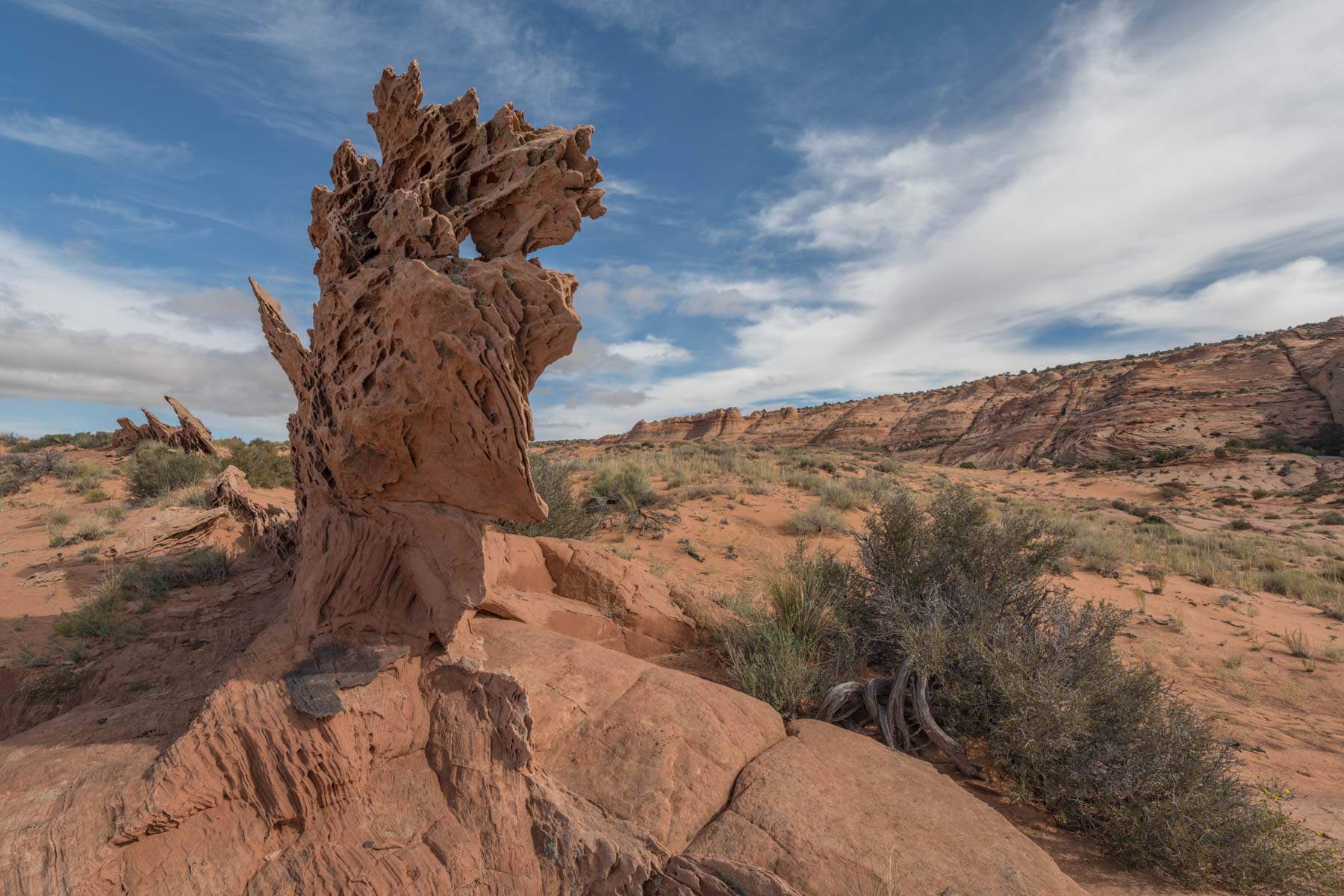
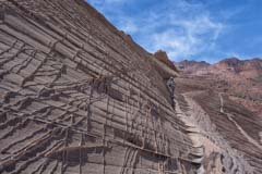
The sandstone fins and lace rock found on both Edmaier's Secret and West Clark Bench are very fragile. The fins are typically only 1/8 inch thick and can be several feet long. They are very easily broken, please do not walk on or touch them. If you have a dog with you I suggest you keep it on leash when near fins. Some damage in the area had already been reported to me. If damage continues the BLM will probably institute a permit system like that used to protect Coyote Buttes.
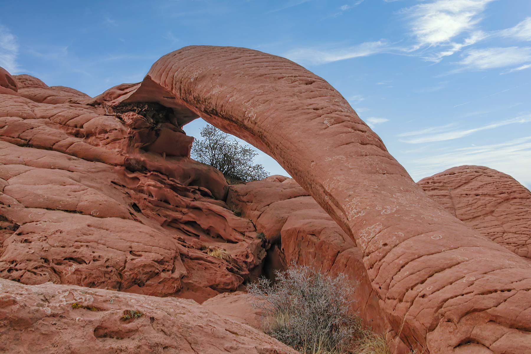
Cobra Arch
I have not been to Cobra Arch in many years and it is high on my list of places to return to. The hike to Cobra Arch begins at the Middle Route trailhead on West Clark Bench. A high clearance 4x4 vehicle is needed to drive to the trailhead. The drive begins at the intersection of US 89 and Long Valley Road at milepost 21.4 on US 89. Head south on Long Valley Road 4.2 miles and turn left onto Dry Lake Flat. Bear slightly left after .35 miles and continue another 3.2 miles on Dry Lake Flat to the trailhead.
The hike to the arch is 3.5 miles long one way. There is little shade or no water available on the hike so if you go in the summer begin early in the day and carry the recommended four liters of water. The trail is cairned. At the trailhead sign the register and hike south along the fence-line for 800 feet to the edge of the cliffs known as The Dive. Turn left and hike two miles along the rim to a break in the escarpment. The break is cairned. Follow the cairned trail .5 miles down the cliffs in a generally southwest direction to the base of a sand dune. Hike up the sand dune and continue another .5 miles to the arch. I suggest you download the track and follow it during your hike and back.
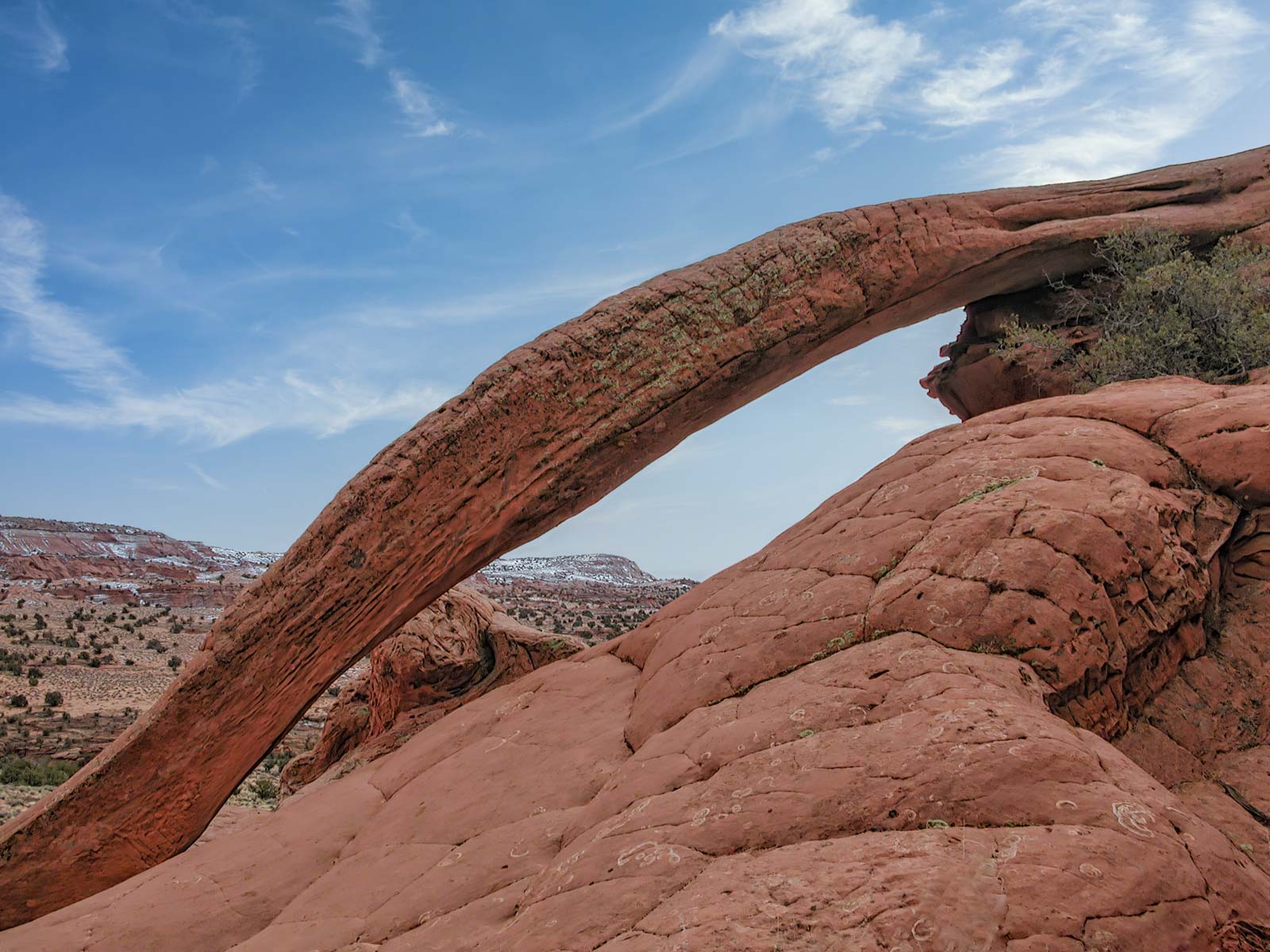
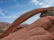
Cobra Arch is made of Navajo Sandstone and is colored red by the layer of Page sandstone just above it. Nearby rocks and vegetation make composition challenging. The arch is most cobra like when seen from the east or south which suggests shooting mid-day to late-afternoon. A wide angle or ultra-wide will help with framing.
The Nautilus
Note - In 2014 there was a partial collapse of the Nautilus and it is not nearly as photogenic as before. The information below is included for historical reasons only.
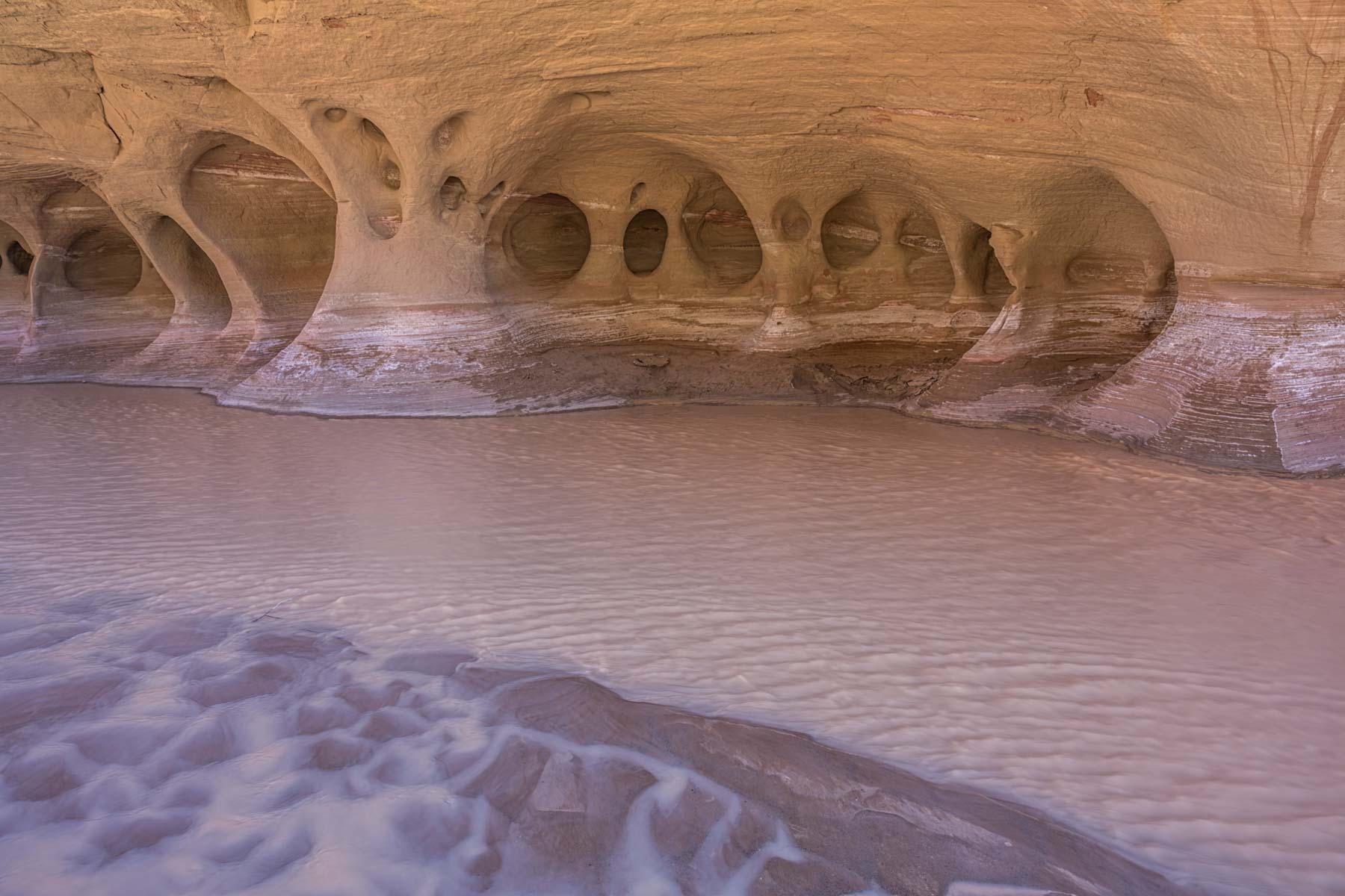
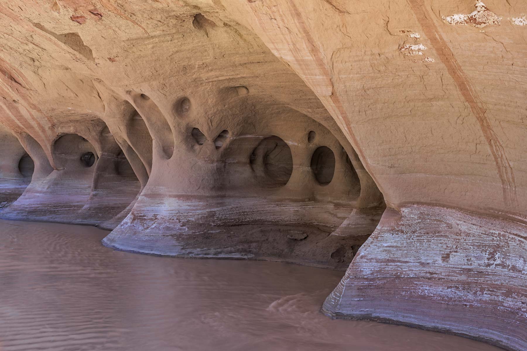
To get to the Nautilus take the White House Trailhead Road (this is the road that turns off from the Paria Ranger Station ) about 1.6 miles to a small wash. Right after crossing the wash there is a small place to park on the right marked "No Camping". Head up the Wash (East) about .4 miles. The Nautilus is on the right side of the wash. This is a very short hike. There is a barbed wire fence at the start of the hike. It can be easily bypassed by climbing over the wood part at the right side of the fence. The barbed wire fence was installed in 2011 by a local rancher. The Nautilus is on public land. The Nautilus is made of Page sandstone and is very fragile so please tread lightly.
Photo Tips - The first time I was there on a clear day around 1PM, not the best time to shoot the Nautilus as there are very deep shadows. The second time was on an overcast day with no direct light. The cloudy day worked better. I was at the Nautilus in the evening recently and found that there was some very good reflected light a bit before sunset. Shoot from the bottom just after it goes into shadow, the upper interior has a very nice red glow then. Alternatively try photographing the Nautilus in the blue hour (20 minutes after sunset) when it will be lit only by reflected light. You will need a fish-eye or ultra-wide to best photograph the Nautilus. Night time photography with star trails / light painting should also work very well here. Finally - the background is very busy so I would try to eliminate as much of it as possible.
Google Map of Edmaier's Secret
Here is an Google overview map showing how to get to the locations listed above:
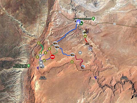
To view the map in Google Maps please click anywhere on the map above.
- Click to download a KMZ file (Note - in IE Right Click and choose Save Target as).
- Click to download a KML file (Note - KML Files do not include custom icons).
- Click to download a GPX file (Note - in IE Right Click and choose Save Target as).
Photo Map
The following map shows the locations of all of the geocoded photos in the Edmaier's Secret, West Clark Bench, Paria Windows, Cobra Arch, and Nautilus galleries.
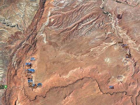
To view the map in Google Maps please click anywhere on the map above.
The points of interest on the map can be downloaded as a kmz file by clicking here.
USGS 24K Topo Maps
The area around Edmaier's Secret is covered by the West Clark Bench USGS 24K topographic map.
| 24K Map (GeoTiff/Avenza) | KMZ | Oruxmaps | KMZ Decollared | Oruxmap Decollared | Avenza Decollared |
| West Clark Bench | KMZ | Oruxmap | KMZ Decollared | Oruxmap Decollared | Avenza Decollared |