Death Valley National Park
Introduction
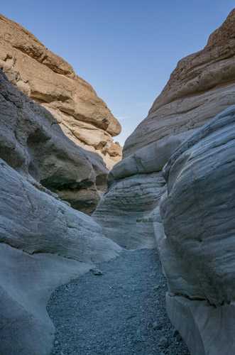
Death Valley is the largest National Park in the lower 48 states. It is my favorite winter destination. Death Valley's Furnace Creek area is only about two hours from Las Vegas, and Stovepipe Wells is only four hours from Los Angeles. Many of the best photo opportunities in Death Valley require only short hikes. These include Zabriskie Point, Badwater, the Mesquite Dunes, the Racetrack, and Scotty's Castle. There are three lodges within the park and many campgrounds. This makes it easy to stay within Death Valley most of the year. Exceptions include holiday weekends, and during rare "superblooms" of wildflowers. In short, Death Valley is an easy park to visit with short hikes, pleasant temperatures, and many great photos to be had.
Visiting Death Valley is not without its problems. Distances are vast and there are only two gas stations. 4WD is needed for some of the destinations such as "The Racetrack", lodging and food can be pricey, and Internet and cell service are scarce to non-existent. Summers in Death Valley should be avoided. They are incredibly hot. Death Valley's clear skies and haze sometimes make photography difficult.
Official Park Map
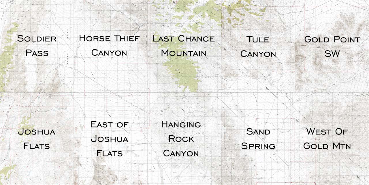
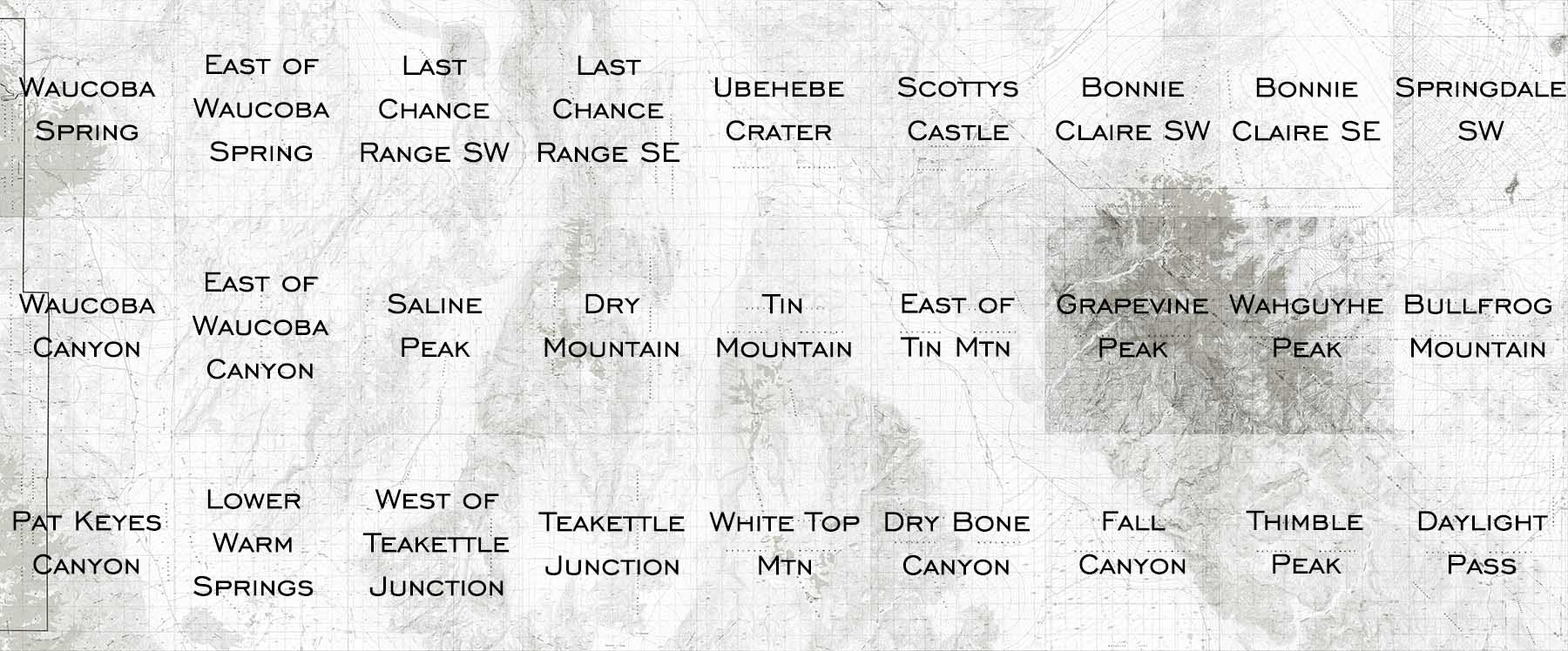
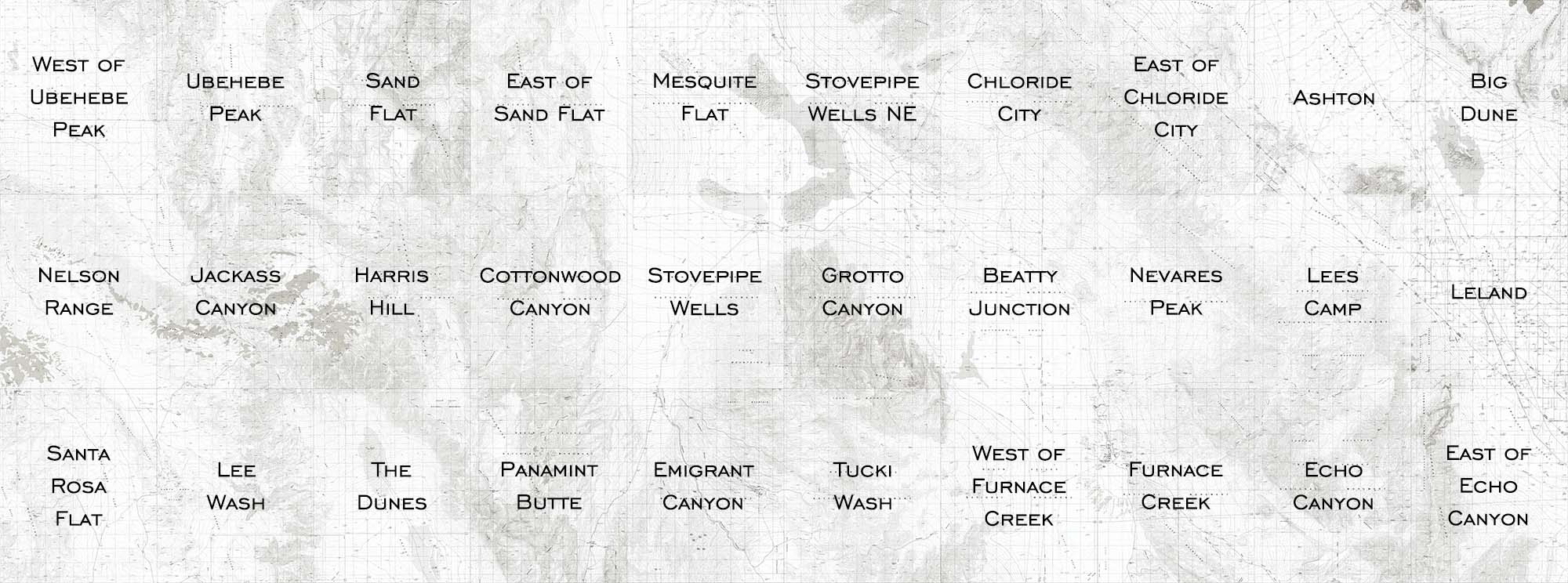
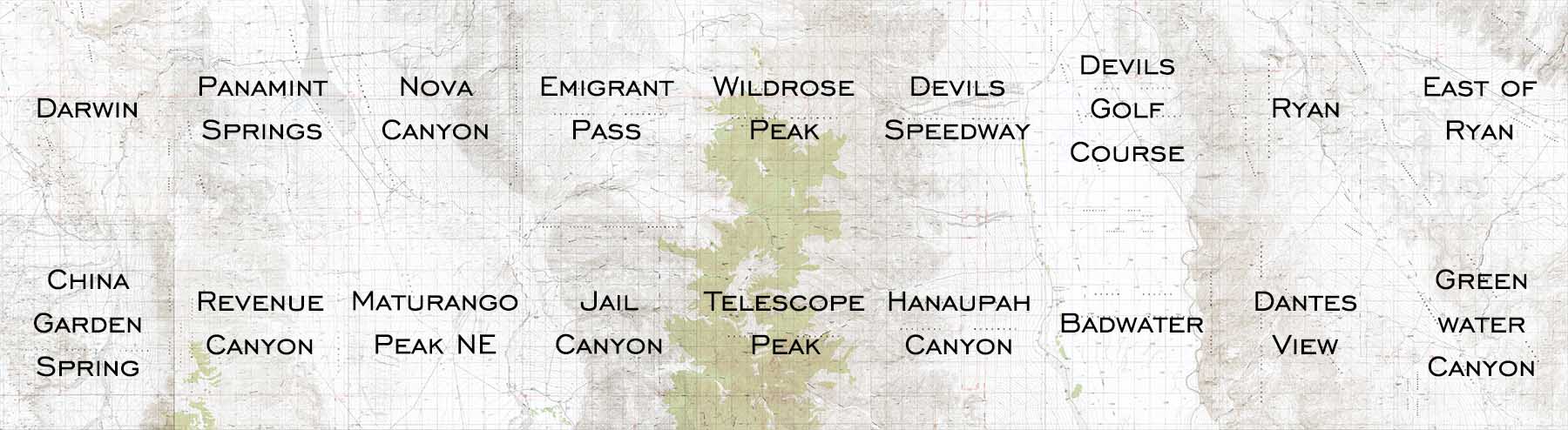
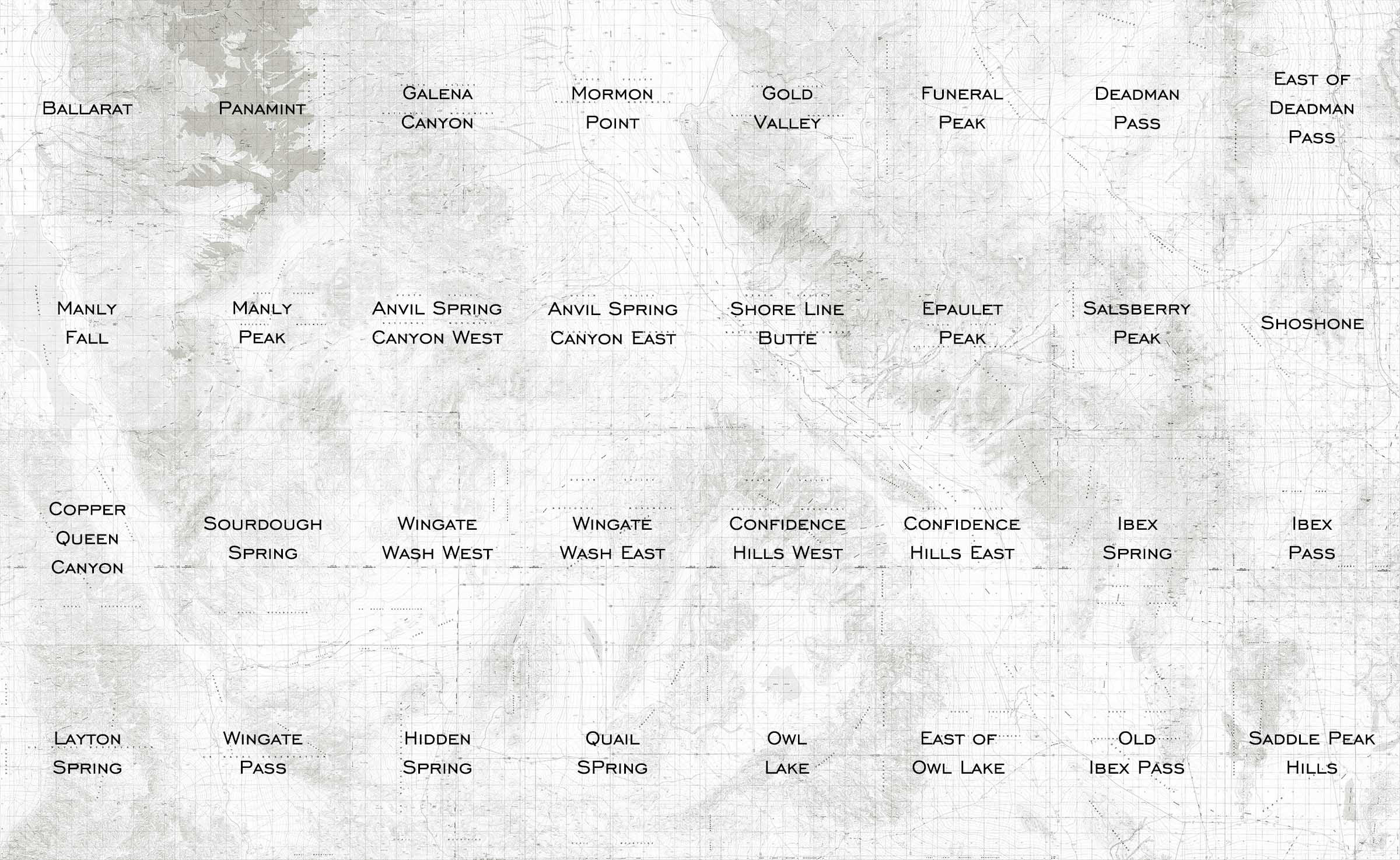
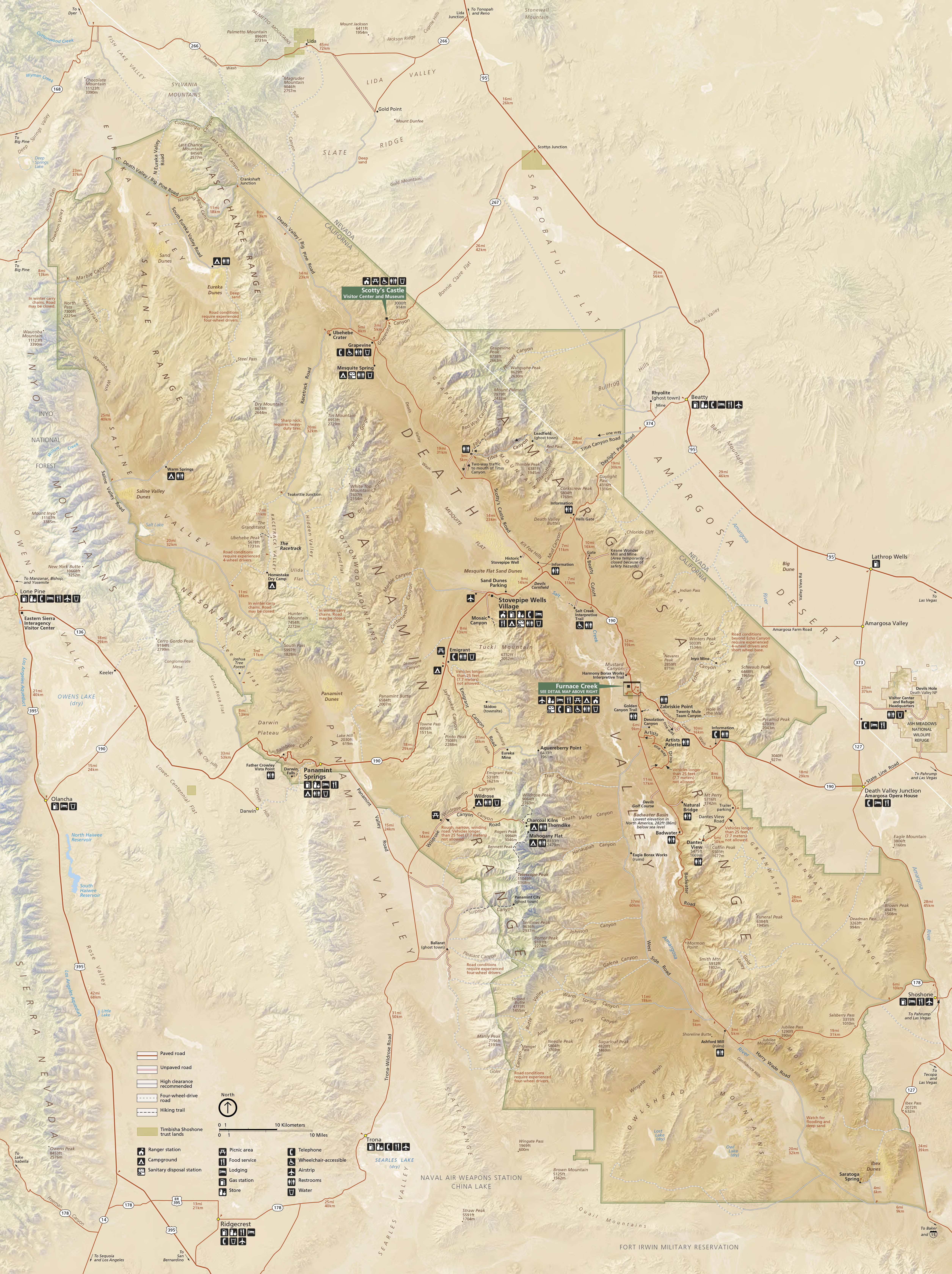
Below is the official Death Valley National Park map as a jpeg and in three geocoded formats, as a GeoTiff, as a KMZ file, and in Oruxmaps format. The official park map as a Geo PDF can be found here. The jpeg image below displays in low resolution, however if you download it you will get a full resolution 300dpi image. To download the full resolution jpeg right click on the image and choose Save Image As.
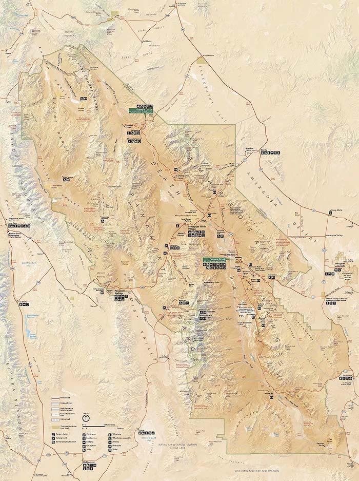
- Click to download a high resolution Jpeg file. File is not geocoded.
- Click to download a GeoTiff file viewable in PDF Maps
- Click to download a KMZ file viewable in Google Earth
- Click to download an Oruxmap file (Note - in IE Right Click and choose Save Target as)
When to Go
Death Valley is open every day of the year. Some campgrounds and hotels are closed from mid-May through mid-October. The period from mid-October through April is the best time to visit the park. Visitation peaks over holiday weekends and lodging may be unavailable then. Avoid Thanksgiving, Christmas and New Year's, Martin Luther King Day, and President's Day if you wish to dodge the crowds. Wildflowers peak from mid-February through mid-April. During a rare "superbloom" visitation in March can be double that of normal levels and lodging will be impossible to get. The superbloom in 2016 peaked on the valley floor in late February, an excellent time to visit. The National Park Service maintains visitor statistics on their website here.
Overnight stays by month - 2019
| Month | Concession Lodging | Tent Campers | RV Campers | Concession Camping | Backcountry Campers | Misc Campers | Total Overnight Stays |
| January | 1,368 | 1,600 | 1,139 | 561 | 221 | 0 | 4,889 |
| February | 1,766 | 9,334 | 15,843 | 561 | 221 | 92 | 27,818 |
| March | 2,663 | 14,403 | 22,518 | 653 | 539 | 158 | 40,935 |
| April | 2,795 | 9,786 | 10,189 | 513 | 211 | 51 | 23,544 |
| May | 2,238 | 3,472 | 4,384 | 134 | 97 | 1 | 10,326 |
| June | 1,517 | 1,398 | 934 | 94 | 23 | 0 | 3,966 |
| July | 3,146 | 788 | 371 | 94 | 2 | 0 | 4,402 |
| August | 3,943 | 899 | 205 | 70 | 4 | 0 | 5,121 |
| September | 1,862 | 2,181 | 1,485 | 221 | 135 | 5 | 5,889 |
| October | 2,389 | 6,334 | 9,376 | 495 | 105 | 33 | 18,732 |
| November | 2,125 | 14,223 | 19,098 | 495 | 267 | 60 | 36,267 |
| December | 1,947 | 10,093 | 12,032 | 469 | 90 | 54 | 24,685 |
| 2019 Totals | 27,759 | 74,511 | 97,574 | 4,360 | 1,915 | 454 | 206,574 |
Lodging and Campgrounds
Lodging within Death Valley is moderately expensive and cell and Internet service are poor to non-existent. Cell service is best in the Furnace Creek area. There is limited service near Stovepipe Wells. When I visit Death Valley I either camp in the park or stay at Stovepipe Wells or in Beatty, Nevada. While Beatty lodging is on the economy side, food and rooms are inexpensive, and gas, cell and Internet service are readily available. Beatty is only ten minutes from Rhyolite ghost town (a great photo op), and forty minutes from the Mesquite dunefield. The Mesquite Dunes are the best photo op in Death Valley. Official information on lodging can be found here. Information on campgrounds can be found here. Information on "backcountry" camping can be found here.
As of December, 2020 all Death Valley campgrounds and most lodges within the park are closed due to California's Covid "Stay at home" order. The campground closure includes backcountry campgrounds such as those at Eureka Dunes, Panamint Dunes, and Ibex Dunes. Here are some alternate places to stay if you wish to shoot the dunes fields at sunrise or sunset:
- Stovepipe Wells - The closest open lodging is at the Panamint Springs Resort. Gas and takeout food is currently available at the resort. Lodging is also available in Beatty, Nevada. Tent and RV camping (boondocking) is available at Lee Flat (Boxcar Cabin) and also just outside Beatty (the Pond site and the Bull Frog Campground). Campgrounds with hookups are available in Beatty.
- Panamint Dunes - backcountry camping on the road to the dunes parking area is closed. Alternatives include the Lee Flat area for boondocking and the Panamint Springs Lodge.
- Eureka Dunes - normally you can car camp right near the foot of the dunes but overnight camping is currently closed. The nearest lodging is in Big Pine which is two hours away! Primitive dispersed camping is likely available on BLM land at the abandoned Crater Mine area north of Death Valley Road seen on the way to the dunes.
- Ibex Dunes - camping along Saratoga Springs Road within the park is allowed. Primitive dispersed camping can also be found on Saratoga Springs Road outside the park and on the dry playa of Silurian Lake.
Death Valley Climate (°F)
Data below is measured near the Furnace Creek Visitor Center, elevation -190 feet. The highest ground temperature ever recorded in the US was 201°F in 1972, the air temperature that day was 128°F. Expect temperatures exceeding 100°F from mid-May through the end of September. The world record, highest air temperature of 134°F (57°C) was recorded in Death Valley on July 10, 1913 at Furnace Creek Ranch. Historical temperature and rainfall data for Death Valley can be found here.
Landmarks and Shooting Locations
| Location | Latitude | Longitude | 24K Topo Map | Rating | Comments |
| Aguereberry Point | 36.35795 | -117.0479 | Wildrose Peak | *** | Late afternoon, 4WD, use a polarizer to cut haze. On the drive in stop at Eureka Mines. |
| Artists Palette | 36.36352 | -116.80266 | Devils Golf Course | *** | Best late afternoon to sunset. Shooting from the overlook at the parking area produces unremarkable images that are front lit. I suggest you hike in closer to the Palette for more interesting compositions. |
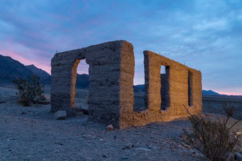
| Ashford Mill Ruins | 35.91863 | -116.68322 | Shore Line Butte | **** | Excellent for Milky Way shots with the ruins light painted or lit by a slender moon. Good in the blue hour, sunrise, and sunset. Wildflowers in the foreground would improve your images. |
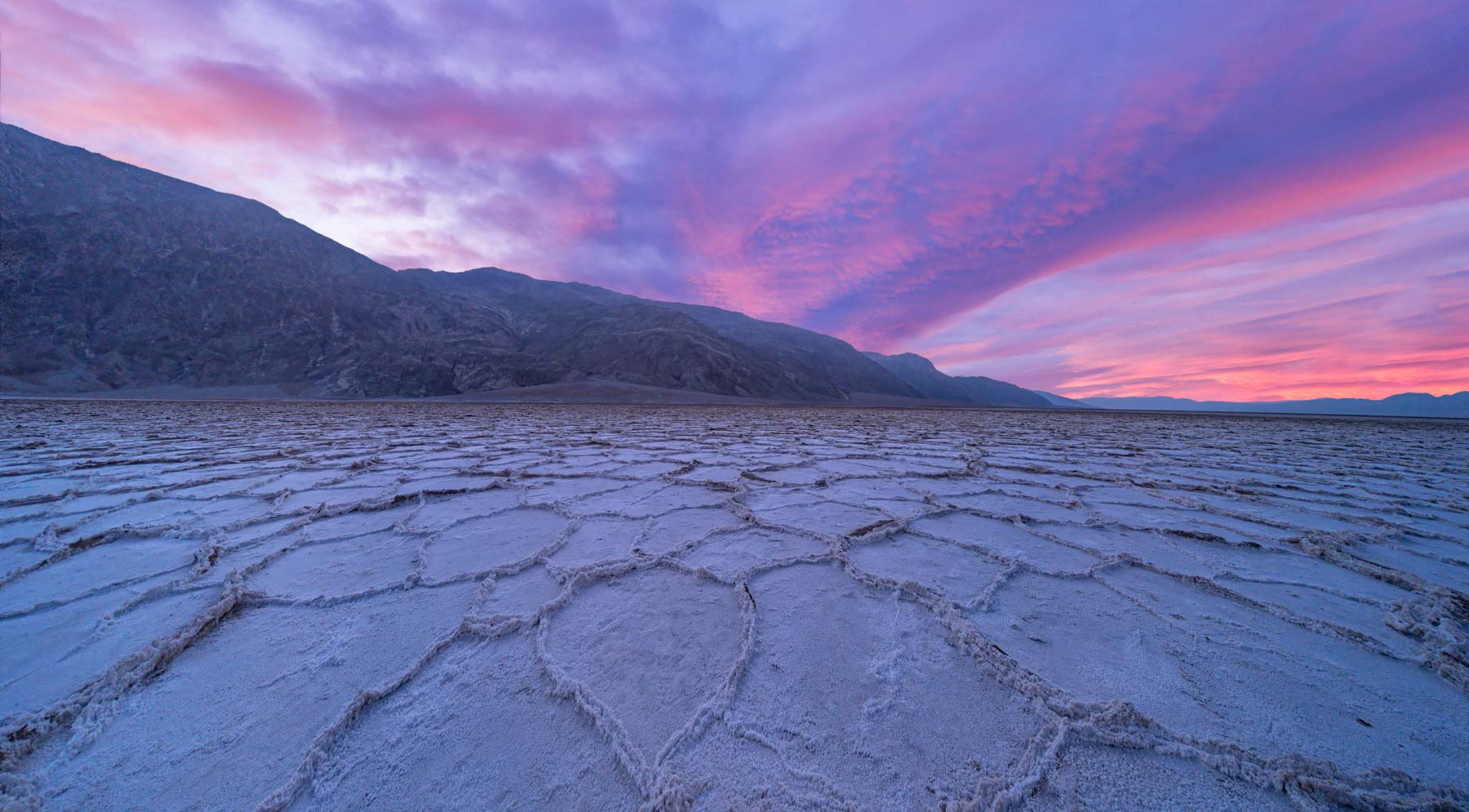
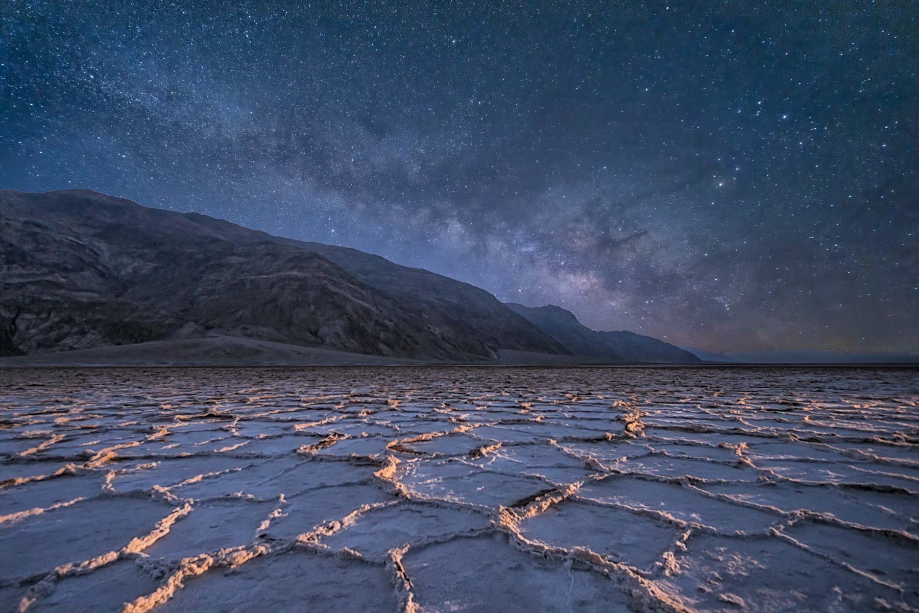
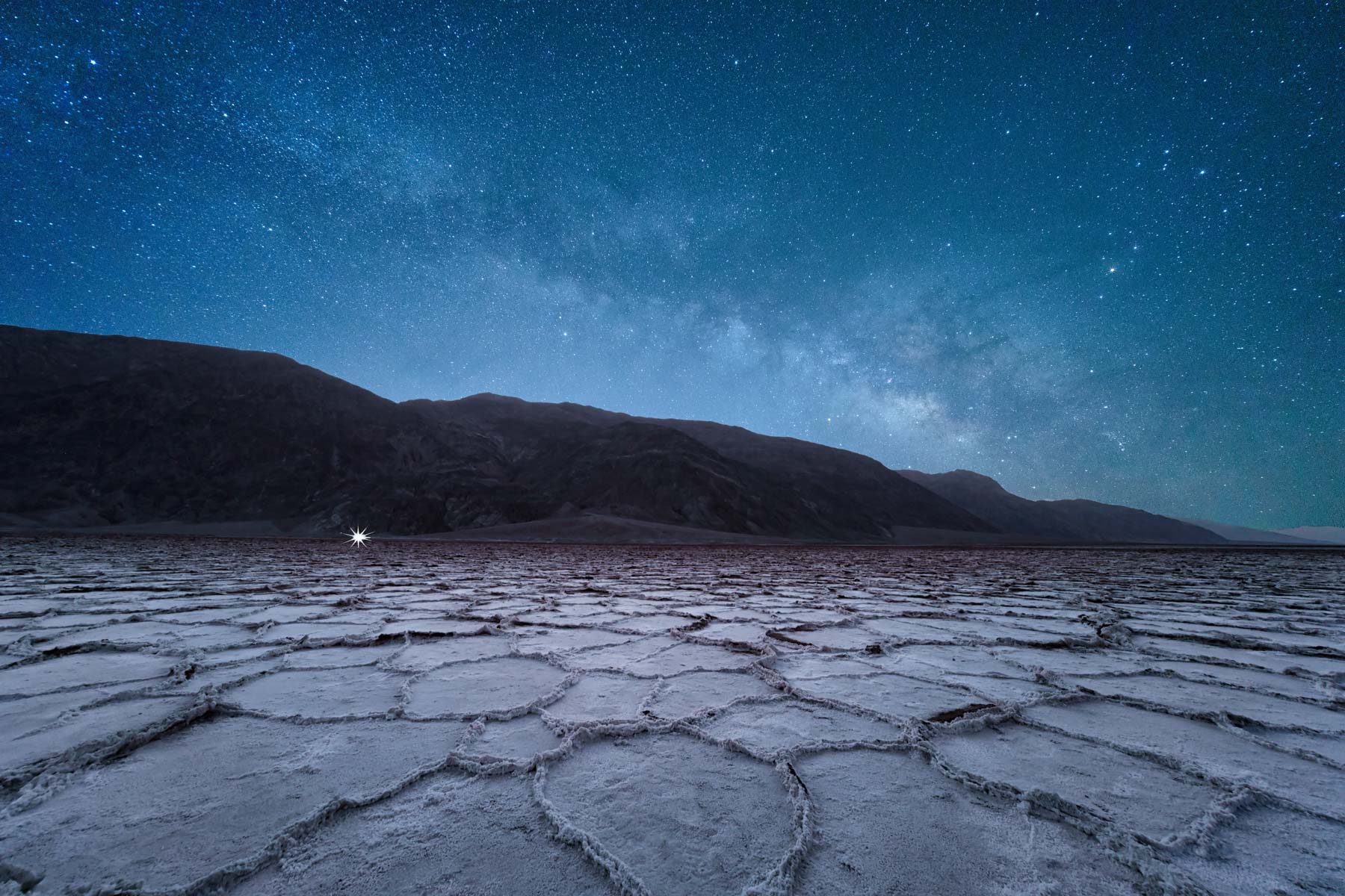
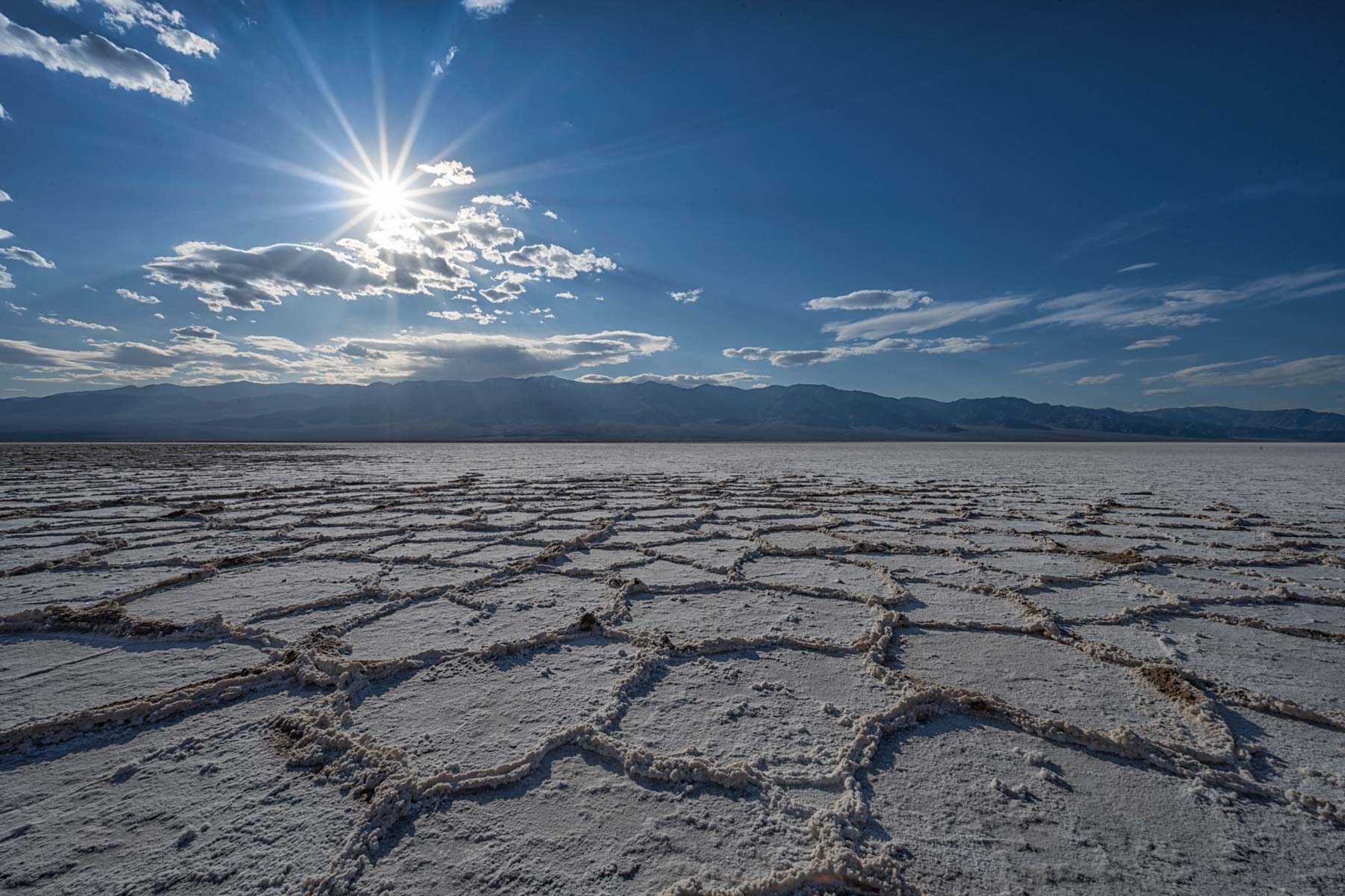
| Badwater | 36.22985 | -116.76743 | Badwater | *** | Good early morning, late afternoon, and at night. Use a wide angle lens to emphasize the salt ridges. Consider shooting in the general direction of the sun to emphasize the salt ridge shadows. The quality of the salt ridges varies greatly from year to year, and you will need to walk out about at least 1/4 mile fore the best ridges. Badwater is an excellent Milky Way destination. Consider using a light panel to bring out the salt ridges in the foreground. |
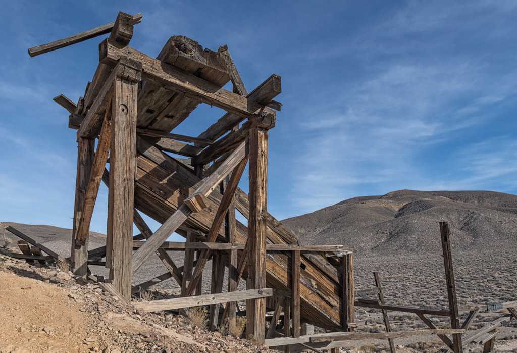
| Barker Ranch | 35.8596 | -117.0886 | Sourdough Spring | *** | Included mostly for its historical significance. Charles Manson and his followers lived here and at nearby Myers Ranch until his capture at Barker Ranch in 1969. A fire destroyed most of the ranch in 2009 but the foundation survived. It is constructed of multi-colored local stone and is photogenic. Easiest access to Barker Ranch is via Panamint Valley Road. Stop at the Ballarat ghost town along the way. 4WD only. Very remote. Access from the West Side Road is also possible but you need to go through Mengel Pass which is difficult for many stock 4WD vehicles. Call the NPS for current road conditions. Also visit the Geologist's Cabin and Striped Butte on the same trip. |
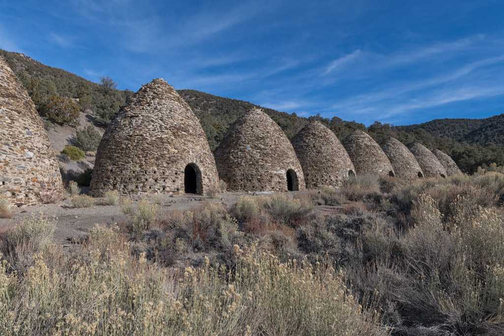
| Charcoal Kilns | 36.24659 | -117.07629 | Telescope Peak | **** | Best a few hours before sunset. After visiting the kilns stop at Aguereberry Point for sunset. An ultra-wide or panorama head is needed to get all ten kilns in the image. Great at night, place led lights in the kilns. |
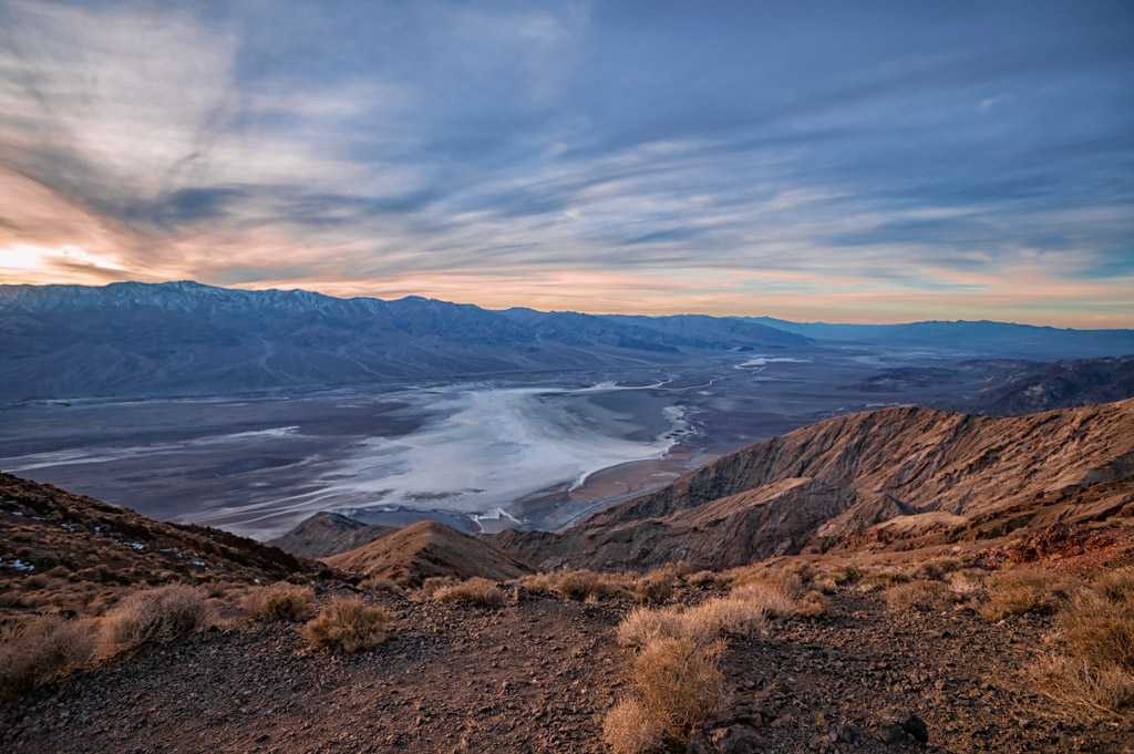
| Dante's View | 36.22066 | -116.72661 | Dantes View | **** | Best near sunrise and during the blue hour, sunset works also. |
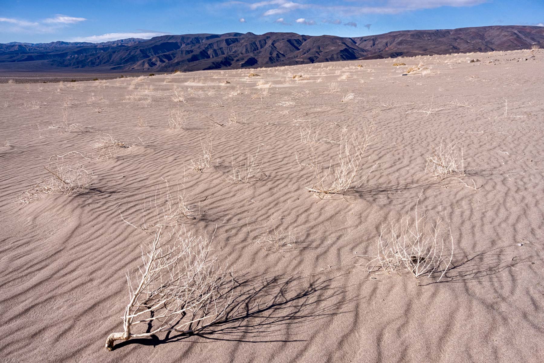
| Eureka Dunes | 37.11226 | -117.68102 | Last Chance Range SW | **** | Arguably the tallest sand dunes in the United States. Best late afternoon to sunset. At some point of almost every afternoon you'll be greeted by a squadron of low flying fighter jets buzzing the dunes. A long drive on a 4WD road is required. I suggest you camp at the dunes to avoid doing the drive at night. Eureka is a linear dune running north south so it is often front lit. Eureka is seldom visited; you might have it to yourself. The lower dunes at the south end are better subjects than the main dune, but they are almost two long miles from the parking area. On the plus side you won't find footprints at the south end of the dune field. |
| Geologist's Cabin and Striped Butte | 35.8596 | -117.0886 | Manly Peak | *** | A photogenic cabin in Butte Valley. The cabin is oriented so that the porch faces Striped Butte which makes for great background. The cabin is constructed of multi-colored local stone. Very remote. Easiest access is from the West Side Road and Warm Springs Road. 4WD required. On the way you will pass the Warm Springs Talc Mine where Big Horn are sometimes seen. Barker Ranch (where Charles Manson lived) is six miles from the Geologist's cabin but you need to drive through Mengel Pass which is difficult for many stock 4WD vehicles. Call the NPS for current road conditions. A good night site in late summer / fall when the Milky Way is to the southwest and more vertical. Light a candle or leave the lights in the cabin on and shoot the Milky Way framing the cabin. It is possible to sleep in the cabin but due to the possible presence of hantavirus I do not recommend it. First come first served. When you get there run the US flag up the flagpole to indicate that you are staying there. Burros in Butte Valley are common. You should check out Stella's Cabin and Russell's Camp while in the area. |
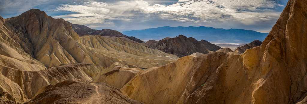
| Golden Canyon | 36.42065 | -116.84683 | Furnace Creek | ***** | Mid-late afternoon, the Red Cathedral area is excellent. |
| Ibex Dunes Talc Mine | 35.69124 | -116.36252 | Saddle Peak Hills | *** | Best late afternoon. Consider a focal length blend (perspective blend) to maximize the size of the Talc mine. Nearby Saratoga Springs is worth a quick visit while ion the area. |
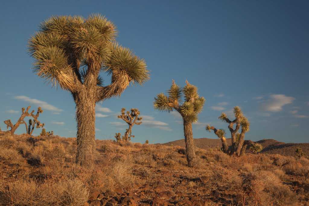
| Lee Flat | 36.43659 | -117.62194 | Lee Wash | *** | Many Joshua Trees, best blue hour, sunrise, sunset, Milky Way shots at night. Check out the Boxcar Cabin. Due to the possible presence of Hantavirus I suggest you do not sleep in the cabin. |
| Marble Canyon | 36.61886 | -117.33055 | Cottonwood Canyon | *** | Best around noon, long 4WD drive from Stovepipe Wells. |
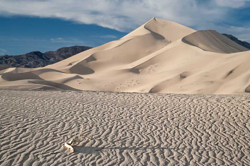
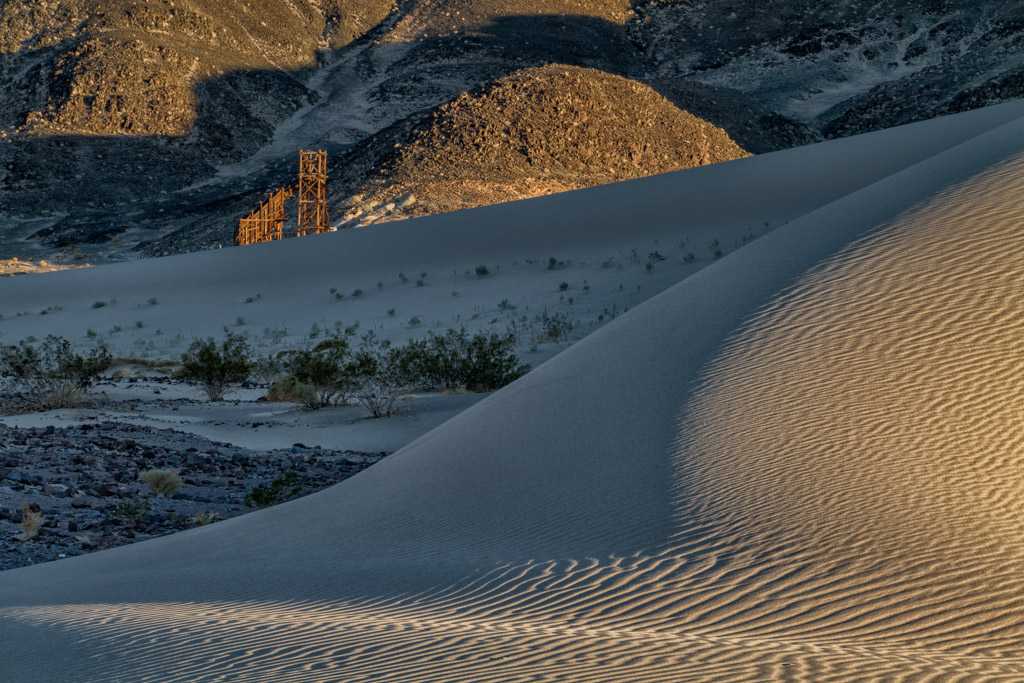
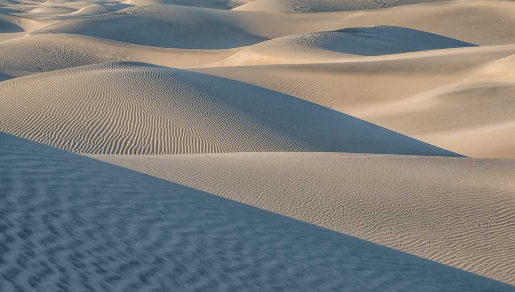
| Mesquite Dunes | 36.60548 | -117.11098 | Grotto Canyon | ***** | Best photo opportunities in the park. Good near sunrise and sunset, during the blue hour, and under a full moon. The dunes are uninteresting during mid-day. Sunrise works better than sunset as there will be fewer footprints, less wind, less haze, fewer people, and the angle the sand ridges present to the light is better. While most people hike to the top of the tallest dune, I find the east end of the dunes to be the most photogenic. I usually park about .4 miles east of the main parking area near Grotto Canyon Road. Park along the side of the main road. Compressed telephoto shots work well, hike to the top of a dune and scan the dunefield for interesting sand patterns. You will need a 150mm - 300mm lens for these shots. Consider including someone in the image for scale. A polarizer can do wonders if there is haze. You can drive up Grotto Canyon Road to get overview shots of the dune field. Stay at Stovepipe Wells or in Beatty if you wish to save money or need Internet access. |
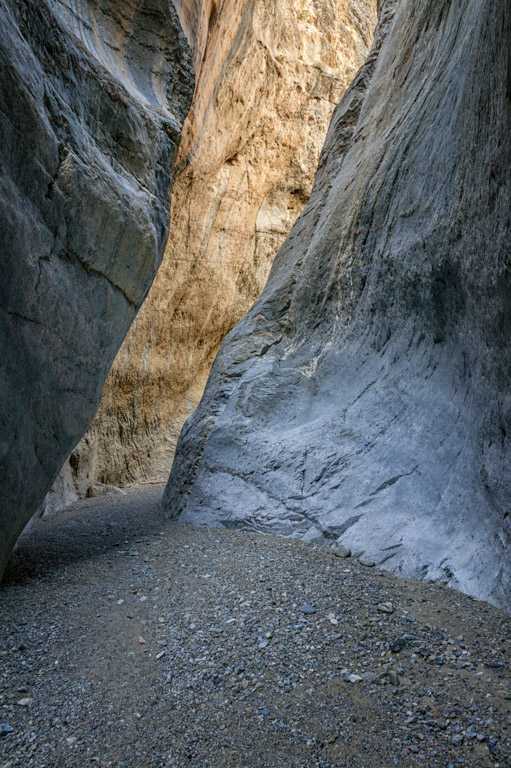
| Mosaic Canyon | 36.57197 | -117.14433 | Stovepipe Wells | *** | Best around noon, a short 2WD drive from Stovepipe Wells. |
| Mushroom Rock | 36.38707 | -116.85158 | Furnace Creek | *** | This rock used to be a main attraction in Death Valley, and there was even a parking area for it. Unfortunately over time people damaged the rock and it is not nearly as photogenic as it was, and the parking area was removed. It is still worth visiting however. Late morning to sunset is probably best, shoot low to the ground to the NW. |
| Panamint Dunes | 36.45739 | -117.45886 | The Dunes | *** | A very bumpy five mile drive on a 4WD road is required, and a boring seven mile RT hike. Despite the drive and hike Panamint is my second favorite dune field in the park. Lake Hill and Panamint Valley are spectacular as seen from the dunes. Use a focal length blend to emphasize both the dunes and the background. The dunes are best at sunrise and sunset around the winter solstice. There is decent car camping along the road to the trailhead. |
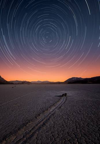
| The Racetrack | 36.66574 | -117.56822 | Ubehebe Peak | **** | Best at sunset and at night. It has become very popular and there will be many other people present requiring patience or cloning. A long 4WD over a rocky road is required so if you'll be shooting at sunset plan on camping at Homestake Dry Camp. Many people get flat tires on the drive to/from the Racetrack. |
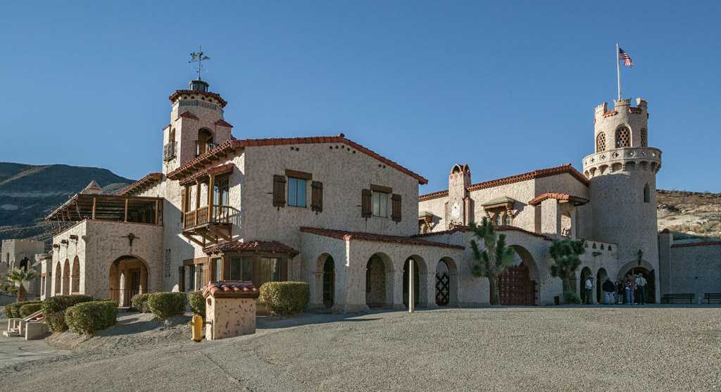
| Scotty's Castle | 37.0323 | -117.34139 | Scotty's Castle | **** | Unfortunately closed until the December of 2022 due to road and other repairs following a flash flood in 2015. When it reopens be sure to do the tours of the interior even though tripods are not allowed and light levels are low. There is a gorgeous circular staircase. |
| Zabriskie Point | 36.42006 | -116.81223 | Furnace Creek | ***** | Good in the blue hour and until Manly Beacon becomes harshly lit after sunrise. Very popular at sunrise. Arrive well before dawn if you wish to shoot during the blue Hour. Also good at sunset. |
Google and Caltopo maps showing various Points of Interest
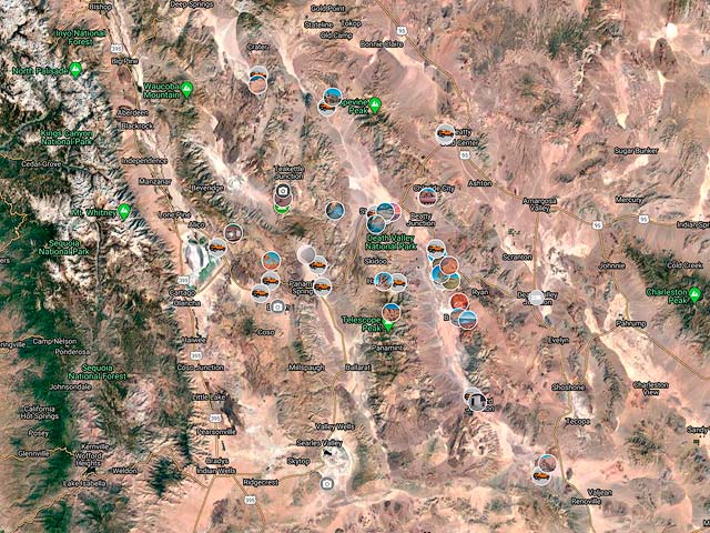
To view the map in Google Maps please click anywhere on the map above.
- Click to download a KMZ file (Note - in IE Right Click and choose Save Target as)
- Click to download a KML file (Note - KML files do not include custom icons)
- Click to download a GPX file (Note - in IE Right Click and choose Save Target as)
In addition to the Google Map above I have also added a Caltopo Map that can be accessed by clicking on the next icon. ![]()
