Dinosaur Tracks
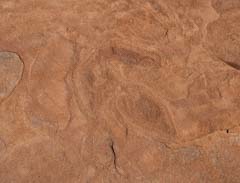
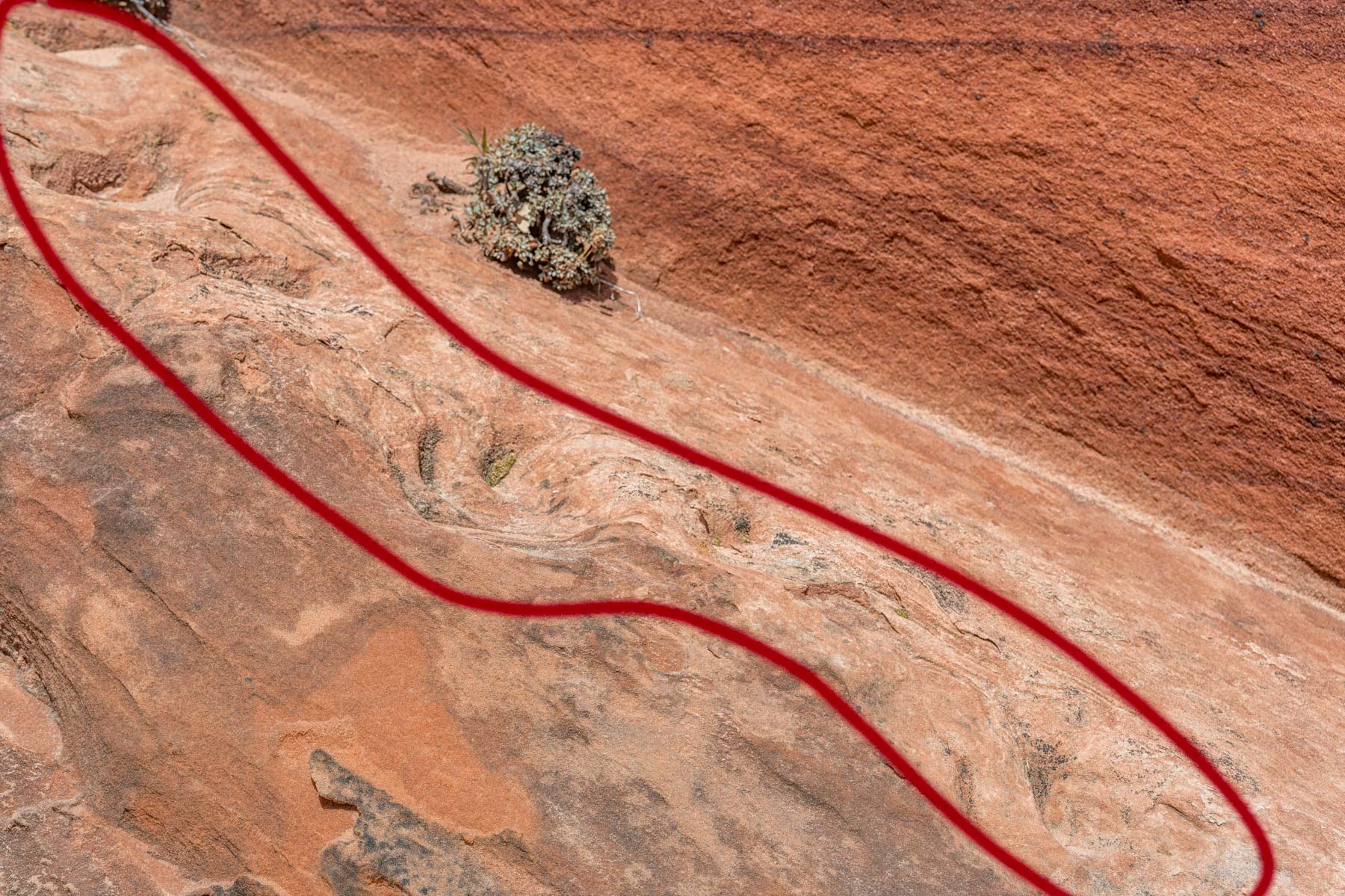
If you're going to The Wave and have never seen dinosaur tracks, you should make a slight detour to see some. There are several sets of tracks and two trackways in the area. One of the trackways is a 50-meter detour from the hike to The Wave and is a must-see. It is easy to find. The trackway is located at 37.004553, -112.007718, about 100 meters south of "The Hooters." The trackway is a few feet up the south-facing side of a butte. There are two bushes next to the tracks. I counted 14 tracks in the trackway. Guided tours always stop there on the way to or from The Wave. Tour guides have been referring to these tracks as Giant Sloth tracks. This is incorrect. Giant sloths only migrated to North America about 8 million years ago. The other tracks in the area are about 190 million years old. A research paper by Jesper Milan in Acta Palaeontologica Polonica, June 2008 pg. 201 states that a Sauropodomorph made the tracks in the early Jurrasic. The early Jurassic epoch ran from 201 to 174 million years ago. The paper includes a photograph of the trackway (Figure 4) and discusses how the trackway was made. There is a hard-to-find single track 30 feet east of this trackway. An image appears on the right.
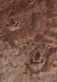
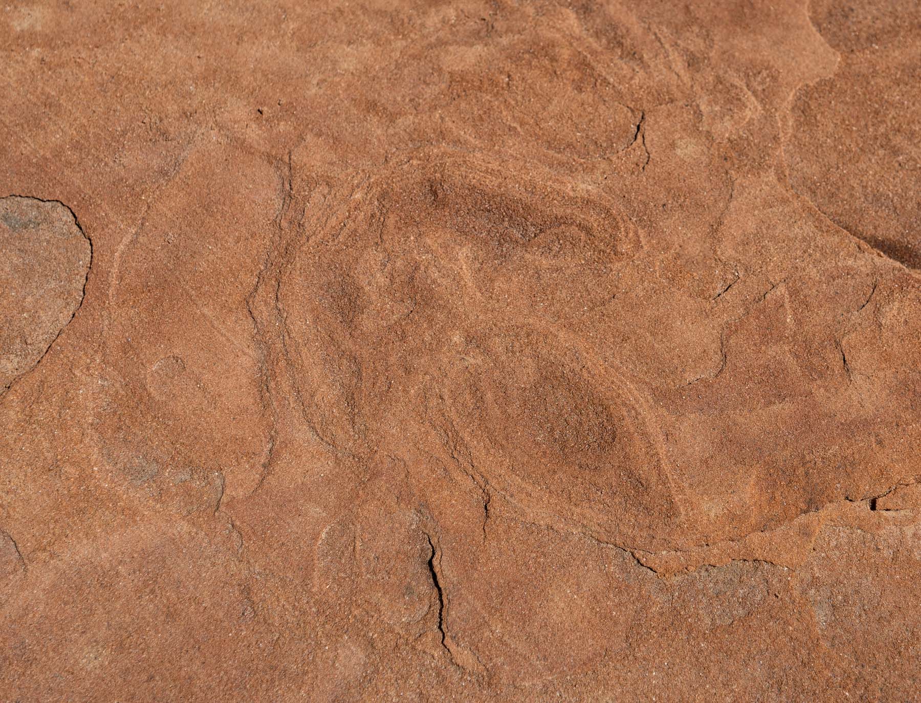
There are more tracks 0.4 miles south of the trackway. The tracks are about a ten-minute detour from the route to The Wave. Allow a half hour to get to the right area, find, and photograph them. The prints are located at the foot of the cliffs on the west side of the permit area, just a bit north of The Wave. On your way to The Wave, delay crossing the last wash for a few hundred yards before turning east. On the way back from The Wave, crossing the wash as soon as possible after descending the sand dune, hike a few hundred yards west to the base of the tall cliffs and head south along the base of these cliffs. The tracks are in the area just before the west side cliffs become difficult to ascend, in a reddish/white area. The footprints are generally about four inches long and are three-toed (tridactyl). Claw impressions can sometimes be seen. The footprints are indented into the rock and may be filled with sand. Please do not brush or otherwise remove sand from the tracks. If you wish to add contrast to an image of the prints, pour water on them. The tracks have endured 200 million years of rain; more water won't hurt.
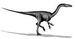
Grallator drawing
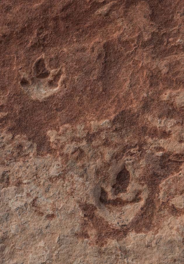
They were most likely made by Grallators. Grallators lived about 200 million years ago (late Triassic / early Jurassic periods). Two sets of footprints can be seen in my gallery. One footprint is near a large rock at 36.999758, -112.009503. The circled rock in the picture is about a yard in length. If you can find it, you can find the footprint. The second set consists of two clear prints and a third possible print. These footprints are at 36.999238, -112.009852. To help you find the footprints, I have placed a small circle of rocks around them. Normally, I don't create cairns (rock piles) as it takes some of the fun out of exploring an area. In this case, I created the cairn since the footprints can be hard to find by a novice and because there are many other footprints in the area for those who wish to find tracks on their own. As of mid-2018, the rock circle was still there.
An aside on GPS accuracy
The GPS coordinates above are correct to within ten feet with 95% confidence. Of course, if your GPS only has an accuracy of thirty feet, you could still be off by thirty feet or more when looking for the footprints. If you are looking for the tracks using a GPS, enable WAAS if your receiver is enabled.
GPS measurements were made with a WAAS-capable receiver with WAAS turned on. The accuracy of GPS coordinates can vary greatly depending on the location of the GPS satellites in the sky, the quality of the GPS receiver, ionospheric characteristics at the time of reading, and whether post-processing was done. A high-quality surveying GPS, like those made by Trimble, can cost $5,000 or more and, with post-processing, can have horizontal accuracy of ten centimeters after post-processing. Good quality GPS receivers, like those made by Garmin, are typically accurate to within 30 feet without WAAS or less than 10 feet if WAAS is enabled. The accuracy figures above are at a 95 percent confidence level, i.e., the GPS-reported location is within a ten-foot circle of the actual location 95% of the time.
Here are some other GPS concepts which relate to accuracy
- Assisted GPS (AGPS) - some GPS chipsets, such as those found in phones or tablets, allow users to periodically download (via Wifi or 3G/4G ) information about exact satellite locations. The GPS then uses this data to speed up acquisition time or even to acquire a location when the GPS can't find one. AGPS does not improve the accuracy of the location, however. Before I go out on a remote shoot, I always download AGPS data to my phone.
- Differential GPS (DGPS) - Some GPS trackers/ devices can acquire a correction signal from "reference" ground stations. DGPS accuracy depends strongly on your distance from the DGPS broadcasting station.
- Wide Area Augmentation System (WAAS) - Since GPS receivers are often outside the coverage area of DGPS ground stations, the FAA collects measurements from ground reference stations and uploads this information to geostationary WAAS satellites. These satellites then broadcast the information back to those GPS receivers equipped to receive them. WAAS is a US term. It is called SBAS (satellite-based augmentation system) by the International Civil Aviation Organization. WAAS is available throughout the United States and Hawaii. Locations in Alaska and northern Canada may have trouble getting a WAAS signal. 95% accuracy is better than ten feet. WAAS has some disadvantages, such as higher power usage and the fact that it may take more time to get a fix on a WAAS satellite than a normal satellite. You should enable WAAS in the setup menu for your receiver. I have only recently started keeping WAAS on while I hike; so far, power usage has been okay. Tablets and phones normally are not WAAS enabled. Current Garmin receivers can pick up WAAS signals.
- Post-processing - The US maintains a series of ground stations of precisely known locations. Actual GPS signals are monitored at these known locations, and corrections are developed. Corrections can then be applied to the logs created by some GPS receivers to get much more accurate locations. Unfortunately, only very expensive (and heavy) receivers keep enough information in their logs to compute these corrections. Garmin and tablet receivers do not typically output the information needed for post-processing. Post-processing software can be expensive as well.
- GPS (US), GLONASS (Russia), Galileo (EU), BDS (China), QZSS (Japan), and IRNSS (India) Satellites - As I'm writing this, my Samsung Galaxy S22 can pick up signals from 5 Glonass satellites, 13 EU satellites, and 12 US satellites. Recent Garmin receivers and most smartphones and tablets can receive GPS, GLONASS, Galileo, and BDS signals. The extra satellites can improve accuracy since more satellites with better geometry are available for a fix.
- Dual Band (L5) Support - Some GPS receivers can pick up multiple frequency bands. Multiple Bands allow for more accurate positioning, especially in challenging environments. Garmin has a good discussion of multiple band GPS and lists the Garmin models with dual-band support. The iPhone 14 and most Android phones released in the last two years have L5 support.
If you buy a GPS receiver in the US, you should ensure that it is L5 enabled, WAAS enabled and picks up GPS, GLONASS, Galileo, and BDS satellites.