Start at The Wave
So you've finally gotten a permit and want to use it best. There is a nice loop hike starting and ending at The Wave. It covers most of the best photo sites in Coyote Buttes North, and if you are willing to be out most of the day, you can hit all of them in good light. Being out all day is dangerous in the summer, so only do the loop from September through May. The loop does not include Top Rock, unless you are a strong hiker save this for a second trip.
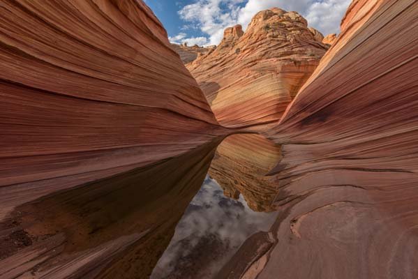
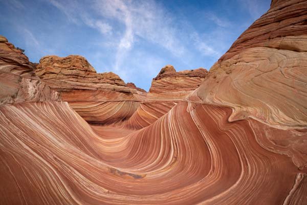
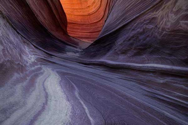
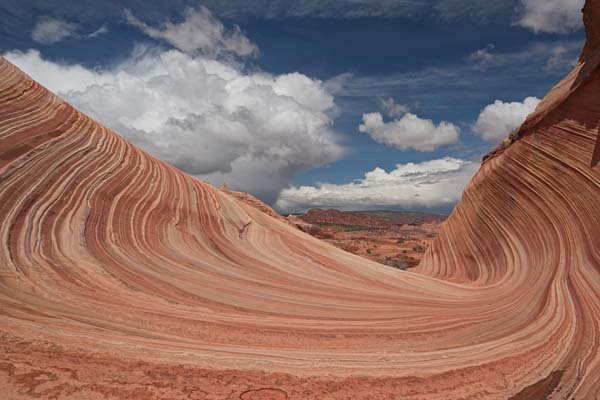
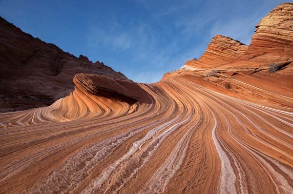
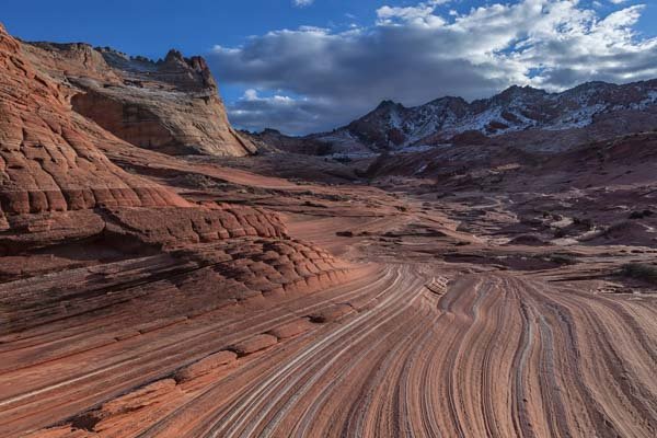
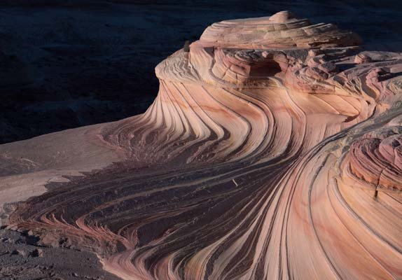
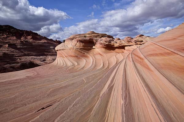
The first stop on the loop hike is The Wave. The Wave starts getting good light 45 to 90 minutes after sunrise; parts are in shadow before then. It takes about 90 minutes to hike from the Wirepass trailhead to The Wave. Most people start their hike very early in the day and leave when they run out of energy, usually before best light hits the remainder of Coyote Buttes North. If you have the stamina to stay out 10-15 hours, begin hiking at dawn; otherwise, I suggest you start your hike later. Do not start hiking too late, as shadows start to hit the south wall of The Wave before midday. After shooting The Wave, explore the area around it for an hour or two. There are usually some nice water pools 150 yards southeast of The Wave. Ginger Rock is a good subject mid-day. It can be found about 200 yards north of The Wave.
Dinosaur Tracks and The Boneyard
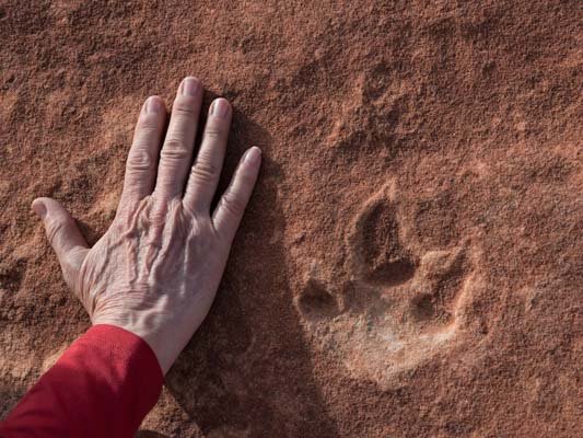
Leave The Wave by retracing your steps down the sand dune to the wash below. At the foot of the dune, turn west, cross the wash, and ascend to the area with the dinosaur tracks. The tracks are located in red stone, very close to the wall. If you are not experienced in finding tracks, they can be hard to locate, even with GPS coordinates. The tracks are three-toed and hand-sized. I left a small circle of rocks around a pair of footprints about ten years ago; as of mid-2017, the circle was still there.
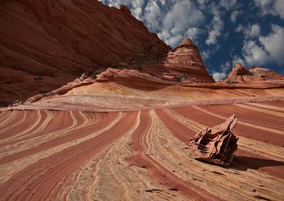
After visiting the dinosaur tracks, continue south about .3 miles till you reach an open area. Fifty yards to the west lies a small brown and yellow striped area with rocks resembling a #D tic-tac-toe board on the stripes. The area was named "The Boneyard" by photographer Michael Fatali. The loose rocks are called lace or box rocks. Please do not move them; they are fragile. Wait until the cliffs to the northwest of The Boneyard are in shadow before shooting; the dark background of the cliffs contrasts nicely with The Boneyard. Stay until the sun goes behind the cliffs to the west, and The Boneyard falls into shadow. The Boneyard is also good at dawn; light hits it just after sunrise, with March and September being optimal times to shoot it at dawn.
Sand Cove
After leaving The Boneyard, head down the sandy wash which runs south-east. In .2 miles, turn to the south into Sand Cove Wash. Continue up Sand Cove Wash about 100 yards and hike up to the teepees to your east (left). This area contains beautiful sandstone curves and is called Sand Cove. It is best captured late afternoon, just before it goes into shadow. A wide-angle lens is needed. Sand Cove is largely in shadow in the morning. Stay at Sand Cove until it starts going into shadow.
The Second Wave
From Sand Cove, hike east-north-east and scramble up the cliff until you reach a flat area just before a much steeper cliff. The Second Wave is at the foot of this cliff. It is a great late afternoon location, but only fair the rest of the day. Shoot it from the small sand dune a few yards south or from the rocks to the southeast about ten feet above it. Make sure the cliffs to the west are in shadow. Shoot until the Second Wave goes into shadow. Leave earlier if you are concerned about hiking back to your car after sunset.
To return to the Wirepass parking lot, head north, passing back through The Wave. There should be many good photo-ops along the hike back, so wait to put your camera/tripod away. After leaving The Wave, head down the dune, cross the wash, and head north to retrace your steps to your car. "The Dive" and the North and South "Teepees" will be in good light on the way back. You will need a long lens to shoot them. If you hurry, you should be able to get back to your car 30-45 minutes after sunset. Warning - if you do not have good navigation skills or have a GPS and know how to use it, you should leave The Second Wave well before sunset.
Map of the Loop Hike
The map below shows the route to The Wave in blue and the Loop hike in red. Routes shown are approximate and do not replace common sense. The loop hike is entirely off-trail; there are no cairns. There are a few cairns/ markers on the hike to The Wave; you should mentally note where they are to help with the return to your car.
Note that the new Google Maps engine does not show you the latitude/longitude of waypoints, points of interest, elevation, or the distance between two points on the map. The engine also does not show track or route elevation profiles. If you need these, download the KML or KMZ file for the map and load it into Google Earth or another mapping tool.