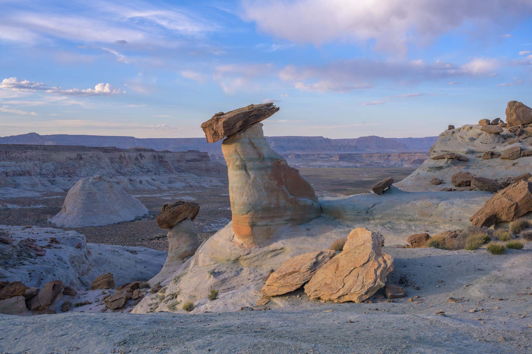
Stud Horse Point and the surrounding area

Stud Horse Point is only a few miles from Page and is a good sunset destination and a reasonable morning destination. If you are going to be in Page for the day (e.g. to photograph slot canyons) you might want to end with Stud Horse Point. The hoodoos of Studhorse point sit a bit below the rim of a cliff but are easily accessible. The rim blocks the best light until an hour or so after sunrise. At sunset the rim also blocks the best light but not as much as at sunrise. Most of the Stud Horse Point hoodoos are on one level. I suggest you shoot the hoodoos from this level and also by dropping down one level (5-10 feet below) and shooting from there as well. The Stud Horse Point hoodoos mostly face north or west and are good subjects for star trail images. Milky Way images do not work as well.
There are dinosaur tracks in the same general area. Stop at the BLM Big Water "Dinosaur" visitor center for driving directions and the general location of the tracks. Getting to the tracks involves about a 1-2 mile (round trip) hike. The tracks are not easy to find.
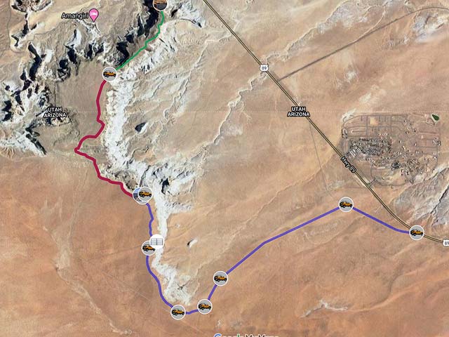
Route to Studhorse Point
There are many small roads in the area so follow the directions carefully and print out the Google map.
- The road to Studhorse Point starts 0.7 miles east of Greenehaven Drive off Highway 89.
- Follow the good unnamed gravel road 0.8 miles and make a left
- Go 1.5 miles and bear left at the fork.
- Go .35 miles and bear right (west)
- Go .25 miles and bear right (northwest)
- Go 0.8 miles and turn right.
- Go 0.1 miles and turn left. 4x4 needed here.
- Continue 0.5 miles to Studhorse Point. 4x4 needed here.
There are two places to park at Stud Horse Point. I recommend parking right where the road curves as shown on the map. Alternatively you can drive down the steep sandy hill to the parking area below. It can be difficult even with a 4x4 to get back up this hill.
Google Map of Stud Horse Point
Here is an Google overview map showing how to get to Stud Horse Point:
To view the map in Google Maps please click anywhere on the map above.
USGS 24K Topo Maps
Stud Horse Point is covered by the Ferry Swale USGS 24K map. For completeness I've also included a few other maps. Skylight Arch is on the Lone Rock map and should be a good sunset destination.

Stud Horse Point Index Map
| Geo Tiff/Avenza | KMZ | Oruxmaps | KMZ Decollared | Oruxmap Decollared | Avenza Decollared |
| Big Water | KMZ | Oruxmap | KMZ Decollared | Oruxmap Decollared | Avenza Decollared |
| Ferry Swale | KMZ | Oruxmap | KMZ Decollared | Oruxmap Decollared | Avenza Decollared |
| Lone Rock | KMZ | Oruxmap | KMZ Decollared | Oruxmap Decollared | Avenza Decollared |
| Water Pockets | KMZ | Oruxmap | KMZ Decollared | Oruxmap Decollared | Avenza Decollared |
| Merge of all four maps | NA | NA | KMZ Decollared | Oruxmap Decollared | Avenza Decollared |
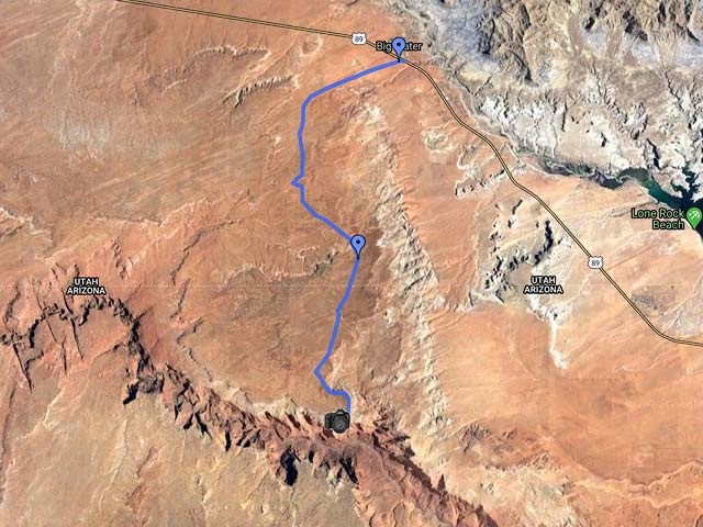
Paria Overlook
The road shown on the map below goes to a nice overlook of the Paria River. Total distance is 12 miles one way. You should allow at least an hour to travel it. There are many unsigned roads on the route so I suggest you download the route below to your GPS. Don't get to the overlook too late as I did or there will be a harsh shadow on the right.
To view the map in Google Maps please click anywhere on the map above.
- Click to download a KMZ file (Note - in IE Right Click and choose Save Target as).
- Click to download a KML file (Note - KML files do not include custom icons).
- Click to download a GPX file (Note - in IE Right Click and choose Save Target as).
USGS 24K Topo Maps
Paria Overlook is covered by the Water Pockets USGS 24K map. You'll also need the Ferry Swale map above if you wish to cover the entire route from Highway 89. Both maps can be downloaded above.