Older Posts
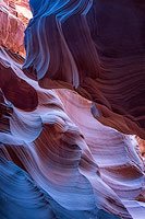
I've added images of two slot canyons near Kanab, Utah. The first is Red Canyon, also known as Peekaboo Canyon. Red Canyon is accessible via a very sandy 4WD road off of Highway 89, or via a seven mile plus round trip hike from the Red Canyon TH at 37.154676°, -112.573318°. The second slot is Upper Red Cave, also known as Heart Vein. Upper Red Cave can only be accessed by crossing private land with a locked gate. The canyon also has several three to eight foot climbs which will be difficult for most without a ladder. I recommend going with guide Jim Anderson of Kanab, Utah. Jim will bring a telescoping ladder to help with the climbs, and also has a key to the gate. Jim can be reached at maddog154@hotmail.com or at +1 435 689-0621. A map with the location of Red Canyon can be found here. The map page also contains the excellent BLM OHV road maps of the Kanab area.
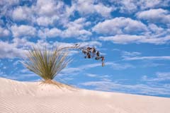
On December 20th White Sands became our 62nd National Park. For now expect little change in the operations of the park; even the signs have not yet been changed. Over time expect increased attendance, more funding, and hopefully more opportunities to explore the park. A gallery of images of White Sands appears here, and a page with park information and photographic tips here.
I've updated the Monument Valley gallery with images from a recent trip to Hunts Mesa.

I've also updated the Adeii Eichii gallery with new images from the Sky City and Hopi Clown areas. The "road" to the Hopi Clown has deteriorated in the last few years and since we are now in rainy season I advise not going there at this time.
The Rimrocks gallery contains new images of the white hoodoos 200 yards west of Toadstool Hoodoo. Thanks to Stan Wagon the Rimrocks map now shows a route from the Lower Rimrocks to the Upper Rimrocks. His most recent Utah trip report discusses the route and shows an image taken during the hike. Stan also has an incredible image of a sandstone stalagmite on his blog. The stalagmite is located deep in Sidestep slot canyon and is only accessible to rock climbers.
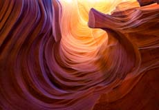
I've updated my Page Slot Canyon gallery with several images from a very narrow slot in the Navajo Nation.
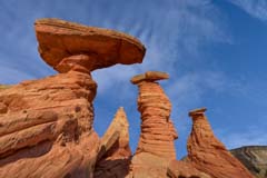
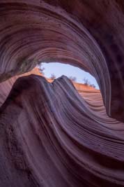
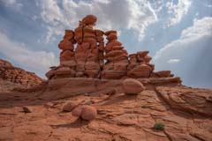
I've added images of a group of very scenic hoodoos near Kanab, Utah to the Western Grand Staircase / Kanab gallery. The hoodoos were shot about an hour before sunset which was not optimal, sunrise or the blue hour would work better.
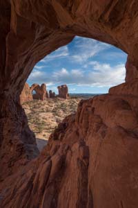
Reader Anthony Marko recently sent me an image of an arch visible from the Notch Trail. I have had reports of an arch near The Notch from others but Anthony is the first person to document it to my knowledge. The arch has a span of about ten feet and is less than one mile from The Wave. I've added some images of the arch to this gallery, and a map showing its location to the Coyote Buttes North maps page. I've also added tracks showing the route to The Maze Petroglyph and of the Notch Trail to the maps page. On my last visit I also noticed a very scenic area .2 miles northwest of Sand Cove, I've added some images to this gallery.

The BLM has issued a preliminary environmental assessment on the impact of increasing the number of permits issued for Coyote Buttes North / The Wave. As a result they have asked for input from the public on three alternatives. The alternatives are:
- A. Permit up to 96 people per day or 16 groups per day, whichever comes first.
- B. Permit up to 48 people per day or 16 groups per day, whichever comes first.
- C. No change, i.e. 20 people per day.
The group size limit of 6 would be unchanged, and no proposal was made as to how permits would be issued. Under alternatives A. and B. it was proposed that parking areas be expanded and that additional route markers be added if necessary. It was also proposed that up to four vault toilets be added at The White Pocket parking area, which I am strongly in favor of.
There is a great deal of interesting material in the scoping report and the environmental assessment available on the BLM's eplanning website. Some highlights:
- 1,570 comments were received on the original proposal to increase the number of visitors to 96. Of these just over half were from a single form letter. Of the non-form letter comments 65% of the people were opposed to any increase. The remaining 35% favored either the full increase, a more moderate increase, or a gradual increase over time. Note that BLM poll results are very different than those of the poll on this site where 72% of the respondents favor an increase in the number of permits issued.
- There has been enormous growth in the number of requested Wave permits. In 2007 5,831 people requested access via a permit, less than the total number of spots available of 20 times 365 = 7,300. By 2013 there were 70,488 people in the lottery and by 2018 200,589 people. In 2018 the odds of getting a permit were only 3.6%. Note that the odds of getting a permit via the walk-in lottery (11.2%) are much better than via the on-line lottery (2.1%). White Pocket visitation has exploded also, for the whole year 2010 there were only 660 visitors to the White Pocket, by 2018 this number grew to 11,794 users, or about 1,000 people per month. More people visit The White Pocket than visit Coyote Buttes South.
If you feel strongly about any of the three alternatives I urge you to visit the BLM's eplanning website and complete the comment form. Alternatively you can comment in person, for locations and dates of public hearings see here.
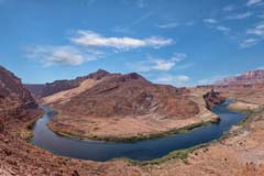
Lees Ferry, best known as the jump off point for Colorado River rafting, is a great destination in itself. Historically Lees Ferry was the only place within hundreds of miles to cross the Colorado River. Today it offers many photographic opportunities and good hiking. Good images can be had along the Spencer Trail, of the Colorado River, of an old Mormon fort, of John D. Lees Lonely Dell Ranch, and in the Balanced Rock area. A map containing many of the points of interest in the area and GPS tracks of the hikes can be found on the maps page.
Great advice from famed war photographer Robert Capa. Wide angle lenses let you get physically close to your subject. Getting close to your subject emphasizes it, and for me the incredible fine lines and sandstone patterns are the star of the show at The Wave. While a normal to short telephoto can also record these patterns, a wide angle allows you to capture them in their magnificent environment. Ultra-wides also present enormous depth of field. At f/8 if you focus a 10mm lens at the hyper-focal distance of 17 inches (measured from the sensor, not the end of the lens) inches everything from 8.5 inches (from the sensor) to infinity will be in focus.
I recently had the opportunity to photograph The Wave using a 10mm (full-frame) lens. Conditions at The Wave were almost perfect except for the heat. The day presented great clouds, there was a water pool at The Wave, and there was little wind to disturb reflections. To beat the heat we went in an hour before sunrise and had The Wave to ourselves for almost two hours before others arrived.
Most of the images below were taken at a distance of six to twelve inches from the front of the lens. Images were shot at f/8 and the camera was mostly hand-held due to the difficulty of accurately setting up the tripod at such short distances.


Navajo Parks and Recreation has suspended the issuance of permits to the Tatahatso Point area along the east rim of the Grand Canyon. Other areas along the east rim such as The Confluence of the Colorado and Little Colorado rivers, The Hopi Salt Trail, and the bends along the Little Colorado River are not affected.
I've added images of the "Sky City" area to the Adeii Eichii Cliffs gallery. I've also updated the Adeii Eichii Cliffs map with the locations of Sky City and some nice formations 1/2 mile north of it. I've left images of the "Eye of the Needle" in place, however the arch collapsed sometime in early-mid 2019 and is not longer worth shooting. A Navajo Nation $12 per person per day permit is required to visit Adeii Eichii Cliffs. The road to Adeii Eichii Cliffs is very rarely taken, be sure to download a track from the maps page before undertaking it as the road is very faint in places.
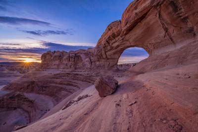
I have added a gallery of images from the western side of Grand Staircase Escalante National Monument and the surrounding area. Locations added include the Flag Point Dinosaur Track Site, The Great Chamber, and Inchworm Arch. Travel directions to Inchworm Arch have been added, and directions to the Flag Point Track Site are available upon request. I have not added travel information for The Great Chamber as the fins in the alcove are very fragile and the area will not support a large number of visitors.


The Bureau of Land Management is tentatively proposing an increase in the number of visitors allowed to visit The Wave each day. Currently 20 visitors are allowed, under the proposal 96 visitors per day would be allowed. As a first step, the BLM has asked that interested parties comment on the increase and on the permit process in general. Comments can be submitted to:
Brandon Boshell
BLM, Vermilion Cliffs National Monument
345 East Riverside Drive
St. George, UT 84790
blm_az_vcnm_pcvc_comments@blm.gov
Three public hearings will be held in early June to review these comments. More information about the proposed change and the dates and locations of the hearings can be found at https://eplanning.blm.gov/epl-front-office/eplanning/projectSummary.do?methodName=renderDefaultProjectSummary&projectId=122125.
All comments must be received by June 21, 2019.
Once all comments have been received and issues evaluated an Environmental Assessment (EA) will be ordered. The EA will be available for public review once complete. If you wish to receive notice of when the EA is complete please mail/email the BLM at the address above. The entire process of determining the scope of the EA and ordering it, completing the EA, and implementing a revised permit system could take a year or more to complete.
The proposed increase affects only the Coyote Buttes North permit area, Coyote Buttes South is not affected. Visitation for Coyote Buttes South will remain at twenty visitors per day.
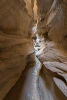
Readers Mark and Tanner Fredrickson recently hiked to Lower Sidestep Canyon from Churchwell and sent me their GPS track. Thank you Mark and Tanner! The route they took back to the their car was enough shorter than the route I was familiar with (via Wahweap Creek, 2.5 miles versus about 4 one way), that I decided to test it out. The hike itself is straightforward, from the reservoir off road K7065 north of Churchwell hike ENE about 2.25 miles to the rim of the West Fork of Wahweap Creek. There is a well defined drop down into the canyon via a sand and clay dune at 37.15308, -111.72434. The hike down the dune is steep but quite easy. When you reach the bottom of the dune you'll be in a scenic portion of the West Fork of Wahweap Creek, with Lower Sidestep Canyon about 1/3 of a mile north on the left (west) side of the West Fork. Full travel directions to Sidestep Canyon can be found here.
Once you are in Lower Sidestep you'll find it quickly slots up. The slot is very narrow and you will need to remove your pack to get through. There was a little water in the canyon. Since we were low on time we only went in a short distance but still found many good opportunities for photos and plan to go back again and spend more time. The West Fork of Wahweap Creek is also very scenic with many hoodoos and side canyons to be explored. While the West Fork is best at sunset the trail back to the rim can be easily seen from a distance. Images of Sidestep Canyon, the West Fork, and the Upper White Rocks can be found here.
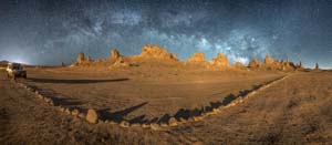
I've added a few images of the Trona Pinnacles to my Lone Pine Area gallery and updated the Alabama Hills map with the locations of several additional photogenic arches. The Trona Pinnacles are about 90 minutes south of Lone Pine and are an excellent location for night photography while the Milky Way is out. To aid in shot planning I have added a table showing when the center of the Milky Way becomes visible by month. The table was created using the excellent app Photopills which is available for both Android and Apple phones.
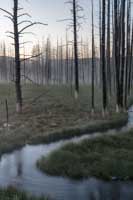
I've added many images from a 2017 trip to Yellowstone to the Yellowstone gallery, and updated the Yellowstone map with many shooting locations. The 2017 trip was in May which is a good time to go as the crowds are much smaller than in summer. Some roads in Yellowstone, like the south entrance road, are still closed in early May so if you do go then I suggest going later in the month. Winter remains my favorite time to visit the park. Yellowstone is currently open despite the government shutdown though some services are not available. More information about the impact of the shutdown on Yellowstone can be found at https://yellowstoneinsider.com/ .
I have added images from the east most tributary of Coal Mine Canyon and from nearby Ha Ho No Geh Canyon to the Coal Mine gallery. Images have also been added for the incredible balanced rock seven miles south of Tuba City. The Coal Mine map has been updated and travel directions added for these new locations.
On Christmas Eve a 14 year old girl from San Jose, California fell to her death at Horseshoe Bend. The girl was seen last seen at 2PM that day, and was reported missing by her parents at 4PM. An Arizona Department of Public Safety helicopter was dispatched and located the body of the girl at the bottom of Horseshoe Bend that day. Due to darkness search and rescue teams recovered the body on Christmas day. Preliminary investigation indicates the fall was accidental.
Once again some agencies of the US government, including the BLM which manages the The Wave permit area, are shutdown. The Wave itself is open so if you have a permit go. If you do not have a permit and are considering bagging The Wave illegally keep in mind that BLM law enforcement personnel are still on duty and will be patrolling the permit area. The average fine for hiking to The Wave without a permit exceeds $1,000.
The BLM walk-in and on-line lotteries are closed until further notice. If you have already applied on-line for an April permit I'm sure the lottery will be held once the BLM reopens. My best guess is that if you have not yet applied and the government remains shut past December 31st you probably won't be able to apply on-line for an April permit.
There have been twenty US government shutdowns since 1976, lasting seven days on average. We are now in the fourth day of the shutdown. Of the twenty shutdowns nine have lasted four days or more, with an average length of twelve days, so it is certainly possible that the current shutdown will run into the new year.
If you are currently in southern Utah / northern Arizona the Grand Canyon, Bryce, Zion and Arches national parks are open, as are the Page slot canyons. The White Pocket is open. Vermilion Cliffs and the Grand Staircase National Monuments are open for hiking but visitor centers are closed and BLM emergency response is unavailable. Local government response is still available, so call 911 in an emergency. Glen Canyon NRA is closed, however Horseshoe Bend is open.
May the holiday season bring only happiness and joy to you and your family and may your New Year be filled with fun and adventure.
I have updated the Arches gallery and map to include two new locations: Cove Arch, and Cobblestone Arch. I have also updated the Covert Arch gallery with shots taken in good light at sunset. Cove Arch is in the Windows section of the park and frames Double Arch nicely. It's close to the road but access requires you cross a narrow ledge with exposure. Cobblestone Arch is 0.5 miles off the Delicate Arch path. It gets great light at sunrise but is close to the ground and difficult to shoot.
Covert Arch is my favorite arch in the park. It's in a great setting and gets good light at sunset. It is seldom visited since access requires a long drive from Moab and an off-trail 2.5 mile round trip hike. I have now been there three times and have not seen another person during these visits. If you're looking for some solitude in one of America's busiest parks try these out, you'll be glad you did.


The Rimrocks is an area of hoodoos and badlands in south central Utah about thirty miles east of Page. I have divided the area into three sections. The first section contains the well known Toadstool Hoodoo, a very photogenic reddish brown and white hoodoo. Access is easy. Only a 2WD vehicle and a 0.7 mile one-way hike is needed.
On the cliffs above Toadstool is a second area of hoodoos, The Upper Rimrocks. To access the hoodoos on top of the cliffs take Cottonwood Canyon Road for 3.0 miles to a turnout on the left side of the road, and then hike 0.6 miles south to the cliff's rim. Below you you'll find over one hundred hoodoos of all sizes and shapes in an area known as The Hoodoo Forest. There are several faint usage trails leading from the rim to these hoodoos. Be careful as the sandstone is very soft and the way down is steep and exposed. Unlike Toadstool the hoodoos in this area are primarily white. They photograph best at sunrise and sunset when they take on a golden color.
The third section of hoodoos is The Lower Rimrocks. They lie below the rim about one mile west of Toadstool. To access them park in the small turnoff on the north side of Highway 89 just opposite the Paria Contact station at milepost 20.8. Hike about one mile northeast to an area with a hoodoo known as Skinny or Long Necked Hoodoo. Skinny is in a small side canyon and probably is never lit at sunrise or sunset. The best chance for good light is at the winter solstice.
A gallery with images of the hoodoos can be found here, and a map with road and hiking directions can be found here.
Black Friday, the day after Thanksgiving, is the busiest shopping day in the United States. It is also the busiest day for walk-in permits at the Kanab BLM office. The BLM Kanab office is open this coming Friday and, based on past experience, it will be busy. Last year over 300 people applied on Black Friday for a permit to visit The Wave. Permits were given out for three days for ten people each day, making the odds of getting a permit less than ten percent. If you hate crowds like I do I suggest you look to work off Thanksgiving dinner elsewhere. Good alternatives are The White Pocket, The Upper White Rocks, Edmaier's Secret and West Clark Bench, the slot canyons around Page, Yellow Rock, and the chinle formations along House Rock Road.
Best of luck to those who do brave the crowds, and a Happy Thanksgiving to all.

This past week I visited Wind Pebble Canyon which is upstream of Antelope Canyon. Wind Pebble is a collection of three short slots the first two of which are quite photogenic. The canyons are named after the moqui marbles embedded in their walls. The Wind Pebble canyons are on Navajo land and you must take a tour to visit them. Tours are offered by Antelope Canyon Valley Tours. I took the photo tour which ran six hours and costs $250 per person. The hike to the slots is 2.8 miles round trip. It ends with a climb up three well secured ladders and a gain of 300 feet in elevation.
A gallery of images of the Wind Pebble canyons can be found here, and a map with travel directions and photographic tips here.
Canyon X
A gallery of images of Cardiac Canyon and Canyon X can be found here, and a map with travel directions and photographic tips here.
Following temporary repairs ADOT has reopened Highway 89 between Cameron and the turn-off to Tuba City.
If you are driving to The Wave or other points in Northern Arizona from Flagstaff your trip just got much longer. On October 3rd a 30 foot section of Highway 89 collapsed between Cameron and the turnoff to Tuba City. Highway 89 is closed in both directions at the site of the collapse. The closure is expected to last for multiple days. In the interim those traveling north from Flagstaff should either take 40 East to 87 North to 264 West to 160 West as recommended by the AZDOT, or take 40 East to exit 211 (the Townsend Winona Rd) to Leupp Road to Highway 264 West to 160 West as recommended by Google Maps. More information can be found at https://azdot.gov/media/News/news-release/2018/10/04/closure-of-multiple-days-expected-on-us-89-north-of-flagstaff.

Per Fstoppers, False Kiva in Canyonlands has been closed. The National Park Service closed the area in early August due to two incidents of vandalism. First photographed by Tom Till, False Kiva is simply magnificent. It is truly a shame that a few ignorant people ruin things for so many. Hopefully the same will never happen to The Wave.
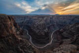
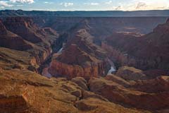
About 15 miles from Cameron, Arizona the Little Colorado River (LCR) begins a serpentine dance on its way into the Grand Canyon. In a distance of less than ten miles you can find five horseshoe like bends in the river. The first bend is named "Hellhole Bend" after the many sinkholes in the area. The other bends are nameless but equally magnificent. The rims tower 1,500 to 2,000 feet over the Little Colorado, compared to about 1,000 feet for the better known "Horseshoe Bend" near Page.
You will want to photograph the bends when the Little Colorado is flowing. This occurs five to ten times a year, typically in April and in the summer. If the LCR is flowing in Cameron it should be flowing at the bends. You can check the flow level at Cameron remotely at https://waterdata.usgs.gov/az/nwis/uv/?site_no=09402000&PARAmeter_cd=00065,00060. You want a flow of at least 200 cfs. You also need a Navajo Parks and Recreation permit to visit the area. You can get one in the Cameron Parks and Recreation office located at the intersection of Highways 64 and 89 (diagonally opposite the Burger King). The office is open seven days a week in the summer months, and weekdays the rest of the year, from 8AM to 5PM Navajo (DST) time. You should call first; they are occasionally closed.
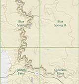
A map with directions to the bends can be found by clicking on the image to the right. A high clearance 2WD vehicle is needed to get to the bends. The map also contains information about the Hopi Salt and Horse trails down to the river. These trails are moderately difficult and typically involve camping at the river overnight. All trails into the Little Colorado River Gorge are currently closed by the Navajo Nation due to excessive heat. They will reopen after summer.
A gallery with many more images is also available.
Apparently Christophe and his son were issued a rare same day permit during the walk-in lottery held Monday. This may have resulted in his death. Someone returned two Monday permits to the BLM that they could not use. The permits were added to the walk-in lottery held Monday for use that day. The lottery is held at 9AM and is followed by orientation/safety instructions, with the entire process taking up to an hour. Including the 90 minute drive from Kanab to the Wirepass TH it is possible Pochic and his son did not reach the trailhead until 11:30, close to the hottest part of the day. If so, the BLM needs to change its process so that same day permits are not issued, especially in the summer months. The BLM has had no comment pending further investigation. More information can be found at fox13news in Utah.
In an apparently heat related incident Christophe Pochic, 49, of Belgium died on Monday while visiting The Wave. His body was discovered near The Wave at 9:15 PM on Monday by two BLM rangers. Pochic was in good health. Temperatures reached 101° F in Page on Monday. There is little shade to be found on the hike to The Wave, and the light colored Navajo Sandstone in Coyote Buttes North amplifies the heat. Pochic still had water in his pack. While adequate water is necessary to prevent heat stroke or exhaustion, it is not sufficient to keep your body cool. In the summer months the BLM normally has volunteers present along the way to The Wave who can help if you need water or become lost. If you must visit The Wave in the summer months I suggest you begin your hike at least 30 minutes before sunrise and plan to be out of the area by noon. More information is available on the St George News website.
I've updated the Coyote Buttes North, Coyote Buttes South, and White Pocket galleries with Favorites sub-folders. My image galleries were created to give trip planners an idea of what they might see at different locations and have not always been shot in best light. The Favorites sub-galleries contain a much smaller set of images and show only the best locations in good light.
The Palouse, a region in the northwestern US, is the premier wheat growing area of the United States. In late May of this year I took a creative photography workshop there with Denise Ippolito which I highly recommend. Denise is very imaginative and took us to several locations that were new to me including the wind turbines area, several lone trees, and a leaning schoolhouse. Spectacular clouds were present for most of the workshop resulting in many good images.
I've added a Palouse map to the website showing many good shooting locations, and have updated my Palouse gallery with images from this past workshop. Since the gallery contains over 150 images I've created a favorites subset showing 19 of my best images, shot in good light and with dramatic clouds. If you just want to see what the Palouse can offer start with these, if you are actually planning a trip to the area I would review the entire gallery to help select shooting locations.
Per CNN Cerro Gordo is up for sale. The price is $925,000 for which you get your own ghost town with 22 buildings on 300 plus acres. The listing can be found at http://www.ghosttownforsale.com. Images of Cerro Gordo can be found here.
City of Rocks National Reserve in south central Idaho is a premier rock climbing destination. It is less than three hours from Salt Lake City. City of Rocks is a great location for photographers and reminds me of a less crowded Alabama Hills. It has many arches, spires, and historical sites. In spring wildflowers abound, and during the third and fourth weeks of October the many aspen change color. This makes October the best time to visit. A gallery of images of City of Rocks can be found here, and maps can be found here.
Recently I stopped by both Radio Tower Rock and Waterholes Canyon while traveling through Page. The New Wave area has become very popular for overnight car/tent camping. I saw nearly ten vehicles parked there. There is also a new heavily cairned trail going to Radio Tower Rock, so expect to see more people there in the future. On the night I was at Radio Tower Rock no one else was present. To minimize shadows Radio Tower Rock is best shot near sunset during the spring and summer months. The Radio Tower Rock gallery has been updated with several new images here.
Waterholes Canyon tours are available from 7:30 am to 5:00 PM at the old Waterholes Canyon trailhead. Tours of the Great Wall area also available until 5PM, just stop at the TH and ask about a tour. You must go in with a Navajo guide. You can probably arrange a Great Wall tour after 5PM, ask at the trailhead for costs and availability. The Great Wall photographs best at sunset.
Effective May 1 you can only visit Waterholes Canyon via a guided tour. You can no longer explore the Waterholes area on your own. Canyon tours are operated by "Waterholes Canyon Experience" and start at the Waterholes Bridge parking area at 7:30 AM and new tours run every 30 minutes or so depending on demand. Tours cost $35 per person and last about 75 minutes. On the tour you are driven to the powerlines at 36.82815, -111.49434, you then drop into the Waterholes slot, and hike downstream for about one mile back to the Waterholes Bridge parking lot. Waterholes Canyon Experience can be contacted at +1 928 660-2031.
Note that the tour only covers the slot canyon between the bridge and the powerlines. Unfortunately you can no longer visit The Great Wall, Waterholes Arch, or Waterholes Bend on your own. A far as I know there are no tours offered to any of these areas.
My thanks to reader George Lin for letting me know about the change to Waterfalls access. I hope to take the new tour in the near future and will update this article shortly thereafter.
Over the past month two people fell to their death at Horseshoe Bend. On May 7 Azcentral reported that a Phoenix man fell to his death, and in a separate incident Azcentral reported on April 23 that the body of a missing Buckeye inhabitant was found at the bottom of the Bend. I have heard that the first fall was due to a piece of rock on the the rim breaking off. I have not been able to confirm this. The National Park Service is constructing a viewing platform at the rim to help prevent such accidents from happening in the future.
In March I visited Iceland for the second time and drove the "Ring Road". March is a good time to visit Iceland. On the plus side temperatures are relatively mild running from 35° F to 50° F, the aurora was out on several occasions, and there were far fewer tourists than in the summer. Tourism is exploding in Iceland, in 2010 Iceland had about 500,000 visitors, by 2017 it had grown to 2.2 Million. Seventy percent of all Icelanders now believe there are too many tourists, versus only 30 percent in 2014. Going in the winter is one way to avoid the crowds. Negatives include limited hiking both on and off-trail, uncertain footing on ice and snow, most roads to the spectacular interior are closed, and frozen waterfalls. While most waterfalls we saw were flowing, we were very disappointed in that Kirkjuellsfoss, the waterfall popularized by Game of Thrones, was frozen and made for a poor photo. Jokulsarlon glacial lagoon had very little ice in it. I'm not sure if this was due to the time of year or was just a random occurrence. We expected poor driving conditions in March but were pleasantly surprised how easy it was to get around the island.
I have updated my Iceland gallery with images from the March trip here. I've also extensively revised my Iceland map. It contains many more locations than the previous map, and has sample images and shooting recommendations. The only area not covered by the map is the West Fjords Region, which will have to wait for a future trip. If you're planning a trip to Iceland you should review this map. Many of the less known locations shown are better photographic subjects than those you'll find in guide books and commercial tours, and you might well have them to yourself.
On March 26 a sandstone boulder near The Wave was inadvertently dislodged and rolled over the arm of a 21 year old female causing a deep laceration. Another member of her party had cell service and called 911 for help. Kane County Search and Rescue and Classic Air Medical responded and a technical rescue was performed using a rope lowering system. Based on the photos I have seen I believe the injury occurred on the west side of Top Rock in an area little visited. Fortunately the woman was not hiking alone as it is unlikely she would have seen anyone else in that area. Additional information and photos are available on KSL News Radio's website here.
On February 23 a 64 year old female fell right at the entrance to The Wave. Bruce Speer, a guide with Grand Circle Tours and a member of Kane County Search and Rescue, was able to call for help and the woman was transported by helicopter to Page Hospital. An image of the accident scene and more information can be found at http://www.sunews.net/article.cfm?articleID=2343 .
From the image you can see that there was a good amount of patchy snow present on the north facing Wave entrance, and that it couldn't be easily avoided. Winter is a difficult season in which to visit The Wave, snow adversely impacts photos, and slips on snow or sand covered slickrock can easily happen. House Rock Road can also be impassable. The plus side is that December through February are the easiest months in which to get a permit.
West Clark Bench is the area on top of the cliffs east of Edmaier's Secret. It is heavily cross-bedded and reminds me of a mix of Top Rock and The White Pocket. It is best after a rain when its many water pockets are full. I have been to West Clark Bench three times now and have not seen anyone else. The best features I have found in my limited explorations are a small but dramatic arch and an S Curve nearby. Both are best photographed at sunset. Thanks go once again to Philippe Schuler for providing me with the GPS coordinates of the arch.
I have added a gallery of images here, and a map with directions here.
The Associated Press has reported that there were 160,000 people applying for the 7,300 available Wave permits last year, making the odds of getting one in the lottery 4.6 percent. If you applied via the on-line lottery every month at the end of the year you would have had a 43% chance of getting a permit. Permit demand increased by 20% in 2017, and increased at an annual rate of 16.5% since 2013 when there were 87,000 people applying.
What can you do to increase your odds?
Above all - persistence matters, and best of luck!
I have added topographic and National Park Service Maps for Badlands National Park in South Dakota, and for Joshua Tree National Park in California. I've also added Denali 24K maps to the Denali maps page. This complete the mapping for Denali.
The Wave walk-in lottery process is well documented in two videos made by Jennifer Kumar. Jennifer recently posted two videos of the walk-in lottery on Youtube. The first video covers the lottery held on December 28, 2017. This lottery was for permits for December 29th and had over eighty applications. The second covers the lottery held on December 29th for permits from December 30th through January 2nd (four days). There was an all-time record of 398 applications on that day. Since most applications include several people usually only three or four groups win a permit each day. Assuming 2.5 people per group there were nearly one thousand people trying for the forty available spots on the 29th, making the odds of winning a permit around 2.5%.
If you feel very lucky and would like more information on how to apply for a walk-in permit please click here.
My Depth of Field app, DOF Easy, has been released for both iOS and Android devices. DOF Easy is unique among Depth of Field Calculators. With most DOF Calculators you enter the focus distance and the aperture and the calculator tells you whether your scene will render in focus. DOF Easy inverts the problem. DOF Easy starts with information about the scene (a range of distances) and the app tells you where to focus and what aperture to use. It also shows blur amounts as a function of distance. Users can easily see how the amount of blur, in pixels, changes with distance from the focal plane.
A web based version of DOF Easy is available at www.thewave.info/DOFEasy/index.html should you wish to try the app before installing it on your phone or tablet. The app is available on the Google Play store at https://play.google.com/store/apps/details?id=info.thewave.DOFCalc. To install it for iOS on your phone search for DOF Easy Belvin in the Apple App store. The app is free for both platforms. Please give it a try.
Cerro Gordo is a small ghost town in the Inyo Mountains of eastern California. It is about 45 minutes from the town of Lone Pine. There are several largely intact buildings remaining, of which the American Hotel is the most photogenic, especially the inside. Although the hotel is currently being renovated you may be able to gain access to the interior.
Cerro Gordo ghost town is at 8,500 feet in elevation and is accessed via Cerro Gordo Road. This is a steep packed dirt road. A 2WD vehicle is normally sufficient, except following rain or snow. While the road is not difficult to drive, it is steep, narrow, and there are drop-offs. Some will be uncomfortable driving it. The town is privately owned and only gets a few visitors per day. It is open every day from 9AM to 4PM in the winter months, and from 9AM to 5PM when daylight savings time is in effect. Admission is $10 per person and a liability waiver form must be signed. The website cerrogordomines.com contains more information about access. A visit to Cerro Gordo can be easily combined with one to the Alabama Hills. Shoot Cerro Gordo mid-day, and the Alabama Hills at sunrise and/or sunset.
The interior of the American Hotel is spectacular and by itself is worth the trip. Be sure to photograph the bar and the painting by Sylvia Winslow. The poker room is also a good subject, as are the interiors of the Assay Office and the museum. The bunkhouse has been renovated and can be skipped. The remains of the Ice House frame dry Owens Lake in the far distance.
I've added a gallery of images from Cerro Gordo here, and a map with travel directions here.
There are many rock formations on Planet Earth with "Wave" in their name. These include Wave Rock in Australia, The Fire Wave in Valley of Fire, The White Wave in the Canaan Mountain Wilderness, the Southern Wave in Coyote Buttes South, and the New Wave just outside Page. All of these pale in comparison to The Wave. Of the above The New Wave is perhaps the easiest to get to, just a mile outside Page, and only a .5 mile RT hike. While it is not nearly as photogenic as The Wave it is worth a brief visit if you are in the Page area. Just a little south of The New Wave is another Wave like formation. I've named it Radio Tower Rock since there is a radio tower nearby. It is spectacular at sunset, much prettier than The New Wave. Both The New Wave and Radio Tower Rock share the same trailhead. I suggest you briefly visit the New Wave mid-afternoon and then explore the Radio Tower Rock area until sunset.
A gallery of images of the area can be found here, and a map with directions here.
At the request of the Hopi Nation this website and many others have been asked to remove travel directions to Blue Canyon. I have done so. If you wish to visit Blue Canyon you must go with an authorized Hopi guide. More information about guiding services and photography in Blue Canyon can be found here.
Some months ago reader Erik Thorvaldsen sent me an excellent image taken at The North Teepees, which are just outside the Coyote Buttes North permit area. More of Erik's images can be found here. The North Teepees are a rock formation with many similar features to those of The Wave, namely conical shaped rock hills, fine sandstone edges, a short slot canyon, and a vortex. The North Teepees are worth visiting if you cannot get a permit to visit The Wave. A map and directions can be found here.
Throughout the Coyote Buttes area you will find many locations that look like vortexes or wormholes. In addition to the vortex at The North Teepees there is also one at The Wave slot canyon and one at the brightly colored rock you see to your left just north of the entrance to The Wave. I call this rock "Ginger Rock" for its tan and orange colors. I have also heard Ginger Rock referred to as the Mini Wave. The Ginger Rock vortex is best photographed around noon to avoid harsh shadows. A gallery of images of Ginger Rock can be found here.
Finally, reader David Coppedge pointed out a nice vortex east of The Boneyard. It's at 36° 59' 40.09" N, 112° 0' 43.50" W. Dave has a very good image of it on Flickr at https://www.flickr.com/photos/psa104/3642218357.
If you wish to avoid the crowds at Antelope Canyon and Horseshoe Bend I suggest you visit Waterholes Canyon. It typically gets less than 30 visitors a day and they are spread over a large area. Waterholes does not require a guide but does require a permit. Permits cost $12 per person and are available at Navajo Parks and Recreation just outside Page. Directions to Navajo Parks and Recreation can be found here. Waterholes has several unique attractions, the slot canyon itself, Waterholes Bend, a photogenic arch, and The Great Wall. All can be visited in a single long day, start with Waterholes Bend, then visit Waterholes slot canyon, after exiting the slot visit Waterholes Arch and finish the day with The Great Wall. The Great Wall is spectacular at sunset.
The Waterholes slot canyon is closed beyond the "Power Lines". The closed area covers several slots including Horseshoe Bend Slot Canyon, formerly known as Secret Canyon. Several Horseshoe Bend Slot Canyon tours are offered daily by Horseshoe Bend Slot Canyon Tours. Unfortunately they do not offer photo tours and tripods are not allowed on their scheduled tours.
I have updated both the Waterholes Canyon gallery and the Maps/directions page to include both the Waterholes and Secret Canyon slots.
Horseshoe Bend is Page's biggest tourist attraction, receiving more than 4,000 visitors a day, up from only 100 five years ago. Despite the recent expansion of the Horseshoe Bend parking area cars often overflow onto US 89, and both dehydration and safety at the rim are real concerns. On November 6th the National Park Service, together with the City of Page, began a project to install a viewing platform with railings on a section of the rim, and to compact the trail so it is handicapped friendly. NPS and Page will each pay 50% of the cost of the improvements. Horseshoe Bend itself is part of the Glen Canyon National Recreation Area; however the City of Page owns the land the parking area is on, hence the cost sharing arrangement. Future enhancements include further expansion of the parking area, restrooms, and most likely a fee booth. As of now the proposed fee is $10 per vehicle for a two day pass.
If Horseshoe Bend is on your to do list, I suggest you do it now, as the experience and photo ops will be totally different once the viewing platform is in place. Alternatively consider one of the other Colorado River overlooks such as Waterholes Bend, Tatahatso Point, Redwall Cavern Bend Overlook, or the other side of Horseshoe Bend. Mark Metternich offers an epic tour called "4 Bends in 4 Days" which, based on the photos I have seen from past trips, is highly recommended.
I have updated the Hanksville gallery with several new locations. These include Leprechaun Canyon, North Caineville Mesa, Skyline View, Long Dong Silver, the Mars Desert Research Station Area, and Little Wild Horse Canyon. Late October is a great time to visit this area with the Cottonwoods changing, fewer tourists, and temperatures in the 60s.
Many thanks to Philippe Schuler for suggesting and providing me the locations of Skyline View, Long Dong Silver, the MARS Desert Research Station, and the Hanksville-Burpee Dinosaur Quarry. Philippe is one of the most knowledgeable explorers of the southwest and his website http://www.phschuler.com/usa2006/index.html is well worth a visit.
I have updated The Wave gallery with a great many images taken this summer. There was quite a bit of water present at The Wave and the water pools above it. When water is present you want to shoot The Wave when the south wall is well lit, but the west wall is still in shadow. This occurs about 75 minutes after sunrise in mid-summer, about 60 minutes after sunrise in early fall, and nearly two hours after sunrise during the winter months. In the winter the sun rises behind Top Rock and it takes quite a bit of time for the sun to clear Top Rock and light The Wave. If you have a Wave permit in the week or two following a moderate to heavy rain I suggest you arrive at The Wave an hour after sunrise or earlier in the summer, and 1.5 to 2 hours after sunrise during late fall and winter.
During this trip I also visited The Alcove on Top Rock and found that noon is an excellent time to photograph it. I also photographed Hamburger Rock for the first time. Hamburger Rock, aka The Big Mac, is on the east side of Top Rock just south of Pine Valley. It is best shot early in the morning. Hamburger Rock looks remarkably like a hamburger, with a yellow rock bun, and red rock burger. It is best accessed by climbing Top Rock from its east side, in which case Hamburger Rock is only a short detour. If you climb Top Rock from the west side, which is more usual, you will add nearly a mile to your day if you visit the Big Mac. I've included a GPS track to Hamburger Rock on the Maps page. There is a similar rock called Half a Burger just above The Wave, about midway between The Wave and The Second Wave.
I have added a gallery of images from the Tucson, Arizona area. Tucson has much to offer besides Saguaro National Park. Other great locations in the Tucson area include Mission San Xavier del Bac and Tumacacori Mission, Tucson Botanical Gardens, Barrio Viejo, and the Arizona-Senora Desert Museum. Many thanks to Mark Elder of the Sedona Camera Club for leading the trip to Tucson.
I've also updated my Tucson map to include gps tracks for fifty hikes in Saguaro National Park.
I've updated my maps for the Hanksville area to include many new locations. These include:
- Routes up North and South Caineville Mesa
- Skyline View Overlook
- Long Dong Silver
- Mars Desert Research Station
- Lith Canyon
- Leprechaun and Blarney Canyons
- Hog Springs
The Hanksville area is best visited in the spring when wildflowers are present (mid-April) and the fall (late October) when the cottonwoods are changing color. It can get very hot in the summer so if you must hike do so early in the day.
In preparation for a trip to Iceland next March to photograph the aurora I've created a preliminary map of this country. The map shows the location of many "must shoot" icons in Iceland along the ring road. Most of these should be accessible in the winter. Downloadable 100,000 to 1 topo maps have also been provided, as has a sunrise sunset calculator. The map will be enhanced over the next year with public domain photographs and website links to further help with trip planning.
Tom Van Bebber, David Kennedy, and David Alexander of the Natural Arch and Bridge Society recently visited Dick's Arch and measured the span to be 54 feet, with a height of 18.2 feet. For comparison, Cobra Arch, which has a somewhat similar shape, has a span of 35 feet. Tom Van Bebber maintains the World Arch Database, a subscription based catalog of natural arches throughout the world. If you are interested in arches you should subscribe. Highly recommended. Tom also indicated they found several other new arches in the area. I do not have details yet.
I recently visited Vermilion Arch, a beautiful alcove arch sitting just below the rim of Vermilion Cliffs. If you have a spare morning while in the area I suggest you visit it together with Double Barrel Arch. The off-trail hike to Vermilion Arch is about a mile one way, but the terrain is difficult and route finding will take some time. Like Dick's Arch, I can pretty much guarantee you'll have Vermilion Arch to yourself. Images of Vermilion can be found here, and location / travel directions here.
We are happy to announce that HTTPS is now enabled on thewave.info. This protects the privacy of our readers and ensures the trustworthiness of our content. HTTPS encrypts traffic between your computer and thewave.info, and also validates that you are communicating with us. The transition should be seamless however if you encounter difficulties please contact me directly at wbelvin1@gmail.com.
I have added a poll about The Wave permit system to the above right. It can also be accessed here. Poll responses can be viewed by clicking here .
I probably missed come options. If you believe an additional option for improving the permit system is missing, please email me and I will review it and possibly add it to the poll's choices.
The old poll on visitor safety has had over 5000 responses and is still open. The poll will close shortly. If you wish to vote the poll can be found at http://poll.pollcode.com/l23ni_result? . One third of this poll's respondents believe that the best way to improve safety is to let more visitors in (safety in numbers). Nearly 25% believe increasing the number of trail markers is the way to go.
I have added several images taken during a recent trip to Coyote Buttes South. New images include an area I've called The Southern Wave, as it bears a strong resemblance to the entrance to The Wave. The detail in the sandstone is also quite similar to that of The Wave. Of course The Wave has many features that the Southern Wave lacks, for example the "Wave Slot Canyon". The Southern Wave has one major advantage though; if you plan ahead you can normally get permits. To get a permit for Coyote Buttes South apply three months in advance within minutes of the date and time the permit calendar opens. For example for a September permit you would apply via the calendar just after 12:00 PM on June 1st. Alternatively you can normally get a permit via the walk-in lottery held at 10 AM Mountain Time in Kanab the day before you wish to hike in.
I have also added some photos of the dinosaur track found near The Southern Wave. I believe it is within ten feet of 36.964075°, -111.990083°. One of the images shows the track in its setting which should make it easy to find.
For some of the locations covered on this website (Coyote Buttes North, South, and The White Pocket) I've expanded the Maps section to include a Photo Map. Photo Maps show the location of each geocoded photo on a Google map. The Photo Map also includes latitude/ longitude, date and time the photo was taken, and in some cases the focal length of the lens used. Photo maps are useful in that they show the areas on the map I have found most productive, areas that might be worth further exploration, they help to identify photos with incorrect geocoding, and are an easy way to get latitude/longitude and time of day information.
When using the Photo Maps keep in mind that GPS accuracy is typically between ten and twenty feet, and could be much worse. Areas where GPS accuracy is sometimes poor include forested areas, alcoves, near cliffs, and in slot canyons. The GPS accuracy of your own phone or GPS device is probably about the same thereby compounding the error. Most of the photos (greater than 90%) on my site taken in the last five years include geocoding. Older photos may not and will not appear on the Photo Map. Finally Photo Maps are relatively large and will take ten seconds to load even on fast connections.
A Photo Map for Coyote Buttes North can be found here, for Coyote Buttes South can be found here, and for the White Pocket here.
In mid-March I spent a week on a photo tour in Northern Alaska photographing the aurora. The photo tour was expertly led by Patrick Endres. Unfortunately the tour was the last offered by Patrick, however he has authored an e-book "How to Photograph the Northern Lights" which I strongly recommend. Shooting the Northern Lights is a challenge. March is one of the clearest months in Northern Alaska and the aurora is at peak. Above the Arctic Circle it can be seen almost every night when clear skies are present. Unfortunately night-time temperatures of -10°F to -30°F are common. The lowest temperature reached on our trip was -29°F. We were shooting on snow or ice between 10 PM and 4 AM the entire trip, and with gloves or mittens on. At these temperatures frostbite is a major issue, and cars and cameras break down. Camera battery life is short, and if you breathe on your LCD or viewfinder it frosts up. You are shooting at night so you need fast wide lenses (no slower than f/2.8), high ISO (typically 1600 to 6400), and long exposures. Exposure times ran from 2 seconds for quickly changing or bright auroras, to 30 seconds for dimmer ones. Fortunately we were blessed with clear skies and a moderately active aurora every night of our trip.
I've added a gallery of images from the trip here. Two timelapses are included in the gallery, the first was ended prematurely when a rare truck approached us on the Dalton Highway, and the second shows how light from the aurora changes foreground brightness.
Charleston, South Carolina is known for its lavish history, its unspoiled architecture, its good food, and its friendly people. It is a very popular tourist destination, especially during early spring when the azaleas are in bloom. In 2016 Charleston was ranked the "World's Best City" by Travel and Leisure magazine, and has been voted "America's Most Friendly City" on several occasions. If you're looking to expand your photography beyond the exotic and alien beauty of the southwest, Charleston is certainly worth a visit. I've added a gallery of images here, and a map showing suggested shooting locations here.
I've added maps of Denali National Park, the area along the Dalton Highway, and Banff and Jasper National Parks to the site. I've also updated the instructions on how to get your own free USGS and Canadian maps and convert them to mobile friendly formats:
- How to convert USGS 100,000 to 1 Historical Alaska Maps from GeoPDF to GeoTIFF, RMAP, and KMZ formats.
- How to convert current USGS 24,000 to 1 GeoPDFs to GeoTIFF, RMAP, and KMZ formats and how to remove the image layer.
- Where to find free 50,000 to 1 Canada topographic maps and how to convert them to RMAP, and KMZ formats.
I recently spent nearly three weeks on a photo tour of New Zealand South Island. The tour was guided by New Zealand natives Chris McLennan and Dean Fitzpatrick whom I highly recommend. New Zealand is a land of contrasts from temperate rain forests to deserted beaches to the frigid highlands. Despite largely cloudy and rainy days many good images were obtained. A gallery of images can be found here.
Sedona is one of the premier hiking and mountain biking destinations in the southwest. For those planning a visit I have added KML and GPX files for over 100 Sedona hikes to the Sedona maps page. The files can be downloaded to your GPS or phone and used to help navigate while hiking.
Aztec, New Mexico is the home of Aztec Ruins National Monument, a 450 room ancient pueblo site. Aztec Ruins is a UNESCO World Heritage Site, of which there are only 21 in the United States. The Aztec area is also home to over 300 arches, perhaps the largest concentration of arches in the US outside of Arches National Park. If you are visiting the four corners area Aztec merits a stop, perhaps in combination with the Bisti Badlands, the Durango area, or Mesa Verde. A gallery of images from the Aztec area can be found here, and maps, directions, and photo tips can be found here.
I've added a gallery of images of raptors including Barn, Eagle, Western Screech, and Saw-whet Owls, a Peregrine Falcon, and a Harris's Hawk in flight. Images were shot at Arizona's Raptor Experience in Chino Valley. Most images were shot with a 70-200 mm f/2.8 lens. Subject distance was about 30 feet, f/8, ISO 800. Shutter speeds ranged between 1/1250 and 1/2000 of a second, needed to freeze the motion of the high speed hawk. Leg bands and tracking transmitters were removed from some of the images using Photoshop.
Strange but true, a new arch with a span probably exceeding 40 feet was reported just 2/3 of a mile from The Wave. Dick Kent, of Centennial, Colorado recently sent me an image of the arch together with the 1996 trip log from his visit to the arch. The arch appears to be unreported, at least to me and many of my friends. The arch is quite elegant and reminds me of Cobra Arch, but is larger. I assigned the arch an identification number (NABSQNO) of 12S-409531-4095398 based on its UTM coordinates. The top of the arch can be seen in Google Earth. Despite being less than a mile from The Wave I believe the arch was unknown because access requires hiking up the apparently uninteresting wash you cross on the way to The Wave, and gaining 600 feet of elevation, all off-trail and mostly in sand. The arch can only be seen when you’ve hiked to within 200 feet of it.
While the official designation of the newly reported arch is 12S-409531-4095398, I refer to it as Dicks Arch for its discoverer. The area around the arch is quite photogenic and contains a great deal of "lace" rock. Unfortunately Dicks Arch only gets good light mid-day. I am not sure if the arch is in the Coyote Buttes North Permit area. The arch can be accessed from the top of the "sage field" that is crossed on the way to the Wave. Once on top of the sage field proceed due south for about 1.5 miles to the arch at 37.00038, -112.01676. A kml file of my track can be downloaded here and a GPX file here. The hike to Dicks Arch is about 2.5 miles one way, and is largely off-trail over rough terrain. Elevation gain is 700 feet from the WP trailhead. The hike is significantly more difficult than the hike to The Wave, and should only be undertaken by experienced off-trail hikers. Strong hikers may wish to explore the area around the arch more thoroughly, and may be able to gain the ridge that overlooks The Wave from the west. The view to the east from this ridge should be spectacular. Because the area is so remote there is a good chance you will see wildlife, I briefly saw a herd of mule deer near the arch. While I often see deer on House Rock Road, I have never seen deer near The Wave before.
More images of the new arch can be found here.
Death Valley is the largest National Park in the lower 48 states. It is my favorite winter US destination with pleasant temperatures and easy hiking. Many of the best photo opportunities in Death Valley require only short hikes. These include the Mesquite Dunes, The Racetrack, Zabriskie Point, and Badwater. Death Valley's Furnace Creek area is only about two hours from Las Vegas, and Stovepipe Wells is only four hours from Los Angeles. There are three lodges within the park and many campgrounds. This makes it easy to stay within Death Valley most of the year. Exceptions include holiday weekends, and during rare "superblooms" of wildflowers. In short, Death Valley is an easy park to visit with short hikes, pleasant temperatures, and many great photos to be had. And Rhyolite ghost town and the Alabama Hills are less than 90 scenic minutes away. If you haven't visited Death Valley give it a try this fall or winter, you'll be glad you did.
I've included a gallery of Death Valley photos here, and maps of Death Valley and shooting tips here.
I rarely get my best photos the first time I visit an area, and often even the second isn't productive. Recently I visited High Heel Arch for the third time. This arch is best late afternoon and near the summer solstice, so I planned my trip accordingly. I went on August 5th, a day with good clouds. High Heel Arch suffered a partial collapse in 2014 which greatly improved its looks. Its best side faces north-northeast and the arch should be visited as close to the summer solstice as possible. The arch looks very fragile and I expect it will not last much longer. A gallery of images can be found here. High Heel Arch is about 1/4 mile outside the Coyote Buttes North permit area, and can be visited at any time. Directions to the arch can be found on my Coyote Buttes North maps page.
In the same vein, I visited Margaret Arch for a third time a few weeks ago. I stayed to sunset and hiked out in the dark. Margaret gets light until about ten minutes before sunset, and, like White Mesa Arch at sunrise, gets a beautiful rosy color then. Images of Margaret can be found here.
Last but not least, I've made a few miscellaneous enhancements to the site. First, a small map appears on each gallery page showing where the photos were shot. Since GPS accuracy is typically 10-30 feet do not expect perfection, but the map should give you a good idea where each photo was taken. Second, I've added the time an image was shot to the photo data. For most photos time is given in Universal Time (UT), formerly known as Greenwich Mean Time (GMT). UT is seven hours ahead of Arizona time all year round, so if the photo data shows a time of 00:40:56 it means 40 minutes, 56 seconds after midnight in Greenwich, England, or about 5:41 PM in Arizona. Since I only started setting my camera's clock to UT in 2012, only rely on the reported time for photos taken since then.
While my photography and health have never been influenced by smoke present in the Page Area, smoke has impacted both in other areas covered by this site. Smoke from wildfires burning near Flagstaff often impacts my home town of Sedona. Current wildfire information is available from the US national Incident Information System (InciWeb.gov) website. I have added links to this system to the Information menu item above. InciWeb provides quick information about both prescribed (i.e. set by management) fires and wildfires including their location, size, % contained, area closures, and prognosis.
I have also added links to air quality / smoke forecast maps. These links were also added to the Information menu above. By default these air quality forecasts display ozone levels, you will need to select "1Hr Average Surface Smoke" to display smoke forecasts. Visibility in areas shown in red on the map is less than five miles and smoke levels in the red areas are unhealthy. Smoke level forecasts for particular cities are available via the Point Data tab in the link above. The following table correlates smoke levels with visibility and health impact.
| Air Quality | Visibility in Miles |
Particles µg/m3 |
| Good | 11 and up | 0 - 38 |
| Moderate | 6 to 10 | 39 - 88 |
| Unhealthy for Sensitive Groups |
3 to 5 | 89 - 138 |
| Unhealthy | 1 ½ to 2 ¾ | 139 - 350 |
| Very Unhealthy | 1 to 1 ¼ | 351 - 526 |
| Hazardous | < 1 mile | over 526 |
Smoke levels are generally highest in canyons / valleys, and at dawn. There were several days this past June when I could not see Courthouse Butte at dawn from my Sedona home less than a mile away. By mid-day most of the smoke had cleared. Based on the table above Sedona air quality was hazardous at dawn. If you must be outdoors on days like this I suggest you wear a P95 or P100 mask. This is especially true if you suffer from asthma or other respiratory or cardiovascular conditions.
At long last I made it to little known Margaret Arch. Margaret Arch was reportedly discovered by Barry Goldwater and was renamed in 1988 in honor of his late wife. Margaret Arch is unremarkable from a distance, but spectacular when seen close-up from its northwest side. My photos do not do it justice as the arch's best side was in shadow. A 4x4 and permission of a local Navajo leaseholder or local guide is required to visit the arch. A two mile round trip off-trail hike is also necessary. Margaret Arch is best shot at sunset and is a good night photography location. A bit of Margaret's history, shooting recommendations, and a map and directions can be found here. Margaret is a fun trip to unexplored territory and you will almost certainly have the area to yourself.
In Margaret Arch's vicinity is Navajo Stand Rock. Navajo Stand Rock is excellent at both sunrise and sunset, and requires no hiking. A 4x4 is required, as is local leaseholder permission.
Finally, I've added a few images of the June full moon (the "Strawberry Moon") setting inside of White Mesa Arch. The full moon appears inside the northeast side of White Mesa Arch only in June and early July. As always, to capture the full moon setting (sun rising) you should plan to shoot the day after the moon is totally full, so that the sun has already risen and the moon is still above the horizon. My shooting location is shown on the maps page.
I've added many new locations, shooting recommendations, and photos to the Arches section of this website. New locations within Arches National Park include Eye of the Whale Arch, Tower Arch and the Marching Men, and the seldom visited Covert and La Boca arches. Locations added outside the park include Delta Pool, Faux Falls, Secret Spire, Corona Arch, and Fisher Towers. Delta Pool sits high on a mesa and access is not obvious. Well, no longer. On the Arches Map page you can find GPS coordinates of and a route to a crack near the mesa top which makes access easy. I've also added new images of Mesa Arch and False Kiva, and provided the route to False Kiva.
Southern Utah News has reported that the Arizona/BLM Resource Advisory Council (RAC) has tabled further consideration of the 2015 Draft Management Plan for The Wave. This plan would have replaced the walk-in lottery currently held in Kanab with an on-line lottery. The total number of permits granted would have remained the same. Reportedly the plan was put aside as the BLM did not provide sufficient information for the RAC to vote on it. Local opposition to the proposed plan may have been a factor as well, as the walk-in lottery contributes as much as $6.9 million to the Kanab economy. There are many arguments both in favor of the current system and in favor of an on-line system and I expect that some version of this plan will reemerge in the future. More information about the shelved plan can be found in the Southern Utah News article here.
In mid-April I revisited Cape Solitude and was greeted with much better conditions than those of my first trip. Arizona is in the middle of a dry spell so the Little Colorado River was running turquoise, and the light in April is much better than in November. The trip to Cape Solitude requires either a three hour drive over a very bumpy rocky road, or a 2-3 day backpack. If you choose the drive as I did you'll need high clearance 4WD and should either go with another vehicle or at least a satellite phone or Spot as this area is rarely visited. I suggest you also check the color of the Little Colorado River before embarking on the trip, it should be turquoise. The best way to do this is to call one of the rafting companies in Lees Ferry, or one of the Grand Canyon flightseeing companies. The new images of Cape Solitude can be found here.
The view of Reflection Canyon from the rim is one of the most spectacular in the southwest, and shooting it has been on my bucket list for some time. Last fall Gary Ladd told me of a possible route to the rim from the main channel of Lake Powell. The route would require a two mile round trip hike, instead of the usual sixteen mile off-trail waterless hike from Hole in the Rock Road. Reflection canyon is best seen at low water so I booked a boat trip for mid-April when Lake Powell water levels are normally at their lowest. To keep costs minimal seven people were in our group, and we camped on shore. A pontoon boat with a speed of 30 knots was used for transportation. On April 14 we hiked from the lake to the Reflection Canyon rim without much difficulty. While conditions were far from ideal (soft light, windy) and our time was limited we got many good images as seen here. Our Lake Powell map has been updated to show the route to the rim from the lake, and to show the overland track.
During this trip we were on the lake for a total of five days and got many other good images. Our Lake Powell gallery has been updated to include these. To view the new images click on one of the new images buttons found on the right side of each gallery thumbnail page.
Grand Teton National Park is one of the most visited US National Parks drawing nearly three million visitors a year. Despite the crowds it is one of my favorite US destinations, especially in late September when the aspen are changing color and the crowds have started to recede. The imposing Teton mountain range stands lies nearly 7,000 feet above the valley below, and is best shot at sunrise. I've added a gallery of images of the park here, and a map showing various shooting locations here.
I've added many new maps to the site including Sedona and the Grand Canyon, Grand Teton, Petrified Forest, Saguaro, Yellowstone, Yosemite, and Zion National Parks. Topo maps are now available for all Arizona and Utah National Parks. All topo maps on the site are now decollared, and I've created merged USGS 24K topo maps for all areas. The maps distributed by the US National Park Service at entrance stations are now available in geocoded format so you can follow the NPS map on your Android or iPhone as you drive through the park. Instructions have been added on how to decollar maps and how to merge them, and on how to create geocoded national park maps. Finally I've added some notes on creating maps for Garmin devices and discussed the limitations of Garmin custom maps.
The Recapture Pocket is a small area of badlands and hoodoos near Bluff, Utah, reminiscent of Goblin Valley. The badlands are rarely visited except for locals, and there are currently no images on Google Earth of the area. I've added a small gallery of images here, and a map with travel directions and some shooting locations here.
In mid-November I finally visited Cape Solitude. Appropriately named Cape Solitude lies on the east rim of the Grand Canyon. It overlooks the confluence of the Little Colorado and Colorado rivers 3,000 feet below. It is rarely visited since the normal route involves a two-three day backpack over waterless terrain. Well, there is a largely unknown alternate route via a long drive followed by a moderate hike. This route is described on my Confluence Maps page, and some images taken on a cloudless day can be found in this gallery. Cape Solitude should be visited by every desert rat. The great Edward Abbey wrote of the cape: "There comes a day when a man must hide. Must slip away from the human world and its clutching, insane, insatiable demands." and "Tonight and tomorrow and for the next few days I am going to walk the rim of Cape Solitude, along the palisades of the desert, and save myself." What more can be said.
In early November I took another tour of Lake Powell, this time for ten days. The tour was once again led by Gary Ladd. We visited several new locations and revisited some of the older locations in better light. New locations include the Dominguez Butte area which is best shot at sunset, the hoodoos near Cookie Jar Butte, a very deep alcove off Fiftymile Creek, Rainbow Bridge Creek, and some good viewpoints of Navajo Mountain. The gallery can be found here. Image previews in the gallery have been increased in size to reflect the trends in monitor resolution over time. The revised maps can be found here. Highly recommended.
Going forward I will provide topo maps in Avenza PDF Maps format. PDF Maps is an excellent GPS and map app available for both the iPhone and iPad, and for Android devices. Oruxmaps formatted files and KMZ files will continue to be supplied. I've also found a simpler more reliable way to make decollared USGS topo maps using G-Raster, and a better way to convert GeoTiff files to various mobile formats using MAPC2MAPC. Instructions on how to make and use the maps on this site can be found here, or via the menu Maps Using the Maps above. Almost all smartphones and tablets now contain a GPS, and numerous free maps are available for navigation, so give up your old handheld GPS and move on to a more modern way of navigating.
I've added many new images of Eggshell Arch taken a few days before Thanskgiving, which is close to optimal. Unlike last years trip the sky was clear which led to an even stronger glow under the arch at sunset. Eggshell Arch is in the Navajo Nation and permission of the local leaseholder is needed to visit it. Many of the images included sunstars either above the arch, or within it, so I also added a tutorial on how to shoot sunstars.
I've added many new images of White Mesa Arch taken at sunrise, and a few images of nearby Margaret Arch and Navajo Stand Rock taken mid morning. White Mesa Arch is great at night as well, here it frames the Milky Way Cygnus Rift. White Mesa Arch is in the Navajo Nation and permission of the local leaseholder is needed to visit it.
The comment period for the proposed Paria Canyon/ Coyote Buttes regulations has been extended until October 16 per this article in the St George News.
Quick update - one lane of US 89 A is now open with flaggers directing traffic through the area. For more information see this article in the St George News.
US 89A is closed between Marble Canyon and Jacob Lake due to a landslide yesterday. Access from the south to Wirepass trailhead, Coyote Buttes South, and The White Pocket via House Rock Road is not possible. To visit these areas you need to drive in from the north via US 89 and House Rock Road. Cliffdwellers Lodge on US 89A is also temporarily closed since it is inaccessible.
Crews are now working to remove mud and boulders from Highway 89A. There is no estimated time for when the road will reopen. The closure is expected to remain in place until at least late Monday morning. For more information and updates see here.
The Ah-Shi-sle-pah gallery has been updated. I've added images of the Milky Way taken at Valley of Dreams East, and new images from spectacular Valley of Dreams, a truly otherworldly place. For information on shooting the Milky Way see this page.
The White Pocket gallery has been updated to include new images from a recent trip taken as a storm cleared. There was quite a bit of water present, and the water pools had many tadpoles. Most of the new images include either The Swirl or The Citadel. I've been hearing from several sources in Kanab that permits will be required to visit the White Pocket in the future, so if you wish to see it on your terms I suggest you go now.
I've also revised my White Pocket screensaver with new or updated images. The screensaver is available for Windows based PCs here. I've also added a Coyote Buttes North screensaver. Unlike most screeensavers both have been customized to exactly fit over 90% of the Windows PC monitors in use today. Displayed images fill the screen without the presence of black bars (pillar boxing) or cropping. Both screensavers are free for non commercial use.
If you're in the Four Corners area consider visiting Shiprock and Royal Arch. Royal Arch is 25 miles from Shiprock; both can be shot in one day. Shiprock photographs best near dawn. Royal Arch can be shot from a distance and is best at dawn, or close up which is best from mid afternoon on. A private passenger car is sufficient for Shiprock; high clearance 4WD is definitely needed for Royal Arch. Royal Arch is rarely visited and the road is heavily rutted so I suggest you go wih two vehicles, a GPS, and good maps. I've added a gallery of images of Shiprock here, images of Royal Arch here, and a map with directions to both here.
This site has been redesigned so that it functions properly on tablets and mobile phones. The site has been tested on the latest versions of Google Chrome, Internet Explorer, Firefox, and Windows 10 Microsoft Edge. I have no easy way to check functionality under Safari. If webpages appear to be incorrect I suggest you try one of the following: refresh the webpage, upgrade your browser to the latest version, clear your browser cache, try Google Chrome, or contact me.
I've added some photos of Point Hansbrough and a nice bend in the Colorado River taken from just south of Tatahatso Point. Tatahatso Point is part of the Navajo Nation and is on the East Rim of the Grand Canyon. I've also added some new photos of The Confluence showing the turquoise Little Colorado mixing with the brown Colorado rivers. The map of the confluence area has been expanded to show access routes to the East Rim, a good overlook of the Little Colorado, and the Hopi Salt Trail. The Hopi Salt Trail can be used to access the Little Colorado from the rim.
With the Arizona Monsoon Season coming and its associated dramatic weather now is a good time to start planning a trip to The Confluence and the East Rim.
Some time ago Randy Langstraat emailed me that High Heel Arch partially collapsed. His report on the collapse and some very good photos appear on his blog here. I recently visited High Heel, the arch is significantly more photogenic now than it was before.
I also visited the close-by little known Moby Dick Arch. Despite the fact that it has an estimated forty foot span the arch does not seem to appear in any arch catalogs or on the web. For now I'll credit Victor of the excellent Rocking V Cafe in Kanab with its "discovery" and have accepted his name.
Locations of both arches appear on my Coyote Buttes North maps page, and a few images are in this gallery. Both arches are just outside the Coyote Buttes North permit area and can be visited anytime.
I received this paraphrased email from the Grand Canyon Trust recently:
On May 12, new Navajo President Russell Begaye took office. The next day he issued a firm statement against Escalade. Begaye’s vice president, Jonathan Nez, added “any attempts to pass legislation to proceed with the development would be vetoed by the president.”
Save the Confluence family members expressed relief and thanked the new leaders for ending their “nightmare” under the Ben Shelly administration: “We believe ‘the two mighty’ rivers, the Colorado and the Little Colorado, have spoken.” They concluded that “while the president’s stance is being recognized as good and welcome news, we will remain cautious of the Navajo Nation Council.”
Amazing Eggshell Arch is, in my opinion, the most beautiful arch in Arizona. It is nearly as spectacular as the better known spans of Delicate Arch, Mesa Arch, and Rainbow Bridge. Eggshell arch lies in the Inscription House chapter of the Navajo Nation and is on private land. If you wish to visit the arch you must get the permission of a local leaseholder, as I did. Navajo Parks and Recreation permits are not available for this area.
The arch is best photographed at sunset. From late November through January it is bathed in a red glow similar to the glow Mesa Arch gets at sunrise. I have heard Eggshell arch referred to as Thanksgiving Arch as Thanksgiving is a very good time to photograph it.
I've added a gallery of images of the arch here. I have not included a map showing the route to Eggshell. Visiting Eggshell without permission may subject you to legal or other action. It is also dangerous due to the confusing array of very rough sandstone / dirt roads in the area, and due to the presence of mountain lions.
The Alabama Hills is a land of potato shaped boulders and myriad arches near Lone Pine, California. Over 400 movies and TV shows have been shot in the Alabama Hills. Mount Whitney is just to the west of the Alabama Hills and towers almost 10,000 feet above them. Many of the Alabama Hills arches frame Mount Whitney and Lone Pine Peak, also to the west. If you're planning a trip to Death Valley or the Eastern Sierras you should include the Alabama Hills in your itinerary.
I've added a gallery of images of the Alabama Hills here and a map here.
If you're in the Death Valley area you should also visit the Rhyolite ghost town. I've updated my Rhyolite gallery with many new images and the maps page has some new shooting suggestions.
If you're planning a second trip to The Wave, or are a strong hiker with good navigation skills able to do nine or more offtrail miles in a single day, you should think about visiting Top Rock. Top Rock is the area above the cliffs just east of The Wave. It has many unique features including four beautiful arches and an alcove whose walls are decorated with spectacular colors and patterns. Hiking up Top Rock is easier than it looks. Top Rock can be climbed via an easy scramble up the ramp near The Second Wave (0.3 miles one-way) or you can hike up from its east side (1.2 miles from The Wave). My actual tracks for both are available on the maps page here.
Top Rock is best visited mid afternoon to sunset. Visit Melody Archfirst, then Hourglass Arch, and finish with Top Rock Arch and The Alcove. You might want to leave Top Rock about two hours before sunset, giving you time to shoot The Second Wave in best light. For the best images of Top Rock Arch and The Alcove you'll need to stay until the sun sets below the cliffs to the west. If you stay this late you'll need to hike out in the dark.
I've updated my Coyote Buttes gallery and maps pages to include more information about Top Rock including new images of Hourglass Arch, Melody Arch, and The Alcove. I've also added several new images and GPS coordinates of lace rock on the west side.
Grand Falls, part of the Little Colorado River, is a unique waterfall in that, when running, it is more a river of mud than one of water. Grand Falls is also known as Chocolate Falls or Muddy Falls. It is best shot in the late afternoon during the few days each year when it flows. Grand Falls typically flows during snow-melt season in late March / early April, or a few days after a heavy rain. It is dry and uninteresting most of the year. Your best of getting a good image of the falls is to go 2 - 3 days after the USGS flow gauge on the Little Colorado River in Winslow registers a flow exceeding 400 cubic feet per second. Winslow flow can be tracked here or you can register for an email or text alert here. I've added a gallery of Grand Falls images here, and travel directions and more detailed flow statistics here.
This from the Arizona Dept of Transportation - "Two years after a landslide ripped apart a 500-foot section of US 89 and split the communities of Bitter Springs and Page, the Arizona Department of Transportation anticipates reopening the highway to traffic on the afternoon of Friday, March 27, barring any potential weather delays or mechanical breakdowns during the paving process, which began today."
Google Earth Pro licenses, formerly $395 per annum, are now free. Google Earth Pro can be freely downloaded here. During installation you will be asked for a username and license key. Use your email address and the key GEPFREE to sign in. One of the features in Google Earth Pro that was not in Google Earth is the ability to make aerial movies from folders and tracks. I've created medium (864x480) and high resolution (1080p 30fps) videos showing the hike from the Wirepass trailhead to The Wave so that hikers can get some idea of the terrain they will be traversing. The medium resolution version is on the maps page and the high resolution version can be downloaded by right clicking here. I've also added a tutorial showing how to create a smooth video from any GPS track.
Wupatki National Monument contains a number of 800-1000 year old ruins. The ruins photograph well and Wupatki gets good light year round making it an excellent destination for photographers. Wupatki is a better sunrise than sunset destination, especially in the winter months when the red rock of the ruins contrasts well with the snow on Mount Humphreys. I've added a gallery of Wupatki images here, and a map showing the locations of the six ruins open to the public here.
White Sands National Monument contains the largest gypsum dune field in the world - 275 square miles. It is located in southcentral New Mexico and is less than two hours from El Paso, Texas by car. White Sands gets nearly 600,000 visitors every year and is very popular in the spring and summer months. Unlike the other major US sand dune fields ( Great Sand Dunes National Park and Death Valley NP), the sand in White Sands is perfectly white and very fine grained. Vegetation (grasses, yuccas, and occasional Cottonwoods) is common throughout much of the park and adds considerably to White Sands photographic appeal. I recently spent several days in the park photographing the cottonwood trees and yuccas and came away with many good images. I've added a gallery of images to this site here, and a map and some tips on photographing the park here.
With over two million visitors a year, it's hard to call Lake Powell a secret. However despite its dazzling beauty few professional photographers go out on the lake and shoot it. Gary Ladd, a resident of Page since 1981 and a well known Arizona Highways photographer, is one of those who regularly do so. When I found out he was leading a week tour of the lake this past October I booked it immediately. Despite imperfect weather I got some magnificent photos and had a great time during the week I spent on the lake.
The Lake offers almost everything a desert rat (photographer) could hope for: great crossbedding, weathering pits, slot canyons, waterfalls, alcoves, arches, magnificent backgrounds, and, of course, the lake itself with its ephemeral reflections and wakes, and its often green hue. The locations we shot at on the Lake are indeed secrets known to just a few, lasting only as long as water levels allow. I've included some images shot on the tour here, and maps and descriptions of the locations we visited here.
Horizon Arch is a photogenic arch close to the town of Escalante, Utah. The arch is also known as Kissing Dragons Arch. Visiting the arch requires a five-seven mile off-trail hike where the mileage depends on whether your vehicle can reach the closer trailhead. Good navigation and route finding skills are needed. I've added a gallery of images here, and maps and directions to the arch here. The arch is best shot at sunset and is worth visiting if you are in the Escalante area.
Many thanks to Michael Haudek who provided me with excellent directions to the arch. His website contains directions in German and some good photos of the area.
October is perhaps the best month in which to visit the Southwest; temperatures are pleasant, and the aspen and cottonwoods are changing. I spent a few days in Escalante the first week of October revisiting Dance Hall Rock, and shooting Sunset and Moonrise arches. It was too early in October for the cottonwoods on Dance Hall Rock to change color but I did get a few good images. Sunset and Moonrise arches are only a few miles from Dance Hall Rock. The iconic shot of Sunset Arch frames Navajo Mountain, shooting the arch from the other side yields a nice sunburst. Moonrise arch frames the full moon at sunset. I was there a few days before the full moon but still got a reasonable image. I've added directions to both arches here, and some images here. Finally I revisited Balancing Rock near Boulder. I shot this last year mid day, sunset yields much better color. The shadow of the hoodoo was not optimal in early October, spring or summer would be better.
Google recently introduced a new version of Google Maps, called My Maps. The old version of Google Maps ("Classic") is being discontinued. My Maps offers several advantages over "Classic" Maps including layers and improved stability. In view of this change all of the maps on this site have been migrated to "My Maps'. Other enhancements to this site include:
- A Help file showing how to use the maps on this site.
- All USGS 24K topo maps have been enhanced to include a version without collars (the white space around the map). This will make them more Google Earth, GPS, phone, and tablet friendly. Versions with collars are still available for printed use.
- The Sunrise/Sunset tabs for each location now include a details section with a link to The Photographer's Ephemeris web app. TPE shows the exact position of the Sun and Moon at a specified location over time, elevations of surrounding objects, and whether a subject will be in shadow. TPE makes it very easy to plan shots when going to an unknown location. Give the TPE link above a try.
Just outside Grand Canyon National Park there is a largely unknown overlook of the confluence of the Colorado and Little Colorado Rivers. The view of The Confluence is as good as any in Grand Canyon National Park proper with one key difference, you will probably have the overlook all to yourself. You can camp right at the overlook on the rim of the Grand Canyon with the Colorado river visible 3,500 feet below. The viewpoint lies in the Navajo Nation and a $12 permit is needed to visit it. The viewpoint is the future site of the controversial "Escalade" project should it be approved and make its way through the courts, so I suggest you visit it now before construction begins.
I've added many images taken from the overlook here, and a map and directions here. A 4x4 and good navigation skills are needed to traverse the thirty offroad miles to the overlook. No hiking required.
Highly recommended, see it now!
I recently visited two spectacular arches in the Hanksville area that are rarely photographed despite their beauty. Both are moderately difficult to get to. The first is Arsenic Arch located about twenty miles south of Hanksville. It's best at sunset and can be combined with a trip to Little Egypt which is nearby and great at sunrise. The drive to Arsenic is easy but the hike, while not difficult, is off trail and requires good navigation skills. I've added a map with good directions to the arch. You'll probably have the arch to yourself, and the hike is fun. A small camping area with room for two cars is close by, again you'd probably have this to yourself.
The second arch is Colonnade Arch located in an alcove west of the Maze district of Canyonlands NP. The arch is also known as Five Hole Arch since it has three outward facing openings, and two openings in its roof. The arch overlooks the Green River and Canyonlands NP can be seen to its east. The arch is best at sunrise when it gets good reflected light and capturing a sunburst is possible for most of the year. It is fairly difficult to get to this arch as it is forty miles over a good dirt road from the nearest highway. A one mile off trail hike over varied terrain is also required. Getting to the arch for sunrise would be difficult unless you camp at the trailhead and scout out the hike the prior evening, or camp near the arch. Please do not camp in the arch!
I've added many new images from a recent trip to The Bisti Badlands. Most of the images are from the northern section of the Bisti. This area includes The Bisti Wings which is perhaps the most photogenic area in the Bisti. The Wings are well photographed at sunrise, sunset, the blue hour, or during the night. Shoot either from overlooks to their east, or up close with a wide angle lens. At night The Wings provide good foreground for The Milky Way to the east, and can also be used as foreground for star trails. Normal access is via a two mile one way hike starting at the main Bisti parking lot, however shorter and easier access is possible from the Bisti north parking area. I've updated the Bisti map to show my GPS tracks from both parking areas.
I've added a gallery of images from Coal Mine Canyon, a scenic area near Tuba City in Arizona. Coal Mine Canyon is a good summer destination since hiking is minimal and it is at 5,800 feet. I've also added a map with directions on how to get there. A Navajo Nation Parks and Recreation permit is needed to visit the rim of Coal Mine Canyon, see the maps page for information on how to obtain one. The Navajo Nation recently increased hiking fees substantially, from $5 pp per day, to $12 pp per day. The permit is valid for a full 24 hours from first use, so backpacking and camping are now included in the fee.
Finally, access to White Mesa Arch is no longer allowed and Navajo permits for this area will no longer be issued. White Mesa Arch is part of the Kaibeto Chapter community which prohibits hiking and camping throughout the entire area under its jurisdiction.
Richard Ong, the 62 year old hiker recently rescued near The Wave, is recovering from his injuries. Richard was discovered near the Notch trail, an alternative route to The Wave. Since Richard's car was parked at the Wirepass Trailhead which is over a mile from the Notch trailhead it is possible he made a wrong turn on his way back to his car. More information and some good tips on safety can be found in this article from the St George News.
A 62 year old man was rescued on Sunday after falling from a cliff south of The Wave. The victim had a permit to visit the area on Friday. On Saturday a BLM ranger noticed his car still at the trailhead and contacted his wife who said she hadn't heard from him. At dawn on Sunday searchers combed the area on foot and horse back. The victim was found by a searcher approaching The Wave from the south. The man suffers from diabetes and is in intensive care in an area hospital. More information is available in this Salt Lake Tribune article.
I've updated several of the galleries on the site. New images taken at Coyote Buttes North, the White Pocket, Studhorse Point, Rhyolite, and Horseshoe Bend were added. The Coyote Buttes North area includes new images of The Wave and several images taken atop the cliffs in the upper west part of the CBN permit area. This area is rarely visited and contains a great deal of Lace Rock. The fins on lace rock are typically less than 1 cm thick and break very easily, please tread carefully.
Startrails taken at the Boneyard, Sand Hills, the Lace Rock area, Studhorse Point, and Rhyolite were added as were timelapse videos made at The White Pocket, Rhyolite, and Studhorse Point. Timelapses were generated using the excellent program LRTimelapse.
Finally I've updated the Coyote Buttes North map section to include GPS tracks from some recent visits, and to include the location of the beautiful Hourglass Arch on Top Rock.
I've added a gallery of images taken at the Adeii Eichii Cliffs. This area, just east of Cameron, Arizona, is rarely visited. It is part of the Navajo Nation and an easily acquired permit is needed to visit it. The region has many red and white striped hoodoos and the rock formations remind me of those in Blue Canyon. The Adeii Eichii Cliffs are virtually unknown to photographers in the US. There is some information on EU websites in the Dutch, German and French languages. My thanks go to my Belgian friend Rudi for drawing my attention to the area, and for translating some of the material available overseas.
The Adeii Eichii Cliffs are quite difficult to find and there has been some trouble with local homeowners in the past so I suggest you read the information on the maps page carefully before planning a trip there.
I've added a small gallery of images from Sedona, my home town. Sedona's many houses often work their way into your pictures, but good images can be had if you know where to go. GPS coordinates are included for most of the pictures in the gallery. Click on the camera icon below the image to get the latitude / longitude, or the marker icon to see where the image was shot on a map. The icons are circled below. The date and time the image was taken is also available, note that times are given in the Greenwich (UTC/GMT) time zone. Arizona times are always seven hours earlier than GMT times, i.e. noon GMT is 5 AM in Arizona.
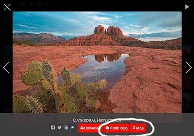
If you've driven Highway 12 from Bryce or Escalante to Capitol Reef you may have noticed a small hoodoo about one mile west of the ranching town of Boulder. Or you may have seen it on page 121 of Laurent Martres excellent book "Photographing the Southwest Volume 1 - Utah". This hoodoo is named "Balancing Rock", and it appears on the Boulder Town USGS 24K topo map. I finally got a chance to visit the hoodoo recently. I have posted a few images and directions on this site. I visited "Balancing Rock" at noon, hardly the best time to photograph it. Photos would be much better at sunset, or even at night if you're willing to hike down the steep terrain in the dark. This hoodoo is spectacular and well worth a visit if you're in the Boulder area.
I recently visited this area and had breathtaking conditions right at sunset. I've never seen the Control Tower in better light. The Control Tower is also a good destination for star trails photography as the best view is towards the north, and the hoodoo is relatively close to the Cottonwood Cove parking area. I have added and reprocessed many of the images in the Coyote Buttes South Gallery. The Coyote Buttes South map has undergone a major revision and now supports layers. This new feature makes it easy to view only the areas and roads of interest on the map.
Dance Hall Rock is a superb destination in the Grand Staircase Escalante National Monument. Little hiking is needed to get some great photos in the summer when dramatic skies are present, and in October when the cottonwoods change color. I've added a gallery here, and maps and some tips on photographing the area here.
Tukuhnikivatz Arch is a great sunset location about ten miles south of Moab. I've added a few images of the arch and travel directions to the Canyonlands gallery on the site. Try shooting the arch from a variety of angles for some new perspectives.
I've added a small gallery of images and map of Collet Top Arch, a rarely visited arch in the Grand Staircase Escalante NM. There is a very well preserved ancestral pueblo granary just below the arch.
If you are in the Bryce area and looking for something a little different you might try the Twentymile Wash Tracksite. This site contains over 1,000 tracks in a beautiful environment of Entrada sandstone. I suggest you visit the tracksite in mid afternoon, and then go to nearby Devil's Garden to shoot sunset. I've added a small gallery of images from the tracksite here, and travel directions here.
Apparently the Coyote Buttes law enforcement ranger has been very active in giving out fines. Here's some information posted on backcountrypost.com:
“I talked to someone at Paria Outfitters about how heavily patrolled House Rock Valley Road is. They said that the ranger who checks permits was not furloughed and that he is catching people poaching the Wave. One of them received a $1200 fine.”
Apparently $1,200 is the standard fine. Forewarned is forearmed.
Thanks Bill for the updated information.
Here's a paraphrased update I received from Lance.
"We hiked The Wave on Oct. 4, 2013. We had four permits from the web lottery run four months prior to hike. We met a ranger when we arrived at the parking lot, who said because those permits were issued prior to shutdown, they are valid and hiking The Wave is allowed with them. He said self-service day use areas are officially closed as are all other hikes where permits are to be picked up at the office. He drove off as we were heading down the wash, and obviously wasn't there the rest of the day, as within a few hours we saw at least 30 people hiking the same trail, and the parking lot was overflowing when we returned. The ranger also mentioned the significant fines for hiking without a permit."
This confirms what I indicated earlier - Coyote Buttes North and South are open if you already have a permit. Note also that since day use of Wire Pass and Buckskin Gulch require a fee to be paid at the trailhead they are closed.
Thank you very much Lance.
I've updated the Sand Hill section of the site with two new locations. The first is an overlook of Wrather Arch, considered the least accessible of the major US arches. The second is Soap Creek Tanks. This is an area of multicolored brain rock near the SE corner of Vermilion Cliffs. Soap Creek Tanks is full of spotted rocks, I have never similar rocks elsewhere. I've also added topo maps covering Sand Hills and Vermilion Cliffs in Geotiff, KMZ overlay, and Oruxmap formats.
I have contacted several sources in Kanab and have received conflicting information about whether existing permits for Coyote Buttes are valid. My best information, coming from the Kane County Visitor Center, is that if you have a permit it is valid. Lottery permits and walk-in permits are not being issued at this time.
I have heard indirectly from a local guide that there were 50 people at The Wave yesterday. Going to The Wave without a permit is illegal. Law enforcement is one of the areas that the BLM and NPS have not completely shut down, and fines for entering Coyote Buttes without a permit are substantial.
If anyone has further information about whether the area is closed, or can provide information about visitation or conditions at The Wave, please email me and I will update this post. I would especially like to hear from someone in the BLM with definitive information.
I've added some images of The Great Wall, a good sunset location near the rim of Waterholes Canyon, just outside Page. A $5 permit, obtainable from Navajo Parks and Recreation, is needed to visit the area. More information on permits can be found here.
I've added a downloadable screensaver / desktop wallpaper to the site. The wallpaper consists of 18 of my favorite White Pocket images. The images were resized and cropped to fit most common screen sizes. The images and installation instructions can be found here. A screensaver for Coyote Buttes North images will be forthcoming shortly.
Drivers headed to Page and the Lake Powell area this Labor Day weekend will have a shorter option when the Arizona Department of Transportation opens the newly paved Temporary US 89 route (US 89T) on Thursday, August 29, albeit with some restrictions. While the 27-mile paving operations have been completed, US 89T remains an active construction zone as crews continue to install right-of-way fencing along the corridor, which has a large amount of livestock. Until fencing is complete, US 89T will be open during daylight hours only (except for local residents) and there will be a 25 mph speed limit in place. When construction is complete, the speed limit will be raised and nighttime restrictions will be lifted. More information about this new route to Page can be found on the Arizona Dept. Of Transportation website.
An estimated 50% of visitors to Coyote Buttes North never explore much beyond The Wave. This is especially true in the summer and winter when extreme temperatures, lightning, or snow cover tend to keep visits short. In view of this I've added some thoughts on how to shoot The Wave itself. A gallery showing what I believe to be the classic images of The Wave is here, and below is a map of The Wave showing where these were taken. Click on any image in the map to zoom in.
The Wave opens up in three directions, to the north (the direction you came in on), to the east, and to the southwest. Each of these openings has a good photo associated with it as can be seen on the map above.
- The most popular photo of the Wave is taken following the red arrow. This photo is best shot in the morning - very early afternoon. Don't shoot too late as the south wall goes into shadow in the afternoon, especially in winter.
- The shot to the north following the blue arrow is also popular and again works well late morning to early afternoon. Outside this time frame either the west or east wall will be in shadow.
- The image taken towards the south (green arrow) works best when there is water present on a calm day. Only a little water is needed to get a good photo, even one inch will do. Shoot close to ground level to emphasize the little rocks in the water, with a wide angle to normal lens. If possible shoot when the foreground is entirely lit or in shadow and some portion of the wall to the south is lit.
- The last image, shot following the black arrow, is of a short slot canyon which gets excellent reflected light in the morning. Watch your DOF when shooting this. You may want to smooth out the sand in the slot using a cloth, jacket, or rain jacket before shooting. It is very difficult to remove the footprints in this sand using Photoshop.
All of the above photos can be shot at night as well. Shoot startrails following the blue and red arrows, or the Milky Way following the green arrow on a moonless night. I have not yet shot the slot canyon at night but believe it would work well also.
Permits to The Wave are so hard to get that I'd suggest you shoot all of the above on your first trip. They can all be shot early morning to noon. In addition to these images there are many other possibilities, see my main Wave gallery for some ideas.
The BLM is currently considering additional measures to improve safety at The Wave. I've added a poll on the right showing some of the actions they might take. To vote in the poll please select one choice from the list of options. Each option has its pluses and minuses such as cost or difficulty to implement, effect on visitors or the environment, and whether the "wilderness experience" is preserved. If you "mouse-over" each option in the poll you'll get additional information about that option.
Please take the time to vote in the poll. If there are other options I have missed please add them in the comments section of the poll here.
The last poll is still available via the Polls tab above, or by clicking here. Based on that poll of 600 people who have been to The Wave about 40% visited The Second Wave, and about 20% visited other areas such as Top Rock, Melody Arch, Sand Cove, etc. Over 90% of the people who visited Top Rock found Melody Arch or The Alcove.
In yet another tragedy Elisabeth Ann Bervel died on her way back from the Wave on Monday July 22nd. She was hiking with her husband and collapsed shortly before 2 PM, probably due to heat exhaustion. Elisabeth is the mother of two and was 27 years old. The couple was hiking on their fifth wedding anniversary.
This is the third fatality this month at The Wave. As a result, the BLM is currently considering adding additional signs marking the way to The Wave, and making changes to the permit process so that people do not feel compelled to hike in on questionable days.
Our heartfelt condolences go out to Elisabeth's family for their sad loss.
Once again it's the time of the year to visit the White Pocket. It rained heavily on July 2nd and there was water everywhere. This led to some great photo ops, and some loud toad croaking. I've updated my gallery with many new images and included a new area that I hadn't visited before. The far north end of the White Pocket has a great many moqui marbles resting on coral colored polygonal cracks. This area is the best I've seen for photographing moqui marbles. It is illegal to remove the marbles. I've also added some images of The Milky Way and of some nearby petroglyphs. Water dries quickly in 100°F plus weather but I would expect there to be water in the deeper pools throughout the summer.
In another terrible tragedy Ulrich and Patricia Wahli apparently succumbed to temperatures that reached 106 degrees on Wednesday July 3rd. They had walk-in permits for The Wave and were found by other hikers early on July 4th. Cause of death is not fully known but is believed to be heat related.
Safety - If you must go into The Wave at this time of year go in early. Leave your car no later than sunrise and preferably a bit earlier. You should be out of the area by 11 AM at the latest. On July 3rd it was still over 100 degrees at 7 PM. Going in late is not a good option. You'll also need more than the normal recommendation of four quarts of water, up to nine! may be needed. Electrolyte drinks are preferable to water. Avoid caffeine. There is no shelter on the way to/from The Wave, you may want to bring a Mylar space blanket to create a temporary one, reflective side up. A PLB or satellite phone may also help but remember, emergency help is at least 1-2 hours away and you can die of heat stroke very quickly after symptoms are recognized.
I've added a long article on Depth of Field together with some good techniques for controlling it to the Techniques Section of the site. I've also added a new Tools Section to the site. The first tools added are a standard DOF Calculator and a Blur Calculator. The Blur Calculator shows, in number of pixels, how blur increases as you move away from the plane of sharp focus. Both tools are web based but can be installed on a laptop, tablet, or smartphone for use in the field.
Until recently the location of the "King of Wings" has been a closely guarded secret. In November of 2012 a good email friend Bernhard Scherer sent me an early Xmas present -a webpage with the location of the KOW. He even translated the webpage to English. The King of Wings was found using Google Earth maps only by Andreas Möller. Its location was publicized by both Andreas and Rainer Grosskopf. For the fascinating story of how it was found see Rainer's article here. Many thanks to Bernhard, Rainer, and Andreas for making the location known to me. I can now cross KOW off my "bucket" list. The King of Wings is on the north side of Ah-shi-sle-pah wash so I have included it in the Ah-shi-sle-pah section of this site. This section includes some older pictures taken in the Ah-shi-sle-pah Wilderness Study Area, and photos of a new area which I've called Valley of Dreams East. I have not seen photos of VOD East before. It is about one mile east of Valley Of Dreams. Valley of Dreams East has a great many hoodoos and mushroom rocks packed into a small area. No hike is required to visit it.
Yellow Rock is a good destination off Cottonwood Wash Road. I've added some images taken near sunrise, and hiking directions to Yellow Rock.
The AZ Dept. of Transportation (ADOT) has a dedicated webpage that can be used to track the status of the closure. Current plans are to pave Indian Route 20 between "The GAP" and Page and use this as a temporary alternate. It may take upwards of four months for paving to be completed. Paving is contingent on funding and Navajo Nation approval. Indian Route 20, also known as Coppermine Road, is a mostly dirt road and is currently unsuitable/closed to truck traffic. Private passenger cars - use at your own risk.
I've updated the White Rocks gallery to include images of some of the incredible hoodoos and formations in Lower Sidestep Canyon. This area reminds me of the Bisti Badlands, it is is very convoluted. I've also added travel directions. Lower Sidestep is difficult to get to, the easiest legal access is probably from the Wahweap Creek trailhead and involves a 10-11 mile RT hike, before any extra mileage for exploration.
I've added a gallery of pictures from the Paria Movie Set, a very scenic location known for the movies that were shot there, and for the Chinle formation present throughout the area. To get to the movie set proceed to milepost 30.6 on highway 89, then turn north on the signed dirt road 4.6 miles. The road continues in one form or another all the way to the Paria river. It is illegal to drive across the river to get to the other side. There are a small number of ruins on the north side of the river, and some abandoned gold mines which were never productive. 4 wheel drive is suggested, and the road is impassable/dangerous when wet. The most famous movie shot there is the movie "The Outlaw Josey Wales" directed by and starring Clint Eastwood.
In the same gallery there are close-ups of Chinle formation shot on the east side of House Rock Road. Access is via short hike starting 12 miles from the intersection of House Rock Road and Highway 89, take the left immediately before the hill and park just before the wash.
This double arch is easily seen from House Rock Road just south of BLM 1017. The arch gets a nice glow at sunrise and sunset and is worth visiting at these times. A wide angle lens is needed to fully capture the arch from close up. Some photos of the arch can be found here, and travel directions are here.
If you walk west along the south rim of Waterholes Canyon you arrive at a little visited overlook of the Colorado River. The view at the overlook is very similar to that at Horseshoe Bend. I've added a few images taken from the overlook and a map showing how to get there. A permit is required to visit Waterholes Bend.
Highway 89 collapsed on the switchbacks between Bitter Springs and Page, AZ and is closed indefinitely. Highway 89 is the main route to Page from the South. Some people I talked to in Page feel the highway will be closed for 6 - 9 months. For those coming from Phoenix or Flagstaff the recommended detour is to take Highway 160 at Tuba City east to Highway 98. Then take Highway 98 west to Page. This detour adds about 42 miles to the trip to Page. Another possibility is to utilize Indian Route 21, a mostly good gravel road that cuts about 25 miles from this detour. This road should not be used by trucks. Here is a map showing the detours.
If you're going to The Wave and have never seen a dinosaur track or footprint you should take a slight detour to see some. I've updated the GPS location of a good set of footprints, and have included detailed directions on how to find them here. The GPS coordinates are accurate to within ten feet. A gallery of images is here.
I finally had a chance to visit Studhorse Point at sunset. Studhorse Point is just a few miles from Page. If you are staying in Page for the day, perhaps to visit Antelope Canyon or Rainbow Bridge, consider ending your day at the point. The hoodoos of Studhorse Point sit just below the rim of a cliff and start going into shadow a few hours before sunset, so don't visit there too late. Studhorse Point is also a good sunrise destination.
In the past I've distributed USGS 24K topo maps as PDF files. These could then be printed for use while hiking. With the increasing prevalence of mapping GPS devices and Apple and Android phones and tablets, this is no longer a good solution. I've started the process of converting the maps on the site to a Geo TIFF format. This format is understand by more mapping software than the GeoPDF format is. I have also started distributing map files in oruxmaps format. Oruxmaps is the best GPS/ mapping software available for android today. It is free and is being aggressively maintained by its developer. Since I do not own an iPad or iPhone I cannot provide a similar solution for these devices at this time. The maps in the Coyote Buttes North section of the site have been updated to the new formats, other sections will be updated over time.
I've added some images and information on Alstrom Point. Alstrom Point is an overlook on the north side of Lake Powell. It is generally regarded as the best overlook of the lake, and is best at sunset. A high clearance vehicle is required to visit it. It is a great destination for sunset shots, in the winter, full moon shots, and for panoramas. It is about 90 minutes from Page. The last few miles of the road can be hard to follow, so I suggest you visit the maps page and download the route before visiting the point.
Jessica Fridrich, a professor at Binghamton University in New York, sent me this article which discusses how The Wave was formed. In short, The Wave and surrounding area was sculpted by wind, not water. Much of the article is beyond my abilities, but I did find the diagrams on p 174 of value. Diagram "A" shows the prevailing wind direction over Coyote Buttes North. It also shows the location of three "scour pits", all on Top Rock. The northern most scour pit is "The Alcove", the middle is the smaller depression just south of The Alcove at the same elevation, and the southern most one is at Melody Arch. Diagram B shows the flow of wind through The Wave. Diagram C shows the volume of sand moved by the winds in the area. Note that sand moving winds largely come form the SSW, and almost never from the East or North. Diagram D shows how the sand dunes in Sand Cove below "The Boneyard" were formed by an eddy. The eddy is created by the headwall on the east side of Sand Cove.
Jessica also passed along a superb photo
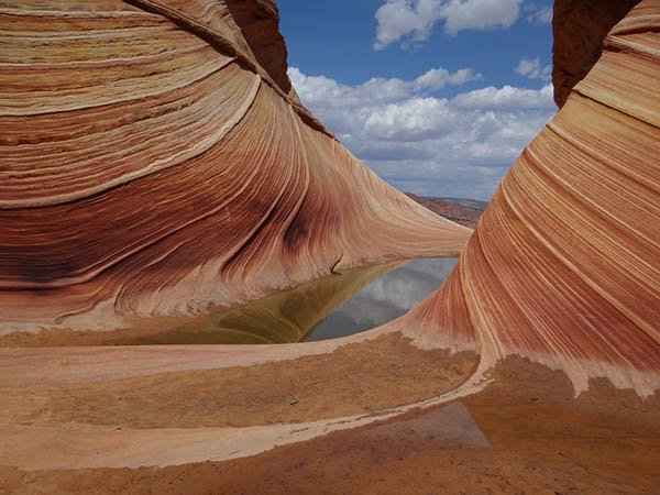
she took at "The Wave" in August. Double click the photo for a larger version. Conditions appear to be about as good as it gets at The Wave, good sky, lots of water (it looks as though you would get your feet wet walking into The Wave), and calm winds. The large amount of water and the calm winds allowed for a "double reflection" - beautifully done. I have only been to The Wave once when there was that much water present. On that occasion in late afternoon I could hear male toads croaking for females right at The Wave.
Hiking in the Southwest during July and August can be challenging. You need to carry lots of water, rest often, and be prepared to find shelter or retreat should a thunderstorm approach. But the rewards can be great: water filled potholes teem with tadpoles and fairy shrimp, skies are dramatic, and lightning and rainbows are frequent. Nights can be very pleasant so the summer is an excellent time to photograph startrails and starpoints. The Milky Way is at its peak in the northern hemisphere in July and August.
So what do I shoot in the summer? I shoot destinations which require little hiking. The White Pocket is my favorite August destination. This past August I was there for just one day, but, like last year, I got great images at both sunrise and sunset with minimal effort. This year there wasn't as much water as in 2011, but the potholes were still full enough to provide good reflections. It rained briefly when I was there producing some double rainbows, and a semicircular one. The rainbows were present for over an hour. Even faint rainbows can be easily enhanced using the saturation adjustment brush in Lightroom. Or you can use a digital rainbow filter, e.g. the one in Tiffen DFX, to produce your own rainbow when there were none. I also saw a beautiful rainbow at the Paria movie set just after sunrise.
I've added about 25 images to the White Pocket gallery. Two are of note: The first was shot about 20 minutes after sunset (the "blue hour"). Since is only a half mile back to your car it's easy to shoot this late at The White Pocket. The second is a sunrise reflection of the White Pocket Monolith in the stock pond on the western edge of the pocket. This pond usually has water in it.
I've added a Road Conditions link to the information menu above. On the linked site you'll find House Rock Road near the bottom. Take the information about road conditions on the linked site with a large grain of salt:
- Information is sometimes old as rangers may not drive a road for several weeks.
- After a recent rain or snow roads will probably be impassable even if not listed as such in the report.
- When Buckskin Gulch is listed as flooded there is a bypass that may get you past it. Alternatively consider driving to the Wirepass trailhead from the south.
- If you are in doubt about road conditions call the GSENM visitor center in Kanab. They may have updated information from visitor trip reports that do no make the official road report.
I took the locations of these down at the request of the BLM in February 2011. In the period since the Nautilus coordinates have been become readily available on the web (including Googlemaps), and the location of the Maze petroglyph has been published in Kelsey's excellent book "Hiking and Exploring the Paria River - 5th edition". The Nautilus is at 37.086329,-111.891643, and the Maze petroglyph at 36.985013, -112.026157. Directions to the Nautilus can be found here and directions to The Maze petroglyph can be found here. Please respect both - do not touch the petroglyph, and do not walk through the Nautilus. If you photograph the Nautilus from both the top and bottom please walk around it.
Monument Valley is a land of soaring red rock towers and spires, arches, sand dunes, and petroglyphs/ Indian ruins. The scenery is unsurpassed. However, MV can be difficult to photograph, and many people walk away disappointed with both the experience and their photos. MV is crowded, hard to get to, days are hot and hazy through much of the year, it's normally not open before sunrise or after sunset, and the travel restrictions imposed by the Navajo prevent exploration. Too often you ending up shooting the icons in flat light. Still, if you're in Page take a few days to visit MV, especially if there is any chance of dramatic weather. I've added many images taken over ten years to the site, and a good map showing the landmarks and where to shoot them from.
I've added additional options to the Maps pages on this site so that you can view either the Google or Bing Map of the area. This was done since in several cases (Sand Hills and Monument Valley) the Google map was partially obscured by snow or cloud cover and unusable. For example - the best known formation in Monument Valley - the Mittens - is totally covered by clouds on the Google map of the area. So far I haven't found any Bing maps where substantial portions are covered by clouds. Bing Maps also seem to have a bit more resolution. Here is a sample Bing map of Coyote Buttes South and Sand Hills. For comparison here is the same map in Google Maps. Zooming in on the lower right section of the map will make the differences clear.
I've also added an option so that you can easily download a KML file which includes the waypoints, tracks, and routes that appear on the map. KML files can be converted to GPX (Garmin format) files using GPSBabel if needed. You can convert KML routes to GPX tracks or KML tracks to GPX routes using GPSBabel as well. This may be needed so that the GPX file can be viewed on your GPS, tablet, or phone.
I revisited Sand Hills towards the end of May and added some images. There has been a drought in the Southwest for several months now so there was little water in the tanks and reservoirs - less than ideal conditions. Additional images of Joe's ranch were added. New areas explored include The Big Sink and the Middle Reservoir which had no water. Many images of Pinnacle Valley were added, this is a good destination at both sunrise and sunset and is relatively easy to get to - certainly easier than the White Pocket.
White Mesa Arch is a superb destination in the Navajo Nation. The arch is very large with a span of 53 feet and a height of 84 feet. It is easily seen from Highway 160. The arch is best photographed within ten minutes of sunrise all year round. There are wonderful leading lines on its eastern side. I've added a gallery of images taken at dawn and a much needed map with directions and GPS coordinates to help get you there. A permit is required to visit the arch.
On May 20 a rare annular solar eclipse will occur at the Wave. These events are indeed very rare, the next annular eclipse at the Wave doesn't occur until 2238! I've included some suggested locations and shooting tips here.
Good luck and most of all enjoy this once in a lifetime experience.
Sand Hills is the area east of Poverty Flat. It is also known as the Paria Plateau. It is bounded by Buckskin Gulch and the Paria River to the north and east, and by the Vermilion Cliffs to the south. The White Pocket is part of Sand Hills. Sand Hills includes many other areas of interest including Hole in the Rock arch (already covered), the "Cowboy Hat", and "Joe's Ranch". I've updated the White Pocket gallery to include some pictures of Joe's ranch and the Cowboy Hat, and updated the White Pocket map to include the locations of these and many other points of interest. There is a great deal of "Brain Rock" throughout the area, as well as petroglyphs, hilltop ruins, pottery fragments, and even some Moqui marbles. It is illegal to remove pottery fragments and moqui marbles, please leave them in place for others to enjoy. Sand Hills is very isolated and only gets occasional access by other photographers, environmentalists, and cowboys. The roads are strictly 4x4. Make sure you have good tires, plenty of water, extra gas, and a shovel. Let someone know where you are going and when you'll be back. I've only begun to explore this area, much more to come.
I haven't seen this Disney movie so I have no idea if it is good. John Carter was shot in several Utah locations that I often visit. Between January and July of 2010 I ran into the shooting on three occasions - across Wahweap Creek opposite Big Water in January, near Factory Butte in April, and near Deadhorse Point State Park in July. Other filming locations include Lake Powell and Shiprock, NM. Locations consist predominately of Mancos Shale. Factory Butte shooting was appropriately done near the Mars Desert Research Station. Here is a trailer for the movie.
In mid January I had a walk-in one day permit for Coyote Buttes North. Walk-in permits are fairly easy to get in January. I went to the Kanab GSENM visitor center on a Friday so permits for Saturday, Sunday, and Monday were available for the lottery. There were only 15 people present at 9AM when the walk-in lottery is normally held. With 30 permits available no lottery was needed and many permits went unused. In addition there were same day permits available for Friday since the ten walk-in permits from Thursday had not been used. January is not the best time to visit the area since snow can make both road access and hiking difficult, but you can usually get permits. If you can go on short notice check the weather forecast and check if it has snowed recently, if conditions are good go! It had snowed about four inches in the area on Tuesday so House Rock Road was in poor condition. It was passable if you went in early in the day when the surface was frozen, and drove out well after sunset when it refroze. Hiking was easy as most of the snow had melted. North facing slopes were sometimes impassable.
Saturday was largely clear and I got some good photos. There was a little (less than one inch of) water at the Wave which surprisingly led to some nice reflections. I should have arrived at the Wave a bit earlier (9-10 AM) so that the South wall would be in Sun, another reason to go again!
I also visited Top Rock Arch at sunset. It had a nice glow and very good light even in January when the Sun is well to the south. The Sun set over "The Notch" and could be barely seen from the arch. I expect that sunset photos of the Top Rock Arch would be much better in March or April when the setting sun would be more centered in the arch and the arch more evenly lit. Do not shoot Top Rock Arch at sunset if you are not prepared to hike out in the dark, I only got back to my car 2-3 hours after the sun had set. There was a fatality last year when someone hiked out after sunset.
I had the good fortune to be at The White Pocket last August in great light so I'm posting some new images and shooting recommendations. I've added two new sections to the White Pocket section, one containing some panoramas of the area, and the second with some photography tips. To view the panoramas as "moving images" you should be running a browser supporting html5 such as Chrome, Firefox, Internet Explorer 9 or later, Safari, the Ipad browser, or the Android browser. My site is best viewed using these browsers.
I've added a Techniques section to the site where I'll cover shooting and post processing tips and techniques. The first two topics are Shooting the Full Moon, and Shooting the Night Sky. If you have any comments or questions please contact me.
I've added a poll to the top right of the Home Page. I will update it with a new poll every few weeks. The purpose of the surveys is to provide information to site visitors and the Bureau of Land Management about usage of the permit area and to suggest when/where to go. Ultimately this should help in the design of an improved permit system. I'll hope you'll take the few seconds needed to respond to each poll. Past polls can be found/answered in the Poll tab above. The software I am using allows only one response per poll per visitor. If you have ideas for new polls please email them to me and I'll review/include them in the future.
The January 2012 issue of Arizona Highways pages 26 and 27 has some more information on Blue Canyon. The best contact information for a guided tour is Micah Loma'omvaya 1 800-774-0830, or visit www.hopitours.com. The article also indicates there are petroglyphs everywhere - though somehow I missed them. While there you should also visit the Blue Canyon Trading Post ruins. I've added a 24K USGS topo map (Begashibito Canyon.) which shows the location of the Trading Post ruins.
I've updated these galleries with new images from recent trips. Some of the new images include:
- A reflection of Courthouse Butte shot handheld lying on the ground next to the pool of water which was only a few inches deep. Sunrise.
- The Full Moon shot through the North Window. Sunset. Not a composite!
- Star trails. The star trails were shot using 30 second exposures and combined into one exposure using freeware found at Startrails.de. 90 minutes after sunset under a full moon.
- False Kiva - Directions can be obtained at the Island in the Sky ranger station. Follow them closely. Do not navigate directly to the GPS coordinates I've provided or you may end up cliffed out a few hundred feet above the alcove. Late day.
I've also provided high resolution USGS 24K topo maps for Arches and Canyonlands - you can download them freely from this site. I've updated the Coyote Buttes map page as well to include higher resolution topo maps.
Blue Canyon is a superb location in the Hopi Nation, about 2 hours from Page. As of this writing a permit from the Hopi Office of Cultural Preservation is required to visit the area, and permits are not being issued! That said, you can probably visit the area with an authorized Hopi guide. See here for contact information, or see the official Hopi website. Blue Canyon's location is not widely available on the web. Please respect the wishes of the Hopi people and do not visit without a permit or guide. Blue Canyon is known as Red and White Canyon on various German websites. Blue Canyon requires 4WD and is best visited at dusk. Blue Canyon is spectacular foreground for the full moon, see here for some tips. Fatali has an excellent photo including the full moon.
I added a few pictures of the Nautilus taken less than one hour before sunset. Just before sunset the Nautilus gets excellent reflected light. If you need to know the location just email me.
I added a route and a few photos to a nice overlook of the Paria River. The route starts at the BLM Big Water Visitor Center. It takes at least at hour to drive to the overlook via a 4WD road. I suggest you download my route to your GPS as I found the map/directions provided at the Big Water visitor center to be hard to follow. I was at the overlook mid-late afternoon. This was too late in the day for best light. Grand overlooks are not my favorite type of photography but there may be some good pictures to be had in better light. If you continue on the road past the overlook you will find many good areas to car camp.
I moved information about Coyote Buttes climate to the information tab and added information about wind speed and direction, and cloud cover. I also added sunrise/sunset, moonrise/moonset, and moon phase to the information tab. The site that I use to display sunrise/sunset times has some limited advertising - my apologies, I've tried to keep the site ad free.
I've added some new pictures of Colorful Canyon taken at sunset under very good light, and some pictures of Sidestep Canyon, taken midday in poor light. Sidestep Canyon is very difficult to photograph successfully. Important note - BLM 431, the road that gets you closest to the White Rocks, is an "administrative" road, using it could result in a fine. I have therefore added an "off trail" route to the Upper White Rocks that begins on BLM 435 and ends at Colorful Canyon. Sidestep Canyon and the "Twisted Hoodoo" are only a short distance away from Colorful Canyon. Finally - BLM 435 is currently washed out where it crosses Coyote Creek, this will add about a mile RT to the above hike or to the hike to the Lower White Rocks. BLM 431 looks like it has been washed out for a while.
I have confirmed that effective November 16, 2011 the walk in lottery will be held at the GSENM Visitor Center in Kanab year round. During the winter months the lottery will be held Monday-Friday with permits for Saturday through Monday available on Friday. During the other months the lottery will be held seven days a week. I have updated my permit information pages to reflect this change. The official Coyote Buttes website has not yet been updated but I am confident that the above information is correct. I have also added a section containing emergency phone numbers to the information page.
Effective November 15, 2011 the walk-in lottery for next day permits will be held year round in Kanab. The walk-in lottery will no longer be held during the non-winter months at the Paria contact station. The lottery will be held at the Grand Staircase Escalante National Monument (GSE-NM) visitor center on Highway 89 on the eastern edge of Kanab. The address is 745 E. Highway 89, the phone number is (435) 644-4680. The visitor center is open from 8:00 AM to 4:30 PM seven days a week. I assume the lottery will be still be held at 9:00 AM Mountain time. The visitor center is open seven days a week so it is likely that the practice of holding the lottery for Saturday, Sunday, and Monday permits on Friday morning during the winter months will be abandoned. I expect the lottery will be held every day year round except for national holidays. If you plan to enter the walk-in lottery after November 15, 2011 you should call the GSE-NM visitor center to confirm the above.
I've added a small gallery of photos taken at Studhorse Point. Studhorse Point is close to Page and is a good sunrise location if you are going to be in the area all day. No hiking involved. The drive is only a few miles but the myriad of unmarked small roads in the area can make Studhorse Point difficult to find. You should print out a map and follow the directions closely. A 4WD vehicle is needed.
A California hiker apparently lost his way coming back from the Wave in the dark and fell 100 feet into Buckskin Gulch. Bo Tian, 36, of San Jose, California had a permit to hike The Wave. He was last seen at The Wave near dusk on the night of July 23. It is unknown whether he was doing some additional exploration of the area after visiting the Wave or was lost. It was reported that the flashlight he had with him did not work. Sunset was around 7:45 PM on the 23rd, and moonrise (waning quarter) was around midnight. It would have been too dark to hike without a flashlight after 9 PM on the evening of the 23rd.
Despite the fact that Buckskin Gulch is considered one of the most dangerous places to hike in the US this was the first fatality there.
Reminder - Safety first:
- In an emergency the most important thing you can do is keep a cool head and think before you act.
- During the warmer months bring lots of water, one gallon per person per day.
- Bring a GPS and know how to use it. Mark the location where you cross the ridge into Coyote Buttes.
- If you plan to return late bring a flashlight and make sure the batteries are charged and it works. If you get lost in the dark stay put until either sunrise or moonrise (weather permitting).
- Hiking alone is especially dangerous. A short fall can be fatal if there is no one to go for help. If you hike alone let someone know where you are going. Do not count on cell service - though you may be able to get service if you can gain elevation. The "Spot Communicator", a satellite phone, or a personal locator beacon (PLB) may be worth investing in if you often hike alone.
If you like photographing farm land, you'll love the Palouse. The Palouse is the most productive wheat growing area in the USA. It is full of rolling hills, old barns and grain elevators, rusting cars and farm equipment, crop dusters, and animals. Within an hour of arriving we saw mule and whitetail deer, porcupines, marmots, and a yellow crop duster. Rarely moose are seen! The Palouse is best visited during the months of June to August. In June you'll get rolling hills of green and Palouse Falls is near its best. In July the wheat is turning amber, and August is harvest time. We went in early July, however because of a cold wet spring, everything was about a month behind. The wheat was still green, the canola fields a spectacular yellow, and Palouse Falls still had very good flow. This trip was one of my most productive trips ever.
If you go to the Palouse I strongly recommend going with a local guide as the Palouse is over 3,000 square miles in size. While you can get many good images from the top of Steptoe Butte, from Palouse Falls, or just from driving the back roads, you'll do much better with someone local who knows where the old cars and barns are, and whether the barns are still standing, who knows the farmers and can get access to some of the properties, and who knows what farms look good at this time of this year. And remember, every year is different as farmers vary their planting and harvesting patterns. We went with photographer Jack Lien who, with his wife Barbara, has a beautifully set home in Colfax, the town closest to Steptoe Butte. Jack really knows and loves the area, and got us to the right locations at the right time. He works for reasonable rates and put in 10-12 hours each day with us. Jack is also a good teacher should need you need advice on composition or just how to work your camera. I highly recommend him!
We stayed in Colfax at the Best Western Wheatland Inn which we recommend. If you book a tour with Jack Lien you might be lucky enough to stay at his home, which he sometimes uses as a bed and breakfast for his students.
Other recommendations - Most of the land is private; please respect it. Do not walk in the wheat or other fields, or on fields freshly planted. Do not drive down private roads without permission. When you park on the side roads pull way over as farm equipment can be wide. Normally you do not need a 4x4 in the Palouse; most roads are paved or graveled and are well graded. Bring some long telephoto lenses. I found 300-500 mm got a lot of use on a full frame body. We photographed crop dusters, deer, owls, and eagles from a long distance, and 300mm works well from the top of Steptoe Butte. 150 -300 mms is needed to photograph some of the barns from the road. There can be a lot of haze, especially in the evening so bring a polarizer and/or a haze filter. Views from Steptoe Butte photograph better in the morning when there is less haze. Palouse Falls should be shot early to mid afternoon before a harsh shadow starts to creep across it. Finally, bring boots or non-mesh sneakers to walk in. I brought mesh sneakers with me and am still picking out the burrs.
I've added a gallery of images taken in Bodie, California and some recommendations on how to handle the unique shooting circumstances you'll find there. The best time of year to visit Bodie is in late September - mid October as the aspen in the Eastern Sierra's will be changing color then. Should you go to Bodie I highly recommend going on "Photographers Day" so that you can be there at sunrise and sunset. Bodie is a great place to visit if your visiting the Yosemite high country, the Eastern Sierra's, Mono Lake, the Ancient Bristlecone Pine Forest, Death Valley, or the Alabama Hills.
I've added a gallery of images taken at Bryce Canyon, mostly shot in the winter. On February 26 it snowed about 18 inches at Bryce and I had the good fortune to be in the area so off I went. I couldn't reach the NPS at Bryce by phone so I called Ruby's Inn and they indicated that the park road was open. I made a reservation at Ruby's for the night of the 27th. It is easy to get reservations at Ruby's in the winter. Highway's 9, 89, and 12 were clear of snow less than 12 hours after the snow stopped. Bryce Canyon road was open up to Sunrise/Sunset points. Inspiration point opened up later on the 28th but I didn't have time to visit it. The hiking trail from sunset point was open but had heavy snow on it. It you plan to hike the trails you may want to bring (or rent) crampons, the trails can get very icy. Make sure to bring warm clothing, it was 15º F at dawn on the 28, I have been there when it was -25º. Also be sure to arrive shortly after the snow stops, you want to catch snow on the hoodoos and trees before it melts. Sunset point is probably the best point from which to shoot Bryce, both at sunrise and sunset. Highways 89/12 from Kanab to Bryce are also beautiful in the winter, and there is a ranch with llamas and bison on 89 about four miles South of the intersection with 12. Steam coming off the Sevier River also makes a good photo this time of year.
This petroglyph is outside the permit area. It is one of the finest I have seen, and is in excellent condition. The BLM is considering a sign at the trailhead asking that you treat the petroglyph with respect and do not touch it. I will not provide GPS coordinates on my site pending this decision. In the interim if you ask at the Paria Ranger station they should provide directions, they have in the past. Or you can email me, just indicate in your email that you will not post coordinates on the web.
The Petroglyph is best photographed from midday to sunset. Shooting later in the day will give the best color, or use an Enhancing filter to bring out the red.
Although I had been given "permission" to post GPS coordinates for the Nautilus I recently received an email from the BLM asking nicely that I remove them from this site. The primary reason given was that the Nautilus is made of "Page" sandstone and would not survive extensive visitation. After some soul searching I have decided to follow the following policy -
1. I generally believe in the free distribution of location information.
2. I will comply with government requests to withhold coordinates from my site.
3. If someone gives me location information and explicitly asks that I withhold it I will do so.
4. I will include GPS coordinates in the exif of my photos whenever I have them, subject to the above.
I have therefore removed the coordinates/directions for the Nautilus from my site. If you need them email me and I will supply them provided you agree not to publish the coordinates on the web.
I have seen some posts recently where GPS coordinates were withheld even though the author had them. Two arguments were given for this - first, GPS coordinates are not needed since the route to the location is obvious. Second - the author believes that providing them is "dangerous", i.e. if you don't have good navigation skills you should not be relying on a GPS. I disagree. Even when a route is obvious in the daytime photographers often return to their car or go to the location well before sunrise or after sunset. A GPS can help here. Conditions also change - in Alaska I hiked over three miles in heavy fog navigating totally by GPS. The trail was obvious in good light but not in heavy fog. In emergency situations coordinates also allow one to reliably give rescuers good location information, and can help you take the shortest path to get help. GPS coordinates allow you to locate a destination on Google Earth, words do not if the trail is too small to be seen on the map. With GPS coordinates and tools like "The Photographer's Ephemeris" one can easily check whether the sun will hit a given location at sunrise or an hour later. A Google Earth map and location information also helps one search for alternate routes. GPS coordinates are also a "universal" language. For example, I don't read German. Even simple directions given on a German web site are, sometimes, just incomprehensible to me, even with Google translate.
Finally, some good news - I have added a few more images of the Nautilus taken under better conditions, here is an example. I will be adding some pictures of the "Maze" petroglyph in Coyote Buttes North to the site shortly as well.
Permits for the Wave are increasingly difficult to come by so if you get one you should plan your day carefully. Here is my recommendation for a relatively fit photographer who wants to hit most of the key areas in the best light. This advice is based on over 20 trips to Coyote Buttes North starting in 1998. 8 - 9 miles of relatively flat hiking are involved. There is some slight exposure during the scramble from Sand Cove up to the Second Wave. To shoot everything in best light will require getting back to your car after sunset so you'll need a headlamp.
Many new bird and animal photos added from a trip to Kenya in early October 2010. Photos were taken in the Maasai Mara and on Mfangano Island in Lake Victoria. Lake Victoria is the source of the Nile.
Rhyolite began in 1905 as a mining camp and grew to about 5,000 people by 1908. By 1911 the mines were closed and by 1920 the population was zero. It is about 120 miles from Las Vegas and less than an hour from Death Valley. If you are staying in Death Valley you should make plans to stop by it late afternoon when the light is excellent. Especially photogenic are the remains of Cook Bank, the Bottle House, and the car shell near the Bottle House. At least four movies have been filmed in Rhyolite - The Reward, The Island, Cherry 2000, and Six-String Samurai.
Added many new photos of Capitol Reef National Park and included the surrounding area. Boulder Mountain and Capitol Reef are superb in late September (when the Aspen are changing color) to late October (when the Cottonwood change). New locations include Factory Butte, Goblin Valley, Little Egypt (best shot at dawn), and the rarely visited Colonnade Arch. An excellent area to explore on foot or via 4WD - I've only touched the surface!
Added images taken in the Upper White Rocks of South Central Utah. Especially photogenic is the "Twisted Hoodoo" which photographs well at either dusk or dawn. Also added directions and a map, 4WD is necessary.
This is a little known formation near the White House Campground. I've posted directions to and the GPS coordinates of "The Nautilus" (with permission - first time on web?). The photos in the gallery were taken midday and there were very harsh shadows, a very late day (reflected light) or cloudy day exposure should work much better.
I've also added some new photos of Toadstool Hoodoo taken late day in good light. By shooting very late in the day the white background goes into shadow and improves the images considerably. A red enhancing filter (either glass or digital) also helps.
Added a photo gallery of Lower Antelope Canyon. I've also added a map which contains information about when to go and what to expect.
Added some new photos of the White Pocket from a recent trip. If you are in the mood for an adventure here is one: While in the area I visited Hole in the Rock Arch . The arch is about two miles west of the White Pocket. It is rarely visited since the road to the arch is indistinct, sandy, and infrequently traveled. If you go to this arch make sure someone knows where you are going. If you get stuck or break down it could be days before you see another car. I would not go to the arch in the winter if there is snow. The arch was in poor light when I got there and wasn't very photogenic despite being made of Navajo sandstone. Visit the arch for the experience and not for the photos. It may be possible to ascend to the arch by going up the sand dune on its left; perhaps one can then find some good foreground closer to the arch. When I visited in August there were many wildflowers in the area..
I also added some nice images of Fatali's Boneyard to this page. Photographer Michael Fatali shot a superb image of the "Boneyard" at dawn. My picture to the right was shot late afternoon just before the area went into shadow. By shooting late afternoon the cliff in the back of the Boneyard is dark and provides good contrast to the boneyard itself.
Coming soon to this log - many more images of Coyote Buttes North taken during my last trip.
Added a gallery of 20 photos from the White Pocket taken in the last three years, and added White Pocket travel directions from Coyote Buttes South and from House Rock Road. Added a link to the Natural Arch and Bridge Societies List of US arches. The list includes Google maps of the arches in Utah and Arizona. In the Arizona section Top Rock Arch (NABSQNO 12S-410195-4094000) is misplaced. Melody Arch (NABSQNO 12S-410520-4094320) is called Joanne's arch and is a buttress natural arch eroded through Navajo sandstone. Vreeland listed Joanne's Arch as number 12-2 in his catalog and reported a span of 10 feet. The outer arch there is described as Danny's Arch and is a fin natural arch eroded through Navajo sandstone. Vreeland listed Danny's Arch as number 12-1 in his catalog and reported a span of 12 feet. The Utah map is missing what I call "Overlooked Arch", the 5238AT arch on the 24K topo map.
Added 90 new photos taken in North Coyote Buttes over 15 trips between 2004 and 2010. New locations added include unique views of Melody Arch, Fatali's Boneyard, Sand Cove, Top Rock Arch, the arch near 5238AT on the topo map, and the dinosaur tracks on the West side of the Buttes. The map section has been expanded to include directions to each of these areas.
Added a gallery and map of the Bisti Badlands. About 50 images added, most are geocoded. The photos were largely taken in two trips - late May of 2009 and late May of 2010. The Bisti is one of my top ten sites in the US West. While the area generally lacks color the fantastic shapes and great light at dusk and dawn more than make up for it. The Bisti photographs well during the "Blue Hour" and even works well for nighttime shoots. The Bisti has no formal trails so if you go I recommend you bring a GPS and map and know how to use them.
Added a section on Horseshoe Bend. You need a 24mm lens or wider to shoot this effectively. I've also included the location of a dinosaur track that is right on the trail. I found out about the track from a volunteer at the Bigwater BLM visitor center. If you're interested in dinosaur tracks you should definitely stop there.
The story behind Edmaier's Secret- The story behind the pictures is perhaps more interesting than the photos. For some time I've been looking for areas to go to in the Arizona Strip (area of Arizona between the North rim of the Grand Canyon and Southern Utah) when I can't get a permit for the Wave. Wave permits are increasingly difficult to get. Thanks to Laurent Martres' books I've been to many of the (already obscure) areas in the strip such as the White Pocket, the Upper and Lower White Rocks, Yellow Rock, and Wahweap Wash. I wanted to see if I could find something on my own. So I started looking at Google Earth aerial maps for terrain which looks similar to that found in North and South Coyote Buttes. I found an area about five miles North of the Wave and East of Buckskin Gulch that looked interesting, the aerial photos showed that it had lots of "Brain" rocks. When I looked last December on the web in preparation for a January trip I couldn't get any info on the area, or find any photos. I never got there in January because the weather didn't cooperate on the day I planned to go. In March I decided to look at Google Earth again (for an April trip) and to my surprise I found a new "Panoramio" photo labeled "Edmaier's Secret". So I googled "Edmaier's Secret" and found that the area is just starting to become known (about 3 years now). As is so true of the Southwest, it was first photographed by a German photographer Bernhard Edmaier from a plane. A photo can be found in the book GeoArt authored by him, I haven't seen it. Another photographer named the area "Edmaier's Secret" because even having seen Edmaier's photo it is very difficult to find out where it was taken. Even Edmaier didn't know exactly!
Getting There - The normal route into "Edmaier's Secret" is from the Buckskin Gulch trailhead (four miles down House Rock Valley Rd.). You'll need to pay the BLM a fee of $6 to day hike in Buckskin Gulch, you can pay where you park. You then hike about 2.5 miles down Buckskin Gulch before you exit to the east to arrive in the general area of Edmaier's Secret. I have not been in from this direction because it looked like there was a much shorter way (described next), but I can see that this way would be a little tricky, there is a barbed wire fence that needs to be crossed, and a way needs to be found to climb up to the area. I devised an alternate route coming in from Long Canyon Rd., take Long Canyon Rd. about 4.5 miles to the Road labeled "Jeep Trail' on the topo map and bear right. In .6 miles you hit "Dry Flat" on the topo map "West Clark Bench", bear left and continue on "Jeep Trail" for about 1 mile and park anywhere. From your car its about .7 miles to the edge of the escarpment versus 2.5 miles via Buckskin Gulch. You will have to descend 200 feet from the top of the escarpment and do a bit more hiking to get to the best area for photos. You will need a 4x4 for Long Canyon Rd. and especially the "Jeep Trail" , and the road is totally impassable with substantial drop-offs when wet. Only a fool would drive this when wet! Long Canyon Road also goes to "Cobra Arch".
Photography - The area has many good photo ops, but of course none nearly as good as "The Wave". Definitely a late afternoon location, in fact you get good light almost till dusk. At dawn the escarpment will block off the best light for 2 hours or so. Overall - I'd rate the area as Good-Very Good, not quite as photogenic as the White Pocket, but a lot easier to get to!
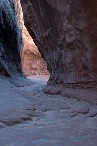
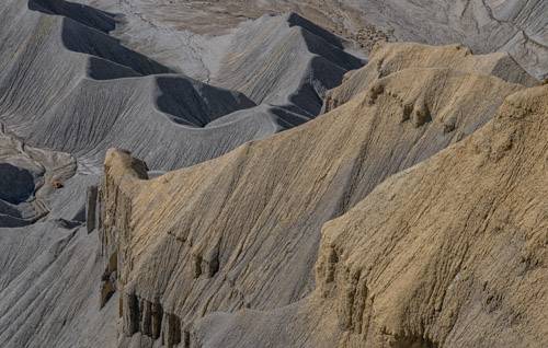
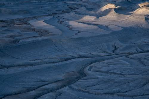
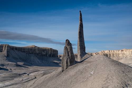
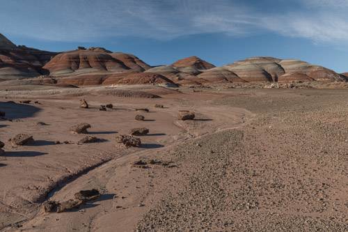
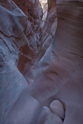
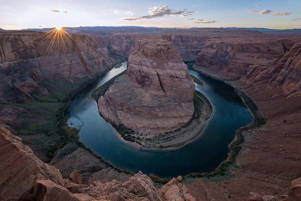
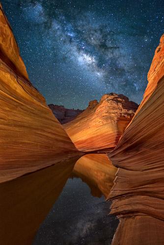
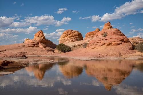
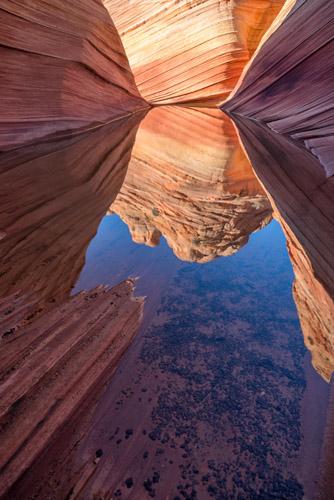
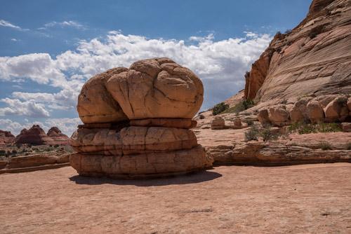
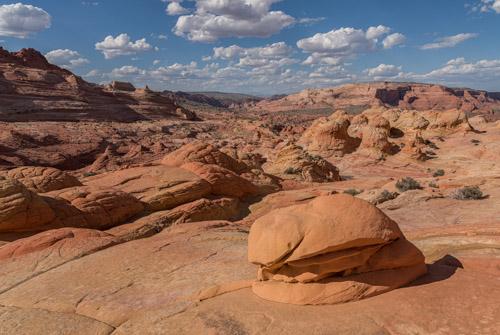
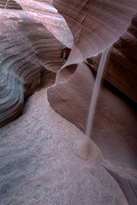
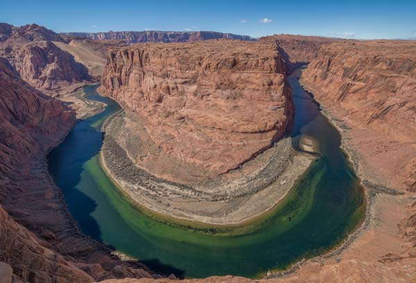
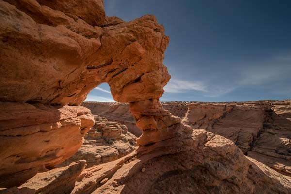
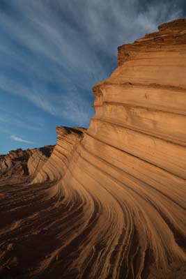
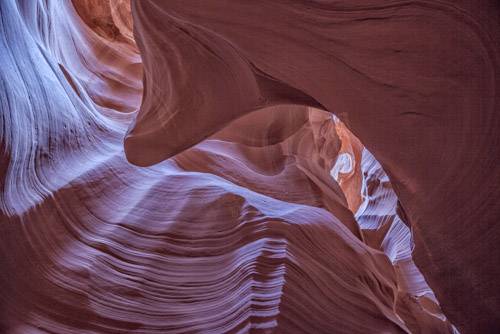
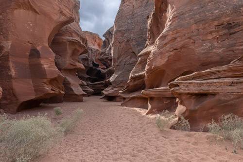
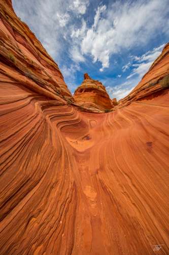
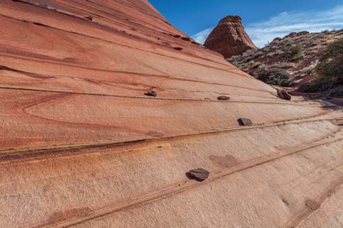
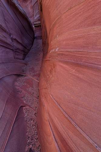
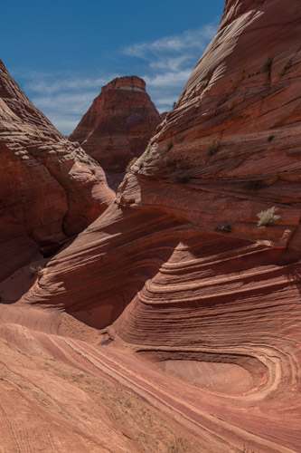
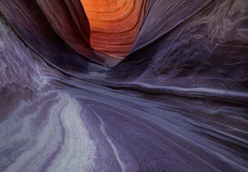
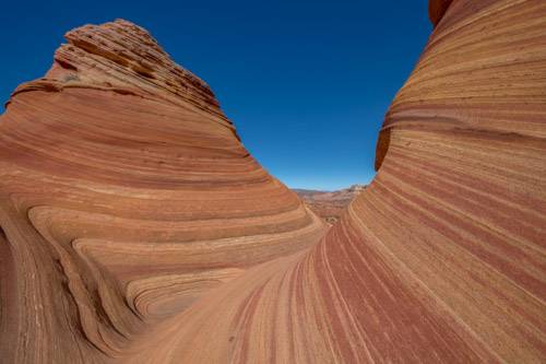
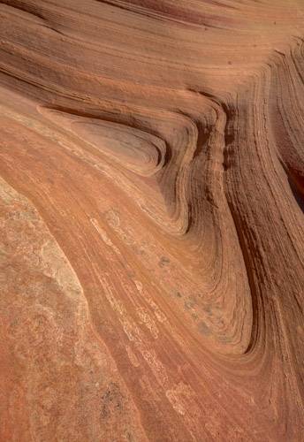
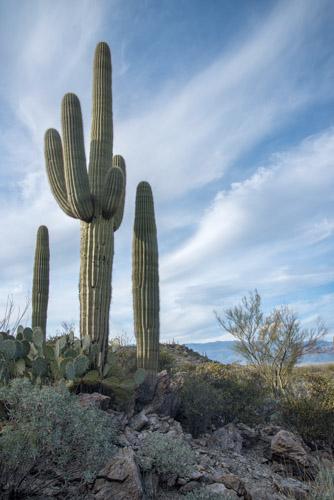
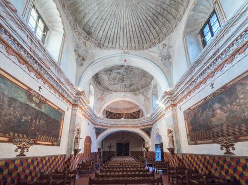
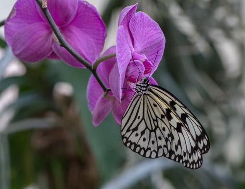
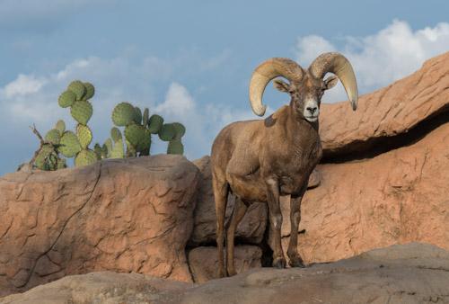
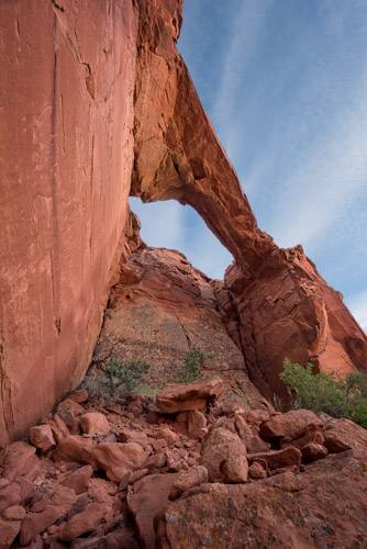
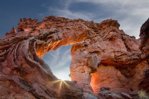
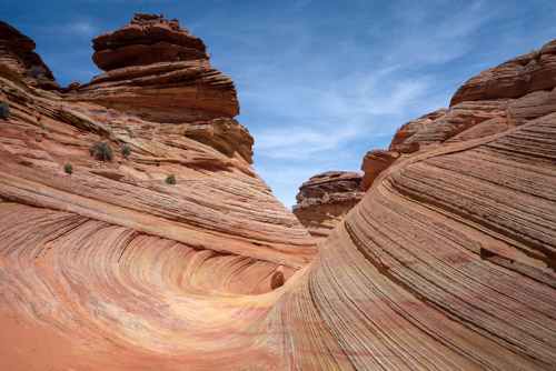
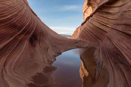
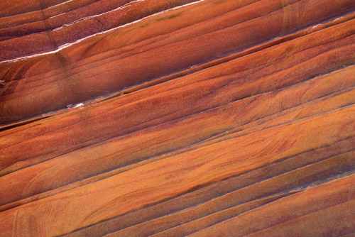
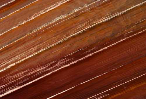
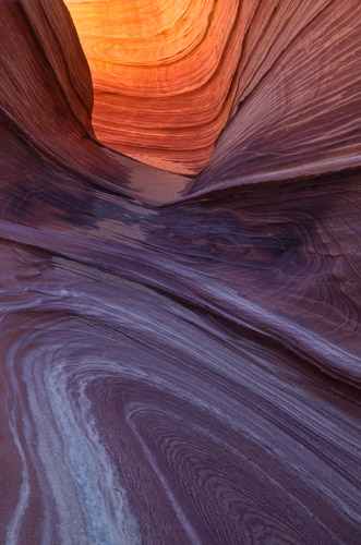
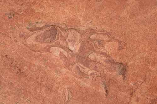
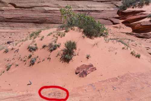
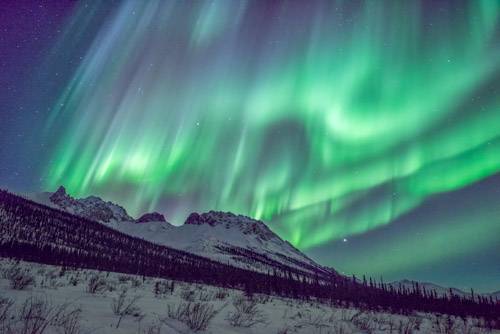


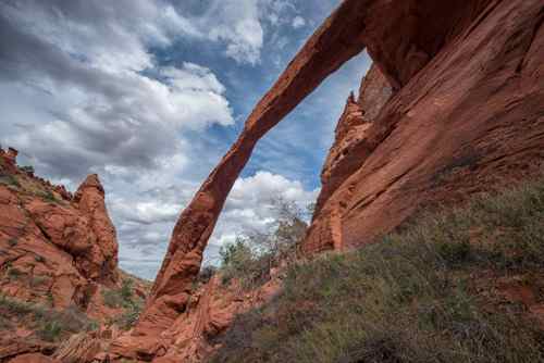
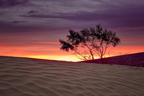
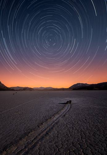
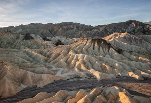
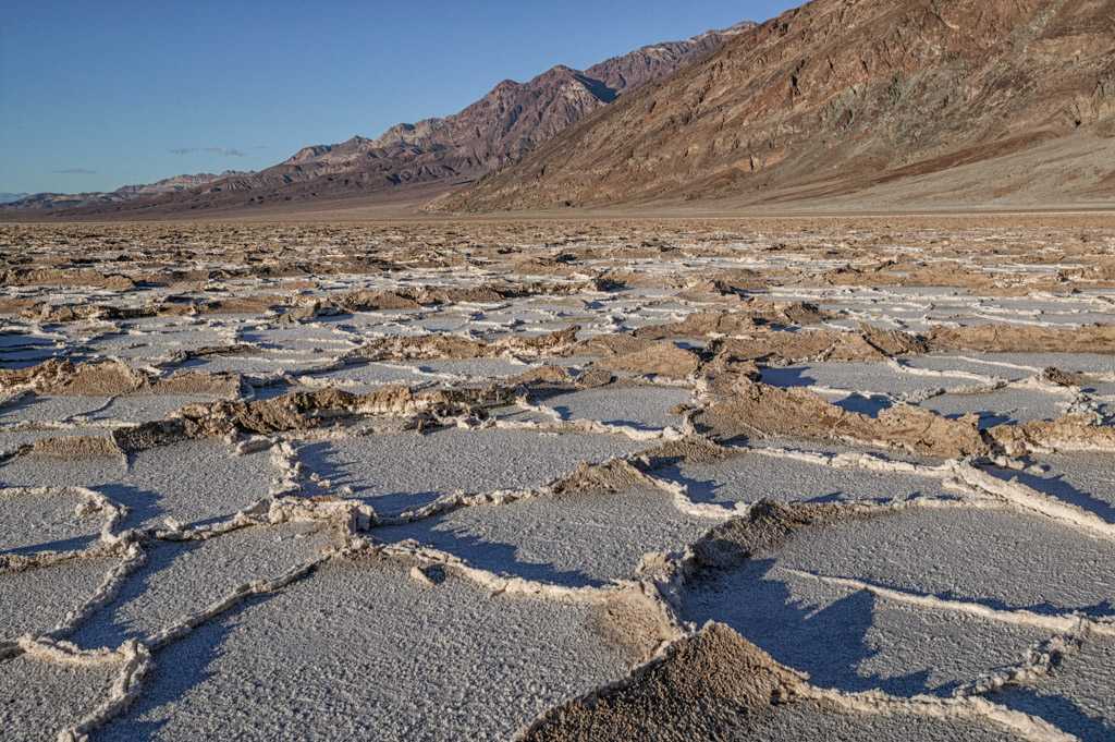
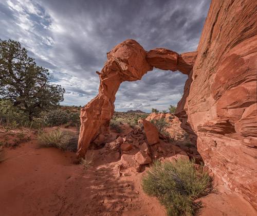
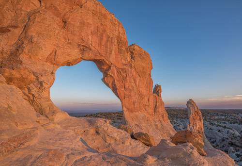
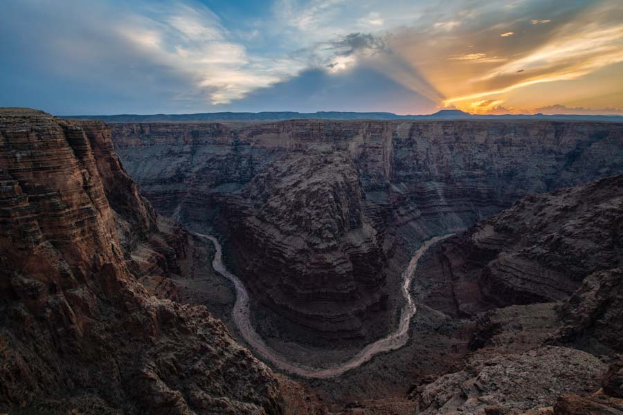
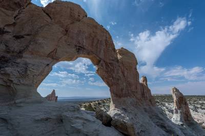
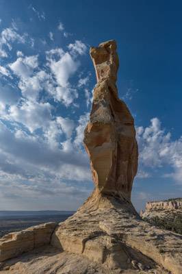
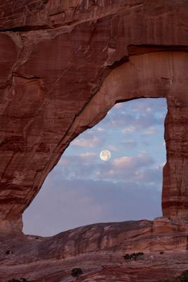
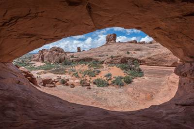
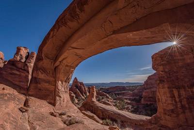
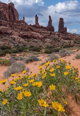
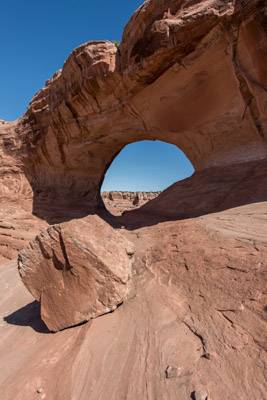
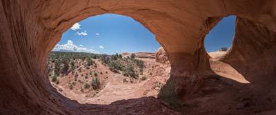
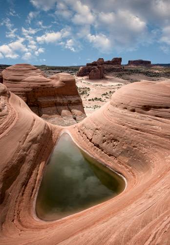
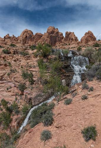
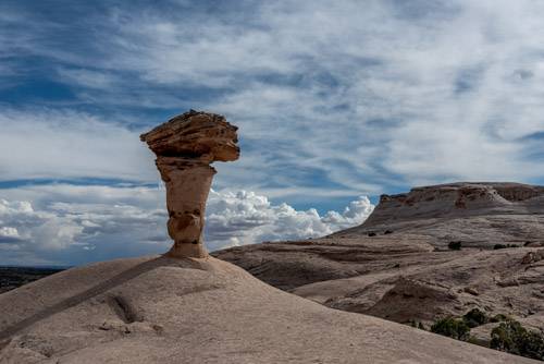

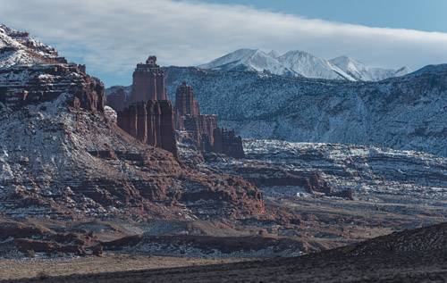
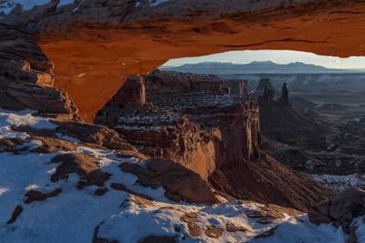
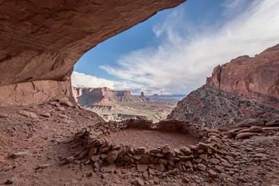
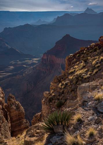
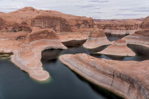
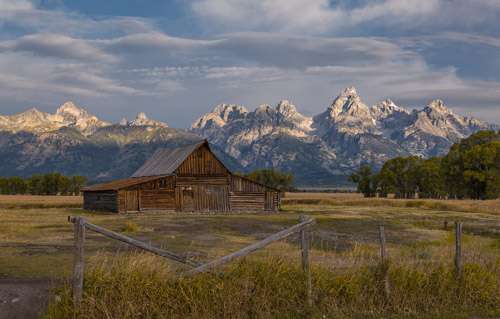
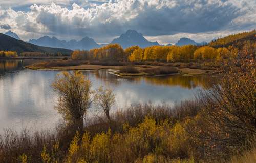
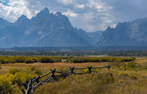
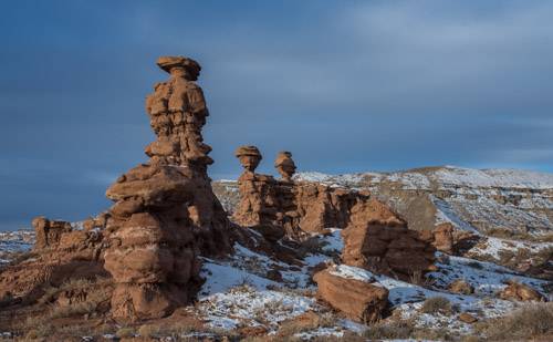
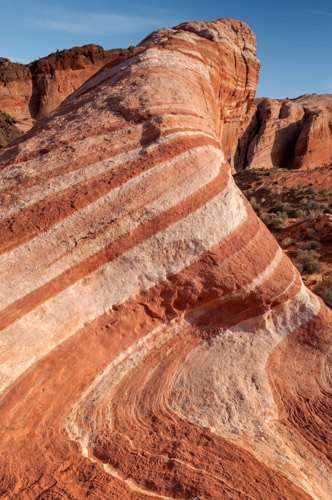
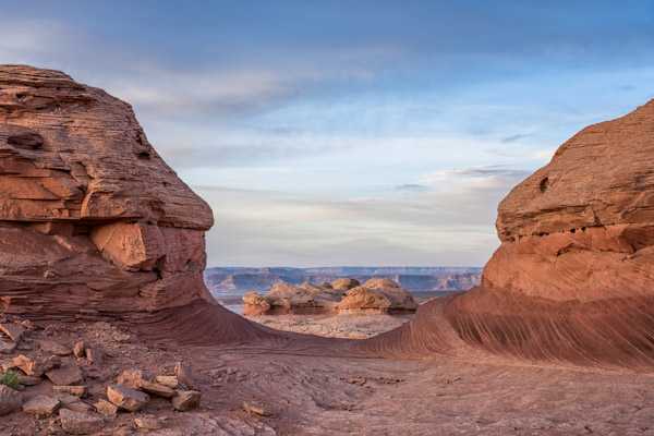

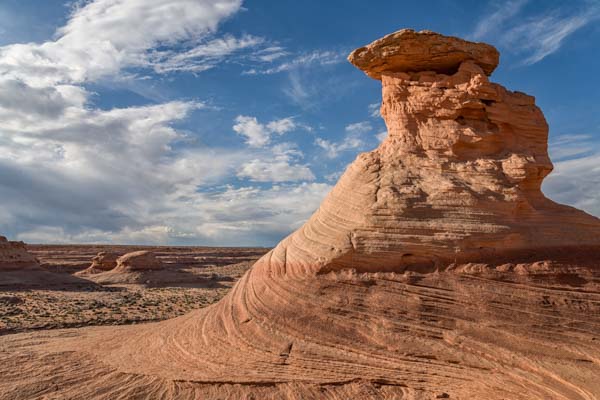
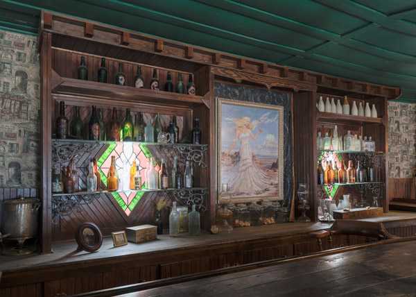
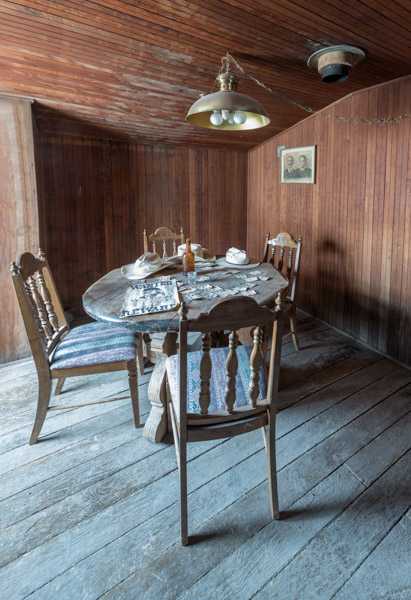

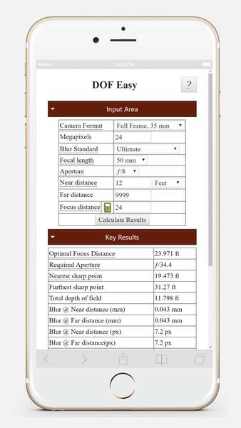
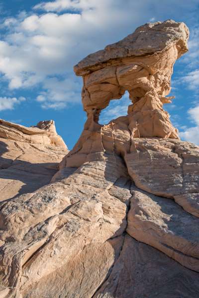
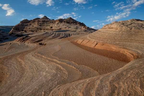
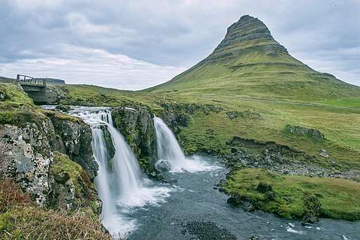


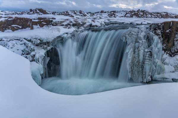
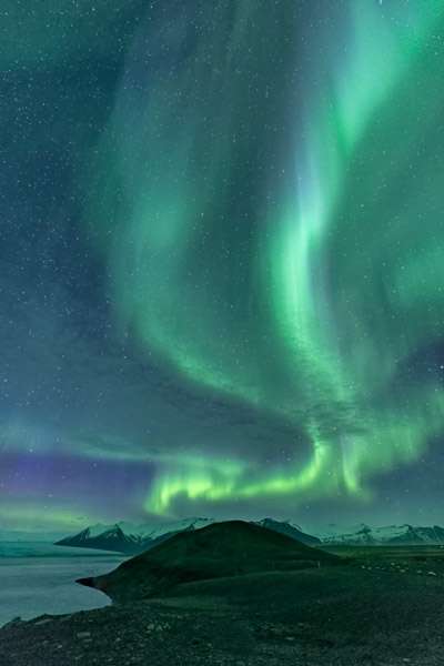
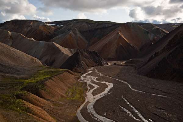
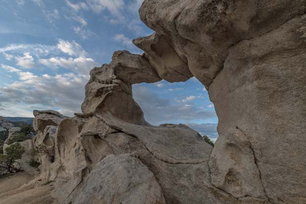
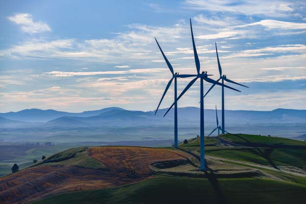
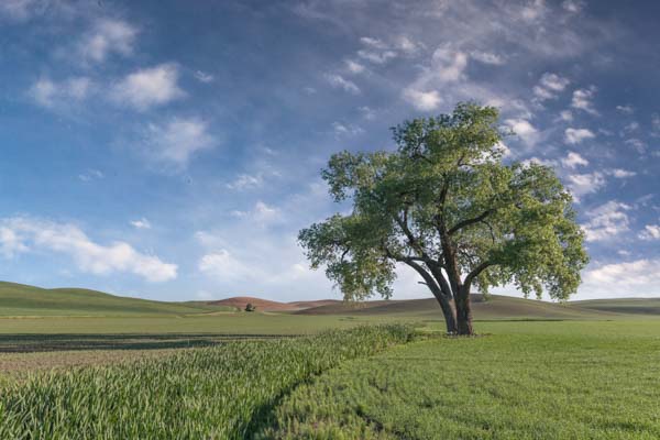
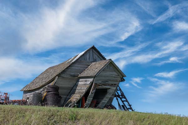
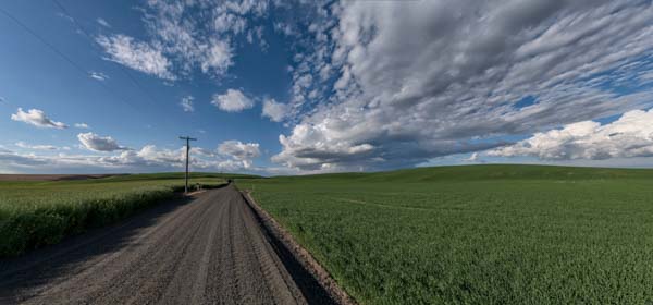

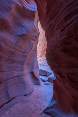
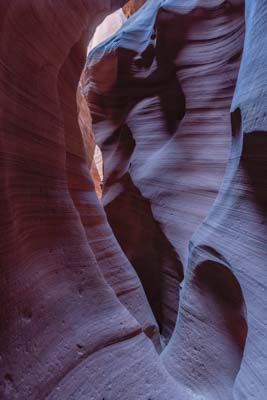
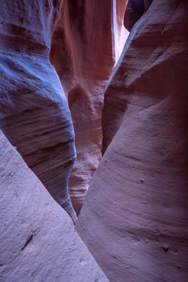
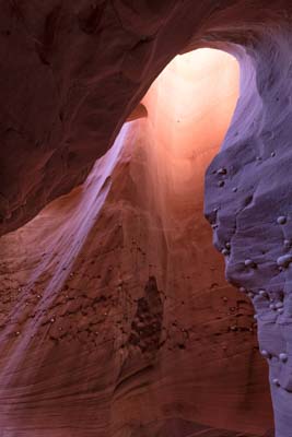
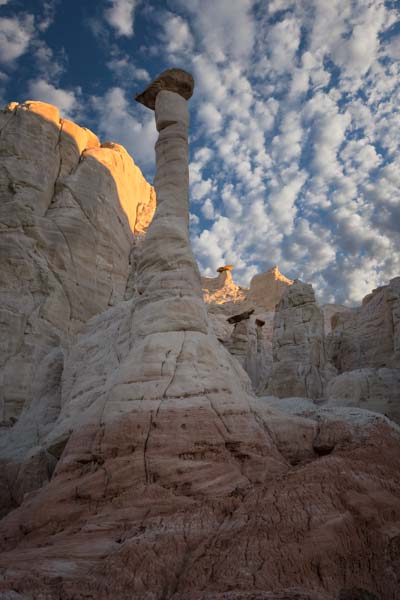
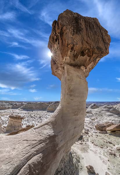
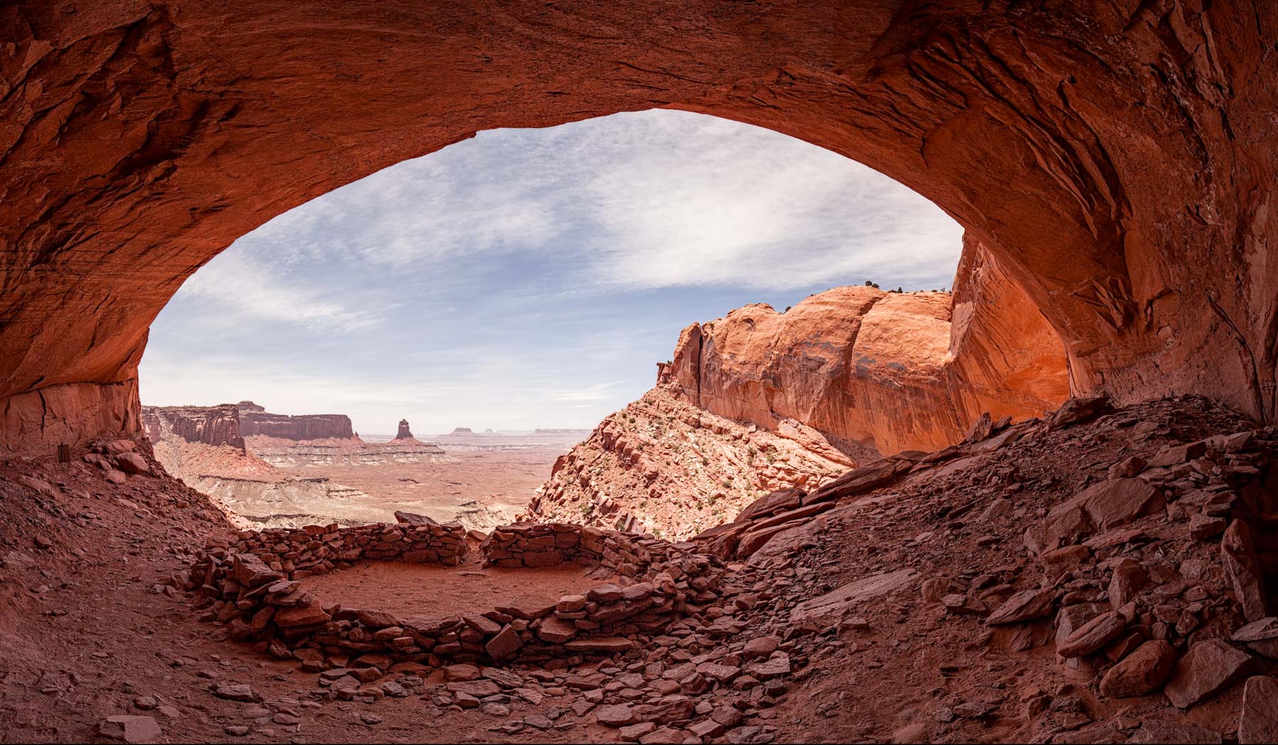

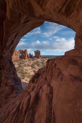
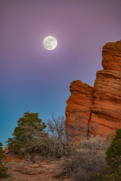

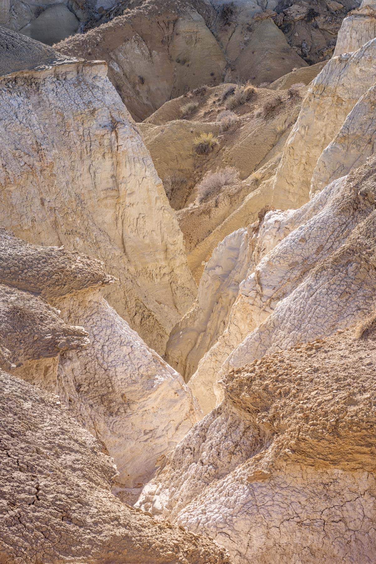

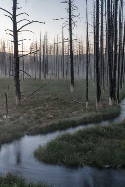
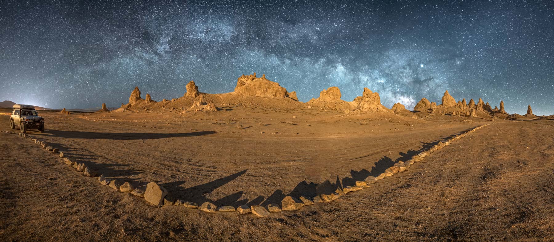

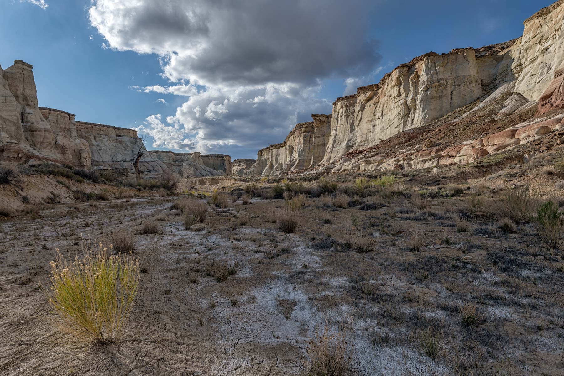
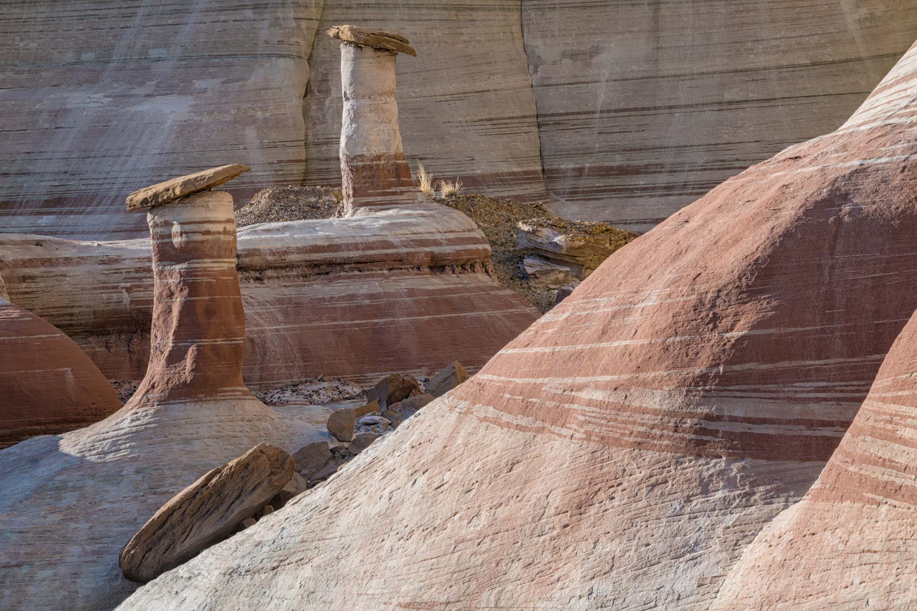
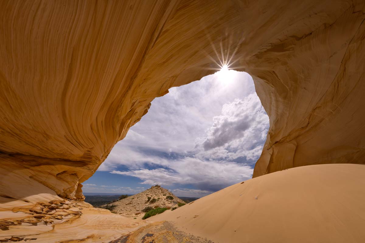
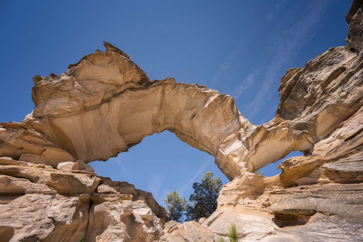
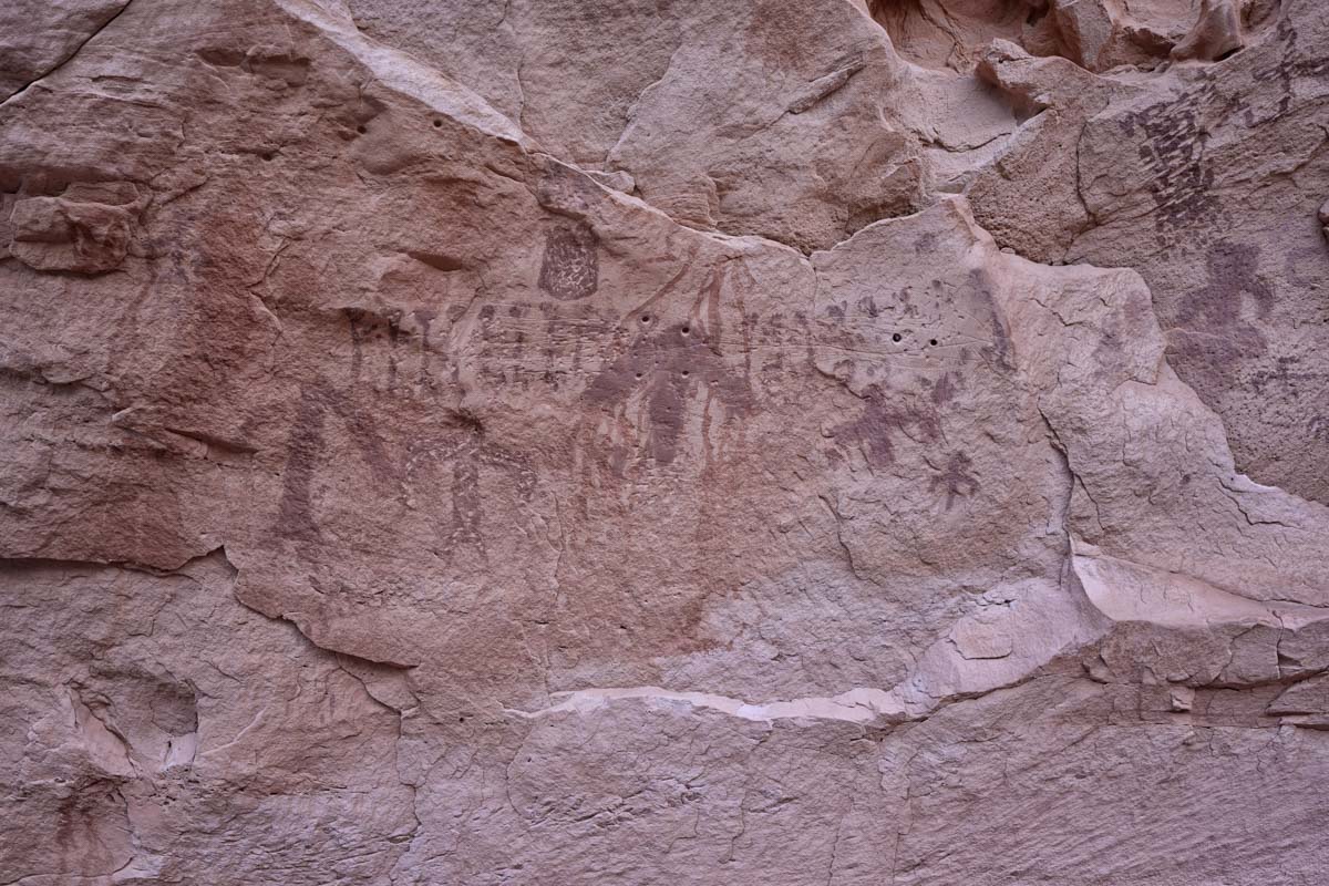
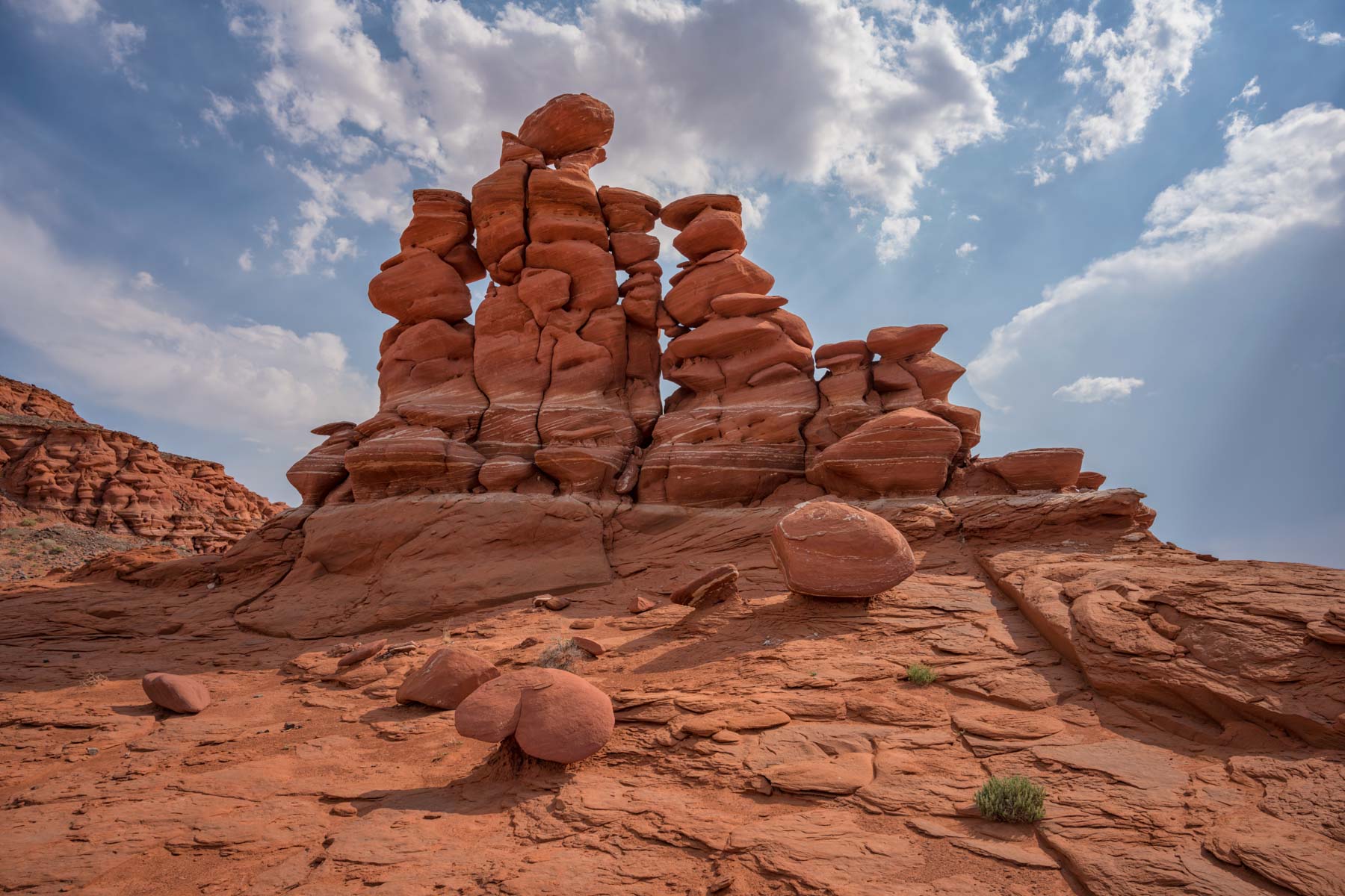
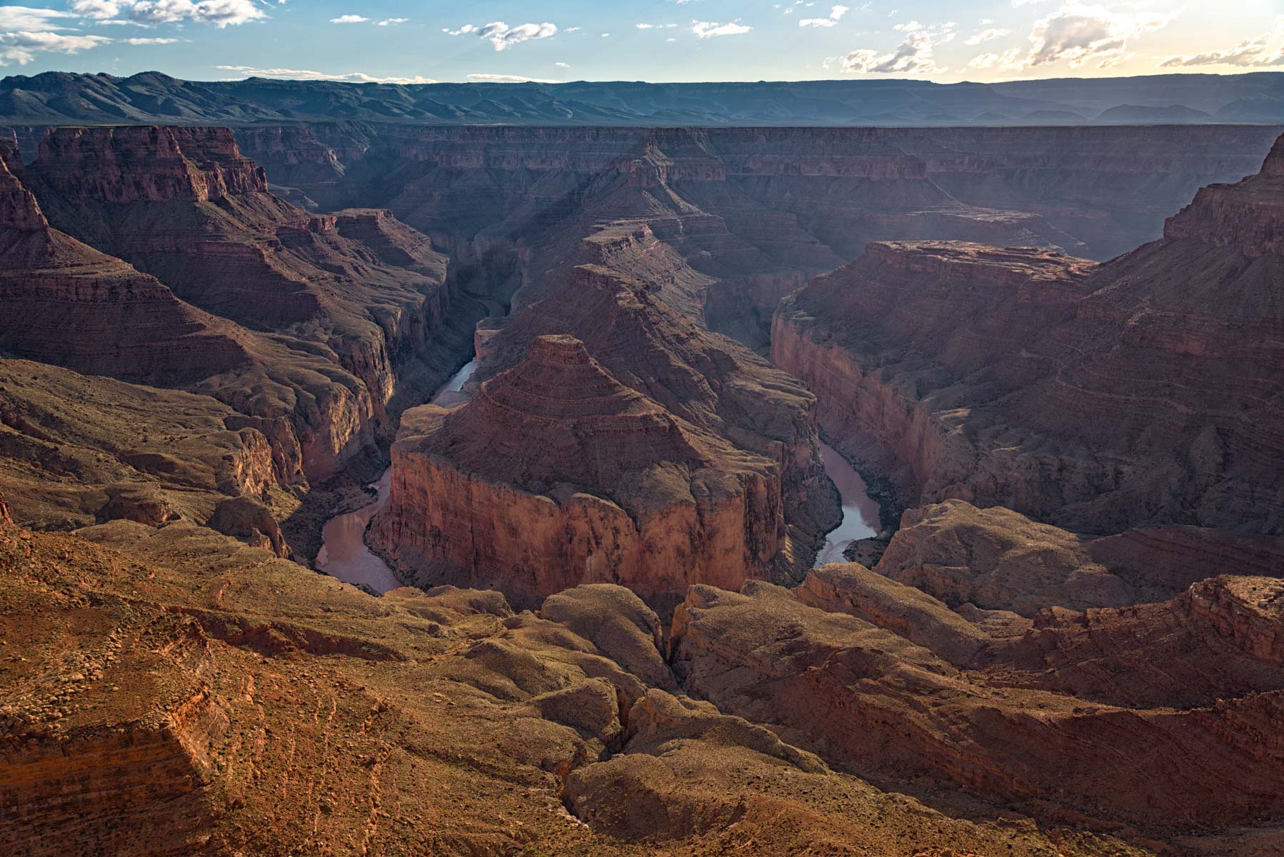
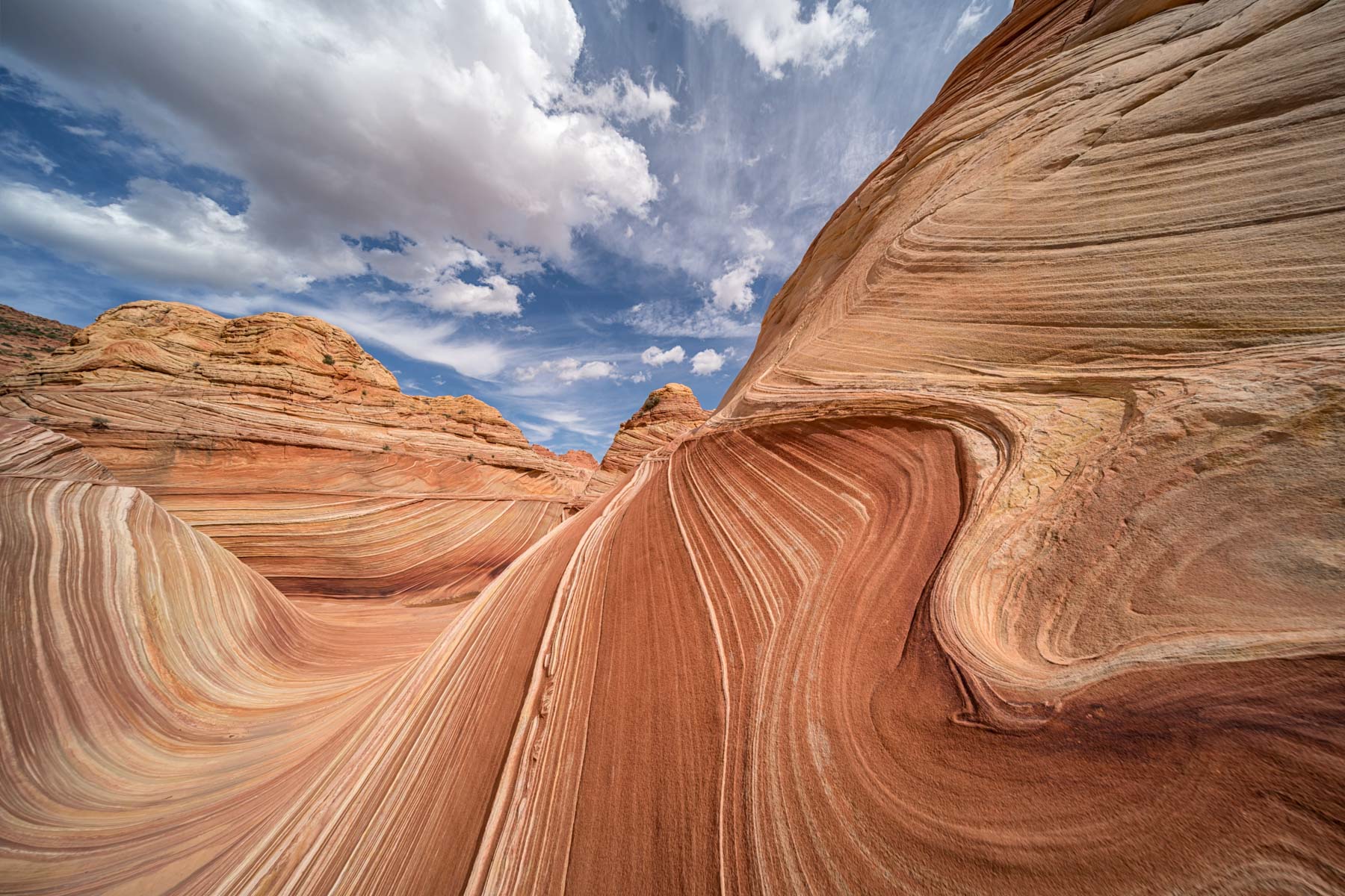
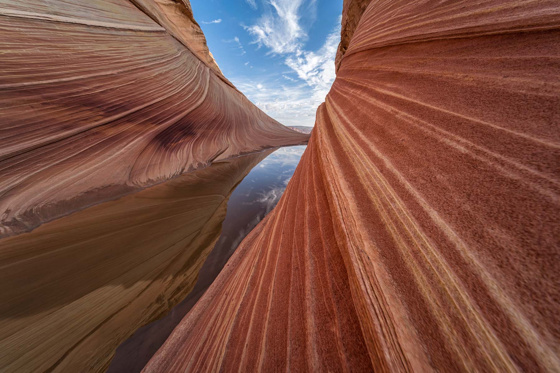
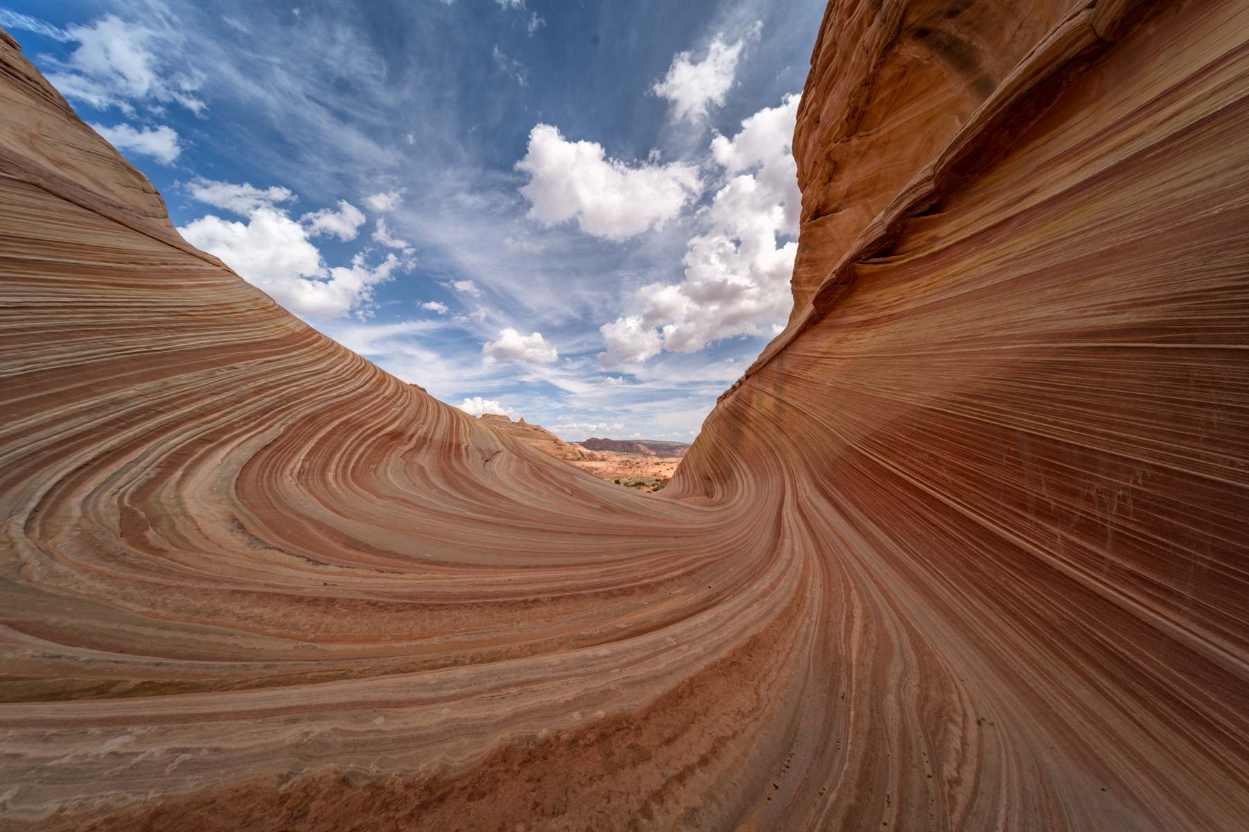
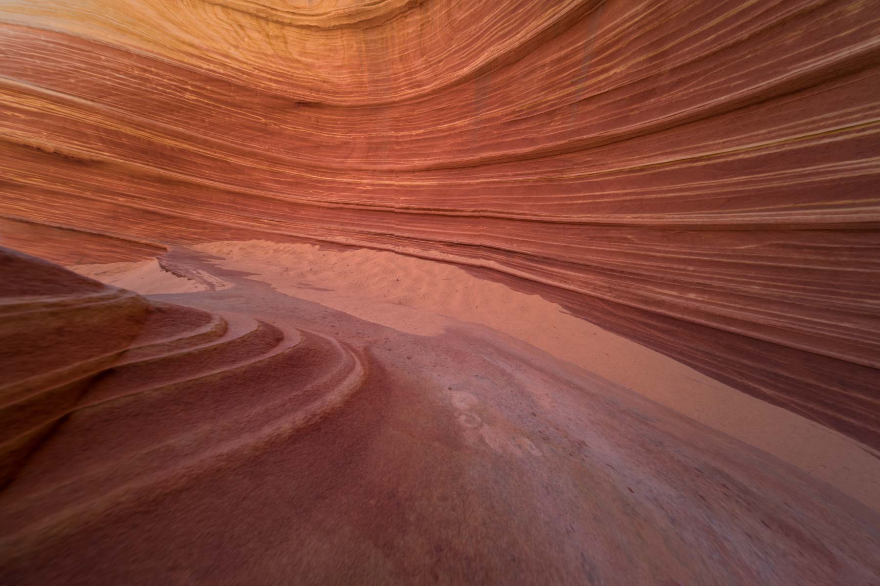
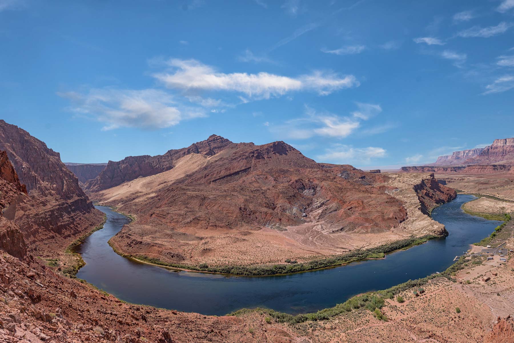
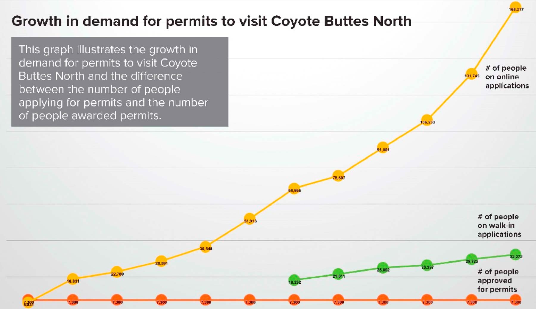


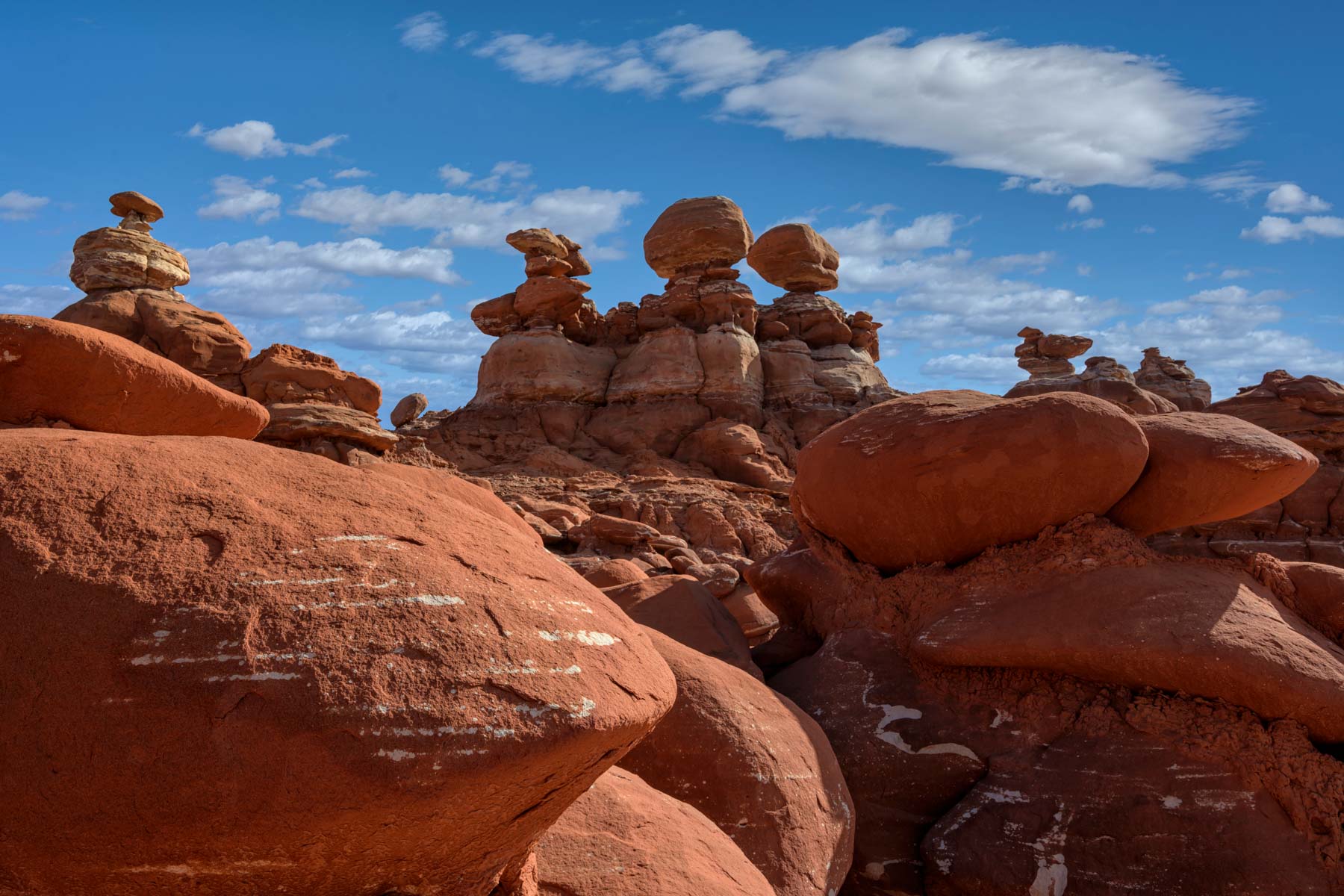
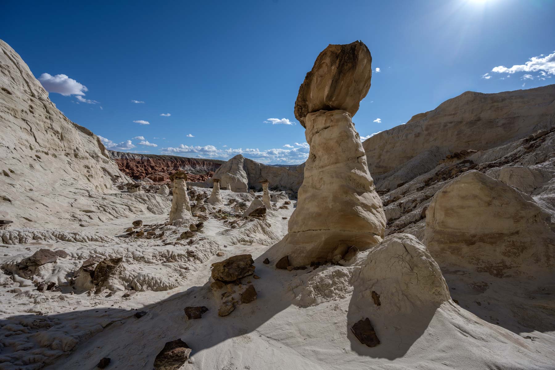

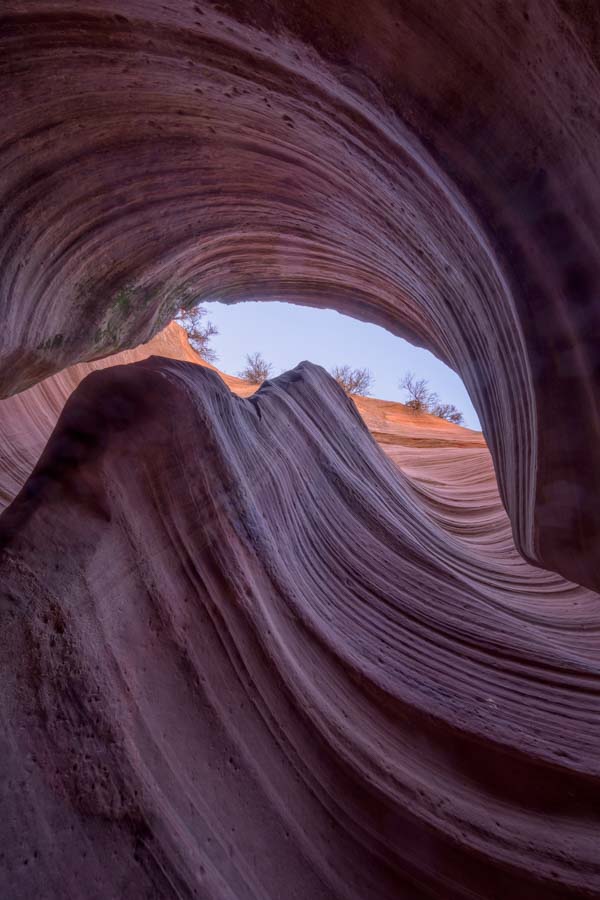
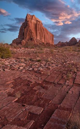
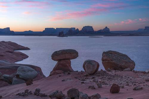
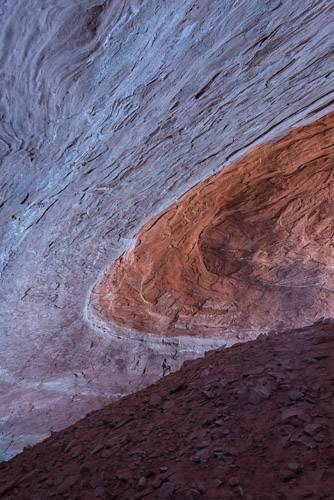
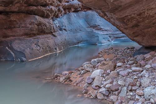
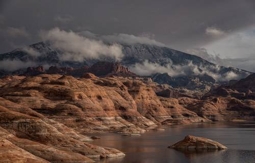
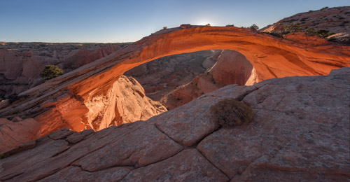
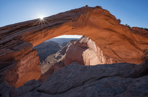
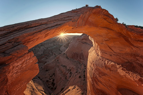
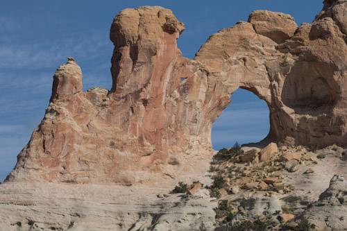
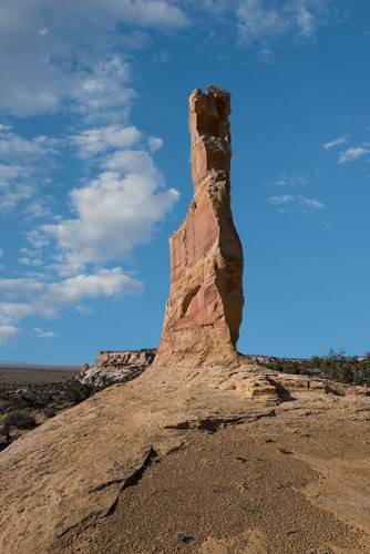
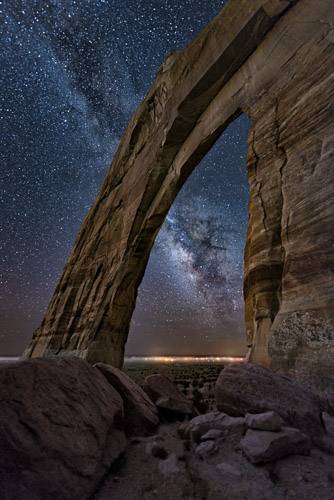
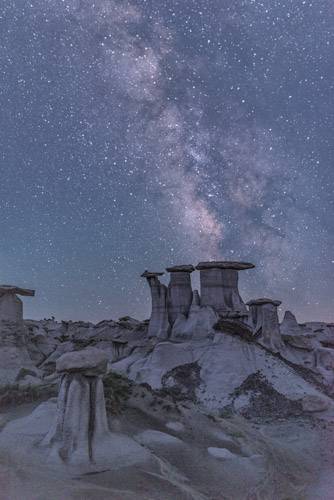
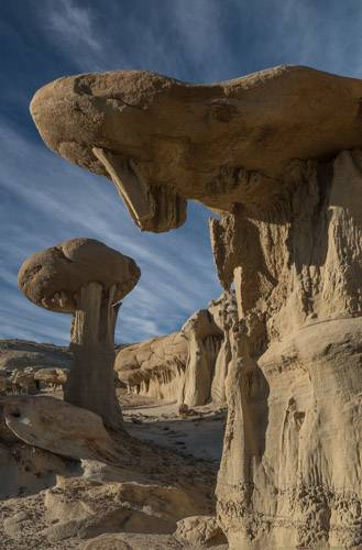
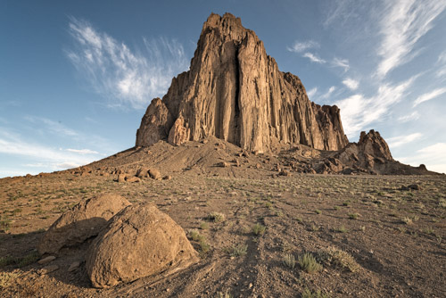
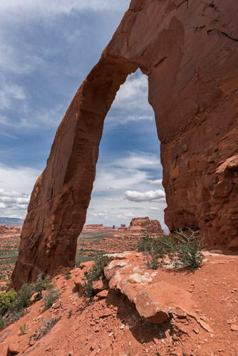
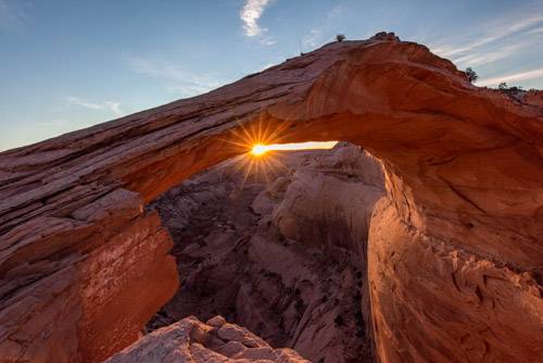
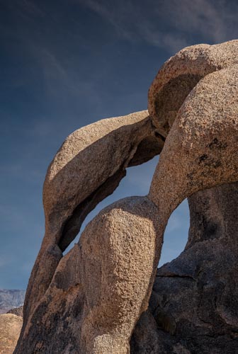
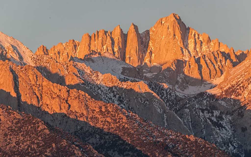
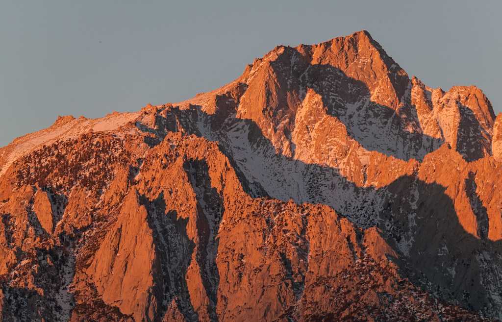
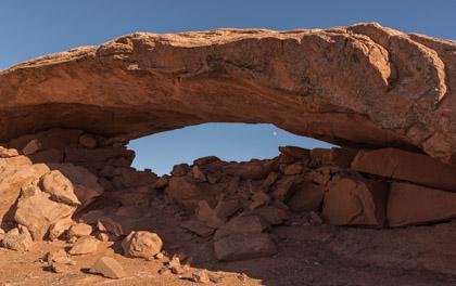
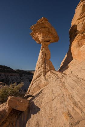
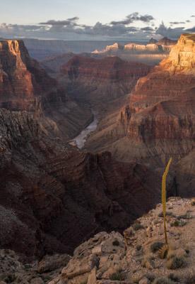
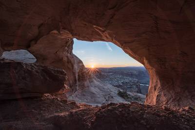
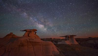
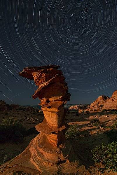
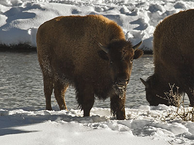
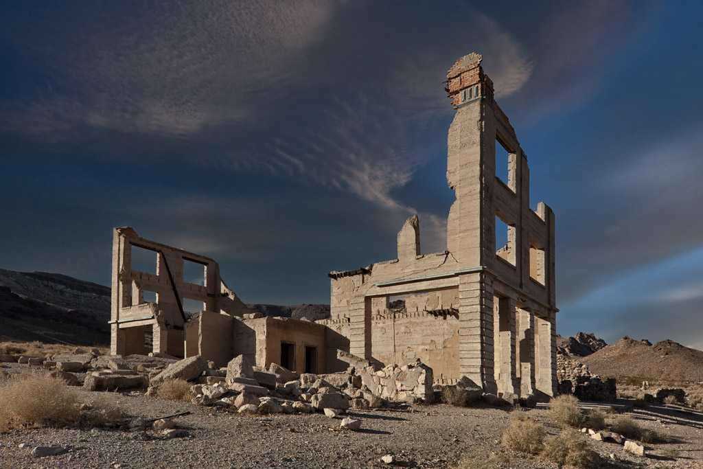
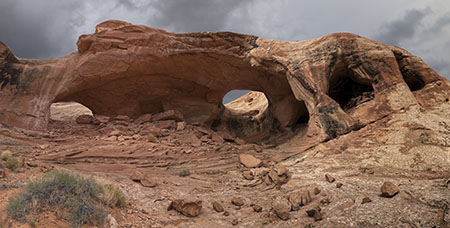
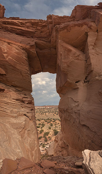