Capitol Reef National Park and Boulder, Utah
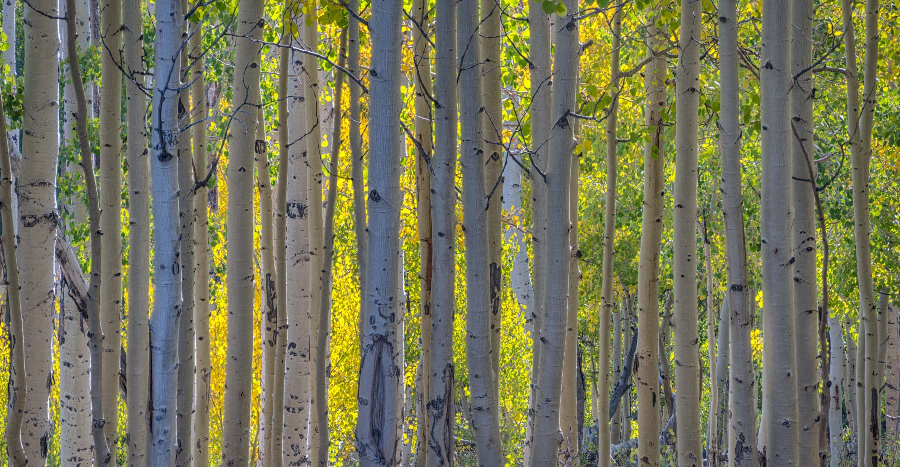
Capitol Reef is one of the least visited National Parks in the United States. Despite this, it and the surrounding area is a photographer's paradise, especially in the Fall when the Aspen, Cottonwoods, and Poplar are changing color. Aspen are found on Boulder Mountain which is about 15 miles south and a bit west of Capitol Reef on Highway 12. Highway 12 is often named as the most scenic highway in America and the drive over Boulder Mountain from Boulder Utah to Torrey is spectacular when the Aspen are changing. This usually occurs about the last week of September and can be short lived if there is an early snowfall or high wind. Cottonwoods and Poplar trees are found along Sulfur Creek and the Fremont River, and along the Dirty Devil river in Hanksville. The last week of October is a good time to catch them changing. Some of the areas to visit in the area include:
Highway 24 and the Scenic Drive

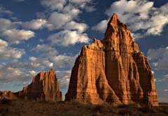
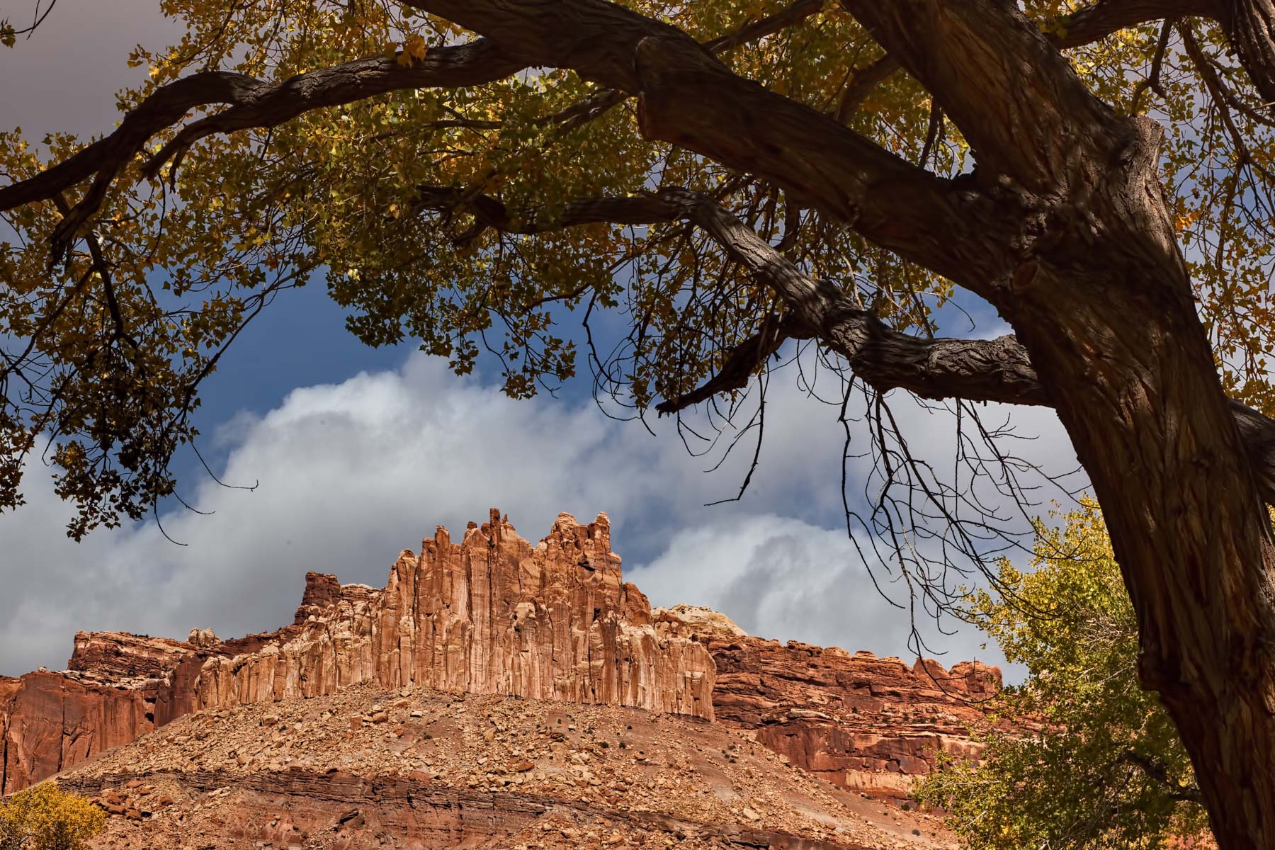
The Castle
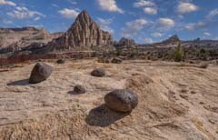
Pectol's Pyramid and Hickman Bridge
- Sulfur Creek and the Castle - are across from the visitor center. The Castle is best late October after sunrise. Sulfur Creek is good foreground for the castle.
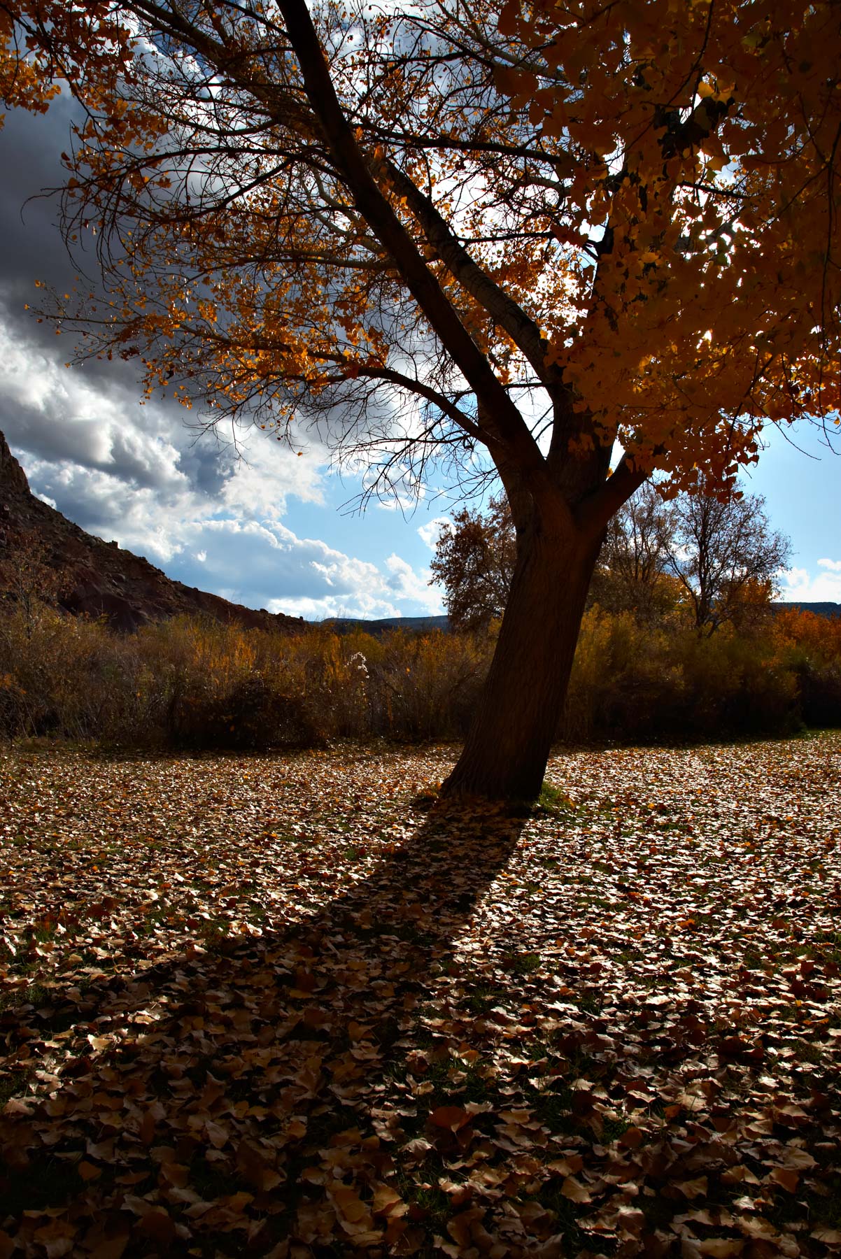
- The picnic area has many poplar trees and is very good in late October, mule deer are often present but shy.
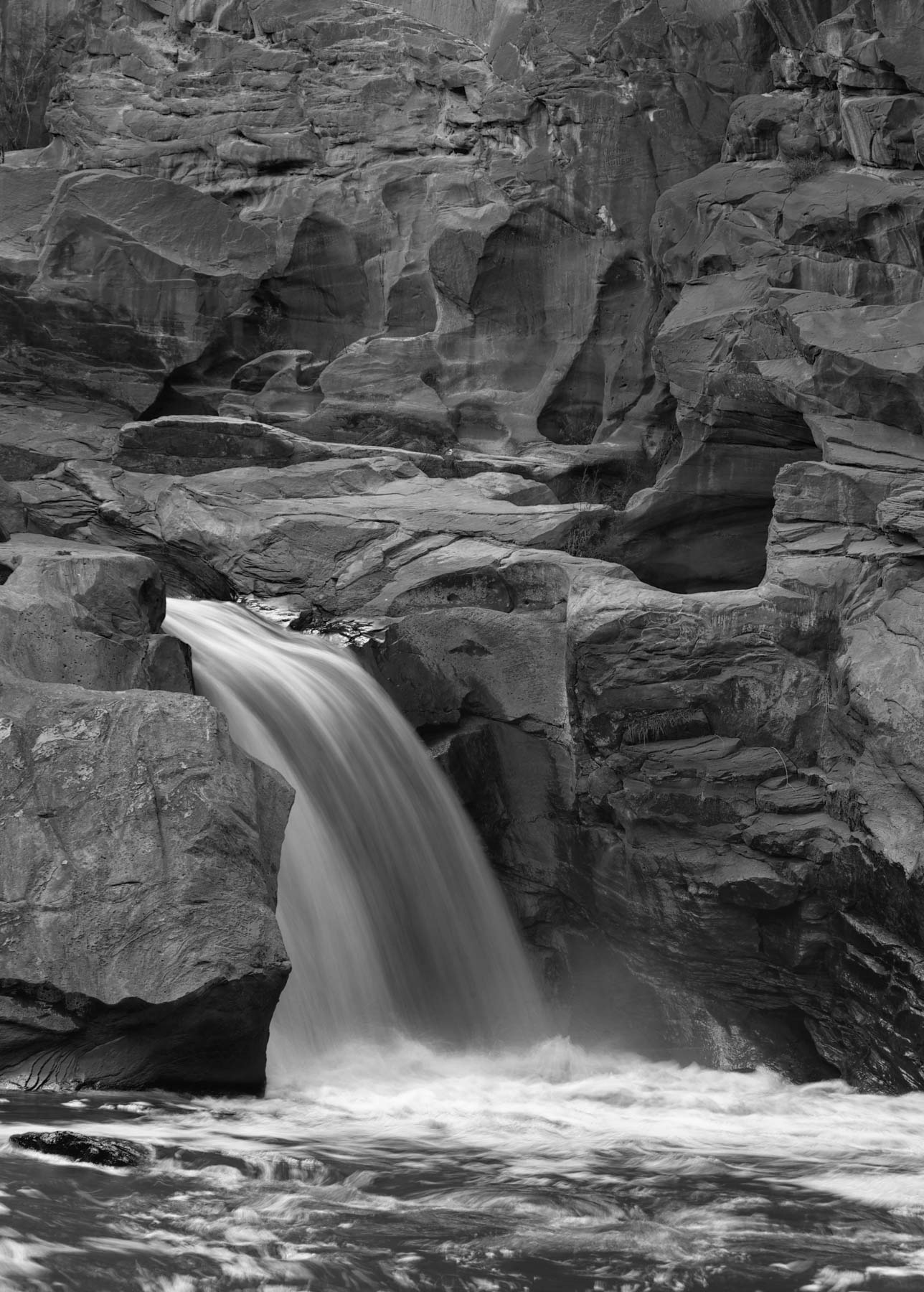
- There is a small waterfall on the Fremont River on the left just past Behunin Cabin on Highway 24. Park at Behunins' Cabin or at the pullout on the North side just east of Behunin Cabin marked by a sign that states no jumping, diving, ...
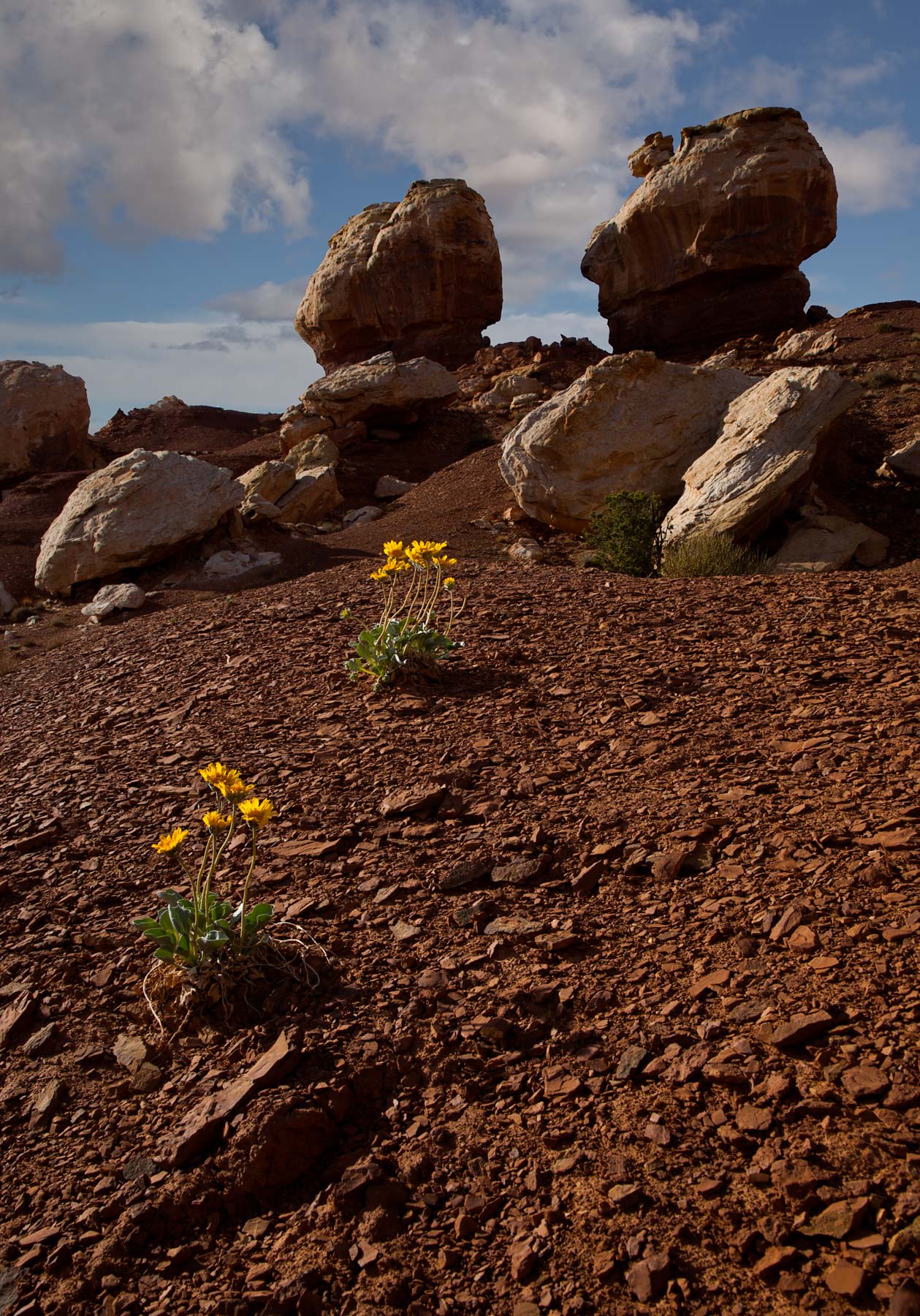
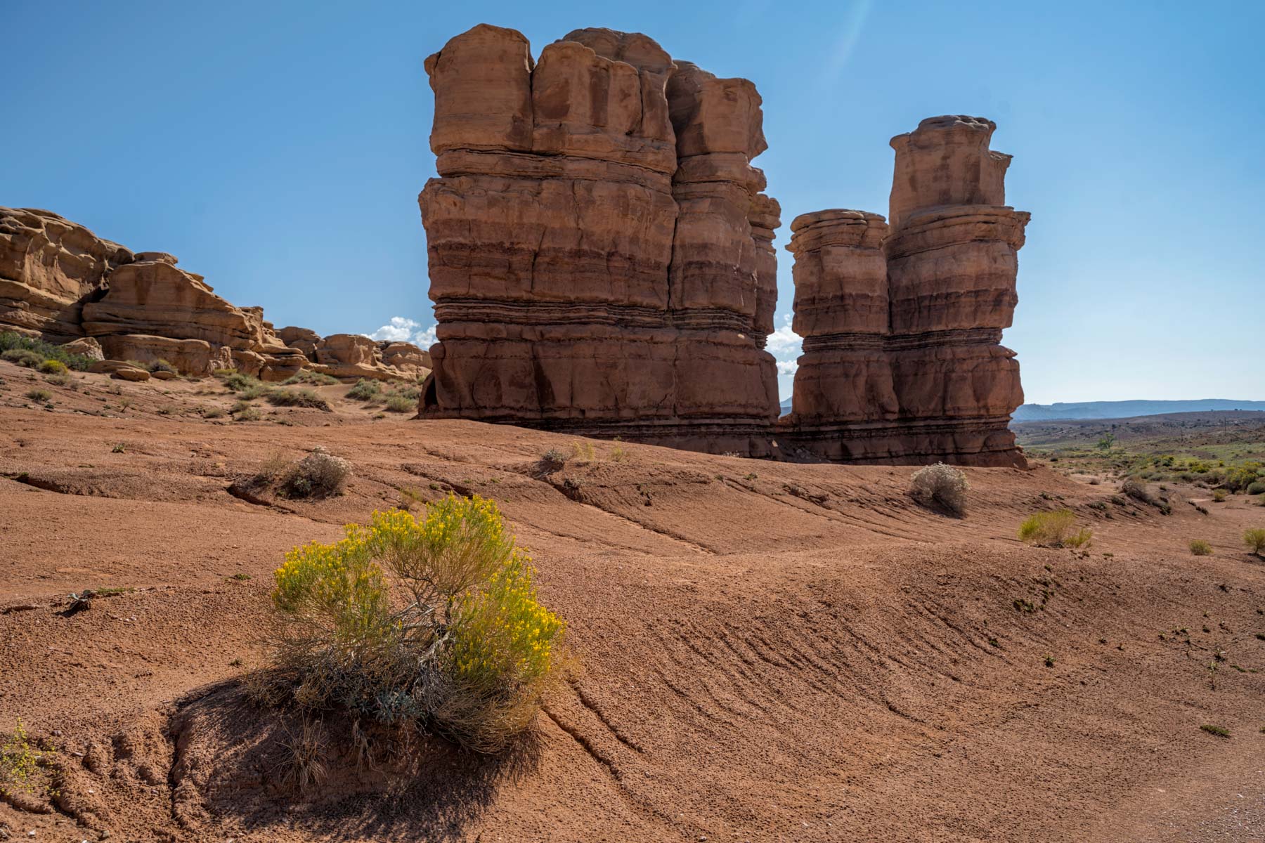
- The twin rocks near the west entrance on Highway 24 photograph well in the spring when there are wildflowers present. A good sunset shot.
- Panorama point near the West entrance at sunset.
- Pectol's Pyramid and Hickman Bridge - Both are accessed from the Hickman Bridge, Rim Overlook Trailhead on HIghway 24. Hickman Bridge opens west-southwest and is excellent at sunrise in the late fall and winter, I'm not sure if it gets light in the summer at dawn. ALternatively you can shoot s sunstar in the afternoon. Pectols Pyramis in just off the rim trail, the classic view is at 38.29128, -111.23055. Best in mid to late afternoon.
- Behunin's Cabin and the Fruita Schoolhouse - Behunin's Cabin is an okay shot at last light. Unfortunately the interior of the cabin is bare. The interior of the Fruita schoolhouse is definitely worth shooting. Press your camera to the window and use a dark cloth or jacket to elimiinate reflections. An ultra-wide is needed to capture the full interior. The schoolhouse opened in 1894. Last classes were held in 1941. Nettie Behunin was the first teacher at the school.
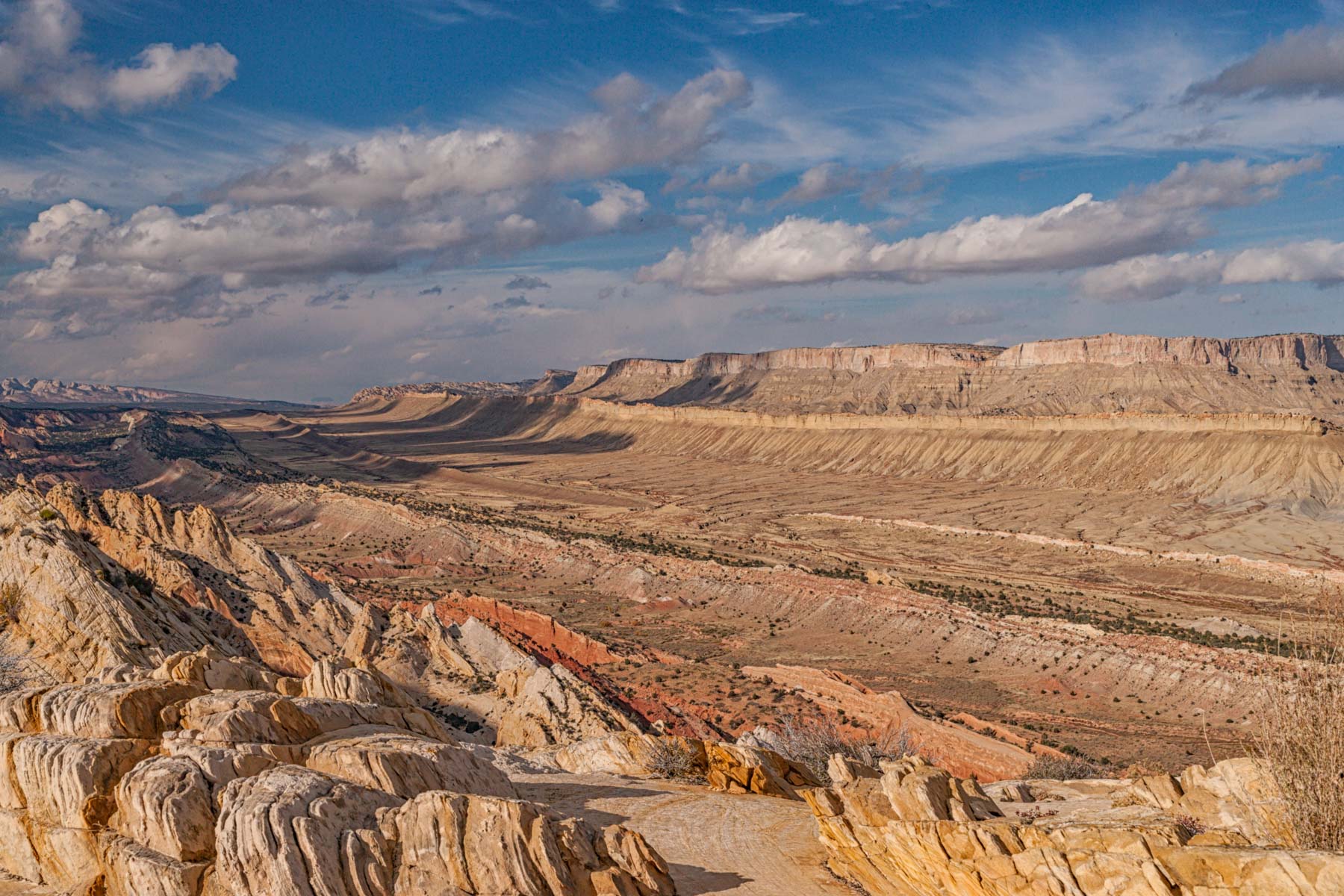
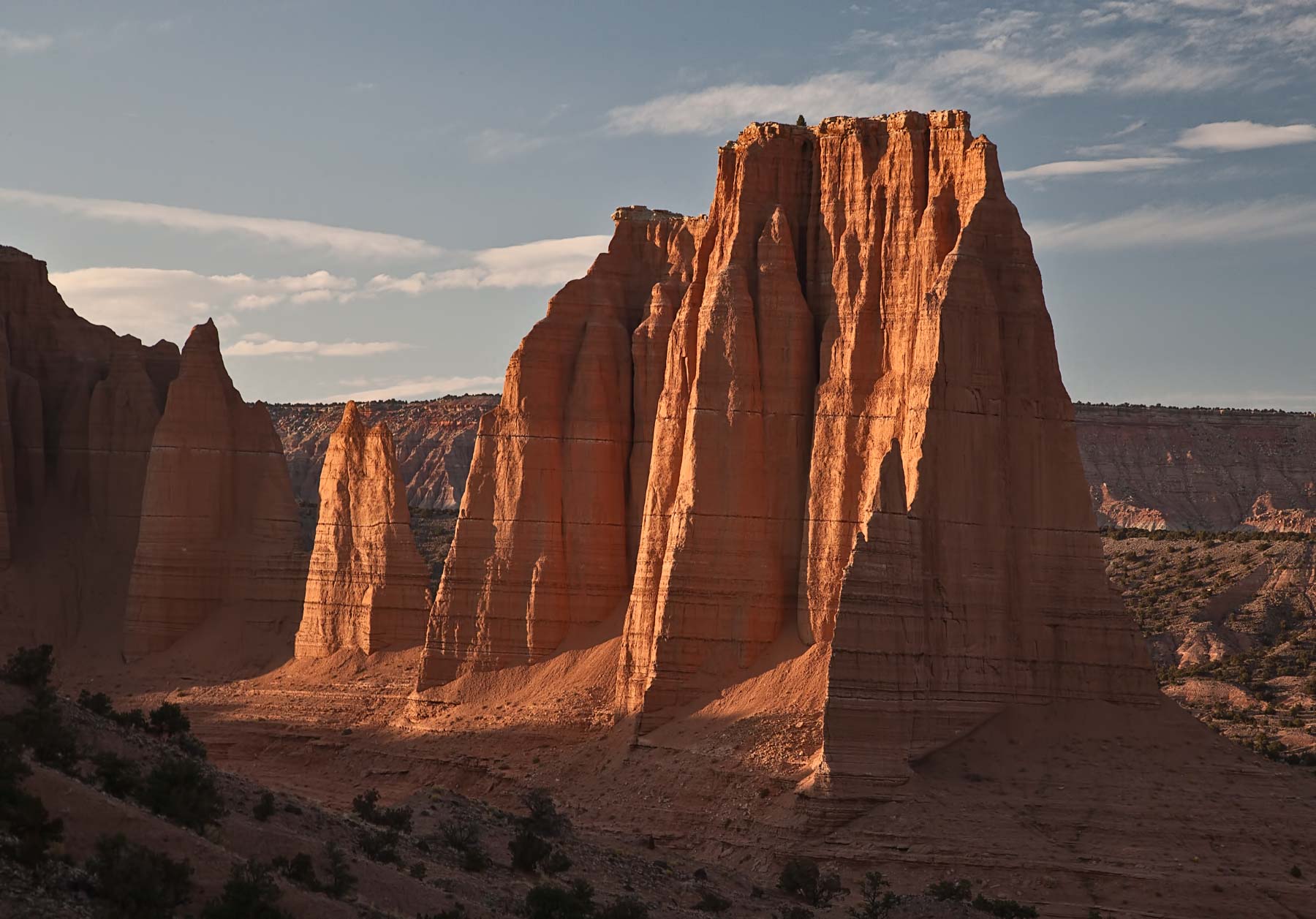
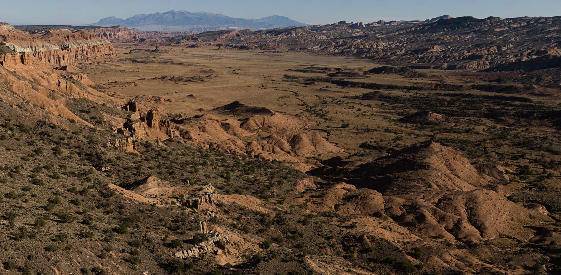
The Waterpocket District
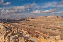
Strike Valley Overlook
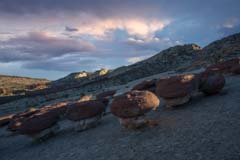
The Hamburger Rocks at Sunset
- The Hamburger Rocks are small dark capped hoodoos on an east facing slope just east of the Waterpocket Fold. They can be accessed from either the Post Trailhead or from Halls Overlook. The hike from Halls Overlook is about four miles one-way versus six miles from The Post trailhead but in my view is significantly more difficult as there is an 800 foot elevation gain at the end of the hike. The hike from Halls Overlook is nore scenic however. The rocks are best at sunset but sunrise also works. The Hamburger Rocks are also good at night under a full moon or to shoot the Milky Way to the southeast. If you plan to visit them I recommend you backpack rather than doing them in one day so as to catch the best light. Several backpacking routes are possible, from THe Post TH you can do an out and back via Halls Creek which is almost always dry or you can take The Post Cut-off trail to the top of the fold and then hike down Lower Muley Twist Canyon to the rocks. Return to the trailhead via Halls Creek.
- Halls Creek Narrows are a 3.8 mile slot canyon at the extreme southern end of Capitol Reef National Park. The narrows are very photogenic and are most safely accessed via a 22.4 mile backpack starting at Halls Creek Overlook. The narrows always have water in them and swimming may be required. THe National Park Service has a good description of the Halls Creek Narrows backpack.
- Upper Muley Twist
- There is a small waterfall on the Fremont River on the left just past Behunin Cabin on Highway 24. Park at the pullout on the North side just east of Behunin Cabin marked by a sign that states no jumping, diving, ...
- Lower Muley Twist - If you like photographing alcoves Lower Muley Twist is as good as it gets. There are two trailheads that provide access to Lower Muley, the first is on the Burr Trail at a small parking area @37.84719, -111.02677 jusr before the switchbacks, and the second at The Post.
- Panorama point near the West entrance at sunset.
- Strike Valley Overlook - off the Burr Trail three miles from the west end of the road (intersection of the Burr Trail and the Notom Bullfrog Road). The turnoff is about 30 miles from Boulder, Utah on the Burr Trail if you are coming from the East. Turn north off the Burr Trail, drive about 3.25 miles to the trailhead, and sign the register. This road is only passable to 4WD vehicles. From the trailhead, it is about .35 miles to the overlook.
Cathedral Valley
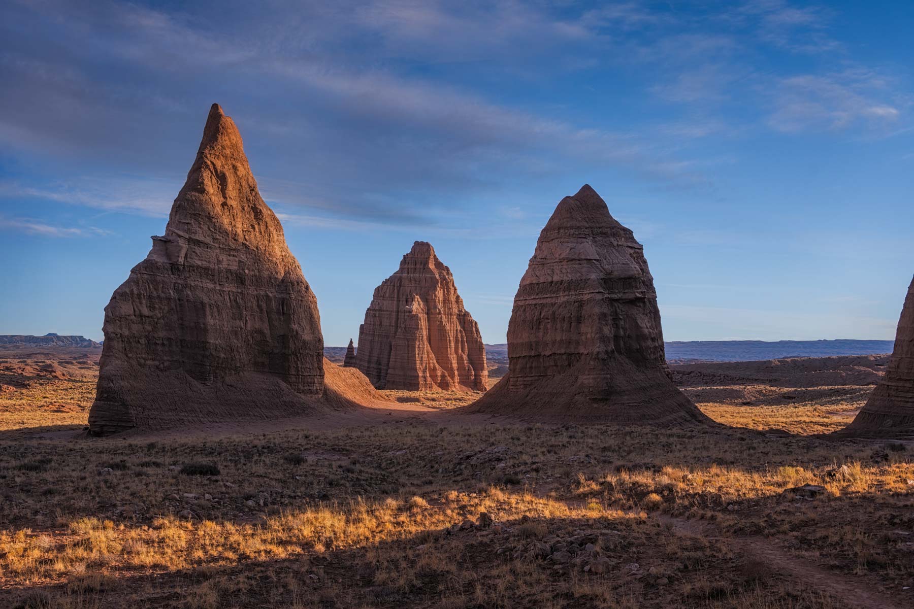
Temple of the Sun and Moon
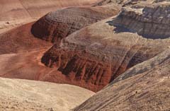
The Bentonite Hills
- Cathedral Valley is perhaps the most photogenic part of Capitol Reef. There are two access roads into Cathedral Valley from the South, and several from the North. Access from the North is via the Thousand Lakes region from I70 and will not be covered here despite being very scenic and worth exploring. Almost all visitors, and there are few, come in via the South. A 4WD vehicle is required to access the area. Cathedral Valley is accessed via a 60 mile long loop road from Highway 24. Allow at least four hours to travel the loop and probably a lot more. To complete the loop requires fording the Fremont River. Water levels in the Fremont are usually less than a foot and the ford is normally not difficult. You should ask about conditions at the Visitor Center in Capitol Reef before attempting it. The crossing is 2.7 miles from the east boundary of Capitol Reef on Highway 24 and is clearly signed. It is recommended that if you drive the loop road you start with the river ford so that if there are any problems you find out about them immediately rather than driving 60 miles and having to return the same way you came. The other southern access is via Caineville Road which intersects Highway 24 9.3 miles from the east boundary of the park (18.6 miles from the visitor center). Most of Caineville road is on BLM land and you can freely car camp overnight along the road. To car camp within Capitol Reef NP you must park in a designated campground.
- Temple of the Sun and Moon - if you are not driving Cathedral Valley's full loop, the easiest access is via Caineville Road. Drive 15.3 miles from the intersection of Caineville Road and Highway 24 and turn left onto the signed dirt road. Temple of the Moon is about 2 miles down this road. Park just before it so your car is not in your pictures. The temples photograph best in the morning. The best time of year is around the spring or fall solstice, when sunlight will hit them earliest. At dawn, they take on a wonderful red glow. If you are photographing both "temples" I suggest walking 100 yards south of Temple of the Moon before shooting. Doing so will make the Temple of the Sun more prominent. Otherwise, it will appear very small in your picture despite being taller than the Temple of the Moon. The shot of both temples is almost due North, so this is a good "star trails" location. If you intend to shoot at dawn, you can either drive Caineville road in the dark, plan for at least an hour to do this, or car camp anywhere on Caineville Road. You cannot camp at the temples themselves since they are within the national park where camping is permitted only in designated campgrounds. If you plan to shoot both temples in the evening, you need to be there a few hours before sunset, otherwise, one temple will be in shadow. Glass Mountain is nearby. I find it uninteresting from a photographer's perspective..
- Upper Cathedral Valley Overlook is a good evening location and is 30 miles from the river ford. A short hike is needed to get to the overlook. Best a bit before sunset, you can camp at the NPS Cathedral Valley campground - pit toilets, no fee, no water. Six sites are available, first-come, first-served. It is improbable the sites would ever fill.
- South Desert Overlook is an evening location 27 miles from the river ford.
- Bentonite Hills is a great location 9 miles from the river ford. It photographs best a few hours after sunrise or before sunset, otherwise they are in shadow. If there is heavy rain, the road at the hills is impassable, and you will have difficulty walking on the clay-based soil.
National Park Service Map
Below is the official Capitol Reef National Park map as a jpeg and in three geocoded formats, (GeoTIFF, KMZ file, Oruxmaps). The official park map as a PDF can be found here.
- Click to download a Hi res Jpeg file. File is not geocoded.
- Click to download a GeoTiff file viewable in PDF Maps
- Click to download a KMZ file viewable in Google Earth
- Click to download an Oruxmap file (Note - in IE Right Click and choose Save Target as)
Google Map of Capitol Reef
To view the map in Google Maps please click anywhere on the map above.
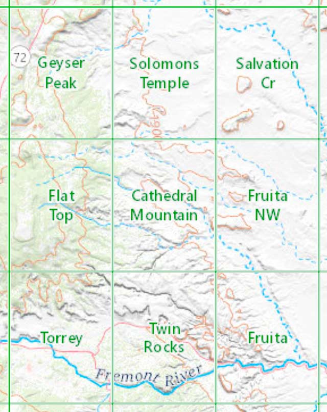
USGS 24K Topo Maps
Capitol Reef and the surrounding area is covered by 27 topo maps. Due to the size of the park I've provided two distinct merge maps of the area, one for locations generally north of Highway 24, and one for locations south. I suggest you download both if you plan to hike in the park extensively. Here are the maps included in each.
Capitol Reef North Index Map
Capitol Reef South Index Map
The maps can be downloaded in a variety of formats by clicking or right clicking in the table to the right (or below):
East of the Park
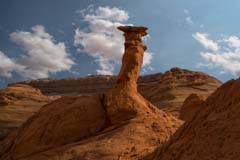
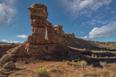
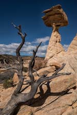
Pedestal Alley
Burro Wash Arch
- Burro Wash Arch is a photogenic arch just east of the Waterpocket District. The arch is best shot at sunrise. To access the arch: Take the Notom Bullfrog Road 7.8 miles south from its intersection with Highway 24. Park at the Burro Wash pull-off on the right side of the road. Follow the Burro Wash trail west for 0.7 miles and leave the wash where a drainage comes in from the right. Take the drainage 0.3 miles to the arch. You may want to visit the Burro Wash slot canyon on the same hike. From the arch, continue back to the Burro Wash Trail and follow it for 2.3 miles until its end. Expect challenging scrambling and water once in the slot.
- The Notom Twin Rocks are conveniently just off the Notom Bullfrog Road 0.7 miles south of Burrow Wash trailhead parking. Unfortunately, they are best shot mid to late afternoon, and the arch is best at sunrise. You can fill in the time by following Burro Wash until it slots up and becomes impassable. Alternatively, if you drive the Notom Bullfrog Road in the afternoon, stop for a few minutes to shoot the twins.
- Pedestal Alley is a collection of hoodoos near the Bullfrog Marina at the park's southern end. The hoodoos are as photogenic as those in the better-known Toadstool Hoodoo area. They get far fewer visitors because of the remote area they are in. You are likely to have them to yourself, especially now that the Bullfrog Marina area is closed due to the low water level in Lake Powell. To access the hoodoos from the intersection of Burr Trail and the Notom Bullfrog Road, take the Burr Trail south for 39.5 miles to an unmarked parking area on the right side of the road at 37.5977, -110.77978. The parking area is 0.3 miles past Buffrog Creek. After a heavy rain, Bullfrog Creek may be impassable. In this case, take 95 and Utah 276 south from Hanksville to the trailhead. From the parking area, cross the road and walk east 200 feet to the trailhead. Follow the cairned trail 1.6 miles to its end at "The Big Hoodoo ."There are many other photogenic hoodoos in the area. See the Google map below for locations.
- Due to road closures on my last visit to the area, I have not yet visited the badlands east of the Burr Trail. Based on what I have seen while driving below them on the Burr Trail, they should be spectacular at sunset. You can access them from the Burr Trail via BLM 13000, the Eggnog Star Springs Road. This is a rough 4WD road. If you plan to shoot the badlands, I strongly suggest you call the BLM in Hanksville at 435 542-3461 to get current road conditions.
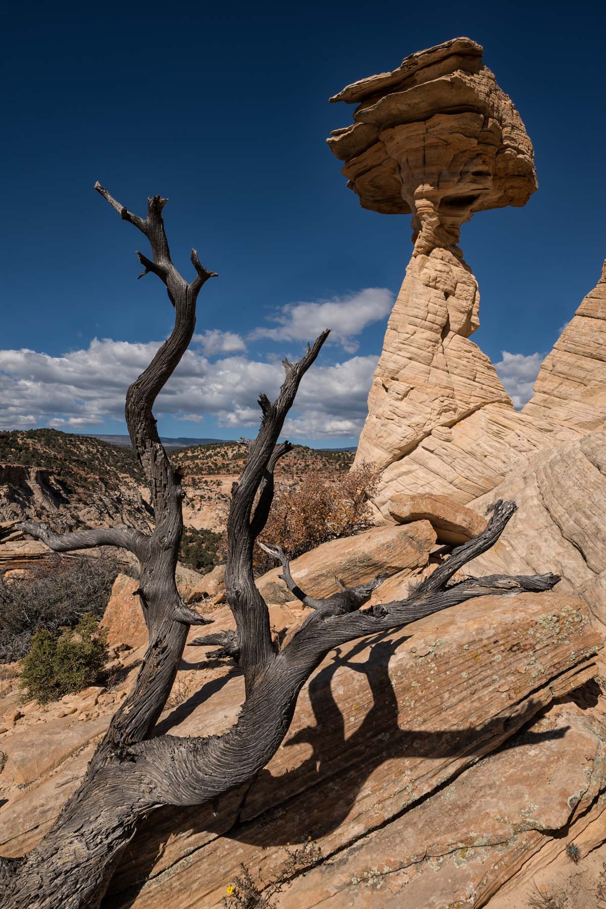
Balancing Rock
West of the Park
Boulder Town has a spectacular hoodoo called "Balancing Rock" about one mile west of town near Highway 12. The hoodoo can be seen from the highway; look north. It is best photographed near sunset. The hoodoo can only be shot from its south and west sides; there are cliffs to the north and east. Balancing Rock is on BLM land. To get to it, you must cross US Forest Service or privately owned land. There is a no trespassing sign on the land west of the hoodoo near Highway 12. No one was present on the two times I was there. To get to Balancing Rock, park as shown on the map below, cross the barbed wire fence wherever you can, and hike north about .35 miles to your destination.
Here is a map showing the track I took to the hoodoo:
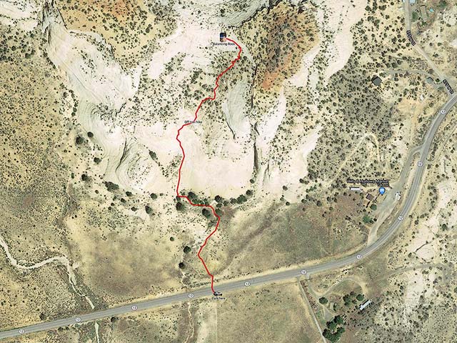
To view the map in Google Maps, please click anywhere on the map above.
- Click to download a KML file of the entire area (Note - in IE Right Click and choose Save Target as)
- Click to download a GPX file of the entire area (Note - in IE Right Click and choose Save Target as)
Balancing Rock is clearly labeled on the USGS 24K topo map Boulder Town, available below.
Boulder Mountain has a great many lakes accessed from spur roads off of Highway 12. In late September, when the Aspen are changing, the views from Highway 12 as it crosses the mountain are wonderful. Snow as early as mid-September is possible, but the road is regularly plowed and is normally open throughout the winter. You can also access the Boulder Mountain area via the South Draw Road, which runs from the end of the paved section of the Scenic drive to Highway 12. Both ends are signed "Pleasant Creek". This road can be difficult even for 4WD vehicles and is closed in the winter. The town of Boulder is a good place to stay in the area; Boulder Mountain Lodge and Hell's Backbone Grill are both excellent, though pricey - reservations are needed at both well in advance for the lodge. The town of Boulder is midway between Capitol Reef and the Escalante National Monument.
Boulder Town Index Map
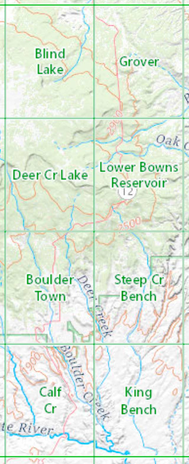
USGS 24K Topo Maps for the town of Boulder and vicinity can be downloaded in a variety of formats by clicking or right clicking in the table to the right (or below):
| Geo Tiff/Avenza | KMZ | Oruxmaps | KMZ Decollared | Oruxmap Decollared | Avenza Decollared |
| Blind Lake | KMZ | Oruxmap | KMZ Decollared | Oruxmap Decollared | Avenza Decollared |
| Boulder Town | KMZ | Oruxmap | KMZ Decollared | Oruxmap Decollared | Avenza Decollared |
| Calf Creek | KMZ | Oruxmap | KMZ Decollared | Oruxmap Decollared | Avenza Decollared |
| Deer Creek Lake | KMZ | Oruxmap | KMZ Decollared | Oruxmap Decollared | Avenza Decollared |
| Grover | KMZ | Oruxmap | KMZ Decollared | Oruxmap Decollared | Avenza Decollared |
| King Bench | KMZ | Oruxmap | KMZ Decollared | Oruxmap Decollared | Avenza Decollared |
| Lower Bowns Reservoir | KMZ | Oruxmap | KMZ Decollared | Oruxmap Decollared | Avenza Decollared |
| Steep Creek Bench | KMZ | Oruxmap | KMZ Decollared | Oruxmap Decollared | Avenza Decollared |
| Merged map of Boulder Area | NA | NA | KMZ Decollared | Oruxmap Decollared | Avenza Decollared |


